Mount Blue State Park - Mount Blue Trail

The Mount Blue Trail offers a short but challenging hike in any season with rewarding scenic views of the mountains surrounding Weld and Webb Lake. 
Trail Activity
Hiking
Length
3.20 miles, Round Trip
Difficulty
Advanced
Town
Weld
Surface
Dirt/Forest Floor
Pets
Permitted
Fees
Yes

Description

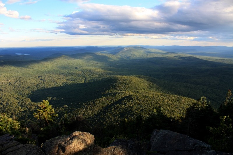
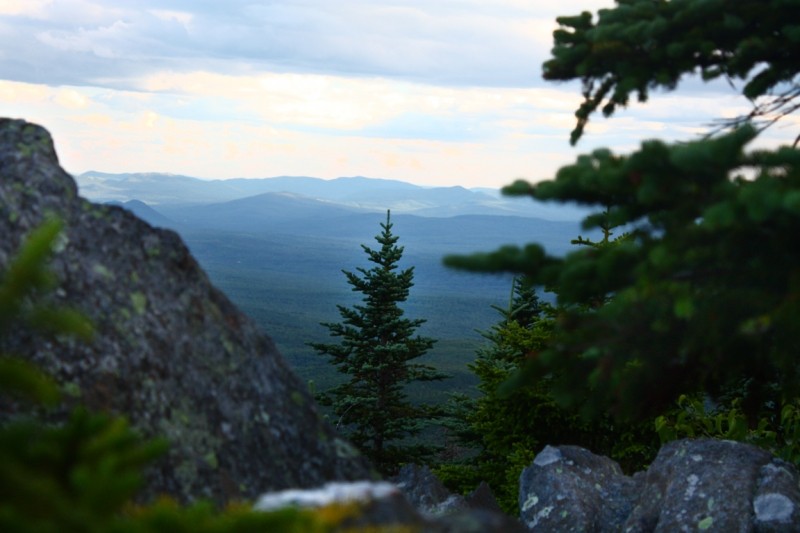
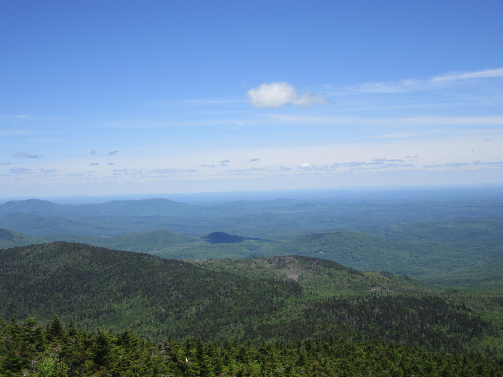
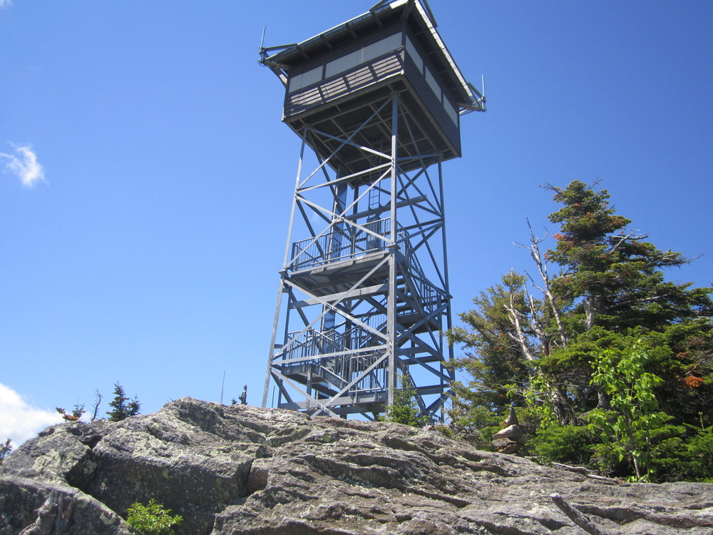
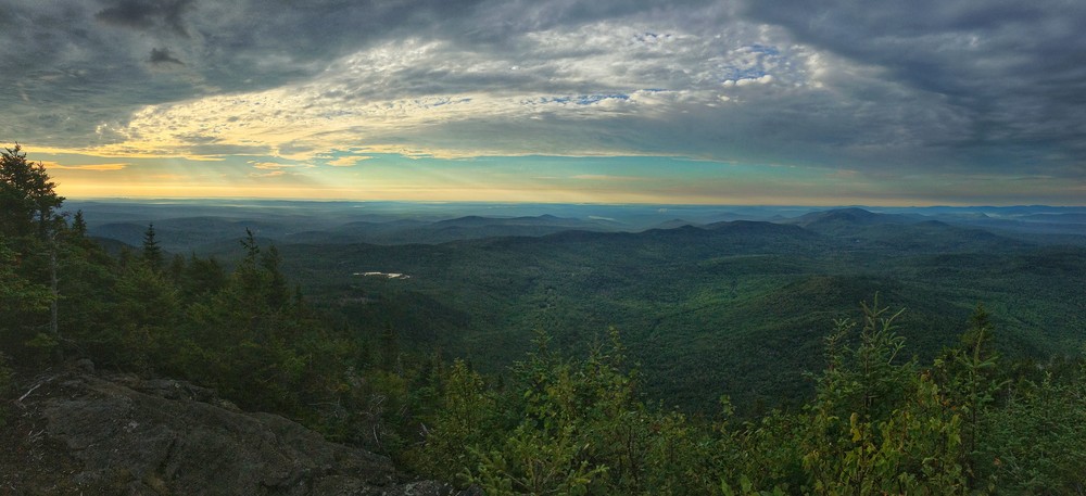
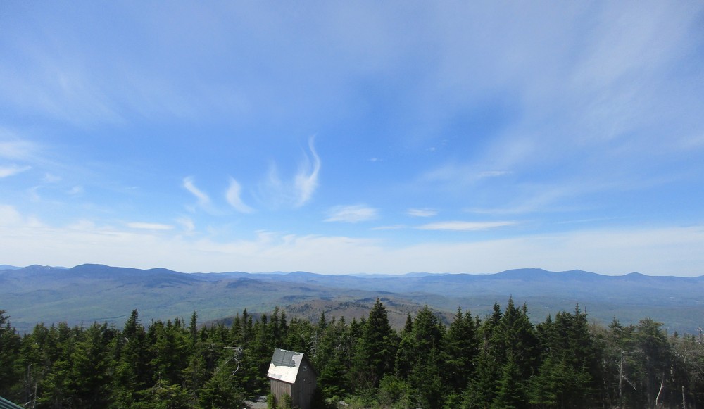
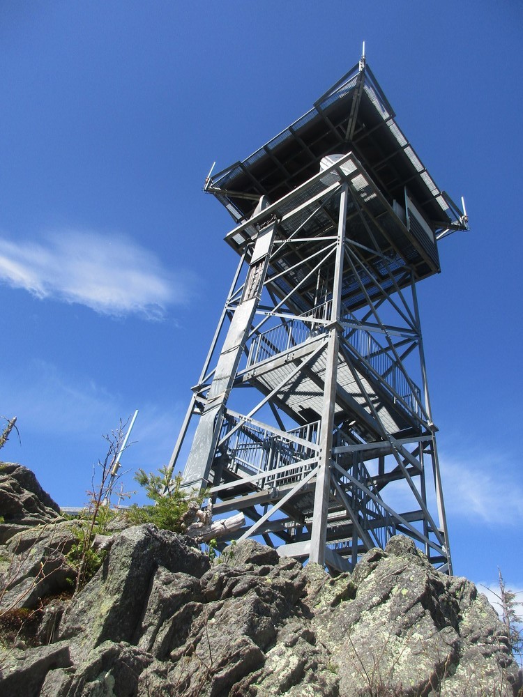
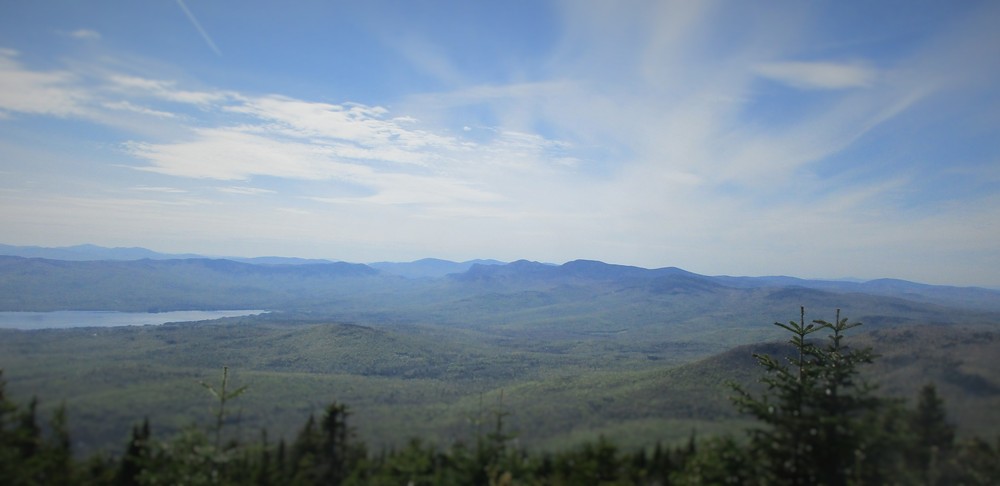
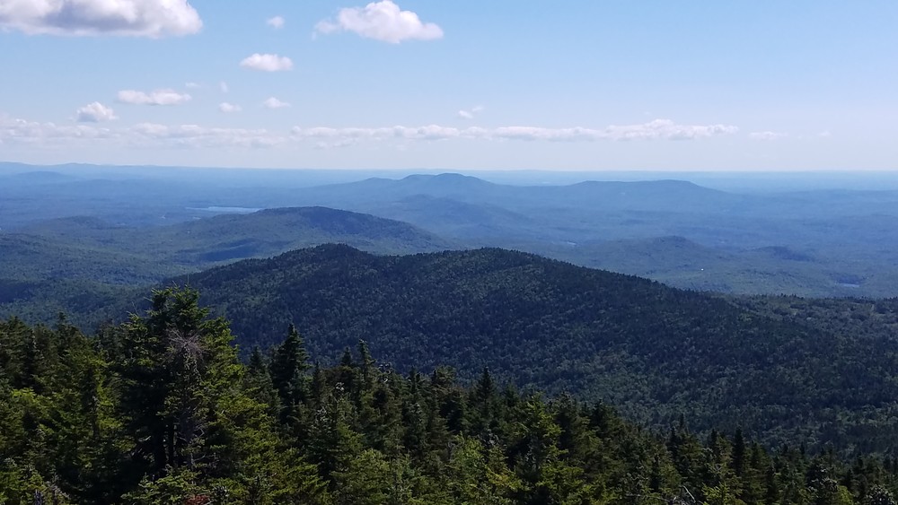
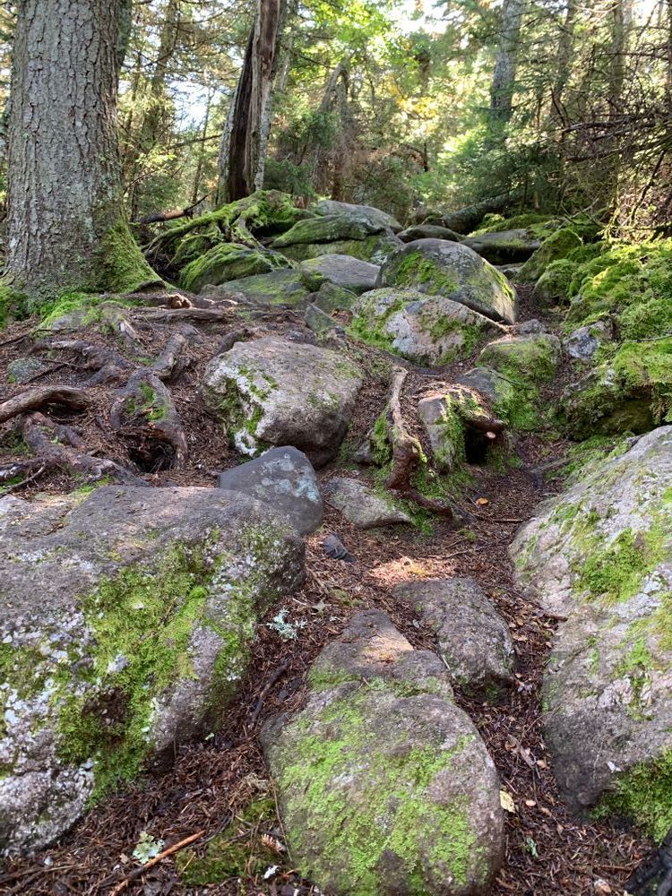
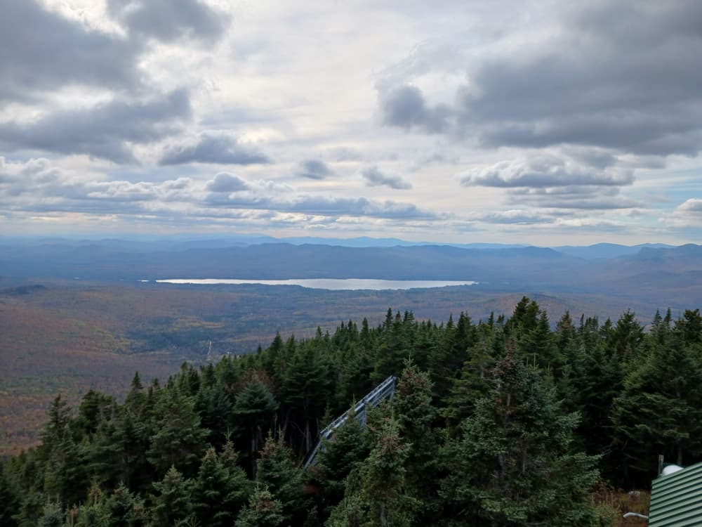
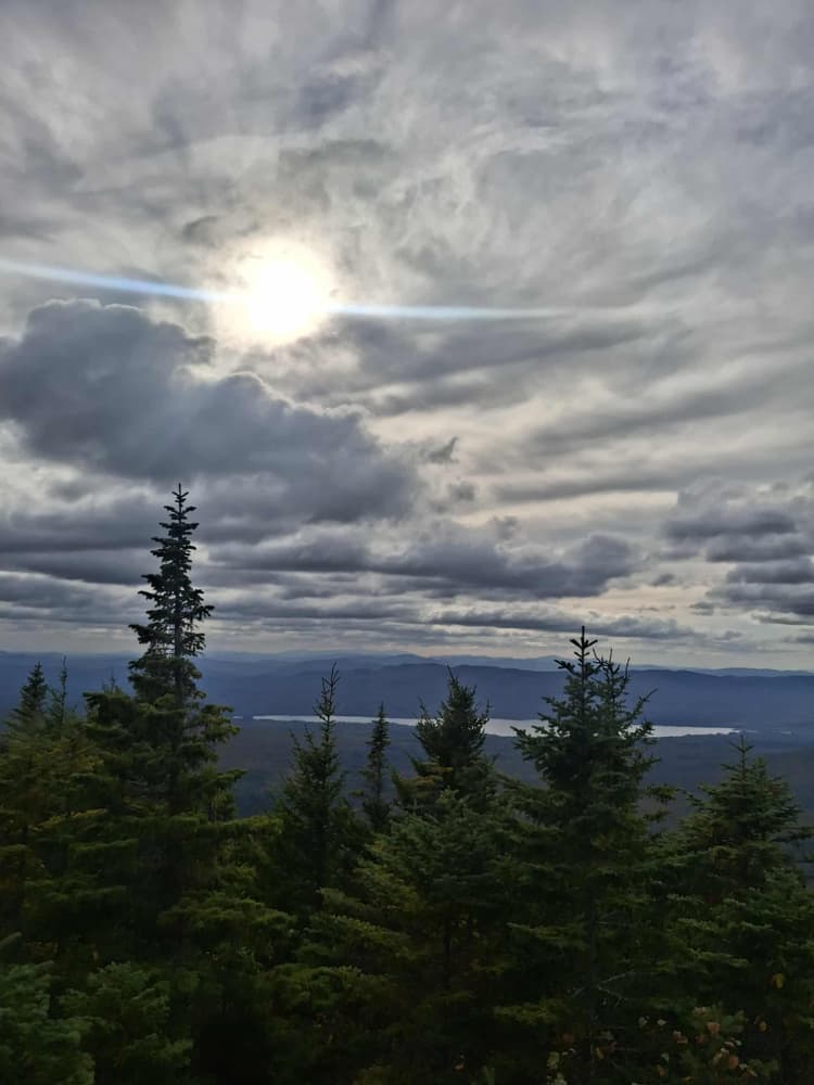
Offering scenic views of the Weld region, the Mount Blue Trail leaves from the northern end of the parking area. About a mile from the trailhead a former fire warden’s cabin provides a place for rest and shelter. The remains of an old fire tower are also at the summit. At the top of Mount Blue, the summit provides many great views of the picturesque Weld area. At 3,187 feet, Mount Blue is not the tallest mountain in the Weld area, but it is probably the best known peak in the region. Visible for many miles to the south, it is surrounded and protected by Mount Blue State Park and is nearly as tall as Little and Big Jackson Mountains to the north and a shade taller than Mount Tumbledown to the west.  This is a popular hike in any season.

View BPL's map & guide for Mount Blue State Park & Tumbledown Public Lands.

Trail Manager

Visit Maine Division of Parks and Public Lands online for more information and a detailed trail guide or contact:

Maine Bureau of Parks and Lands, Mount Blue State Park

Maine Bureau of Parks and Lands, Mount Blue State Park
299 Center Hill Road
Weld, ME 04285
Phone: (207) 585-2261
bruce.farnham@maine.gov

Nearby Events

VIEW EVENTS CALENDAR

Trail Tips

Dispose of Waste Properly
Keep Maine green and clean! Pick up trash, even if it's not yours. Leave soon-to-be trash like excess packaging, stickers, and twist ties at home.
Legend
Hide All

Trailhead Information

From South: At the intersection of ME Route 156 with Maine Route 142 in Weld, proceed easterly onto Center Hill Road. Center Hill Road takes a slight left about 0.5 miles from the main roads; follow the signs for the Center Hill Trails and for parking.  Continue past the park headquarters and Center Hill Picnic Area for another 3.0 miles on Center Hill Road until you reach another fork in the road. A sign indicates Mount Blue Trail and parking by bearing right onto Mt Blue Road.  Follow this road for about 2.5 miles—bearing right at the logging road roughly 1.8 miles from the main fork—to the end where the trailhead and parking are located.

From North: From the intersection of ME Routes 4 and 142 in Philips, follow ME Route 142 south. After about 7.0 miles, ME Route 142 makes a sharp turn to the right; at this point, make a left onto Center Hill Road. After 0.5 miles, Center Hill Road splits; follow the road that forks right. Continue to follow Center Hill Road for another 2.5 miles, and turn a sharp left onto Mt Blue Road. Follow this road for about 2.5 miles—bearing right at the logging road roughly 1.8 miles from the main fork—to the end where the trailhead and parking are located. 

In the winter Mt Blue Road is closed at the fork with Center Hill Road, therefore it is necessary to park there at the gate and to hike the extra 2.5 miles along the road to the parking area and trailhead before hiking this trail.

Click on a parking icon to get custom directions
Please Log In or Create Account to add comments.
thebreester
September 01, 2019
Did this with 3 kids and it took us about 4 hrs start to finish. Very nice views
mainetrailfinder
May 30, 2018
Hikerlady - thanks, we agree that this trail could also be considered advanced, so we've updated its difficulty rating. Happy Trails!
hikerlady
May 28, 2018
Excellent hike- I would put this hike in the moderate/advanced category having hiked many other moderate trails as classified by Maine Trail Finder.
dayhiker82
July 31, 2017
Excellent hike. Just did Sunday. The new tower at the top with the view platform is a nice touch. Gorgeous view from the top. Happy hiking !
navyswomom
August 28, 2016
Beautiful hike, as always. It is a constant climb, very few (aka...none) places that it is rolling or flat. The summit offers all the rewards, beautiful vistas
mainetrailfinder
June 26, 2016
Thanks for the trail update, gopackgo! We have revised the trail length based on your comment. Happy hiking! -MTF Team
gopackgo
June 26, 2016
Regarding the previous warning about blowdowns: We just hiked to the summit in June 2016 and any blowdowns have been cleared. There are no longer any trees blocking the trail anywhere from base to summit. The trail conditions are excellent. Also, my GPS recorded the roundtrip at 3.2 miles, which is consistent with signage and flyers at the park.
switchback
February 09, 2015
As of 2011 there is an observation platform part way up the fire tower, providing excellent views. It looks like there was a microburst during the winter of 2014-2015 - above the old fire warden cabin there is a large patch of deciduous trees with all the tops broken off. Numerous blowdowns block the trail through the coniferous upper section.
These awesome businesses support our goal of connecting people to outdoor adventures in Maine!
Hang Tight!
Nearby services are loading
No Results
No Services Found
SHARE THIS TRAIL

Add Trail Log

Please wait…
Join In on the Fun!
Log in or create an account below to unlock all the great features of Maine trail finder: keep track of trails you want to do, preserve memories of trails you’ve done, earn badges, and more!
Your log in attempt was not successful. Please try again.
    Lost your password? Reset your password
    Don't yet have an account?
    There was an issue with your submission. Please try again.
      * Indicates required field
      Already have an account? Login here
      Enter your username, and we will send you a new, randomly generated password to your email account.
      There was an issue with your submission. Please try again.

        Success! A new password has been emailed to you.

        Log in now

        Please wait…