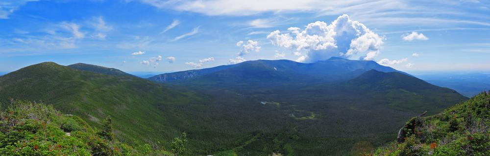
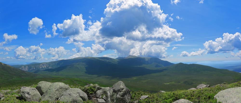
Mount Coe (3,764 feet), North Brother (4,143 feet), and South Brother (3,942 feet) are a part of the ring of mountains that form three sides of the Klondike Basin. As do most of the mountains of this chain, they offer unrestricted views from open, rocky peaks. The other peaks surrounding the basin inclue The Owl, Barren, O-J-I, and Fort Mountain. The unnamed mountains that run from the saddle between the Brothers northwest to Nesowadnehunk Field are known as the Cross Range.
A very nice loop hike can be enjoyed by combining the Mount Coe Trail and Marston Trail. The two summits of the Brothers are a moderate addition to this loop. The round trip loop including summiting the Brothers is 10.5 miles (described below); the loop without the Brothers is 7.7 miles. Hiking the length of the Marston Trail up to North Brother is a total of 9.2 miles out and back. A hike straight up to Mount Coe then back down again by the same route is a total of 6.8 miles. An additional option for reaching Mount Coe and the Brothers, as an alternative to the Marston Trail, is a trip over O-J-I via the O-J-I Link Trail.
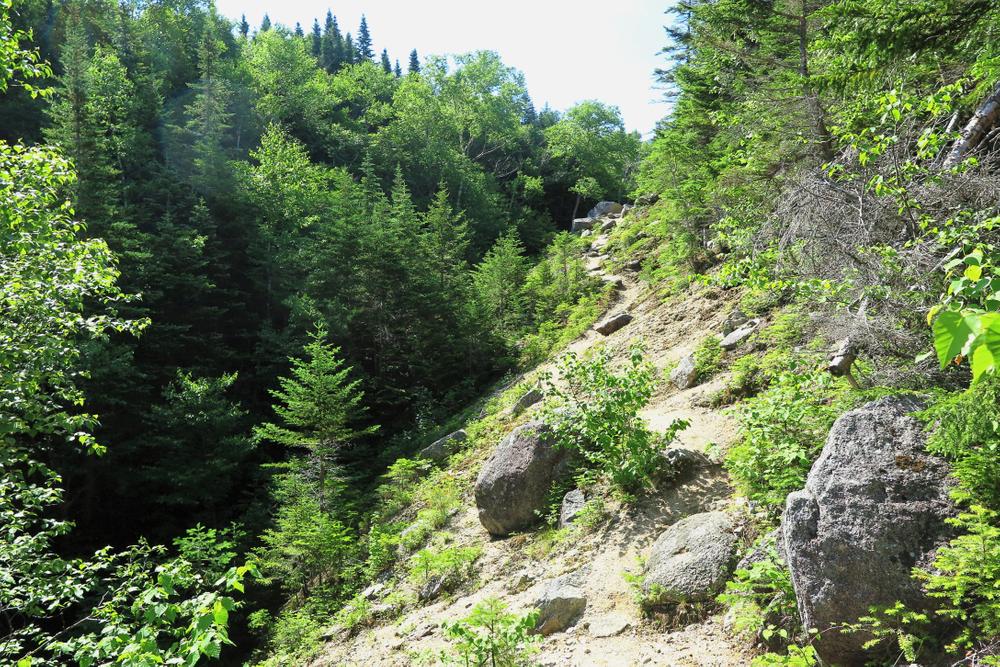
Hikers should exercise caution and not attempt to climb or descend over the smooth-rock sections of the slide that the Marston Trail parallels for some distance. Several very serious accidents have occurred here. Gravel on smooth granite ledges can act similar to ball bearings under the best of shoes. The trail has been rerouted away from these dangerous areas, but there is a temptation to climb out on these adjacent open ledges.
MARSTON TRAIL-MOUNT COE-BROTHERS LOOP DETAILS
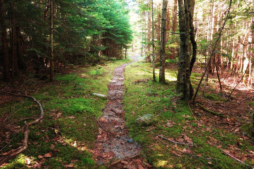
0.0 Miles: The Marston Trail is blazed blue and soon crosses an open outwash caused by deposits from slides above this point.
0.2 Miles: The trail bears left (north) into a wooded area and begins a steady ascent.
0.8 Miles: The trail crosses and recrosses a brook several times. It continues to ascend steadily.
1.3 Miles: A signpost in an open area marks the junction with the Mount Coe Trail. The Mount Coe Trail heads to the right (south).
1.5 Miles: The Mount Coe Trail ascends onto the Mount Coe Slide. This is a long slide that has come down the valley between Mount Coe and O-J-I. The deep gravel along the banks of the stream gives this trail a western feel. Follow the slide uphill. The trail crosses a small stream frequently as it climbs back and forth across the slide.
2.5 Miles: The trail bears left (northeast) up the center part of a wide slide area (the west face of Mount Coe). The climbing here is over very steep granite slabs with sections of loose rock and gravel.
2.8 Miles: The trail reaches the junction with the O-J-I Link Trail to right (leading 0.5 miles to the O-J-I Trail). The Mount Coe Trail continues to the left.
3.2 Miles: The trail reaches the head of the slide entering scrub growth and continues a steep ascent.
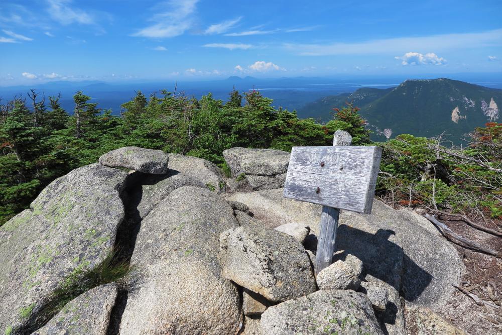
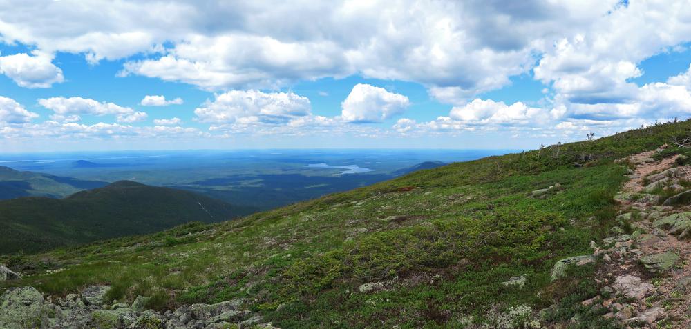
3.4 Miles: Mount Coe summit (elevation 3,764 feet). The open peak provides for views of Nesowadnehunk Valley, Doubletop Mountain, the Brothers, O-J-I, and the flat Klondike Basin to the southeast. From the summit, the trail begins a descent down the north ridge of Mount Coe.
4.2 Miles: This is the low point between Mount Coe and South Brother. Beyond, the trail then contours along the west side of South Brother.
4.2 Miles: The trail passes two clearings with views of Mount Coe, to the left (west).
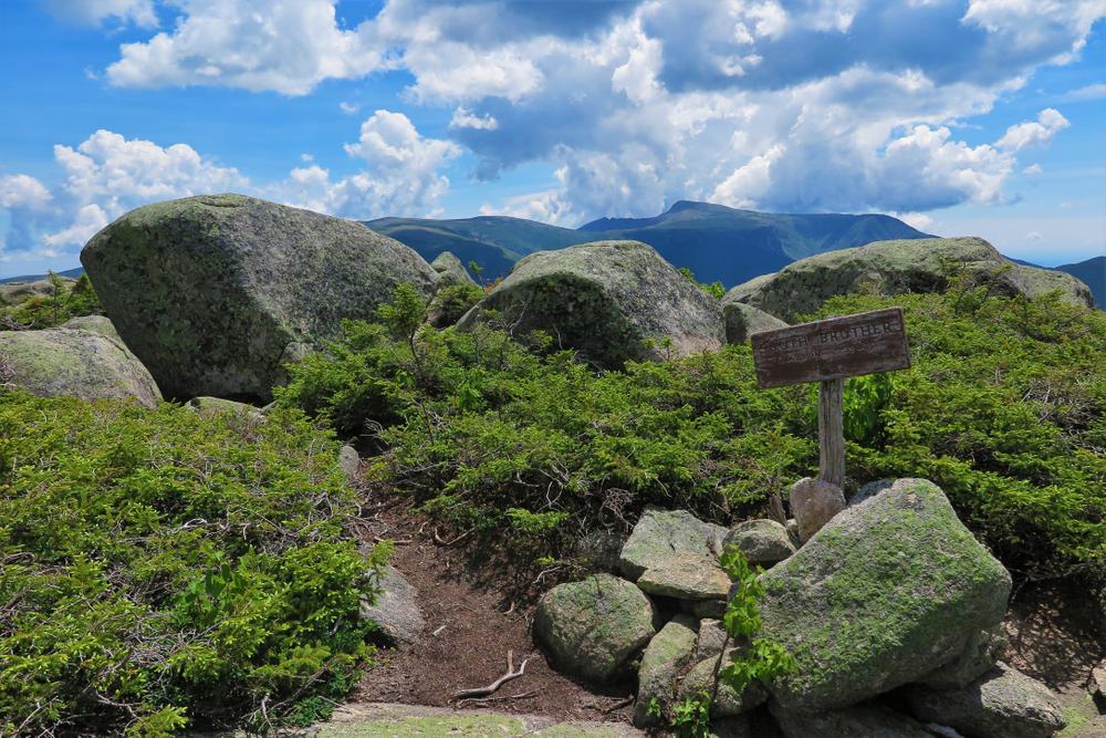
4.3 Miles: The trail reaches a trail junction. The South Brother Trail to the right ascends steeply 0.3 miles to the summit of that mountain.
4.6 Miles: South Brother summit (elevation 3,942 feet). The open peak offers spectacular views. Head back down the South Brother Trail back to the junction with the Mount Coe Trail.
4.9 Miles: At the junction, the Mount Coe Trail continues to the right around the flank of the mountain.
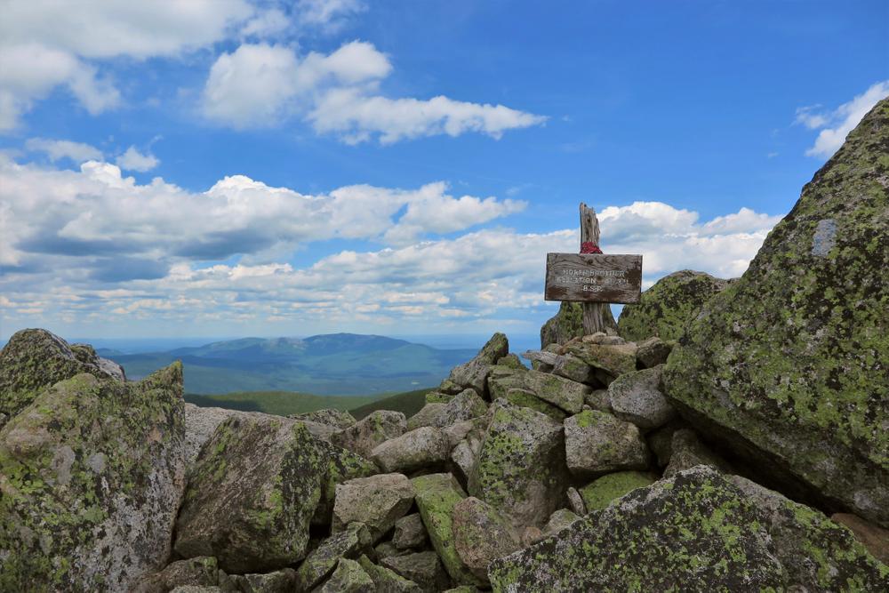
5.4 Miles: The Mount Coe Trail ends at its junction with the Marston Trail. To right, the Marston Trail leads 0.7 miles up a steep ascent to the summit of North Brother Mountain.
6.1 Miles: North Brother Summit (elevation 4,143 feet), with outstanding views in all directions. Head back down the Marston Trail 0.7 miles onto a saddle and the junction with the Mount Coe to return to the loop.
6.8 Miles: At the trail junction, the Marston Trail continues to the right, descending steeply.
8.1 Miles: The trail reaches the bottom of the steep descent at the floor of a bowl.
8.9 Miles: The trail crosses Roaring Brook.
9.2 Miles: At the lower junction with the Mount Coe Trail, the Marston Trail heads to the right, continuing a moderate descent.
10.5 Miles: The Marston Trail ends upon its return to the Park Tote Road.
Park Fees: See website for entrance and camping fees. [No entrance fee for Maine residents.]
Park Rules: See a more complete list here.
For more information and detailed trail maps, visit the Baxter State Park Authority website, or contact:

Please don’t disturb forestry equipment or coastal traps, buoys or gear. Maine’s working forests and waters are an active part of many Mainers’ livelihoods. It’s also a good idea to stay off docks unless invited.
Travel northwest on the paved Baxter Park Road to the Togue Pond Gatehouse, which is 8 miles from the Golden Road Crossing. After entering the park at Togue Pond Gate, bear left and continue onto the Park Tote Road for 13.3 miles to the Marston Trailhead parking area on the east side of the road, 0.2 miles south of the Slide Dam picnic area.
Success! A new password has been emailed to you.