North Trail (0.5 miles)
Beginning at the trailhead on Hiram Hill Road, this trail is marked with blue blazes. The trail parallels the road for a short distance, then turns left, passing a well-house uphill from the trail. (This is an active water supply; please do not approach or tamper with the well.) The trail crosses a small stream, then continues a moderate ascent south through hardwoods towards the mountain. At the crest of a small ridge, the Moraine Trail forks to the left. The North Trail follows the west side of a small valley, then climbs a steep ridge notched by a brook, paralleling the brook for 150 yards. It turns left to cross the brook in a grove of large hemlocks, then climbs away from it. Just beyond, the White Flag Trail diverges to the left.
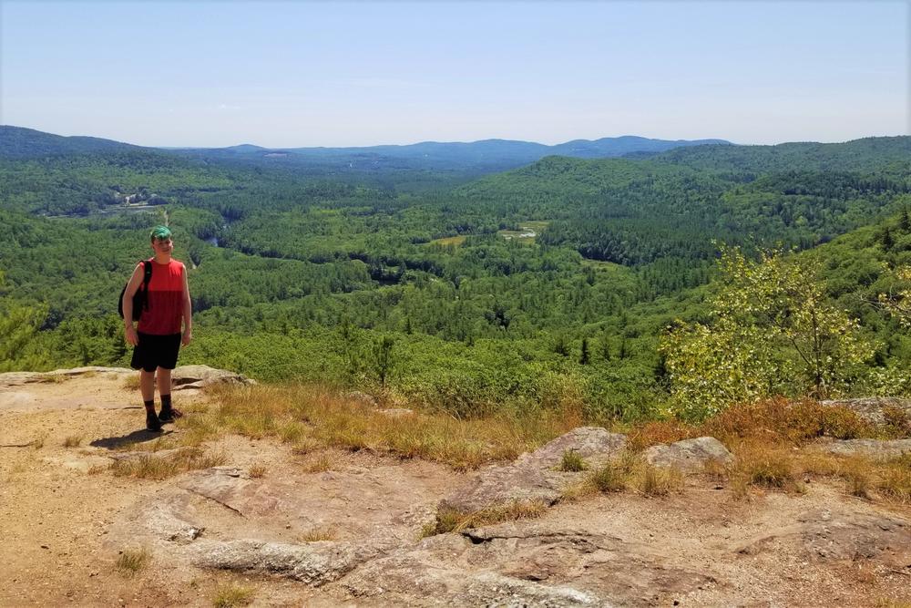
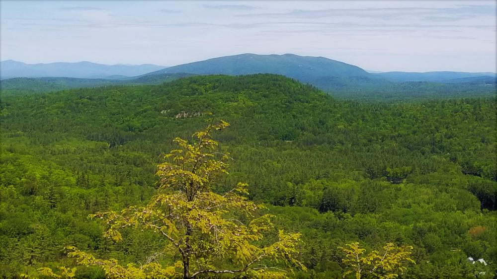
At the foot of a steep, rocky slope, the trail turns left uphill, passing the junction with the link to the Northwest Trail, and ascends into dense hemlocks. Climbing higher through narrow passages in the thick hemlocks, the trail emerges on sloping, open ledges with excellent views to the north and northeast. Use caution on these ledges, which can be slippery in wet weather. Passing through hemlocks, the trail re-emerges to continue up sloping ledges to join the Ridge Walk.
White Flag Trail (0.25 miles)
The White Flag Trail forks off North Trail at 0.3 miles, a short distance above the highest brook crossing. After crossing a small ridge, it ascends gradually to the southeast through long-ago overgrown pastures. Approaching a stone wall, the trail takes a sharp right, while the Boulder Trail is to left. With a stone wall to left, the trail ascends a steep section, turns sharp left, and slabs across gentle ledges until rejoining the Boulder Trail shortly before intersection with the Barnes Trail near Front Ledge, with an excellent view over the village.
The North Trail, White Flag Trail, and upper part of Barnes Trail makes for a nice loop of about 1.5 miles.
Boulder Trail (0.2 miles)
The Boulder Trail, blazed yellow, splits off from the North Trail to the east, and passes large boulders, two stone walls, remains of pasture fences, and ascends several short ledges. It re-joins White Flag Trail a short distance before the Front Ledge overlook.
Moraine Trail (0.2 miles)
White blazes mark this trail that begins at side of the railroad tracks about 0.2 miles south of Hiram Hill Road. Ascending through hardwoods with two S-curves, the trail climbs to the east end of a fascinating ridge (a glacial moraine) at a stone wall, then follows this ridge to the junction with the North Trail.
Moraine Trail Link (0.1 miles)
Blazed yellow, this trail connects the Hiram Hill Road parking area to the Moraine Trail.
Barnes Trail (0.4 miles)
Established in the 1950s, this is the original trail to Front Ledges on Mt. Cutler. Marked with red blazes, sections of this trail are very steep and eroded! At the Hiram Depot trailhead, the Barnes Trail and Snowmobile Trail begin across the railroad tracks and up a steady grade. At about 100 yards the trails divide, the Barnes Trail to the right, entering Merrill Botanical Park, a grove of large pines. Before leaving the Park, a short trail through an opening in a stone wall to the south, leads to the historical “Gold Mine." The trail dips as it leaves the Park and crosses the (usually dry) outlet of a large vernal pool. Historical dug wells are found in this small valley.
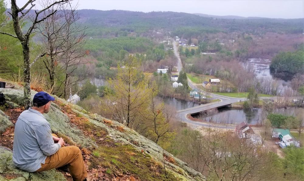
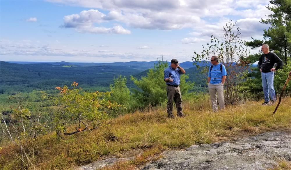
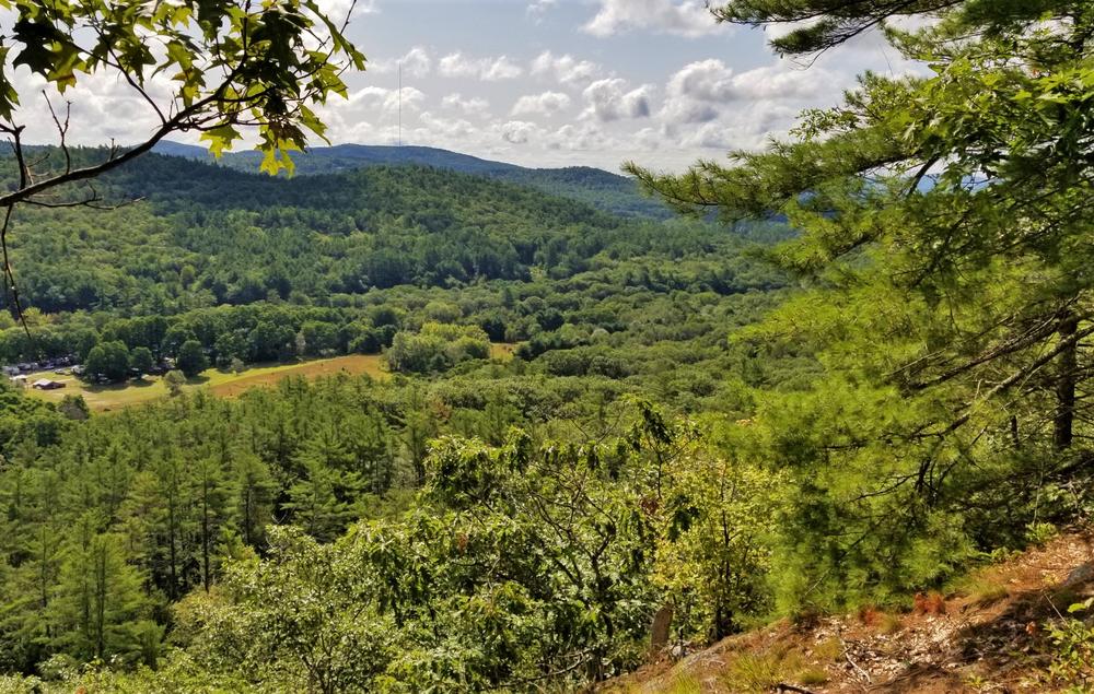
The trail ascends quickly to enter the ravine between Mt Cutler and the shoulder south of the mountain. It stays on the south side of a seasonal stream, up the ravine over rough rocks. After climbing 100 yards, the trail turns right and crosses a rugged boulder area, passes under an overhanging ledge, and steeply ascends the ledges. Extra caution should be used here, especially upon descent. At the top of this ledge, the trail turns right, north to top of Front Ledge overlooking Hiram Village.
Northwest Trail (0.7 miles)
Access this trail via the western Hiram Hill Road trailhead, 0.3 miles up the road from the parking area. Alternatively, use North Trail from the parking area, then access the Northwest Trail via a link from the North Trail. From the Hiram Hill Road trailhead, the trail ascends and crosses a small stream about half way to the Link Trail junction. A short distance beyond, the trail turns right and continues with a gentle ascent in a mix of hemlock and beech, with the North Ledges of Mt Cutler to the left. Crossing a small ridge the trail turns left, to follow a fairly steep old logging road. Turning right off the old road, the trail ascends a larger ridge, then makes a steady ascent into thick hemlocks, eventually emerging onto the Ridge Walk.
Ridge Walk (0.9 miles)
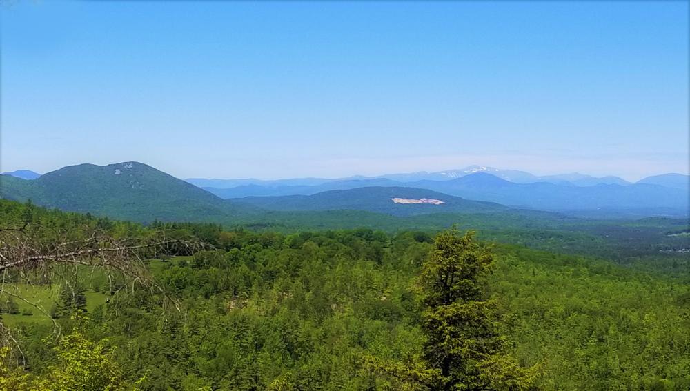
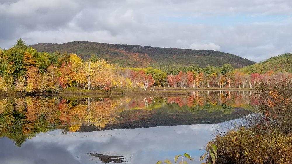
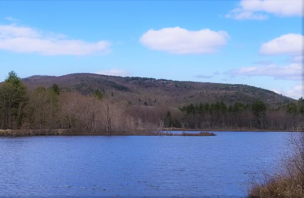
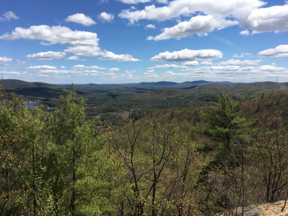
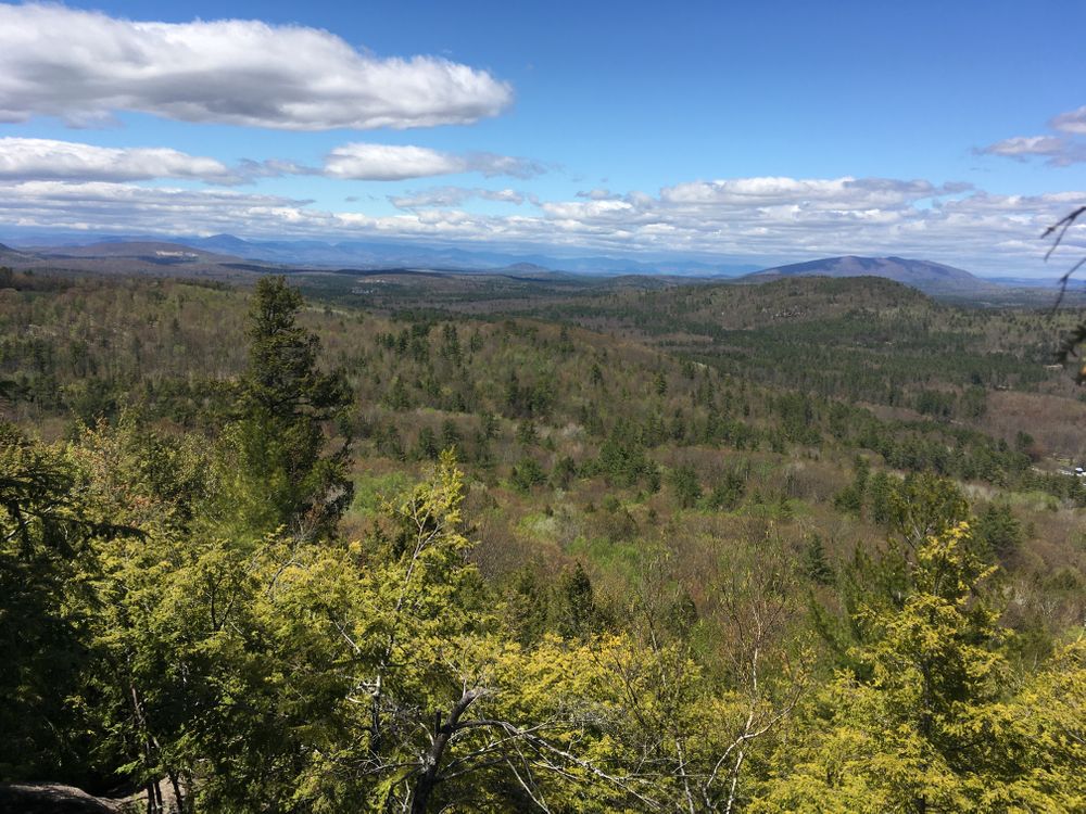
The Ridge Walk gradually ascends the east-west ridge of Mt. Cutler, with excellent views to the northwest and south. Cairns and red blazes mark the trail. From the junction of the Barnes and White Flag Trails, the Ridge Walk heads west into hardwoods, steadily ascending. Steep sections require extra caution. Good views look northeast before a hemlock grove. Above the hemlocks, the trail continues a moderate ascent, emerging onto South View Ledge, with spectacular panoramic views. These ledges are the easternmost end of a long ridge, with west end at a notch just below the true Mt. Cutler summit.
For most of its length, Ridge Walk traverses an area identified by the Maine Natural Areas Program (MNAP) as an Ironwood-Oak-Ash Woodland forest community, a rarity in this state. (Ironwood is also known as hornbeam.) This forest area is unusually open and sunny offering many view-points. The north slopes of Mt Cutler change abruptly from this open woodland to a dense, thick forest of hemlock. On the northern-exposure mountain slopes, this near-mono-culture area is naturally-occurring as a result of climactic conditions. Except on open ledges, please stay on trails to help to preserve this special area of our park.
0.2 miles west of South View Ledge is a junction with the North Trail. Another 0.1 miles, and Gun-sight Ledge offers views to both north and south. 0.2 miles later, the trail passes the Northwest Trail junction, crosses a mostly-wooded secondary summit, and descends to a notch traversed by an ATV trail (on private property, not for public use.) The true summit (1232 ft) is a short, steep scramble west of this notch.
Saco Ridge Trail (South Ridge Trail) (0.7 miles)
From a notch the trail descends south a short distance, down the most prominent southern ridge, marked by cairns and red blaze. The trail bears left and along the south side of Mt. Cutler, gradually descending to a small notch between the mountain and the upper part of this ridge. The trail makes a short ascent to an opening with views to the east. Near the east edge of this clearing, the trail turns right into hardwoods and descends the ridge. Good viewpoints look down the Saco Valley. Before the lowest overlook, the relocated trail with red blazes turns north in a small clearing with pines. This descends to the north, then turns right on an old logging road down to the Snowmobile Trail.
To ascend Mt. Cutler by the Saco Ridge Trail, first follow the Snowmobile Trail as described below. At about 0.5 mile, a short distance after crossing a planked bridge over a stream, the red-blazed trail forks to the right, ascending westward up an old logging road. At a height-of-land, the trail turns sharp left off the logging road and ascends wooded slopes to join the older trail in a small grove of pines. Turn right to continue up Saco Ridge.
Snowmobile Trail (0.7 miles)
The Snowmobile Trail begins at the Hiram Depot trailhead. After the initial 100 yards uphill, the Barnes Trail forks to the right, the Snowmobile Trail continues straight. The trail remains nearly level, passing two houses on the left, until a slight descent to open fields. Turning towards the mountain and away from the fields, the trail re-enters woods and turns left across a small stream. Just beyond the junction with the Saco Ridge Trail, the Snowmobile Trail passes close to a steep shoulder of the mountain. Do NOT continue further west on the Snowmobile Trail from this point, as it is private land on which the public is not welcome.
Railroad Tracks (0.5 miles)
Walking the railroad can be tiresome, but the railroad can be used to complete loop hikes, connecting the Hiram Hill Road with the original Barnes Trail. The Moraine Trail can be used to avoid part of the railroad walk.
For more information, visit the Town of Hiram website, or contact:
![]()
Protect Habitat: Stay out of nesting areas and keep pets leashed.
Hiram Hill Road Trailhead (East)
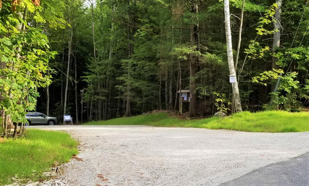
From the intersection of ME-117 (Main Street) and ME-113 (Pequawket Trail) in Hiram, head west across the bridge over the Saco River. At the west end of the bridge, drive 0.6 mile north on ME-113 (Pequawket Trail). Turn left on Hiram Hill Road, cross the railroad tracks, and look up the road, the parking lot is on the left just before the bridge over Red Mill Brook, 0.2 miles from the turn onto Hiram Hill Road. Signs indicating “MT CUTLER HIKING TRAILS PARKING” have arrows pointing to the turn. The trailhead for the North Trail is located here.
Hiram Hill Road Trailhead (West)
Roadside parking here is rough and limited. To access this trailhead, park at the Hiram Hill Road Trailhead (East), and walk the 0.3 west up Hiram Hill Road to this trailhead for the Northwest Trail.
Moraine Trailhead
There is no parking at this trailhead. From the railroad crossing of Hiram Hill Road, walk 0.2 miles south on the railroad. A trail sign indicates the start of this trail, marked with white paint blazes. You can also reach Moraine Trail using the link trail from the Hiram Hill Road Trailhead (East).
Hiram Depot Trailhead
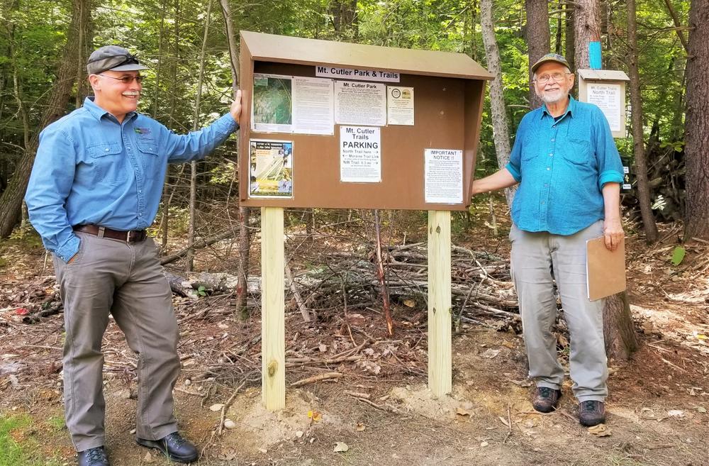
From the intersection of ME-117 (Main Street) and ME-113 (Pequawket Trail) in Hiram, head west across the bridge over the Saco River. At the west end of the bridge take a left on River Road, go 290 feet, and turn right on Mountain View Avenue. Where the avenue turns nearest to the mountain, cross the first set of railroad tracks. There is space to park in the area between the tracks. Look for a kiosk, as well as a sign indicating “MT CUTLER TRAILS” across the tracks south of the parking area. The trailhead for the Barnes trail is located here.
Success! A new password has been emailed to you.
Examples of the confusion: the red-blazed trail that starts at the Hiram Depot parking area (east side) and runs to the summit, goes through FOUR name changes. It is labeled at various segments as the Barnes Trail, the Ledges Trail, the Front Ledges Trail, the Ridge Walk. Worst of all, the signs found at trail junctions may refer to any one of these, so unless you know they are all the same the signage will be useless.
Another example: the Saco Ridge Trail is also called the South Ridge Trail.
There are also odd things like a string tied across the blue-blazed North Trail. Why?
And there are no fewer than THREE different trails that are blazed in white (Moraine Trail, NW Trail, White Flag Trail) which causes you to think you have somehow gone in a loop or are repeating a section, or whatever. You think they are somehow related. They are not.
(As an aside: Painted white blazes should not be used ever on any trail (sorry AT). When they are painted on dark-barked trees like oak, hemlock or white pine they are fine. But gray-barked maple trees frequently have white patches of discoloration or lichen. These look exactly like painted white blazes. Painted blazes should be restricted to non-forest colors like blue, red, yellow, orange, purple, etc. No green or white. Or use the small reflective trail markers attached to the trees, not paint.)
Now to the advice for future hikers: Do not park at the Hiram Depot parking area near the railroad tracks in Hiram. Park at the northern parking area off Hiram Hill Road (follow the brown signs from Rt. 5/113). Hike up via the blue-blazed trail (North Trail). It is a moderate slope, in reasonable condition, that gets steep (but not impossible) just before the first scenic overlook, then opens on to bald granite at a reasonable angle (not as bad as Streaked Mountain). Go past the string across the trail, bear right at the T-junction, and follow the red blazes from here to the other scenic overlooks and the high point of the trail system near the summit. When returning downhill, you can by-pass the angled granite and steep section of the blue trail by staying on the red blazes down to “front ledge” scenic overlook. Do not continue on red past here. Turn left and follow the white-blazed trail (White Flag Trail?) which descends easily through open forest and intersects the blue trail where you came in. Much easier! Follow the blue trail back to the parking area.