White Mountain National Forest - Speckled Mountain

This trail affords hikers numerous views of water falls and other features of Bickford Brook. The summit of Speckled Mountain consists of open ledges with excellent views.
Trail Activity
Hiking
Length
8.20 miles, Network
Difficulty
Moderate, Advanced
Towns
Stoneham, Stow
Surface
Dirt/Forest Floor, Rock/Ledge
Pets
Permitted
Fees
Yes

Description

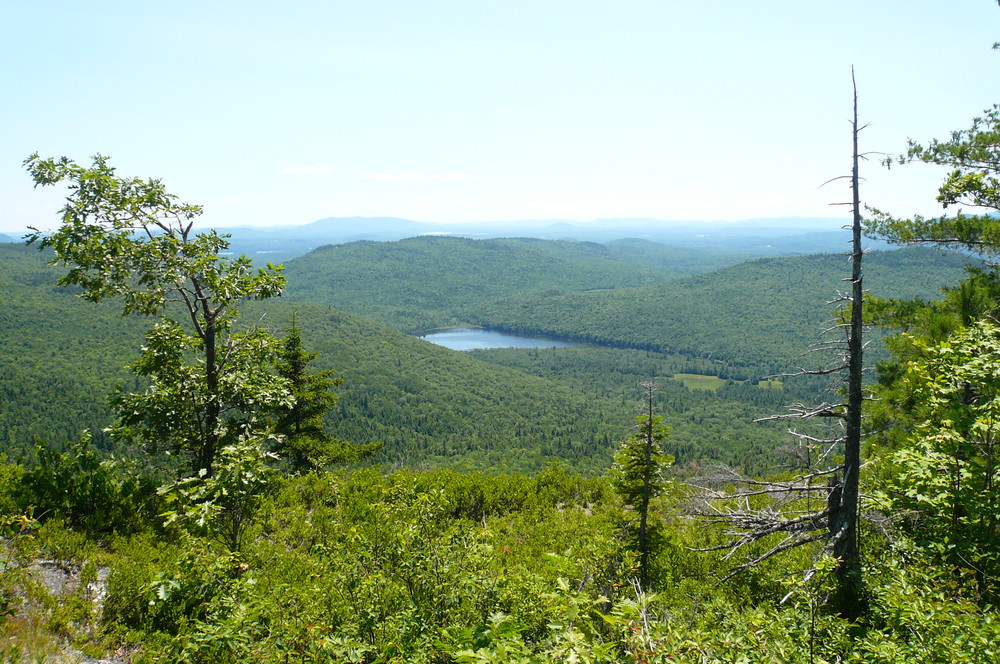
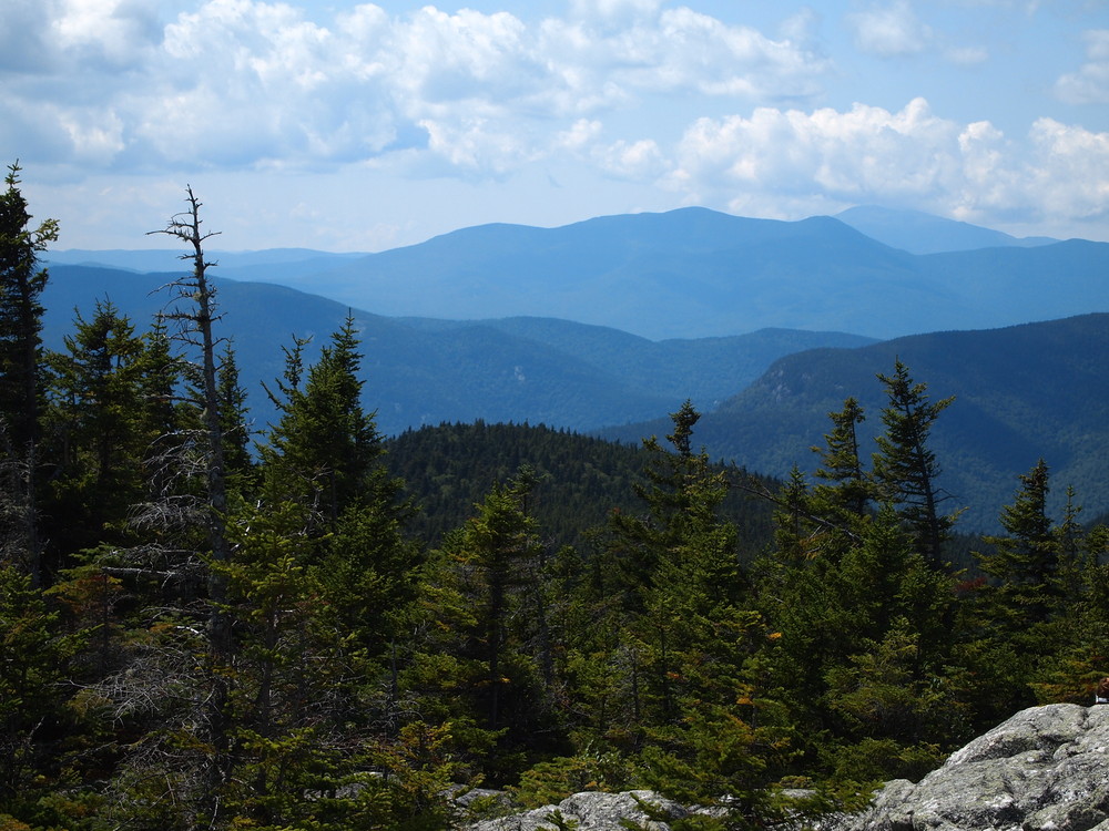
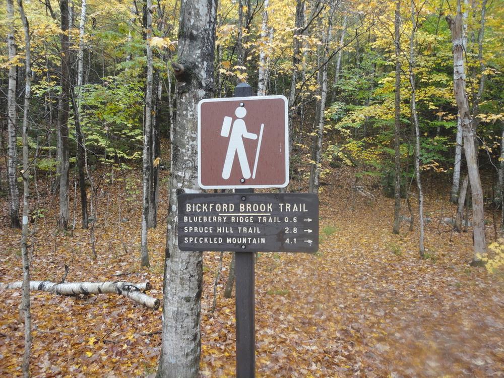
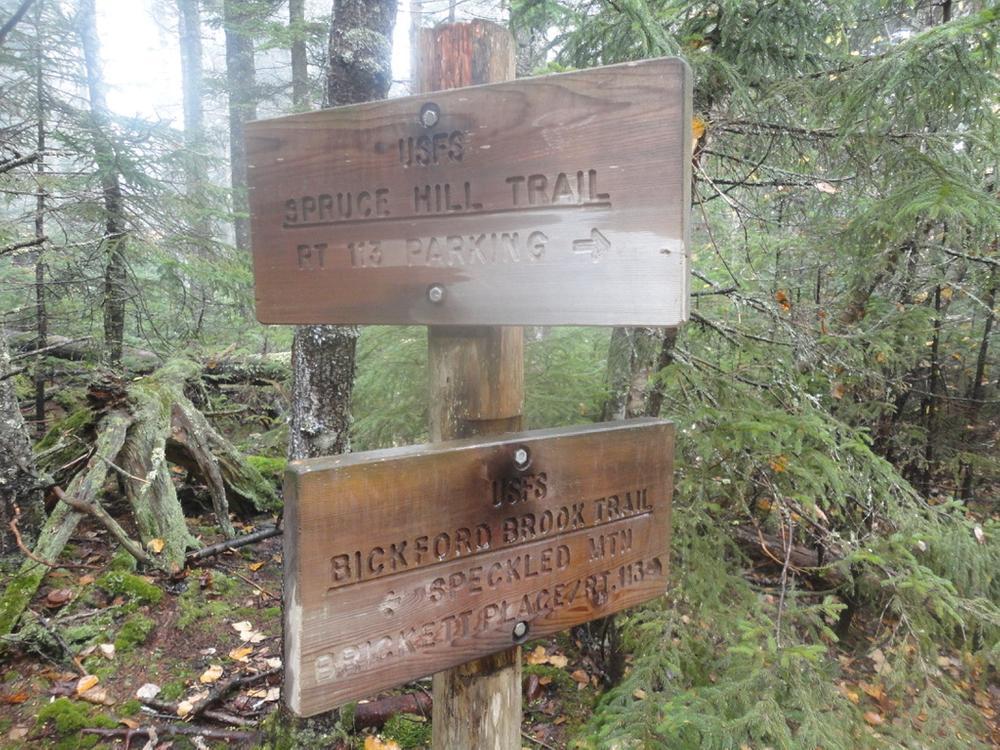
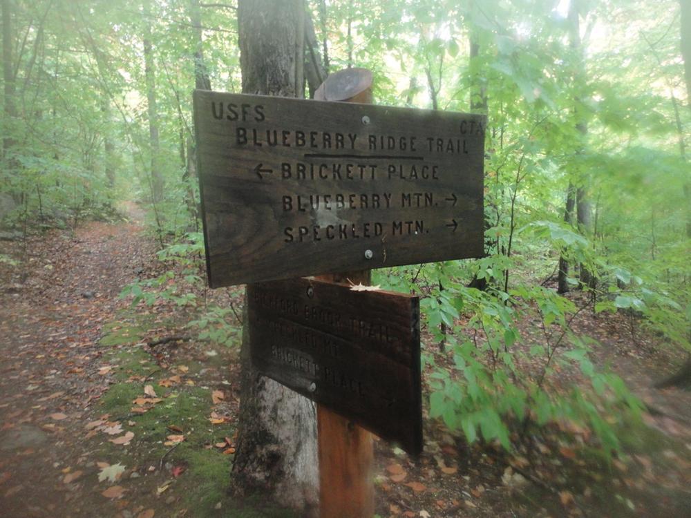
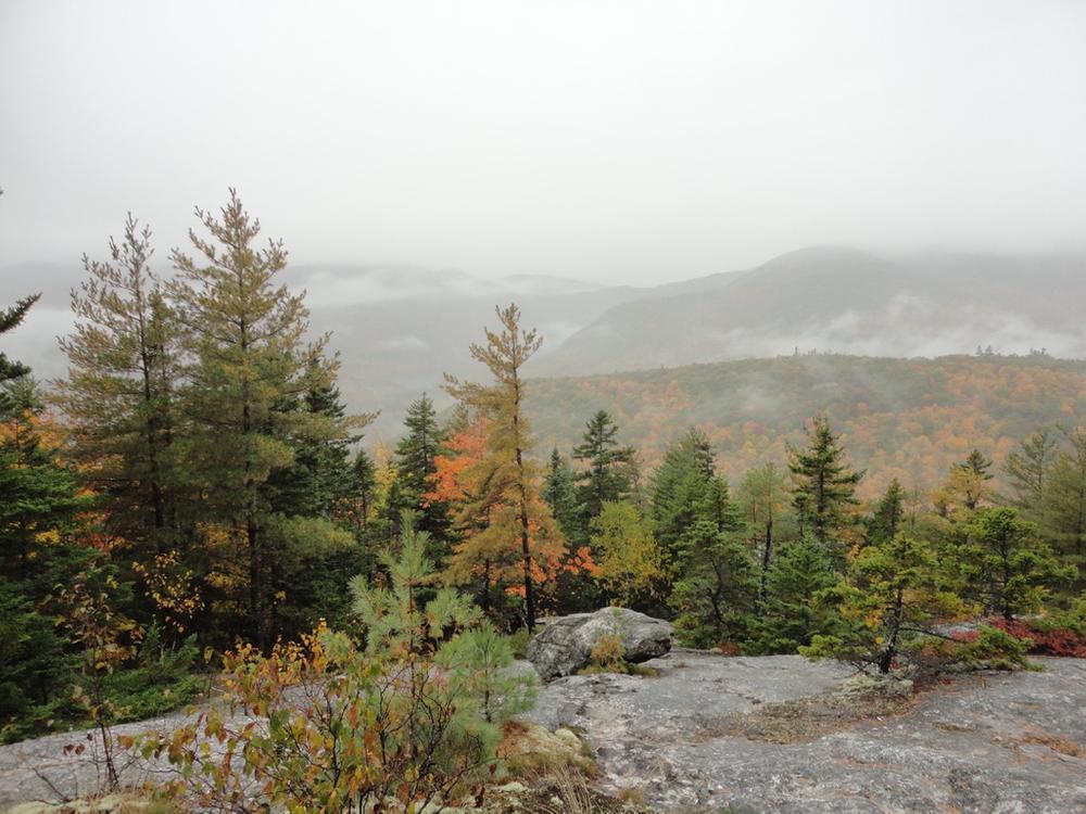
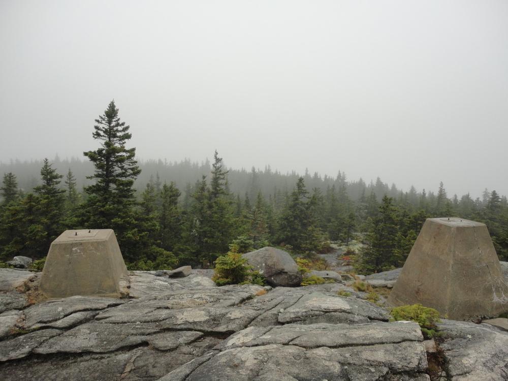
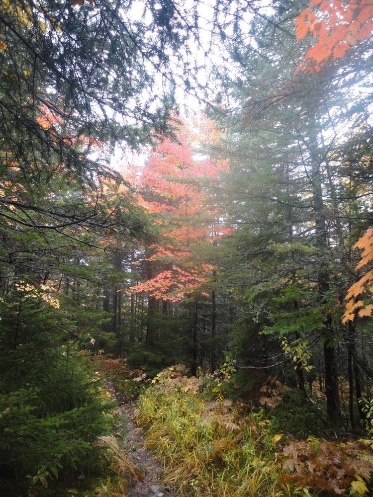
Leave the Brickett Place on the Bickford Brook Trail. At 0.6 mile turn right on the Blueberry Ridge Trail and follow to Bickford Brook where you will find a series of flumes, falls, and boulders of unusual beauty. At 0.8 mile a loop trail leaves the Blueberry Ridge Trail at the lower slide and follows the brook upstream affording views of slides and falls in the brook. Continue on the Blueberry Ridge Trail to the junction with the Bickford Brook Trail. Take the Bickford Brook Trail to the summit of Speckled Mountain (4.1 miles-3 ½ hours). The summit is at 2877 feet and consists of open ledges with excellent views. Return to the Brickett Place on the Bickford Brook Trail.

Other Information

Speckled Mountain is part of the Caribou-Speckled Mountain Wilderness, please check with the Androscoggin Ranger Station for current information about maximum group size and camping and fire regulations. The section of Route 113 that the Brickett Place is located on is closed during winter. A White Mountain National Forest Recreation Pass is required at the Brickett Place Day Use Area. A self-serve pay station is located on site.

Natural Heritage HikesNatural Heritage Hikes is a project of the Maine Natural Areas Program in partnership with Maine Trail FinderView the "Speckled Mountain - Bickford Brook Trail and Blueberry Ridge Trail" guide online here

Trail Manager

Visit the White Mountain National Forest online for more information or contact:

White Mountain National Forest

White Mountain National Forest
300 Glen Road
Gorham, NH 03581
Phone: (603) 466-2713
tpellerin@fs.fed.us
View website

Nearby Events

VIEW EVENTS CALENDAR

Trail Tips

Travel and Camp on Durable Surfaces
Make a small campsite, preferably where there is no vegetation.
Legend
Hide All

Trailhead Information

From US Route 2 in Gilead, travel south on Maine State Route 113 for 10 miles to the parking area at the Brickett Place on the east side of the road. From US Route 302 in Fryeburg, travel north on Maine State Route 113 for 19 miles to the Brickett Place.

Click on a parking icon to get custom directions
Please Log In or Create Account to add comments.
mehiker
May 26, 2021
An excellent alternative, with easier hiking and better trail conditions is by beginning at the Evergreen Valley Link Connector, parking near the Villas directly opposite the trail (44.2542409 -70.93334169). The Link Connector is marked in AMC maps and is nearly level until is merges with the Cold Brook Trail at 1200' elevation. The Link Connector and the Cold Brook Trail are well maintained and as of 05/25/21 in excellent condition. Starting at Evergreen Valley it is 1:45 to the summit, 2246' elevation gain, 3.9 miles (one way). I hiked this trail 10 times in the last two years and only encountered two other hikers (except for occasionally sharing the summit with hikers that came up from Blueberry Mountain). It is a great trail, with excellent views. It is comparable to Rumford Whitecap (but longer) or Kearsarge North (but with MUCH better trail conditions that Kearsarge North).
mstarkey
August 02, 2020
Gorgeous hike, but definitely buggy at the lower elevations—wear deet! The first hour up the Blueberry Ridge Trail is the hardest part of the hike, by far. Don't miss the view at the lookout loop—it rivals the summit!
travelin light
June 07, 2020
Went up Bickford Brook and down Blueberry ridge, It was very buggy, but that's spring hiking! The trail was easy to follow with great 360 views on top of Speckled. The views from Blueberry ridge were just as spectacular, Kezar Lake on one side and the Baldfaces on the other. Would do again, must look great in the fall.
miss mildred
April 27, 2015
Hiked the Bickford Brook trail up on April 26th. Still a significant amount of snow, needed snowshoes. I didn't get much past the top intersection of Bickford and Blueberry before losing the trail and falling into snow past my waist. Will try again next weekend :)
These awesome businesses support our goal of connecting people to outdoor adventures in Maine!
Hang Tight!
Nearby services are loading
No Results
No Services Found
SHARE THIS TRAIL

Add Trail Log

Please wait…
Join In on the Fun!
Log in or create an account below to unlock all the great features of Maine trail finder: keep track of trails you want to do, preserve memories of trails you’ve done, earn badges, and more!
Your log in attempt was not successful. Please try again.
    Lost your password? Reset your password
    Don't yet have an account?
    There was an issue with your submission. Please try again.
      * Indicates required field
      Already have an account? Login here
      Enter your username, and we will send you a new, randomly generated password to your email account.
      There was an issue with your submission. Please try again.

        Success! A new password has been emailed to you.

        Log in now

        Please wait…