This is a guest post written by Enock Glidden, MTF Accessibility Ambassador, Public Speaker, Adaptive Athlete, and Adventurer. To learn more about Enock, please visit his website.
As I was on my way to Lewiston to check out a couple of the many trails in the city, I started thinking about all the interesting places hiking has taken me. Finding trails is an adventure in itself. If I hadn’t looked for places to hike in the Lewiston-Auburn area I never would have known there was a trail amongst all of the housing complexes. What an amazing treasure for all of residents to have in their backyard.
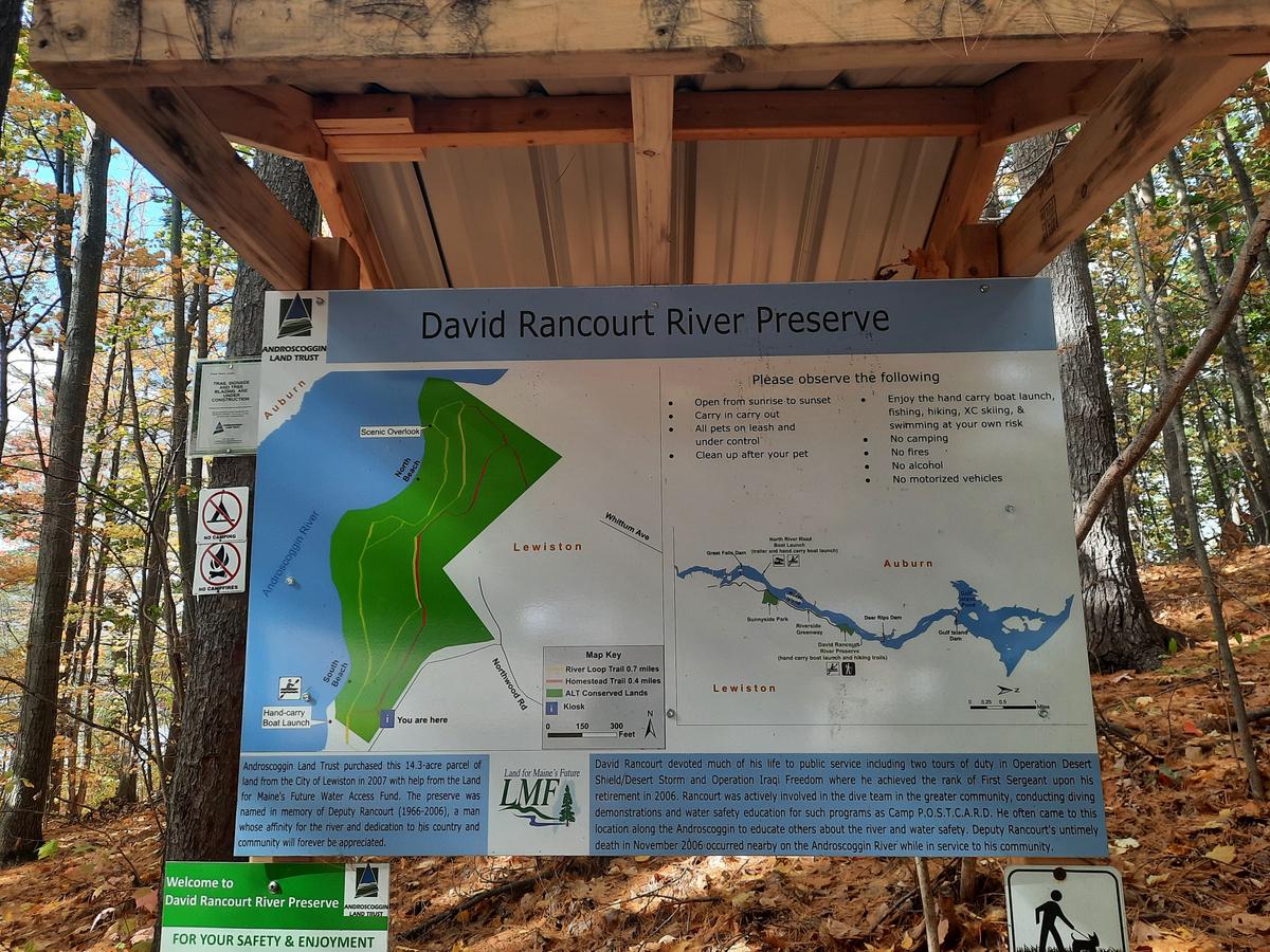
When I first pulled up to the parking area for the David Rancourt River Preserve, I noticed there isn’t any signage to indicate there is a preserve there. If there hadn’t been a car parked there I wouldn’t have necessarily known where to park. Once parked I could see the big sign in the woods.
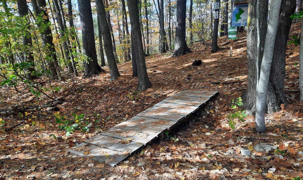
The trail starts with a boardwalk that is easy cross. However, it requires some maneuvering to get off the other end onto the ground again .
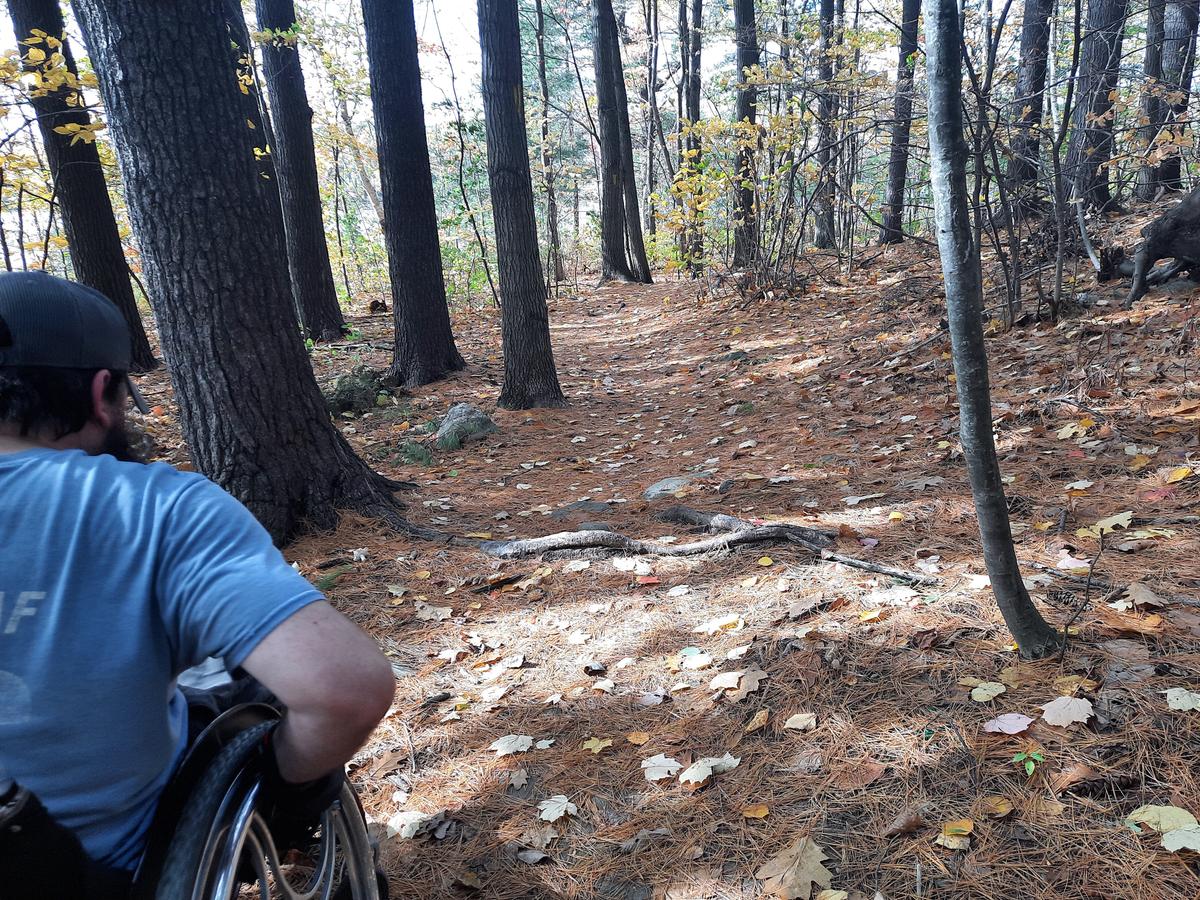
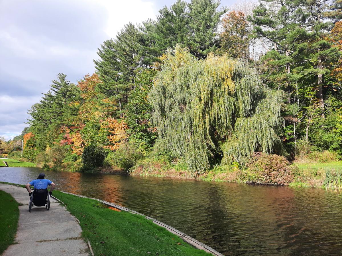
When I first got across the boardwalk I noticed a very steep hill to the right and remarked to Sandy that I hoped the trail didn’t go that way. Luckily it heads off to the left along the shore of the Androscoggin River. There are many large roots in this section of the trail It is wide enough to be able to maneuver around them without much trouble.
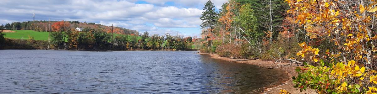
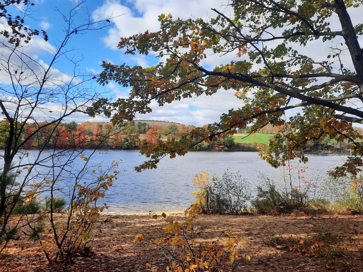
About a quarter of a mile into the trail it comes to a beach area that gives an amazing view of the river and surrounding area.
For wheelchair users with less strength or who may not be feeling up for a big adventure, or for people who are exploring on their own, I would turn around at this point. If you have help or just want an extreme uphill challenge then feel free to carry on along the trail as I did.
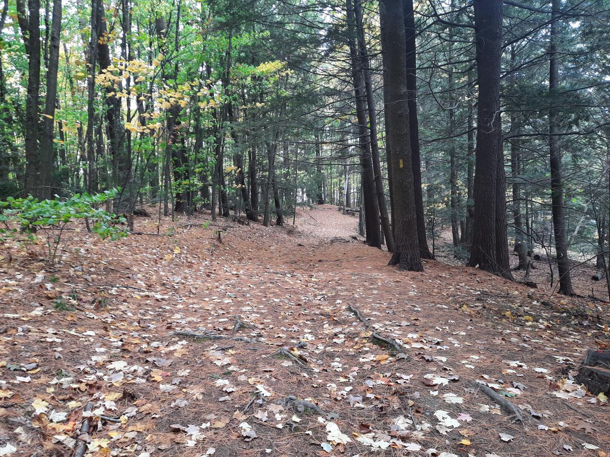
The trail turns away from the river and goes deeper into the woods up a long steep hill. After getting up the steep hill the trail becomes a lot more accessible and easy to navigate. The surface is a little bit soft because it is forest floor but not so soft that it is super hard to push over.
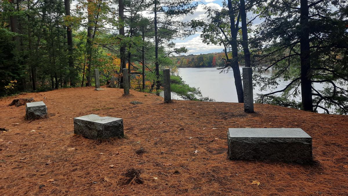
The “make it worth the effort moment” comes at a beautiful seating area in remembrance of David Rancourt. The view from this spot is stunning and the area is a perfect resting spot.
Remember that hill I saw and hoped the trail didn’t go that way? Well that is how the trail ends. It is even steeper than the hill I went up after the beach. It took me quite a while to decide to try making it down this hill on my own. I contemplated letting Sandy back me down. In the end, I had to try it or how could I truly evaluate the trail. I made it to the bottom of the hill and stopped by putting my front end against a tree! I had to have Sandy back me down the last transition because it was very steep and uneven.
Enock navigating down the steep hill. Video credit: Enock Glidden
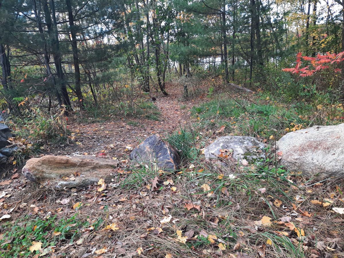
On our way out of the preserve, we noticed a trail that was closer to the water and seemed to start further down the road. We checked it out and found a row of rocks blocking the end of a trail. It didn’t look like I could get through but there was a trail around the rocks that I think was created by people going around the roads. It wasn’t accessible to go that way to get onto the trail. Once on the trail, it was much better. The surface was free of roots. It was flat and very wide. If they remove one of those rocks this would be a much more accessible way to access the preserve and get onto the main trail.
I would rate the first part of this trail Wheelie Easy. If you can get up the hill it gets Wheelie easy again. Unfortunately, there is no way to avoid steep hills and do the loop so overall the trail is not very doable. If you are looking for a great easy way to get to a beach this would be the place to do it.
WHEELIE EASY:
A trail that is easy to push on, has very few obstacles, and is mostly flat.
Since the days are getting shorter there was not a lot of time left after visiting the preserve. I decided to check out one other trail.
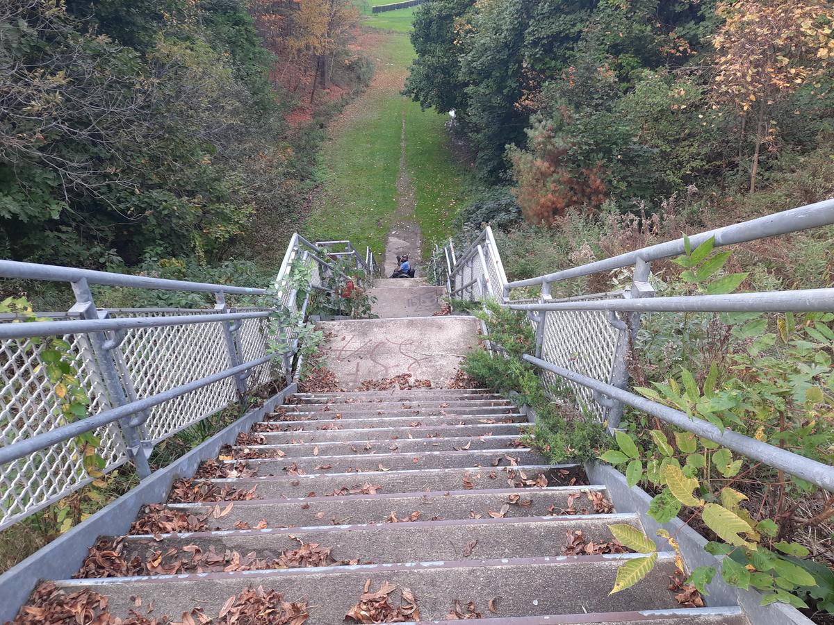
We went over to Pettengill Park to experience the Union Street Greenway. In the description on MTF, it says that there is a stairway in this trail: “The Union Street Greenway follows the edge of a baseball field and leads to a stairway that goes up and over Dennison Street. The path then passes through open fields in Union Street Gully and crosses Chesnut Street passing basketball courts to end at Union Street Bypass.”
I have dealt with plenty of staircases. I wrongly assumed that it couldn’t be that big if t was on the side of a road. I thought it must just be a few steps. I could probably just go up the side of the road to get around it. [Ed. Note: The MTF posting has now been edited to better describe the staircase.]
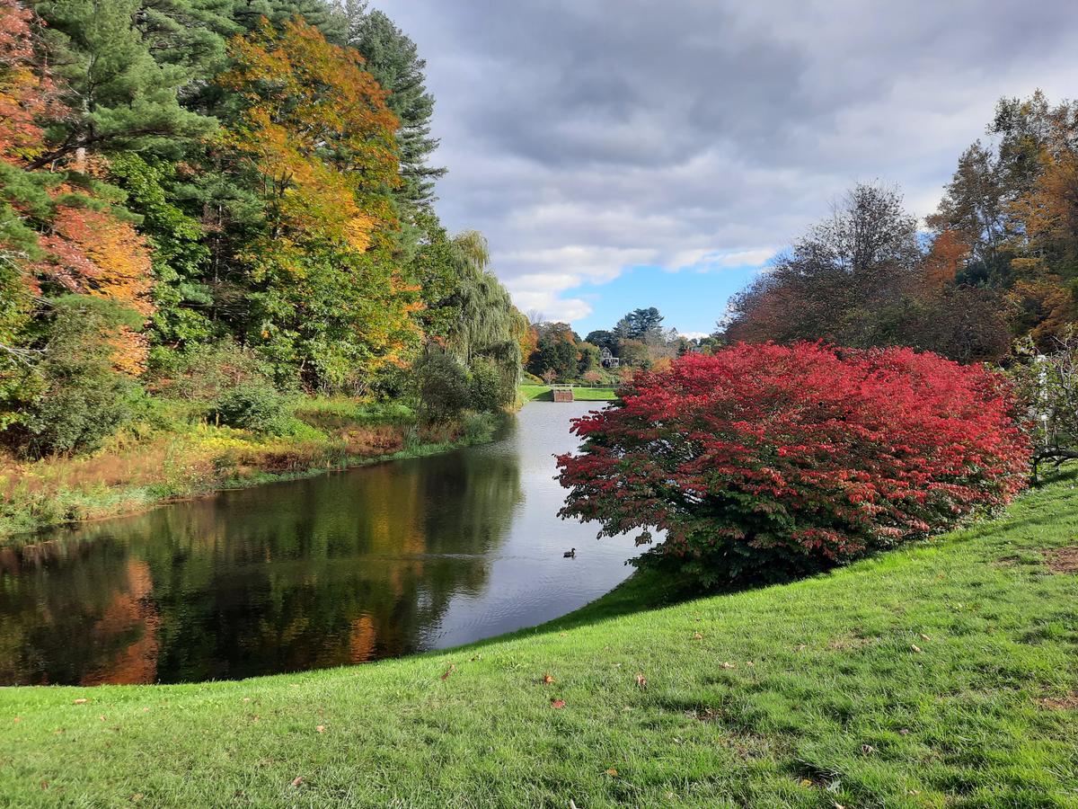
Before we got to the stairway we perused the park. Pettengill Park is a truly beautiful place. There is a pond where kids under 16 can fish during open water season. There are 2 baseball fields. The park is quite easy to get around and is very accessible.
We got a bit confused when trying to find the actual Greenway because it isn’t marked as such. There is not a single sign indicating where the trail is. After going completely the wrong direction and rereading the MTF website we figured it out.
If you enter the park from Winter Street, the trail goes behind the first baseball field. It starts as a paved path and transitions to a dirt road and grass. It doesn’t take very long to come to the aforementioned stairway. I think I would call this 3 flights of stairs which made the trail not doable at all. The trail is also rated easy but I am not so sure that even someone who can walk easily would find those stairs easy. The rest of the trail is easy.
I highly recommend checking out Pettengill Park. It is a very beautiful, peaceful place. The stairway makes the middle of the trail undoable.
There happen to be about 14 different trails around the LA area and I will be going back to check them all out!
JUST DO IT!:
Most people will be capable of navigating this trail with very little assistance.
JUST DON'T DO IT:
There are no accessible or reasonably close to accessible hiking options for manual wheelchair users.
If you have a different type of mobility issue or a different disability and you visit this trail or others, please comment on this post and give us your feedback. The more knowledge we gather and share, the more people we can get outside using the trails of Maine!
Success! A new password has been emailed to you.