This is a guest post written by Enock Glidden, MTF Accessibility Ambassador, Public Speaker, Adaptive Athlete, and Adventurer. To learn more about Enock, please visit his website.
I decided to stick with the theme from the last few weeks and do another rail trail this weekend. With all the rain we have had lately, I thought a paved trail would be the way to go. The Kennebec River Rail Trail is quite familiar to me from the Gardiner end. I lived in or near Gardiner for about 5 years total. I had accessed this trail from a few different points on that end but had never started at the Augusta end so I decided to check out that end this time. That is one of the things I like about this trail. There are so many places you can access it which makes it even more accessible for people with disabilities. It gives us options.
This is a list of all the access points along this 6.5-mile trail stretching from Augusta to Gardiner, I found this list at the Friends of the Kennebec River Rail Trail website, but you can also get directions to the parking areas on the Directions tab of the Maine Trail Finder posting.
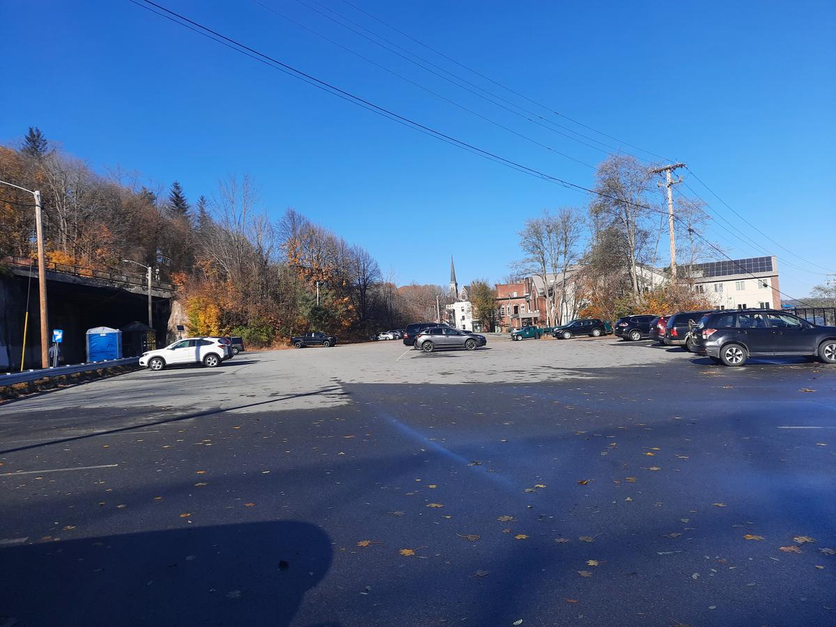
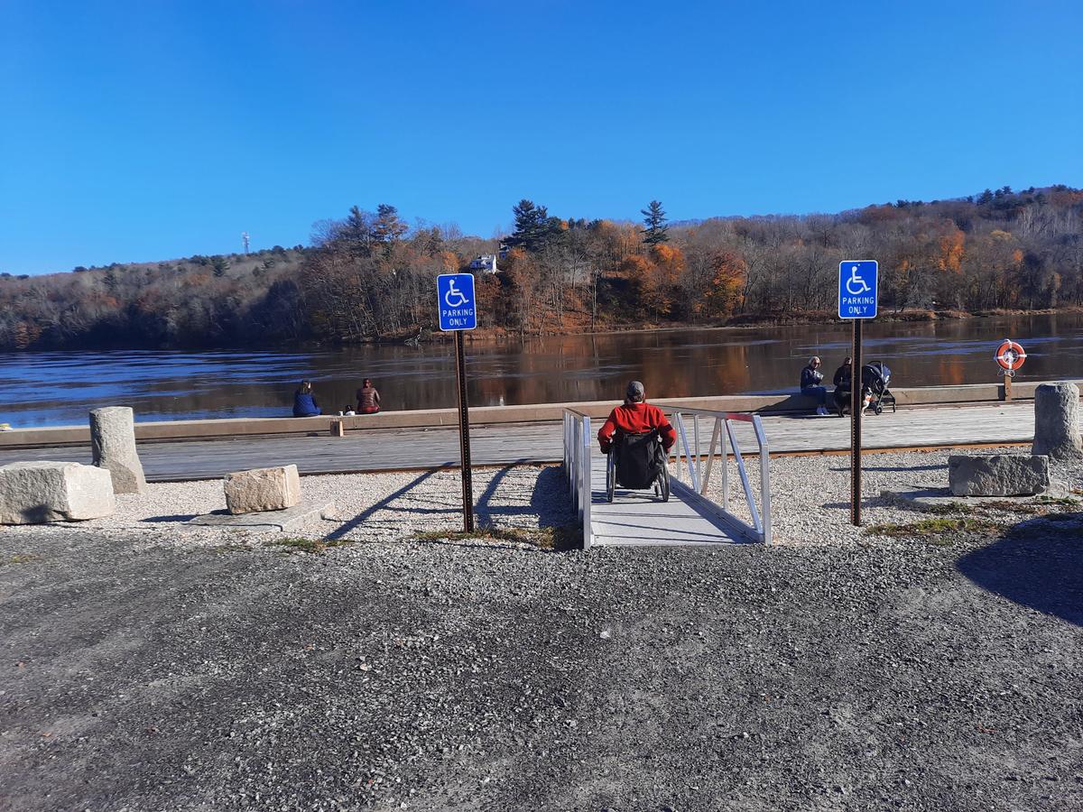
We started at the Maine Department of Inland Fisheries and Wildlife parking lot at the quarter-mile marker. I chose this spot because I knew the parking lot was huge with a lot of accessible parking. It also cuts out the first hill on the trail. The hill isn’t steep or difficult. If you wanted to start from the very end at Waterfront Park it is also doable from there. This is another great aspect of this trail. There are many places to park. If you can’t find accessible parking at one place it gives us many other options. This is a list of the parking areas also found at Friends of the Kennebec River Rail Trail.
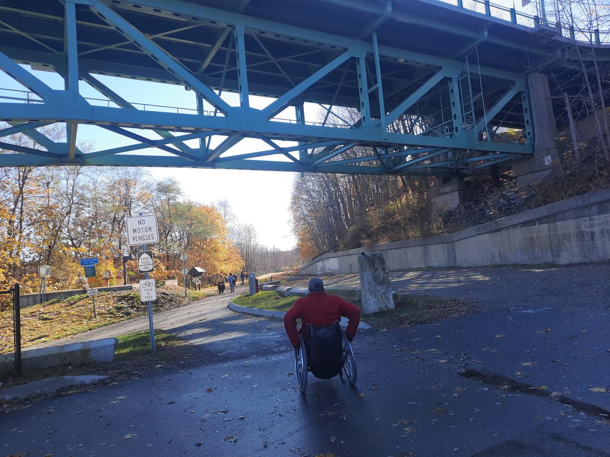
The parking lot we started from is the trailhead under the Memorial Bridge.
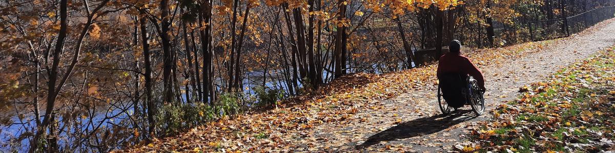
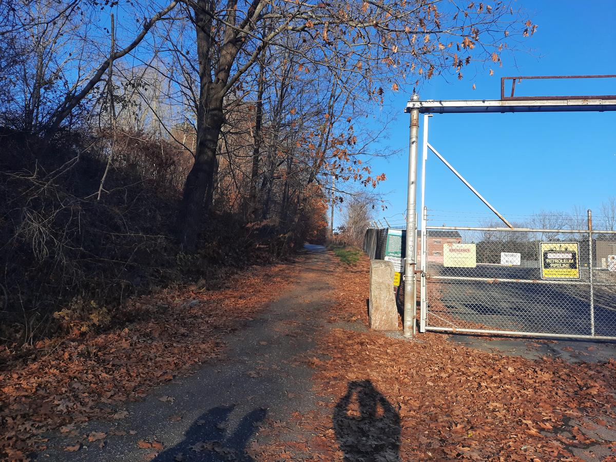
The trail is 10 feet wide and paved for its entirety. This trail isn't the traditional rail trail as you might picture in your head. It actually runs beside the old railroad tracks and even crosses them at some points. What that means is that there are hills. The hills are not steep but are long and gradual. The steepest hill is near an oil pipeline facility about 1.5 miles into the trail. I had no problem managing any of the hills.
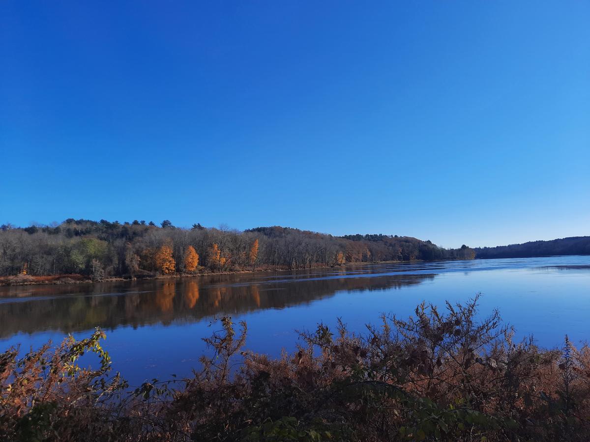
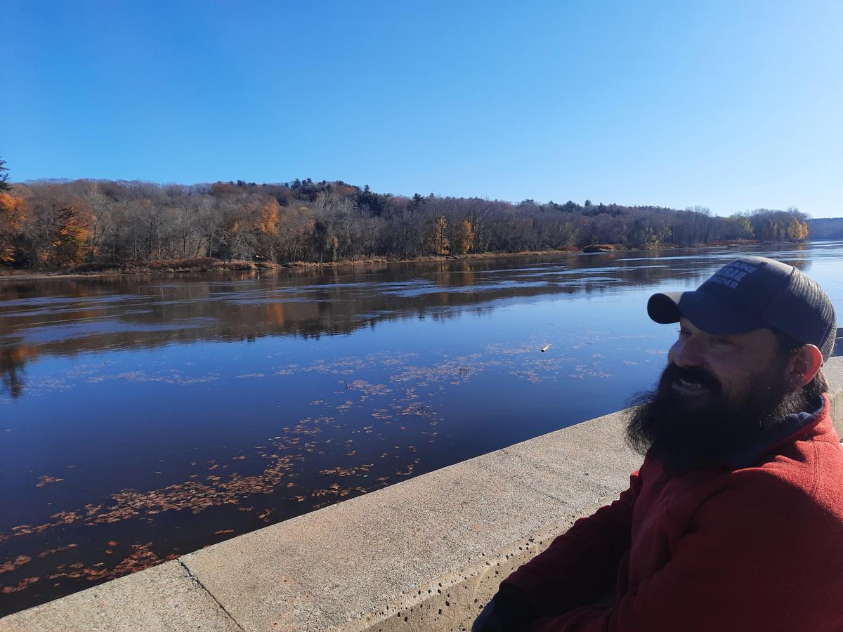
There are quite a few beautiful spots to stop along the trail. Amazing views of the Kennebec River abound.
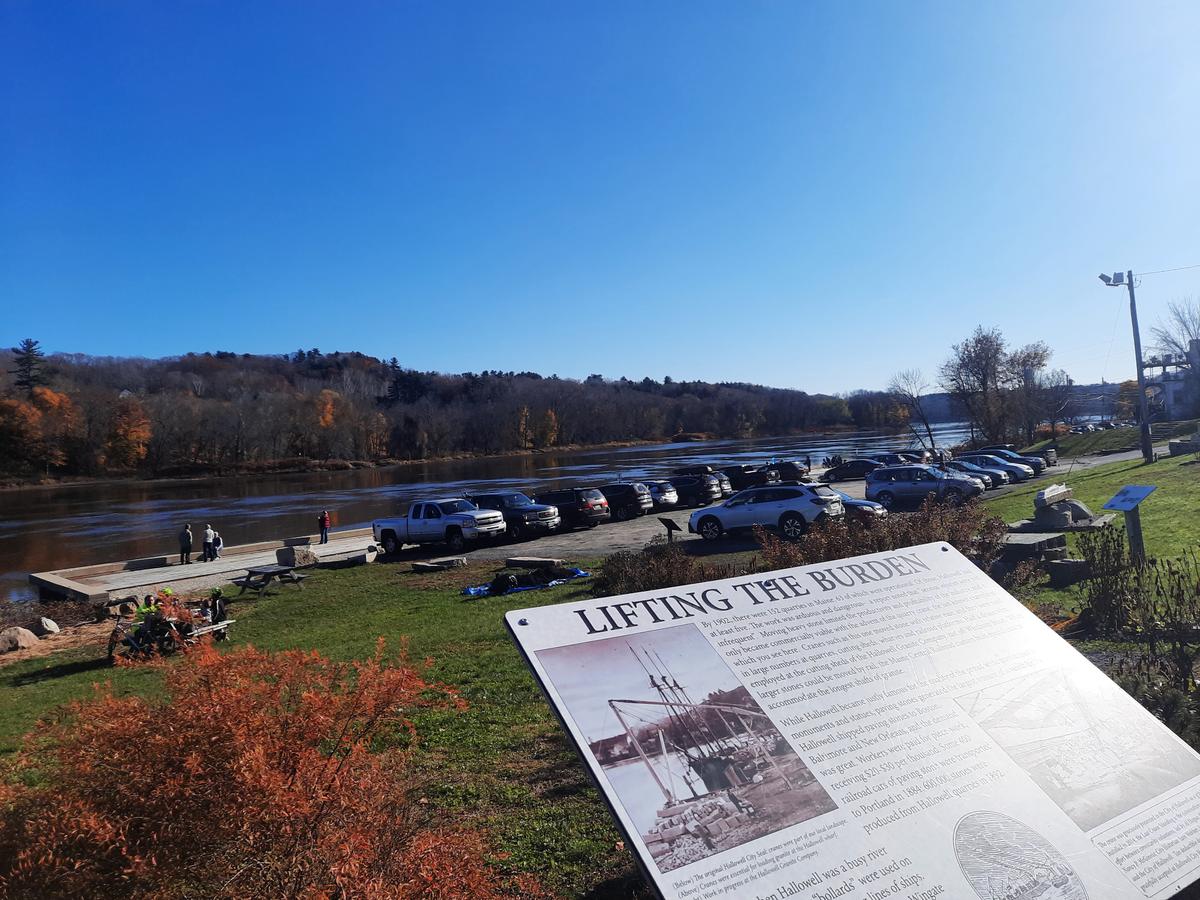
The best spot along the trail is in Hallowell at Granite City Park. There is a huge deck allowing people to sit and watch the water and wildlife. It has a ramp to access it. It could be quite difficult to get down to it. You have to leave the trail to go down the paved hill to the parking lot. Across the parking lot is the deck. There is also a really interesting display of the history of rock quarries in Hallowell. Hence the name Granite City.
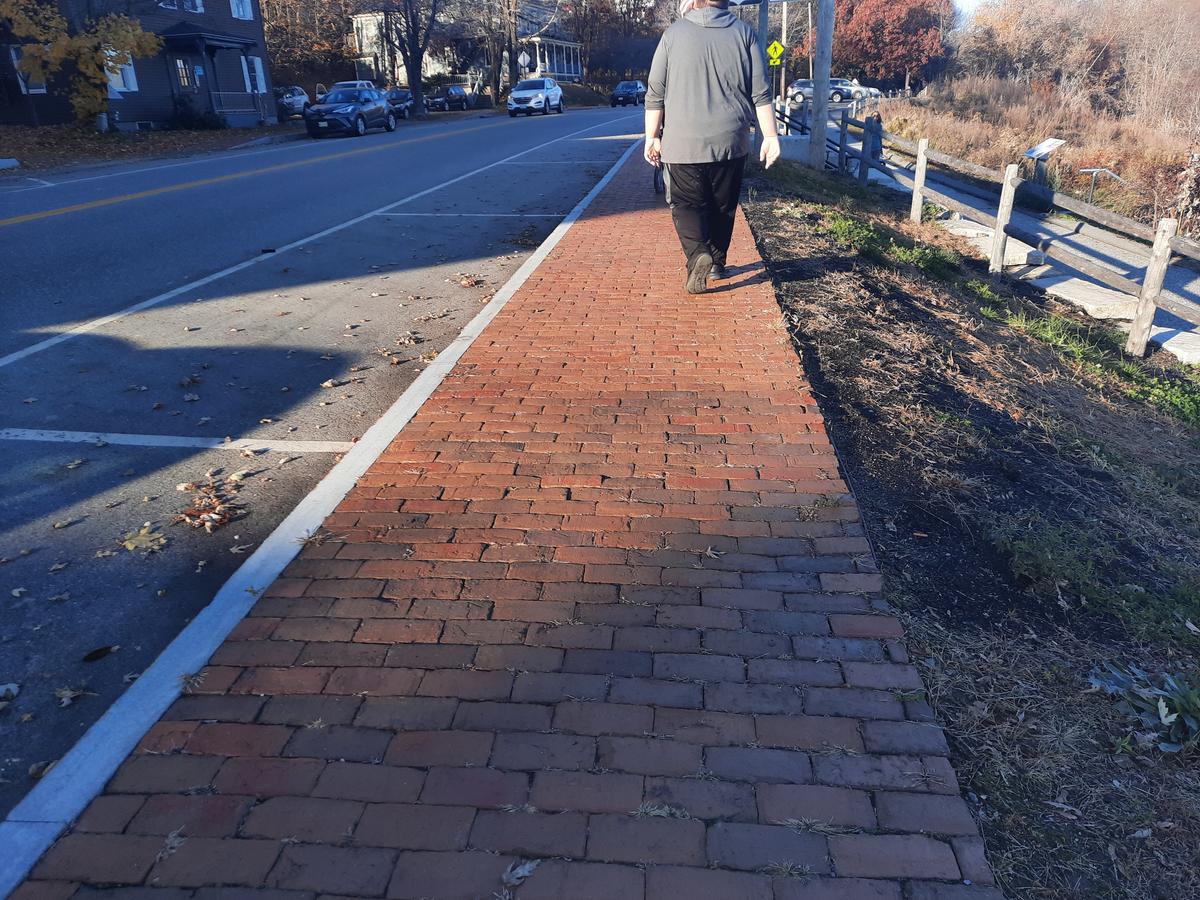
After leaving the park the trail continues on through downtown Hallowell using the sidewalk. Keep in mind the sidewalks are made of bricks. This could cause some issues for people who have trouble walking or use walking devices.
You will need to cross the road at some point as the trail moves to the other side of the road on the other side of Hallowell. We chose to cross in town where the traffic is much slower and drivers are more likely to be looking for pedestrians.
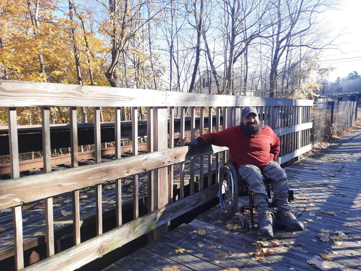
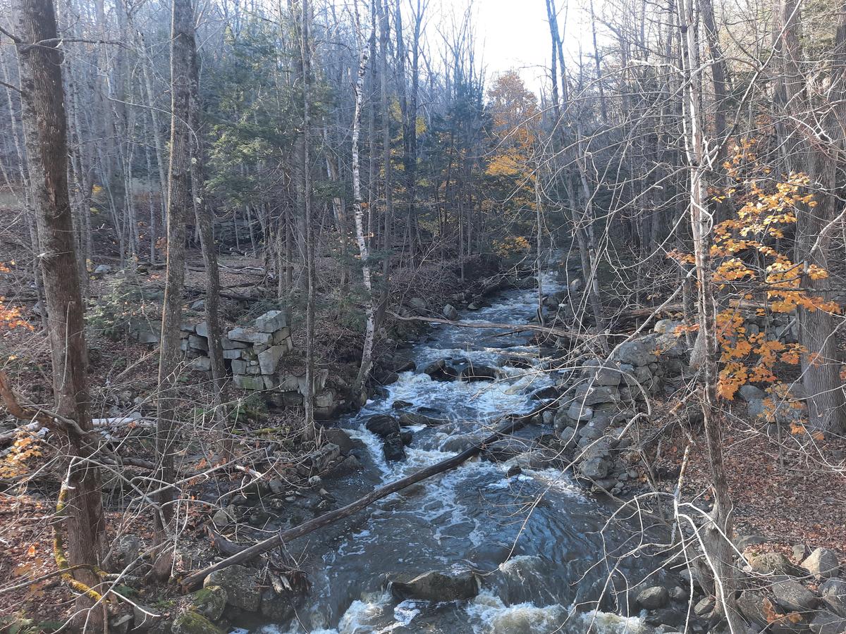
The paved section of the trail begins with another long gradual hill. The reward after doing this hill is a beautifully built wooden bridge that crosses over a waterfall. WIth all the rain we have had lately the water was raging. This is another beautiful spot to spend some time. The rails of the bridge are very high but have adequate spaces to be able to look through.
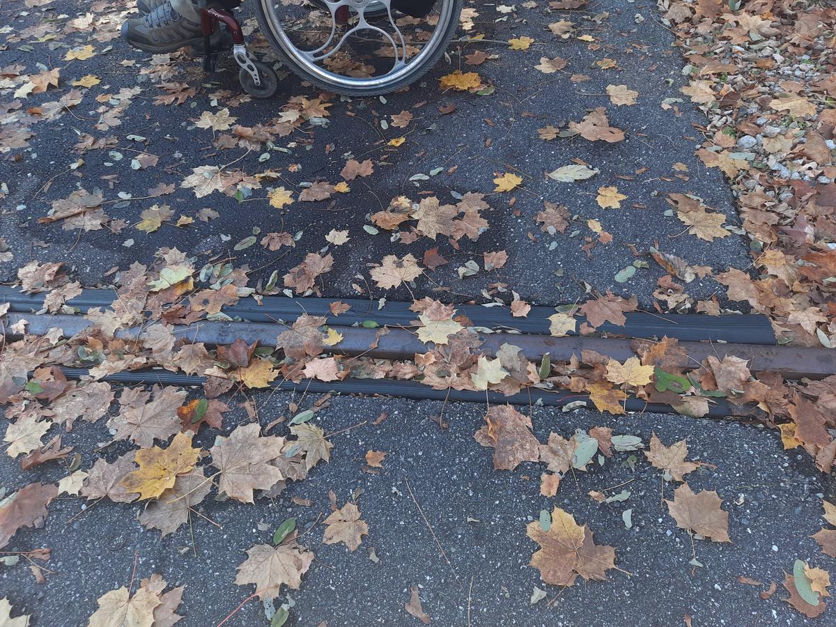
After this bridge, the trail crosses the railroad tracks. This could be another tripping point for people who have trouble walking. They have done a pretty good job of covering the spaces to minimize this risk.
After this it is smooth sailing to the 3.5-mile marker where we decided to turn around. This gave us a great 6.5-mile hike for the day. I know this because they have conveniently marked every quarter mile of the trail with beautiful stone markers.
This is the longest accessible trail I have found in Maine thus far. I will save the Gardiner end for the next hiking season at the same time of year.
I am rating this one a Just Do it! There is nothing about this trail that makes it inaccessible. From the vast amount of places to park and access the trail to the fact that it is paved for nearly the entire length, there is a doable section for everyone.
JUST DO IT!:
Most people will be capable of navigating this trail with very little assistance.
I seem to be in a very reflective mood lately when it relates to trails. In my last blog, I talked a lot about barriers at trailheads. If you look at the picture of the trailhead where we started, it was completely open. It is also paved which seems like it would be more welcoming to people trying to drive things on it that shouldn't be there. It would seem this isn’t a problem for this trail. It has been there for many years with a 10 foot wide or greater opening. I wonder if we should just assume people will do things they aren't supposed to and put up barriers to prevent it or if should we wait until it happens and then do something to prevent it? On this same thought, there are barriers at the other end of the trail which I will show when I do that section. They are accessible width so the entire trail is still accessible.
If you have a different type of mobility issue or a different disability and you visit this trail or others, please comment on this post and give us your feedback. If you would like to visit a trail with Enock feel free to reach out. He would love to have people join him in the outdoor spaces of Maine. The more knowledge we gather and share, the more people we can get outside using the trails of Maine!
Success! A new password has been emailed to you.