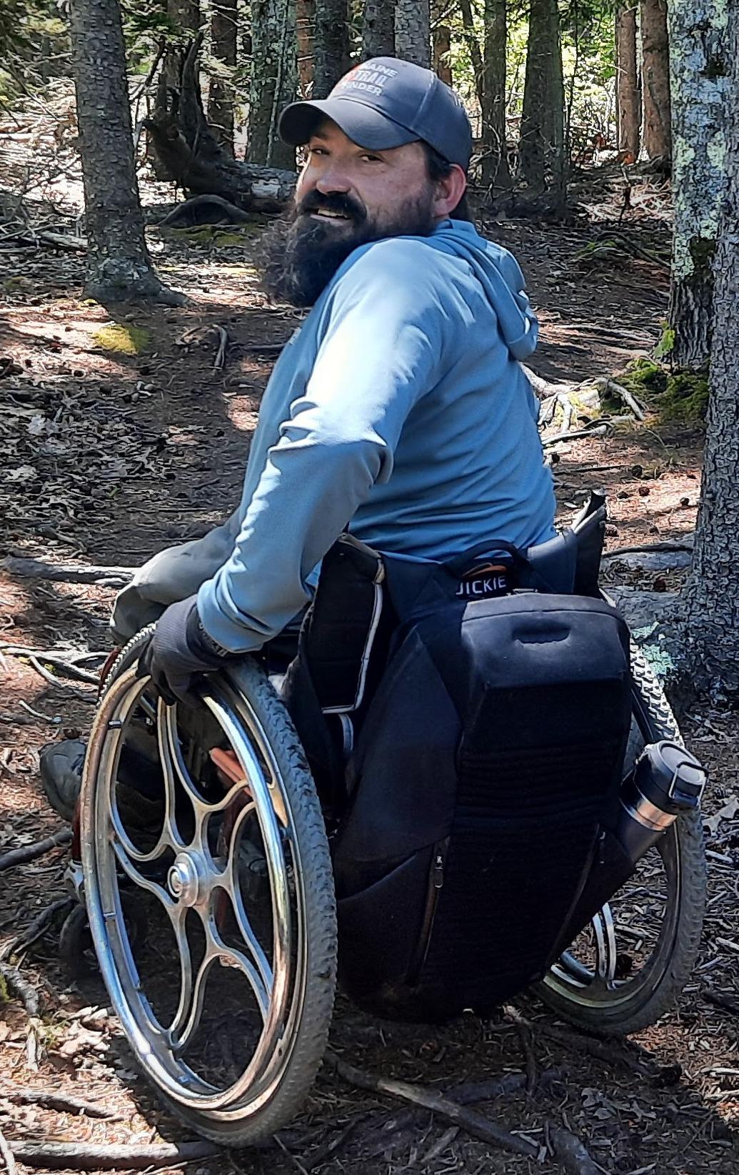
This is a guest post written by Enock Glidden, MTF Accessibility Ambassador, Public Speaker, Adaptive Athlete, and Adventurer. To learn more about Enock, please visit his website.
Hey fellow hikers you are going to be seeing a lot more of me this hiking season. I am going to try to get out 3 times a week. We may try to spread out the posts over the year but I will be out checking trails as much as possible.
I want to make this post a combination of explaining my thoughts on trail ratings and a report, like usual, of the Maquoit Bay Conservation Land Trail owned by the Town of Brunswick.
I got the idea to do this trail when I visited the Adaptive Outdoor Education Center (AOEC) in Brunswick. I like to research trails whenever I have a destination. I found this one and it seemed very doable from the description.
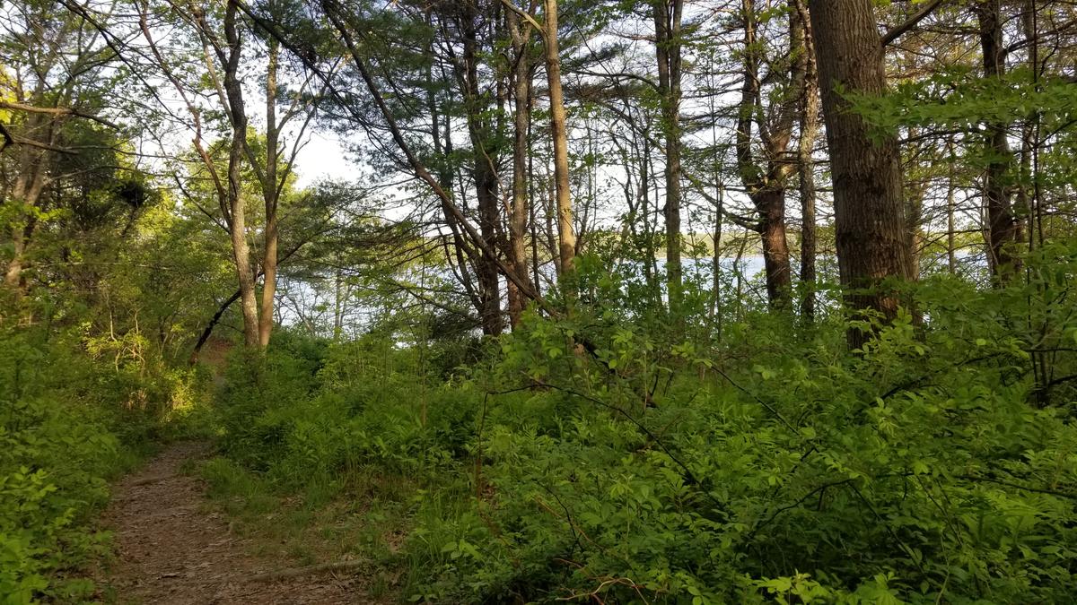
The trail at Maquoit Bay Conservation Land follows an old woods road, perfect for walking or cross-country skiing. The 0.7 mile trail leads to Rocky Point, a unique rocky promontory offering spectacular coastal vistas of Maquoit Bay, on which the oldest trees on the property are found, and from where the public can swim in the warm waters of the shallow bay at high tide.
I also only do easy trails and it is rated easy.
My friend Zach from AOEC had given me some advice before trying this trail. He said that he thought I could probably do most of it, but the end might be difficult. Of course if you know me, you know that telling me something might not be possible makes me want to do it even more.
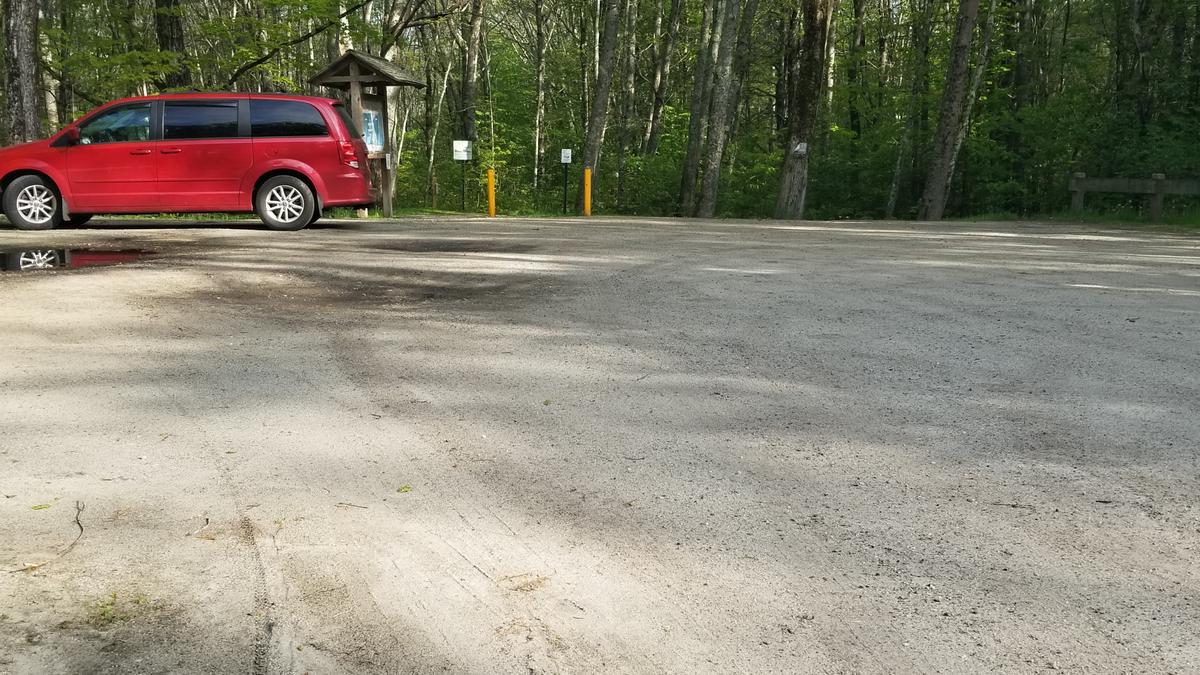
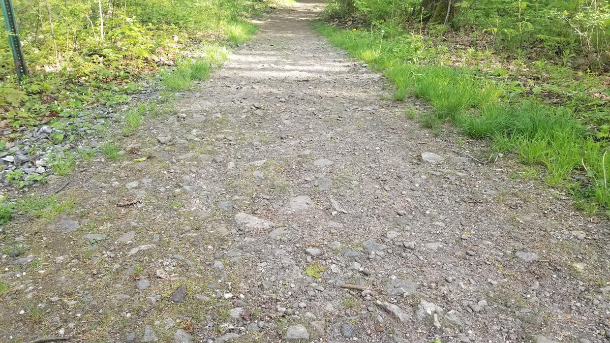
Since I had attended an event at AOEC right before heading to the trail, I did this one by myself. I arrived at the trailhead and found a very nice flat parking lot with plenty of space including a designated accessible space. The start of the trail has a perfectly accessible opening between two steel posts. This was a really good start to the hike.
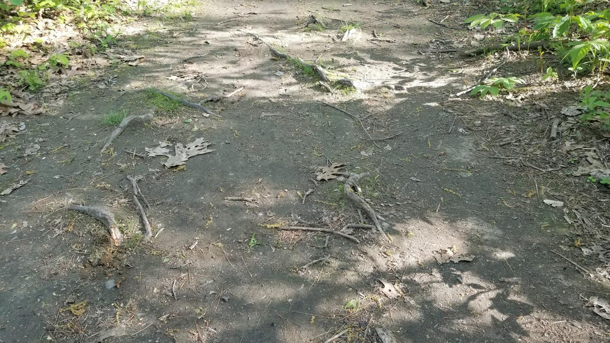
The first half of the trail is slightly downhill -- I would estimate a 2 percent grade or less. It was so subtle I didn't even notice I was going downhill until I was going uphill on the way back. This trail is an old road which makes the surface very firm. There are some rocky areas but nothing that sticks out of the ground more than 2 inches. It will rattle your teeth and chair a bit. I noticed some divots in the ground that would definitely trip someone up if they weren't careful. It dawned on me on the way back that they were hoof prints from a horse.
This half of the trail I would rate Wheelie Easy. There are little to no obstacles. It is flat to slightly downhill. The surface is very hard and makes rolling quite easy.
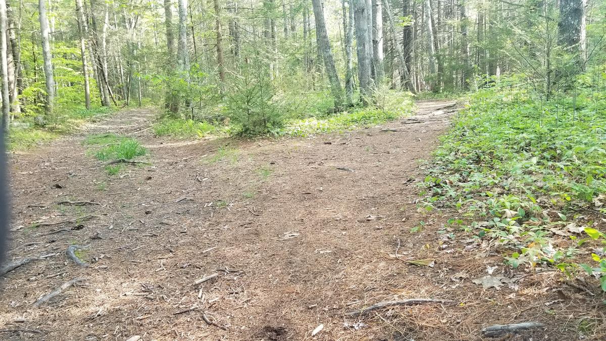
The second half of the trail is where things got a bit more interesting and difficult. I encountered two spots where the trail forks and for good reason. If a hiker were to take the left fork they would be hiking through a mud pit or other treacherous terrain. By staying to the right the trail is flat and mostly obstacle free other than a few roots.
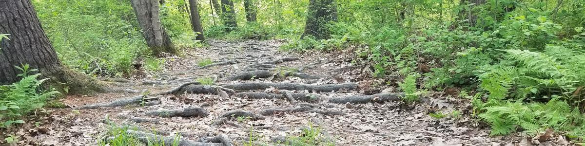
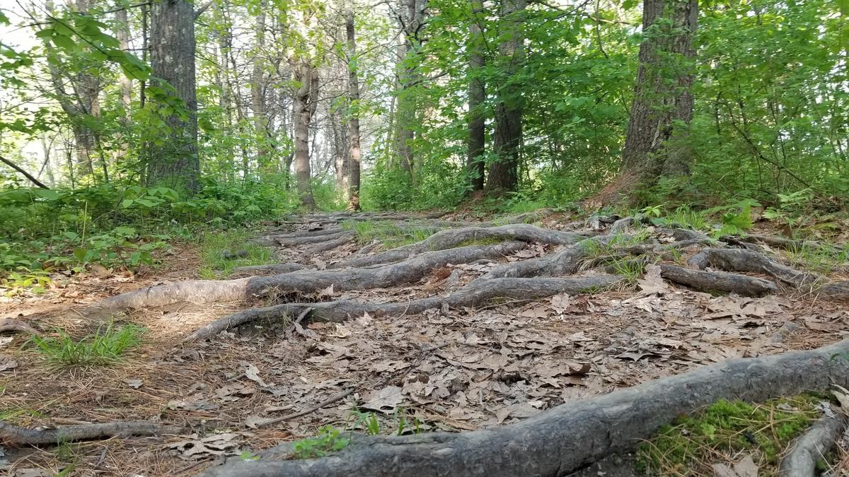
About a quarter of a mile from the end of the trail is when it gets what I would call close to strenuous. There is a massive root system that makes the trail super hard. This happens to be where I started having the most fun. I love the challenge of figuring out how to make it through tricky sections. I had to use a few interesting techniques. I wish I could have done a video for you. I am working on figuring that out. For now, I will just try to describe it the best I can and use pictures.
There was one section that was uphill and riddled with roots. I sat and studied the root system and noticed that it created a switchback up the little hill. I straddled the first root with my wheelchair and then followed that switchback. I even surprised myself with how easy it turned out to be.
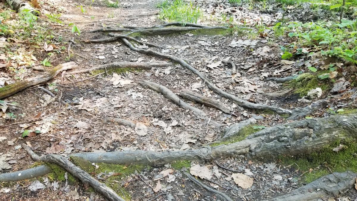
However, it was after this section that it got extreme. There was at least a couple hundred feet of massive roots covering the entire trail from side to side. When I come to these sections I sit and study. I look at where the least amount of roots are and decide if there is a path through them I also look at the sides of the trail and ask myself if going off-trail slightly is a better option. There is also the wheelie and pray technique. In this case, I had to use a little bit of all the options.
When I use the wheelie and pray option, what I mean is I do a wheelie and push very slowly and deliberately. I only go over one root at a time and stop and assess my next move. This section probably took me about 15 minutes to get through but I made it. Unfortunately, my friend Zach was right about the end of the trail. Right after doing that really hard section, I came to a very steep hill with roots that leads to the rock promontory in the description. I could see the water but couldn't quite get to the best view. I honestly did contemplate trying it but I could see a rescue in my future. I opted to turn around and head back.
This is when I noticed the trail is actually downhill on the way in and obviously uphill on the way back. Like I said before it is very gradual. If it wasn't for the roots I would call the entire trail Wheelie Easy. Well, wheelie easy up to the last hill.
The second half of the trail I am rating Wheelie Advanced to Wheelie Strenuous depending on the person.
This leads me to talk about trail ratings. You will notice I said "depending on the person." I thought about that a lot when I was doing this trail. The rating is easy but for who? For someone who has no issues walking at all, it could be easy but I could see even those individuals getting tripped up on the root system at the end.
Trail ratings are a subjective thing. For a world-renowned trail runner, most trails are probably easy, but for the average person that might be different. For people with mobility issues or other inhibiting factors, an "easy" trail might be their Appalachian Trail. This is why I am hoping to get a lot more people to give their perspectives on trails. I want as many opinions as we can get to help define what really is easy, moderate, advanced, and strenuous. From there I am hoping to develop a more standard rating so that people will be able to know some basic information about a trail from the rating. Information like obstacle size, hardest slope, trail surface, cross slope, and anything else I can think of throughout the process. Even my trail ratings won’t apply to everyone in every situation. A trail that is easy for me might be difficult for someone else. I just want to have a place to start so we can move the ball forward.
Wheelie Easy
Wheelie moderate
Wheelie Advanced
Wheelie Strenuous
Until next time keep hiking and exploring and don’t forget to let us know how it went!
If you have a different type of mobility issue or a different disability and you visit this trail or others, please comment on this post and give us your feedback. If you would like to visit a trail with Enock feel free to reach out. He would love to have people join him in the outdoor spaces of Maine. The more knowledge we gather and share, the more people we can get outside using the trails of Maine!
Success! A new password has been emailed to you.