This is a guest post written by Enock Glidden, MTF Accessibility Ambassador, Public Speaker, Adaptive Athlete and Adventurer. To learn more about Enock, please visit his website.
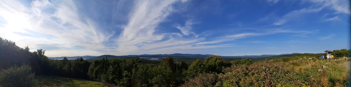
While perusing Maine Trail Finder looking for easy trails, I noticed there are a lot around the Rangeley area. I decided it would be a good idea to try to check out as many of them as I could in one day. That way I could give people a decent idea of what’s available for recreation opportunities if they ever visit this beautiful area of Maine.
I made a list of places to visit. Each trail has its own section with my trip report and thoughts on the experience.
The four trails Enock visited in the Rangeley region.
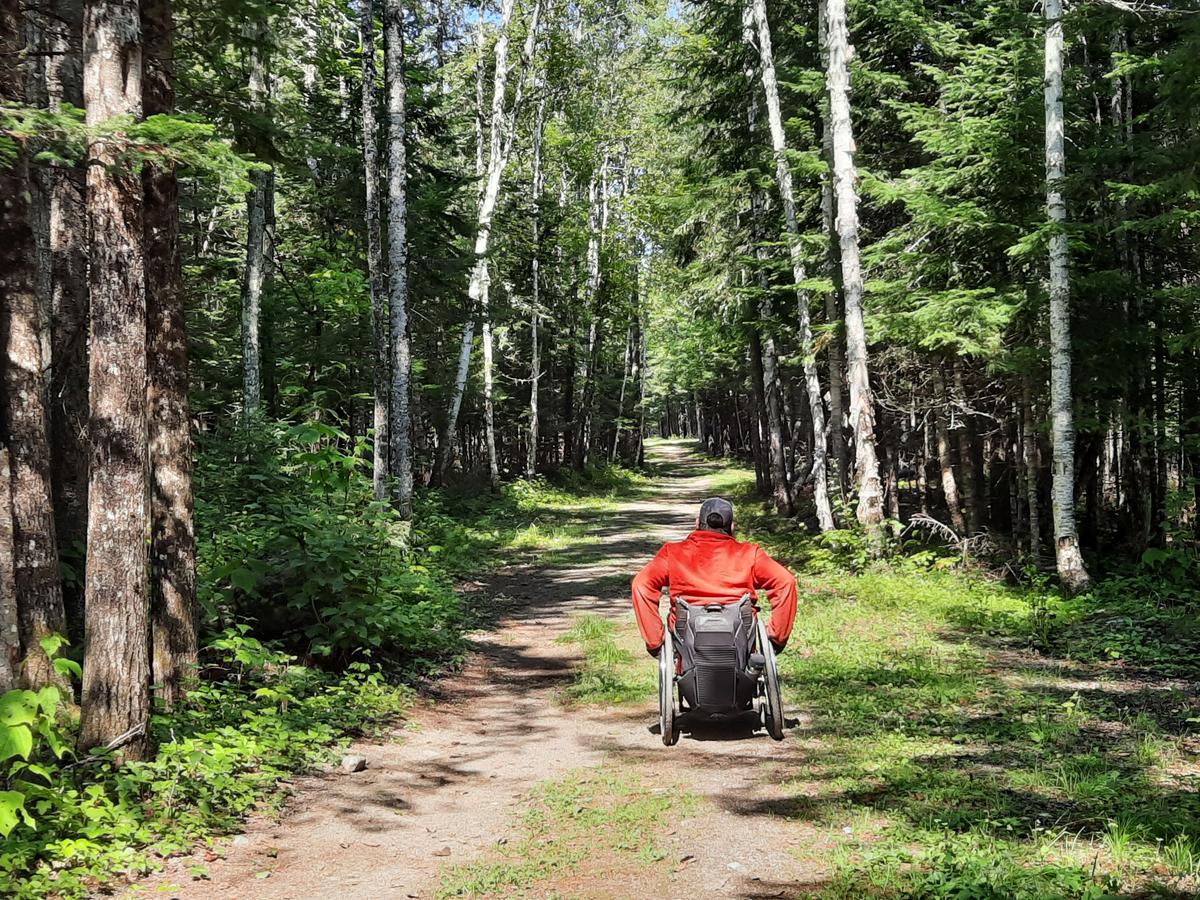
The Rangeley River Trail was by far the best of the bunch. Truth be told, it was the only one I actually was able to fully try out. This is the description on the trail posting, “This short section of shared-use trail provides access to the shores of the Rangeley River and Mooselookmeguntic Lake for hikers, anglers, bikers and snowmobilers. Two stream-side picnic tables and a 0.5-mile side trail to the lake allow trail users to explore the Rangeley River area at their own pace. After crossing the river at its northern terminus, visitors can venture down the narrow gauge railroad bed which runs across the steep opposite bank of the river.”
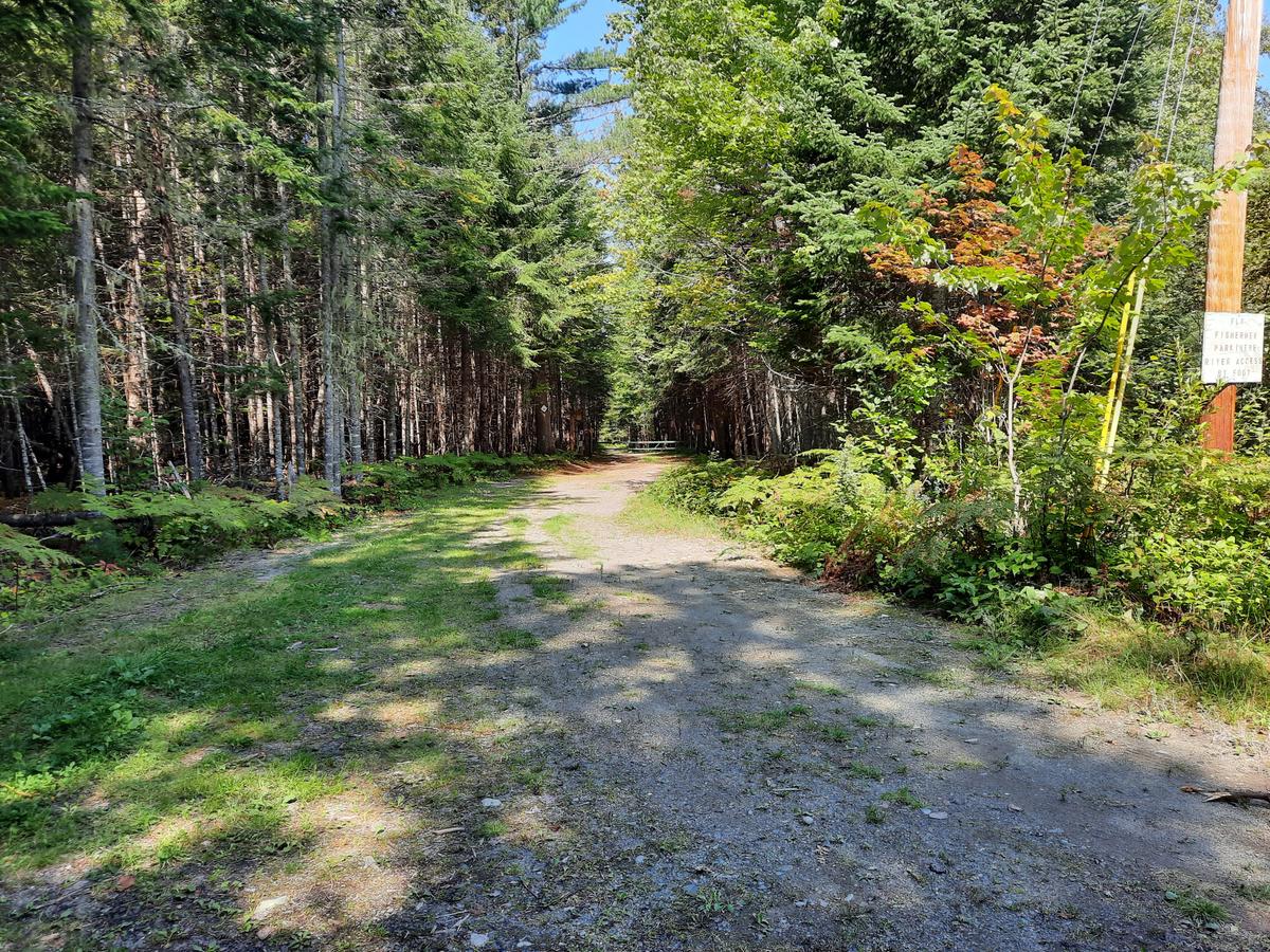
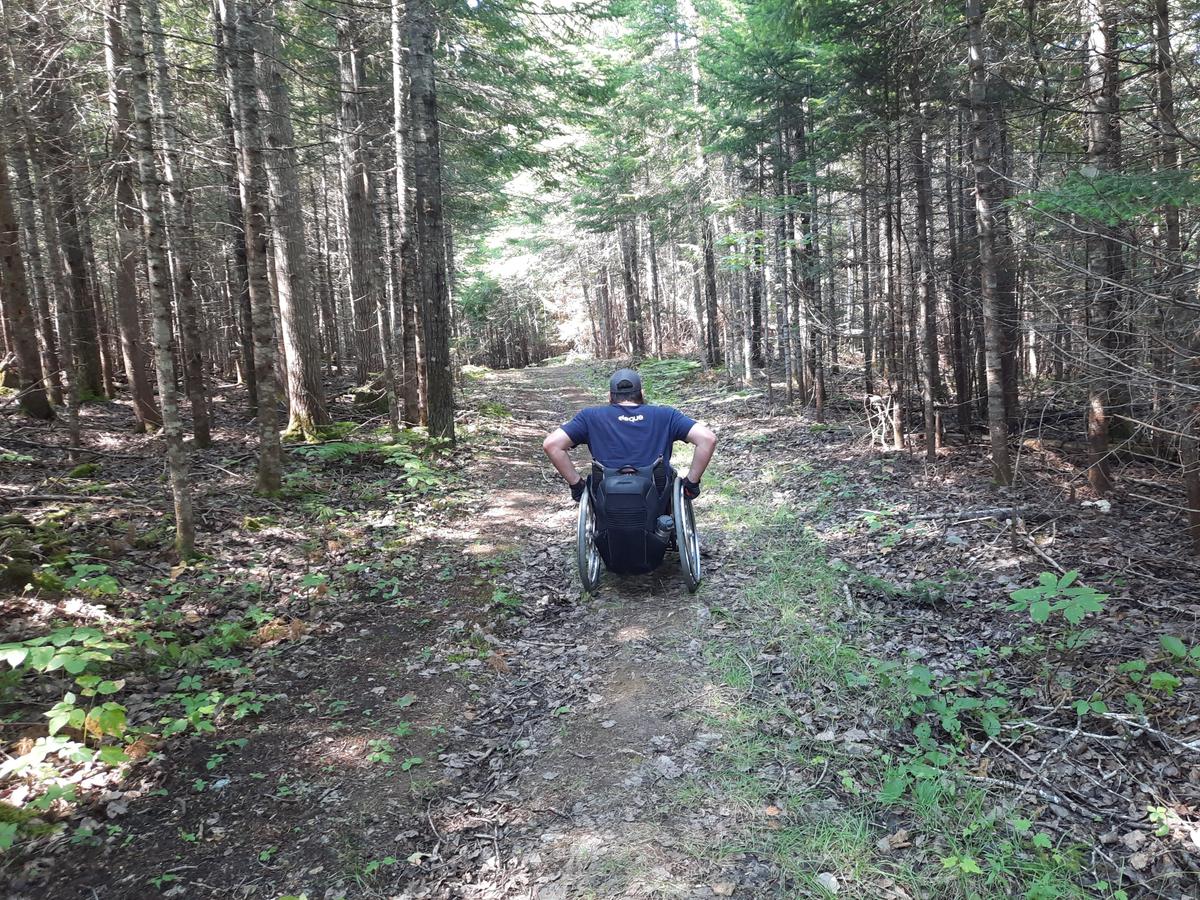
The trail starts out very flat and mostly smooth. It has occasional sections of rocks but not so bad that they are inhibiting the travel of my wheelchair. The trail is actually an old road which means it is very wide. This allows for the ability to pick a path around obstacles if needed. That fact also makes the surface quite firm for most of the trail.
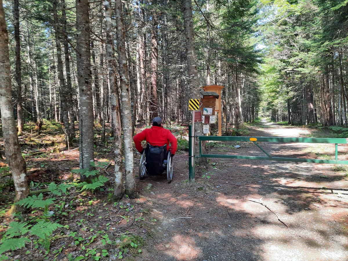
A few hundred feet from the parking area is a gate. When I saw the gate from a distance it looked like game over. I didn’t see any way around it. As I got closer I saw there is a piece of trail to the left that made it very easy to make it around the gate.
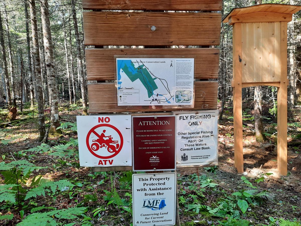
Near the gate, there is a kiosk. The trail information is quite minimal. It looks like they are putting in new kiosks so hopefully, that will get better.
After passing the gate the trail is quite easy to push on for a few tenths of a mile.
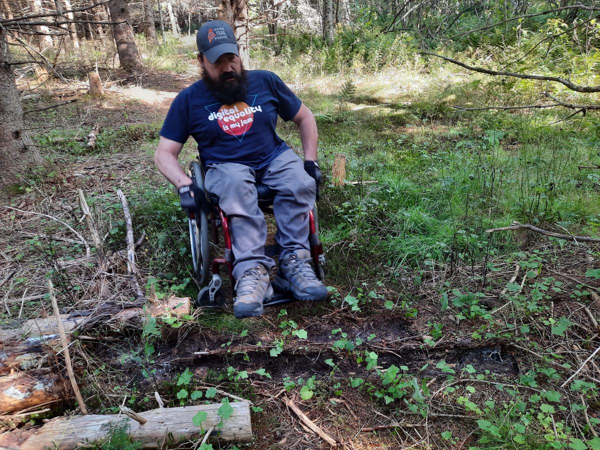
Then things started to get a bit more adventurous. It appears that someone had driven down the road during mud season and left some very deep ruts. I had to start picking a path to get through at this point. It wasn’t super hard, it just made things a bit more tricky to navigate. The trail also starts to go gradually downhill. It was very gradual so it was quite easy to push up on the way back.
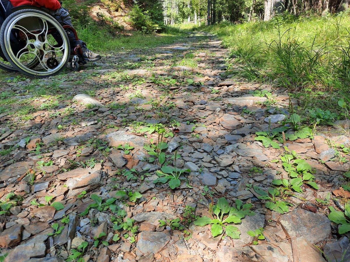
Once past the ruts and downhill, I came to a short stretch of shale rock. I was a bit worried about popping a tire on this stuff but I made it through unscathed.
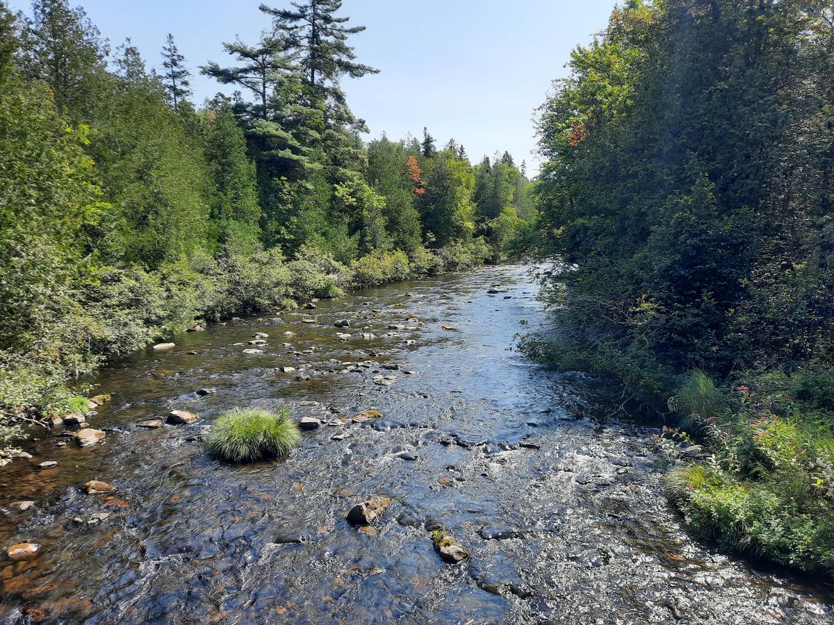
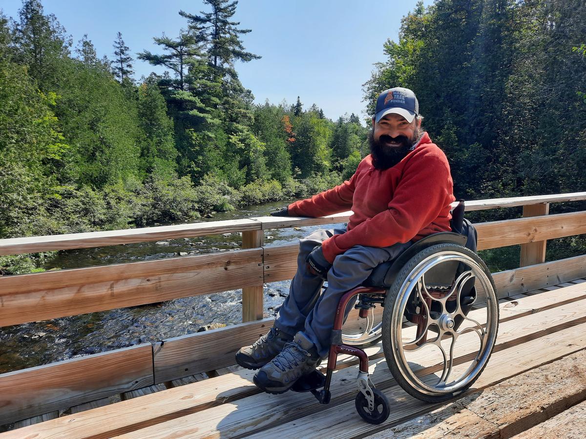
It was well worth the effort. Just beyond the shale is the aha moment of this trail. A snowmobile bridge allows access to the most beautiful view of the Rangeley River. The beauty of the bridge not being built to be accessible is that the railings are really low, so I didn’t have that pesky problem of the railing landing right at eye level. I could see for a very long distance in both directions.
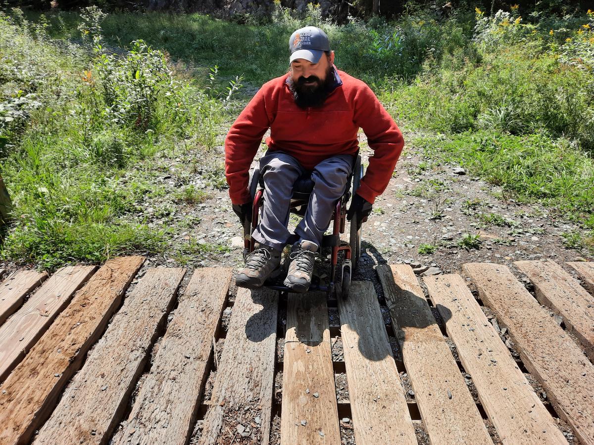
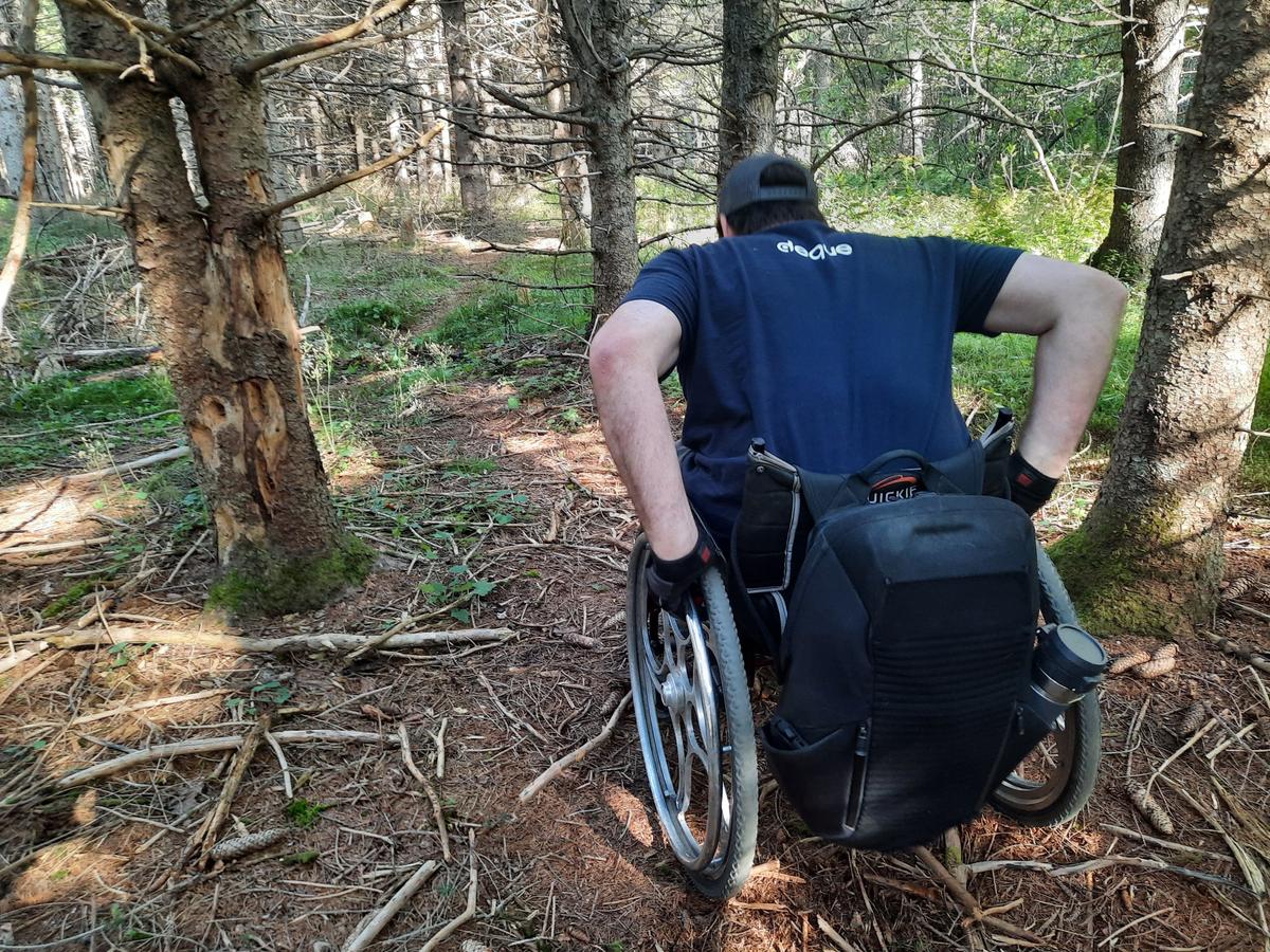
Getting up the bridge took some problem solving. I was able to roll up the steep incline by staying close to the outside boards of the bridge. It was just wide enough for my chair. I was able to push it myself but it definitely took some effort. I would also caution that the gaps between the boards are quite wide. Depending on the width of your wheelchair it may not work for you.
On the way back we decided to try the side trail that goes to the Mooselookmeguntic Lake. The description claims that it is 0.5 miles to the lake but it didn’t seem like it at all. It felt closer to 5 miles!
The trail to the lake is actually much better as far as the surface goes. It is quite easy to push on but it is also downhill for about half the trail, which that means on the way back there is a lot of uphill pushing. It isn’t steep at all but definitely more challenging.
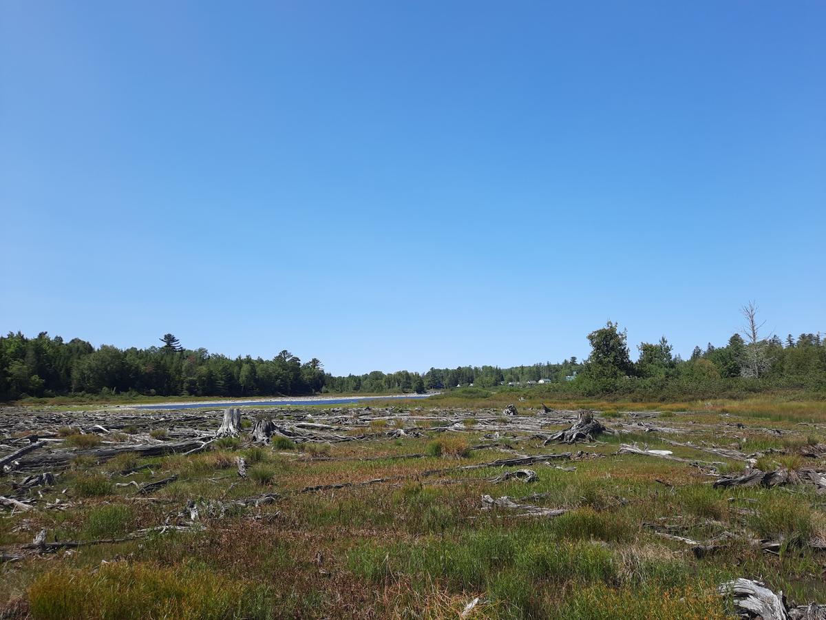
The end of the trail called for some fancy maneuvering of my wheelchair to get out far enough to see most of the view. There were big rocks and logs to get over. I decided to stop when the logs were in huge piles scattered all over the shoreline. It didn’t prevent me from enjoying the view. The wind, sun, and perfect temperature made all that effort extremely worth it The spectacular view and setting at the end was the "this is why I hike" moment. It was the most tranquil spot of the whole day. We saw eagles, geese, and some other birds we couldn’t identify. There is a large number of old logs that I assumed were from the log driving days. We read some history that loggers used to bring logs down to the shore to load on boats. I assume that these logs must have been some of the ones that didn’t make it.
I recommend checking out Rangeley River Trail. It is wheelie easy as long as you can navigate the ruts and some rocks. I could have done the whole thing by myself for sure but it wouldn’t hurt to have some help come along.
WHEELIE EASY:
A trail that is easy to push on, has very few obstacles, and is mostly flat.
This was one of the more disappointing moments of the day. The description on Maine Trail Finder says “This short trail leads into the 90-foot deep gorge of Cascade Stream providing access to a series of waterfalls and chutes. The trail leaves from the south side of the parking area and is marked by white blazes. Shortly after leaving the parking lot the trail passes under a power line and continues into the woods and along the stream. There are several good viewpoints of the stream and falls along the trail which at several points follows the bedrock on the side of the gorge. A higher trail away from the stream offers a loop opportunity. Picnic tables can be found at the parking area and at the power line. The stream itself is often used in the summer month to cool off and escape the summer heat."
We arrived at the trailhead to find cars parked along the road. After passing all the cars we saw a very steep dirt road. Unfortunately, we didn’t even bother stopping or getting out of the car because it just didn’t seem doable from the road. I do wish I had tried driving down the road to see if there was a parking lot. That is something I might do next time I am in the area.
After some lunch, we made our way out to Saddleback Mountain Ski Resort to check out Rock Pond Trail. From the description, it sounded like an amazing hike that would take us to 2 ponds. “Beginning from the trailhead, the trail climbs very gradually along a dirt path. After 0.5 miles the trail reaches Rock Pond where there is a short trail that leads to the pond. The trail continues for another 0.2 miles before the trail splits with signs indicating the way towards the scenic overlooks and Midway Pond.“
The trailhead directions said to park in one of the parking lots and walk up through the condos to the trailhead. Before going through all that effort I decided to just drive up to the trailhead. I wanted to make sure I could even do this trail. I am glad I made that decision. This is another place we didn’t even stop to get out of the van. I actually think I could have attempted this trail if it wasn’t for the big rocks tightly spaced together. They are obviously there to keep people from driving beyond that point but it made it next to impossible to get a wheelchair through. I suppose I could have sat on the rock and had Sandy put my wheelchair on the other side and then hopped into the chair. That is not why I am doing this though. I want people to be able to have good experiences in outdoor spaces that are inviting and inclusive. This was not quite there for me so I decided to move on to the next adventure.
On the way into Rangeley, we noticed a couple of properties that looked very new. They have nice blue signs next to the road that appears freshly painted and installed. The description on Maine Trail Finder said “The Hunter Cove Wildlife Sanctuary trail system is on 100 acres of forested lands bordering Rangeley Lake. The trails lead out to a beautiful section of Hunter Cove on Rangeley Lake with a few benches for picnic opportunities. The property hosts an abundance of habitats for songbirds, wading birds, amphibians; there is also a deer wintering area. This is a popular place for bird watching, snowshoeing, and backcountry skiing. There are several wet areas with bog bridging, but prepare to possibly get your feet wet." I know you say "But Enock you don’t like bog bridging." I saw it too but I had to at least try. You never know if you don’t go.
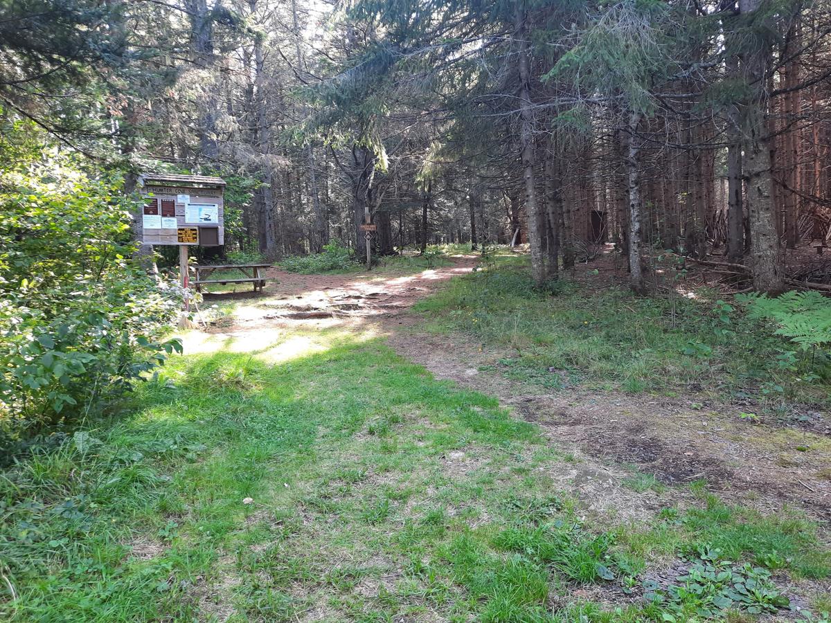
When we first arrived at the sanctuary we found a really nice flat parking lot and the entrance to the trail seemed quite doable. Once we got a few hundred feet into the woods we realized it was going to be a lot more difficult than we expected. First, we couldn’t find the trail. It looked like they may be doing some other trail building and we managed to get onto that part before realizing the red trail we wanted was to our left. I got over to the red trail and found it to be overridden with tree roots. There was very little area not affected by the roots. [Ed. note: More information on the trail surface has since been added to the trail description on Maine Trail Finder.]
I stopped and had Sandy go back to the kiosk to see if there was any information as to how long it was to the cove. She found very little helpful information. I made the decision that without knowing how far I would have to struggle with roots and that late in the day after already doing a lot of pushing it would be wise to call it a day and go home. We thought about checking out the Hunter Cove Uplands but based on the experience at the wildlife sanctuary we skipped it. Hopefully, these properties are new and with time will improve.
There are a lot more properties in the area. I will definitely go back next summer!
I had some thoughts on the way home about what I think could have made this trip a bit easier and more enjoyable. I think we need a universal information system for hiking trails. The kiosks could have a sign with information for each trail. The information could consist of quick hits. The information would be trail length, obstacles (roots, rocks, steep hills, etc.) along with pictures, the highlights of the trail (ends at the water, etc.). After all that it could have the normal description for people to read.
As a rock climber, I can look at the grade of a climbing route and make some general assumptions about how hard it will be to climb. I wonder if the same type of rating system could be applied in a hiking situation. If I had this information at some of the locations we stopped, I could have made a quick decision to move on.
If you have a different type of mobility issue or a totally different disability and you visit trails in Rangeley, please comment on this post and give us your feedback. The more knowledge we gather and share, the more people we can get outside using the trails of Maine!
Success! A new password has been emailed to you.