This is a guest post written by Enock Glidden, MTF Accessibility Ambassador, Public Speaker, Adaptive Athlete and Adventurer. To learn more about Enock, please visit his website.
If you have been following my posts on Maine Trail Finder, you may have noticed I have been all over the western half of the state. I am trying to give as many options for people to hike within a reasonable driving distance from most locations.
Trails that Enock has visited and assessed.
This week I decided to try something more centrally located in Maine. After perusing Maine Trail Finder, I chose the Weston Woods and Waters trail in Madison. I made an assumption or two based on the MTF description: “The riverside trail as well as those in the woods have been cleared and widened for use by the local cross country running teams and all visitors. Semi-official 5K and 10K running courses are being established. In the winter, the trail along the river, as well a half mile portion of the trail in the wooded area, is groomed for snowshoeing and skiing. Apart from the groomer, no motorized vehicles are permitted on any of these trails. There is some parking along Weston Avenue, where the trail crosses the road, but it is limited."
I figured if people can run and ski on the trail then it must be fairly obstacle-free. I assumed correctly for the most part.
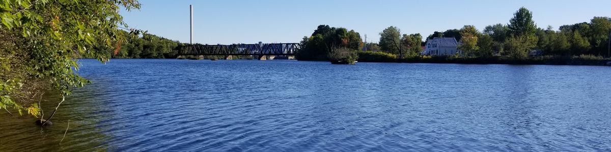
If you enter Weston Woods and Waters Trail into Google Maps it will take you to the farm trailhead on Weston Ave. That is where I ended up first. It looked as though it might not be the best place to start for a wheelchair user. I went back to MTF and checked the descriptions of the other trailheads (there are three). The descriptions I found are under the directions tab on the trail page. I guessed that the Nathan Street Trailhead would be the best one most accessible for me: Heading north on Madison Avenue from the center of Madison, take a left on Nathan Street (0.4 miles from Main Street). There is a boat launch at the end of Nathan Street, offering parking. The trail runs north-south along the river through the boat launch area.
I was totally right.
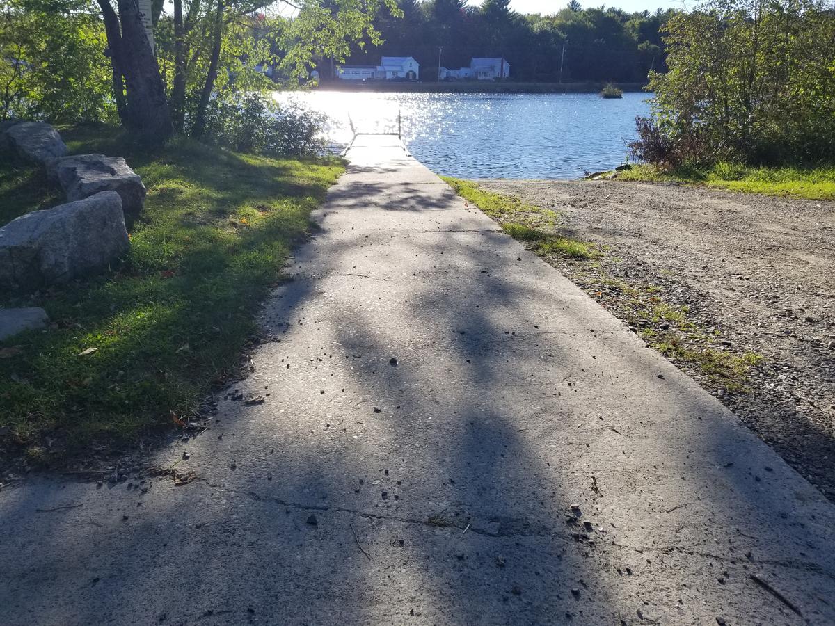
The boat launch area offers a really perfect parking area. There are two flat concrete pads to park at each end of the boat launch area. Near these two spots there are picnic tables to sit and enjoy the view of the Kennebec River while you eat.
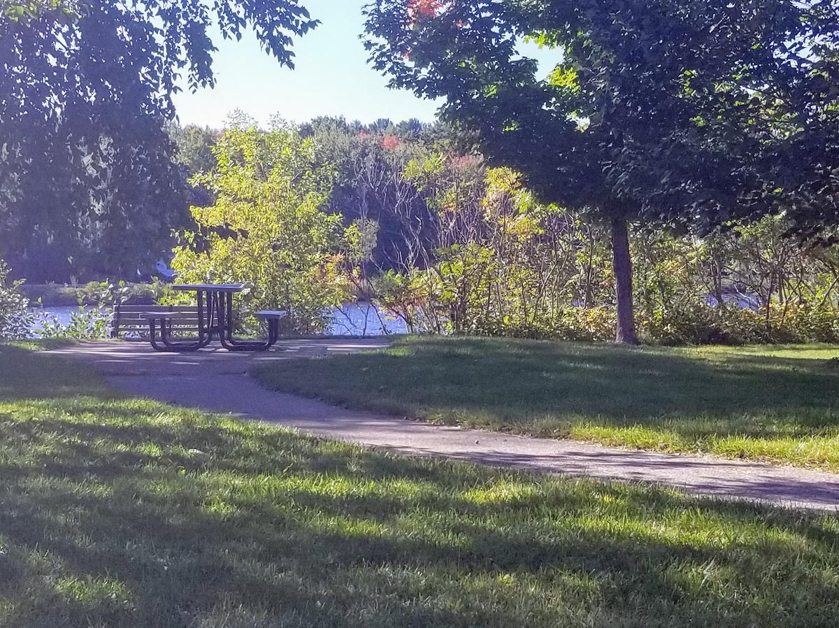
I parked at the wrong end. If you go right as you come into the parking area instead of going toward the boat launch you will find the larger picnic area with another concrete parking spot. There is also a concrete path to the picnic table. This place really is very accessible.
Now onto the trail. This is where things got a little tricky at first. I looked around for trail signs but didn’t find any. In front of me at the far end of the lawn was a row of rocks blocking ATVs and cars from entering. Unfortunately, it also blocks wheelchairs.
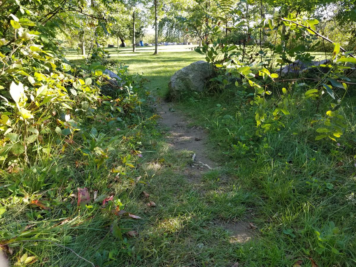
I saw what looked to be a trail off to the right at the end of a concrete path. I decided to investigate that further and to my delight, it was a path around the rock blockade to the trails.
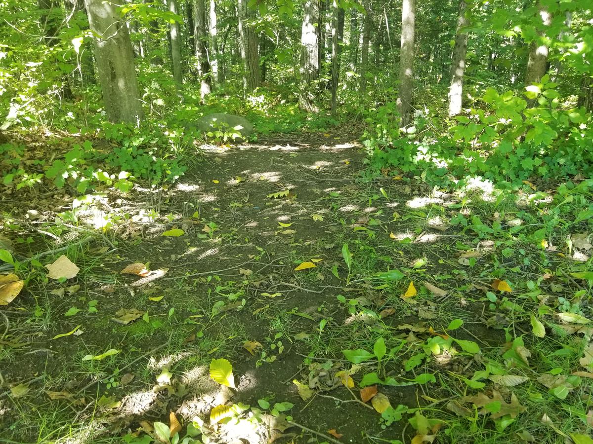
As you can see from the pictures this short section is very well groomed with very little debris or roots. There is one slight hill or really just a bump at the very beginning. The bump didn’t pose a problem at all.
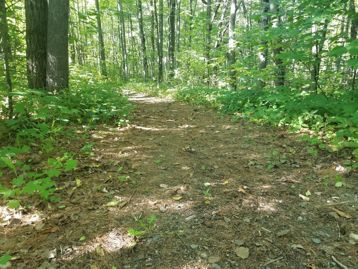
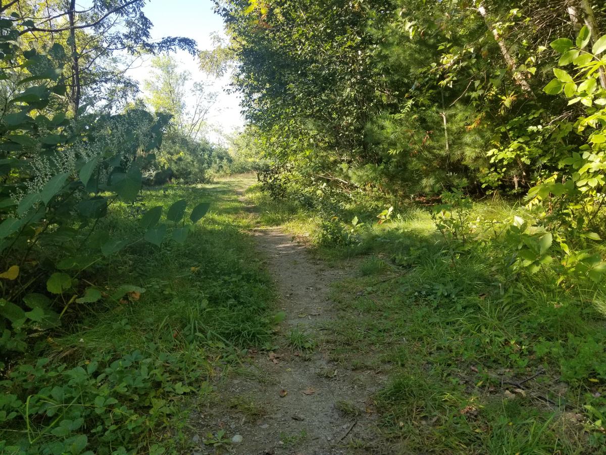
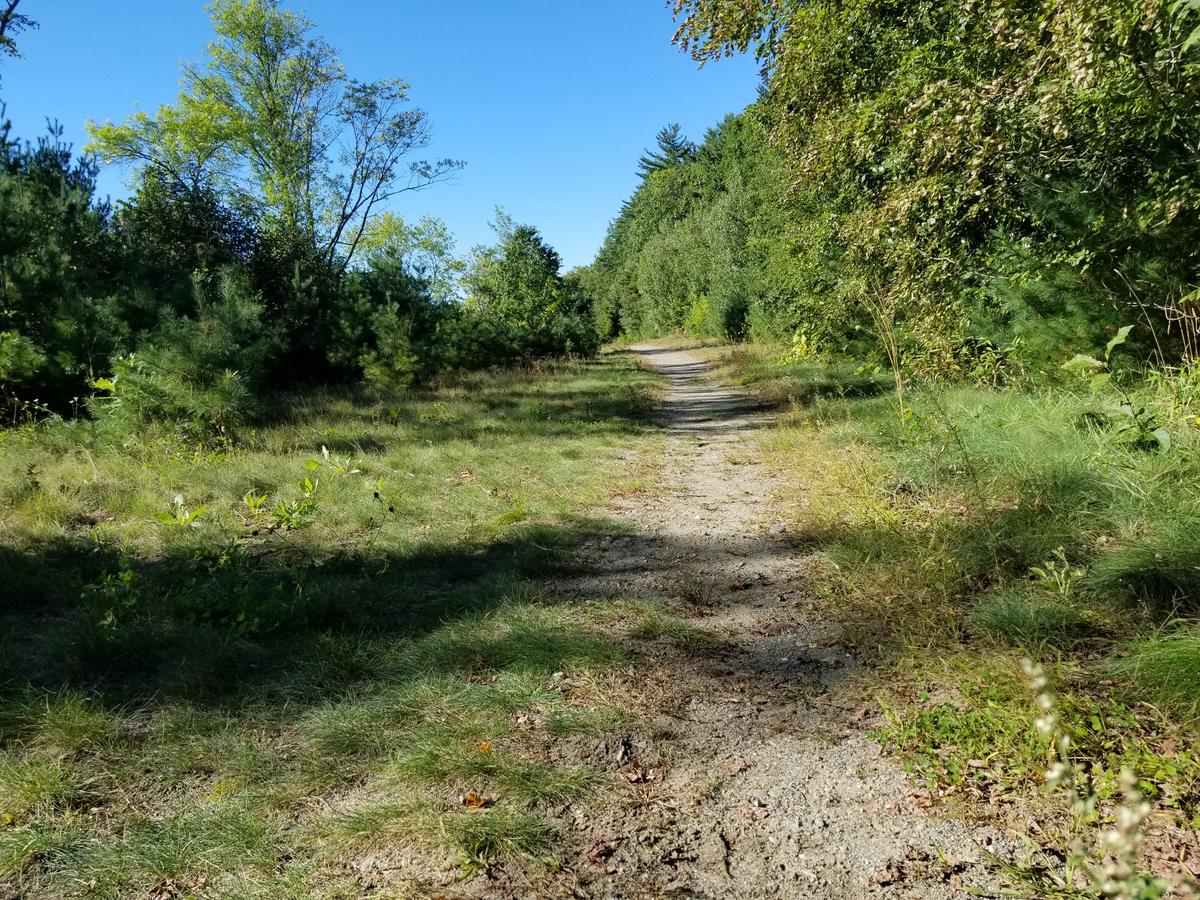
Once I came out of that short section the trail opens up into a wide road. The actual walking path is narrow. This isn’t a problem at all because the area is very wide. This allows a chair to straddle the path and use the grass on both sides. It then gets sandy for a few hundred feet. The sand is only about an inch deep with hard earth under it. This is also not a problem. As you can see in the picture the trail is very wide allowing for multiple choices of travel.
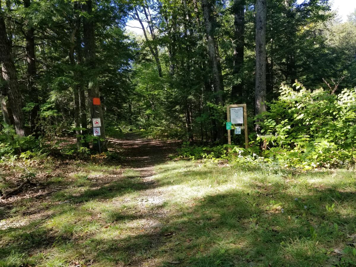
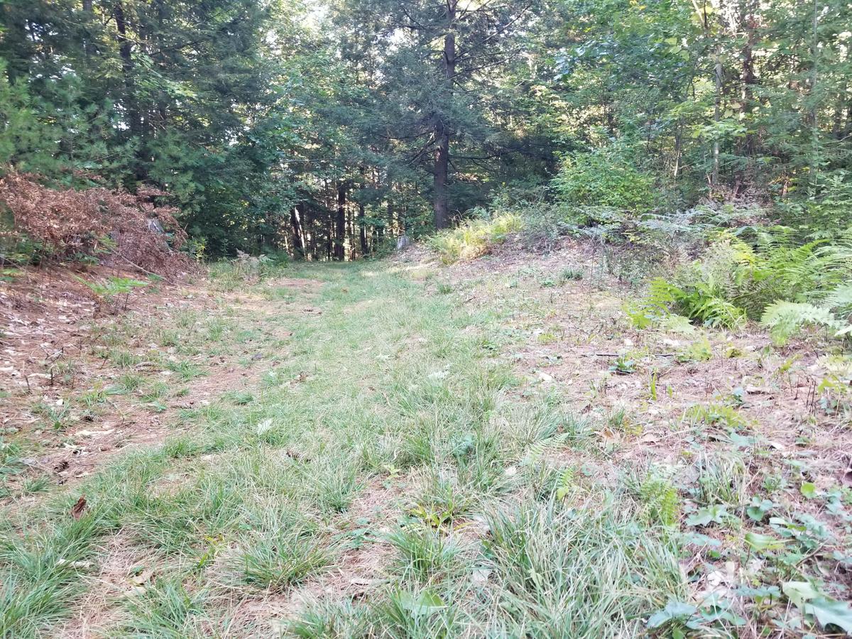
The walking path narrows again for a short section before finally coming to the Weston Woods and Waters Trail sign. This is where the trail officially starts and becomes an amazing place to be out in the woods. The trail is a typical dirt/forest floor with some grass. The difference is that there are almost no roots at all. I never got hung up on an obstacle the entire mile of trail that I did.
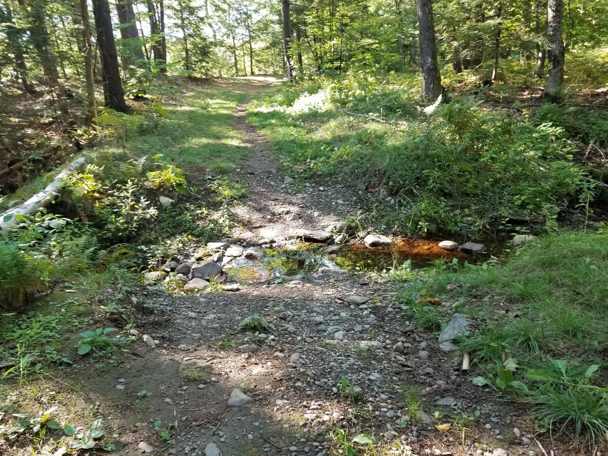
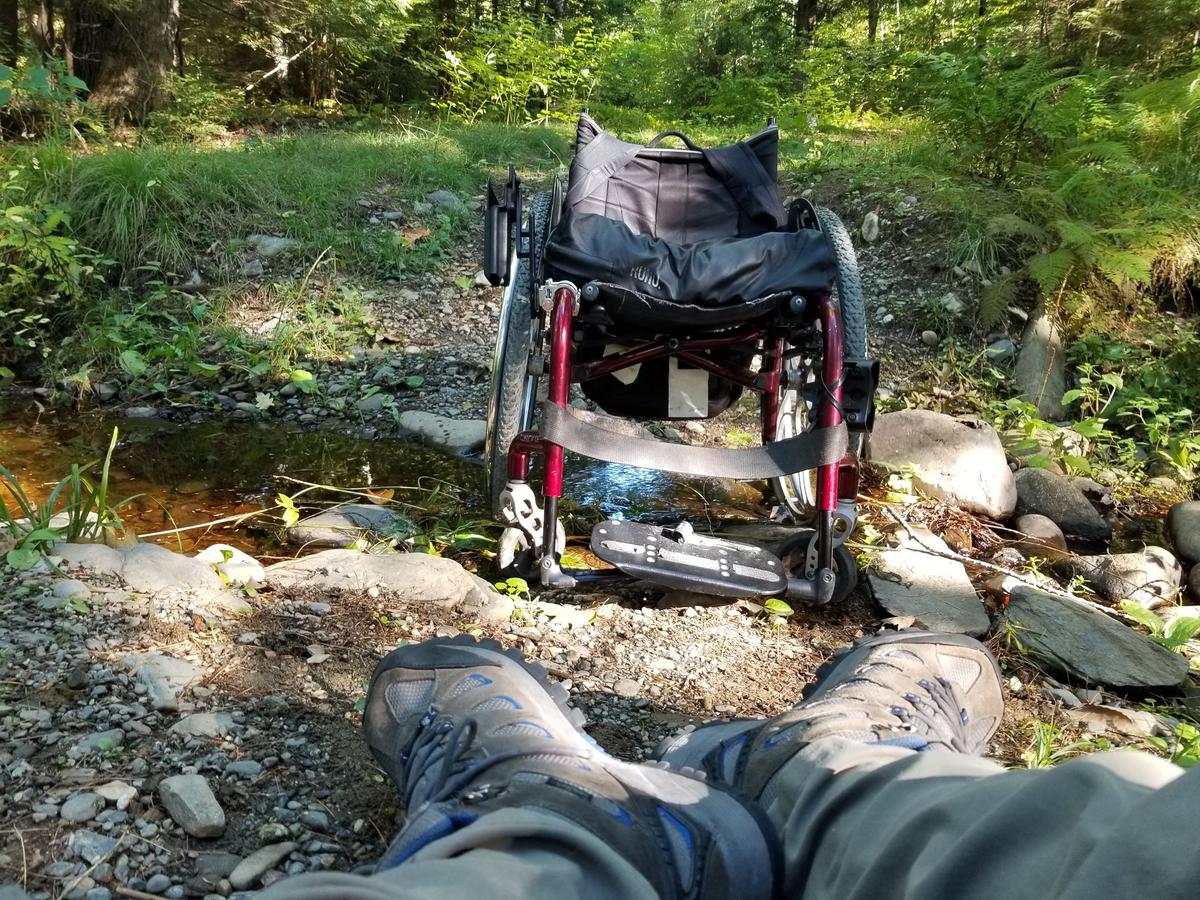
There is one major obstacle, however -- a stream/ditch. If you have read my other blogs you know by now that this is not a showstopper for me. For most people, I think it would be a turnaround point. It is about a third of a mile into the trail . I just did a wheelie down the bank into the water and hopped out onto the opposite bank. I then pulled my chair up the bank, hopped back in, and kept on going.
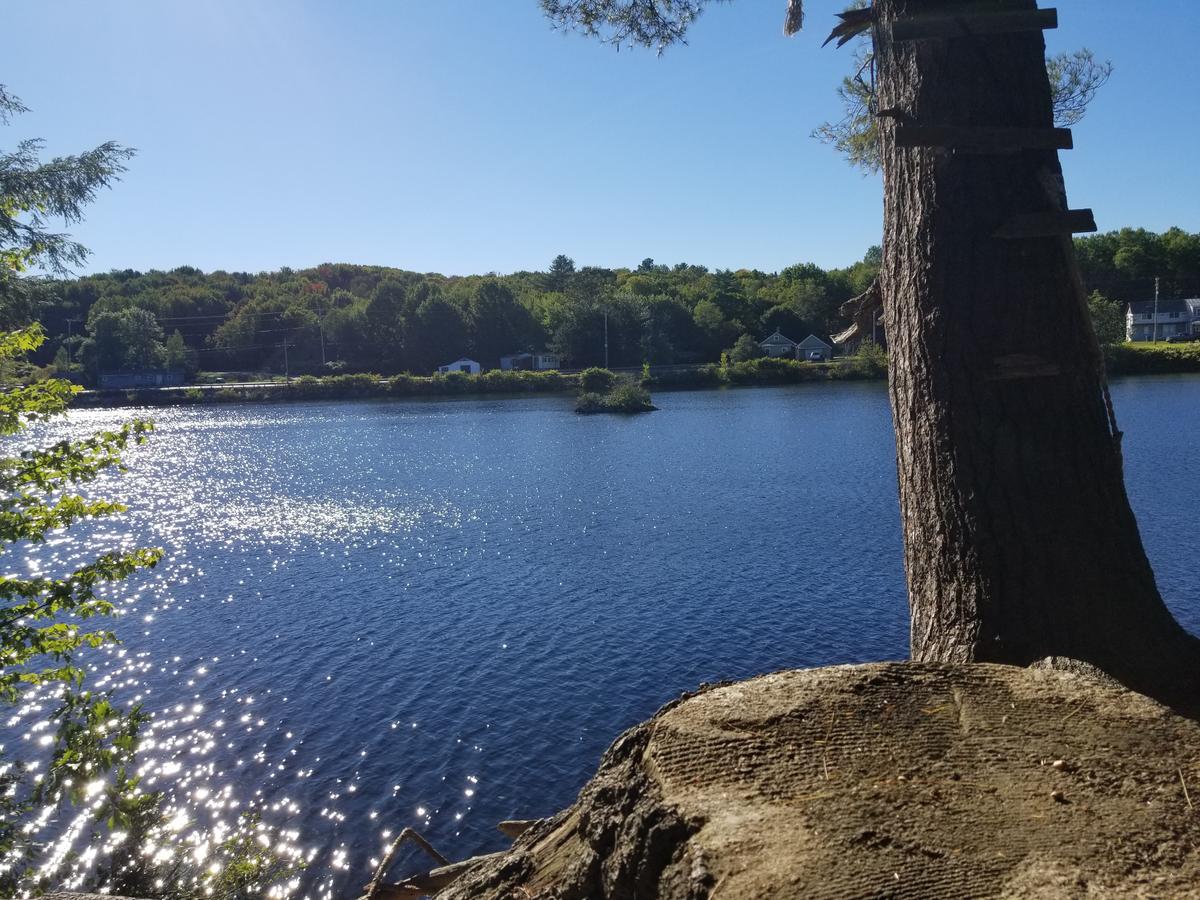
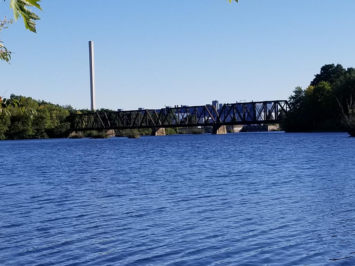
I was happily rewarded with some amazing views of the river after all that effort.
The rest of the mile that I did was a lot of the same terrain. There are a couple of gradual hills that are made more difficult by the grass and uneven terrain, but they are short so they aren't a huge issue.
I thought about doing the entire mile and a half but since I was by myself I decided to do a mile and turn around. I didn’t want to wear myself out and not be able to get back. It was definitely a good work out and I was certainly tired when I finished. I only saw three people, all teenagers. It was good to see kids getting out on the trails.
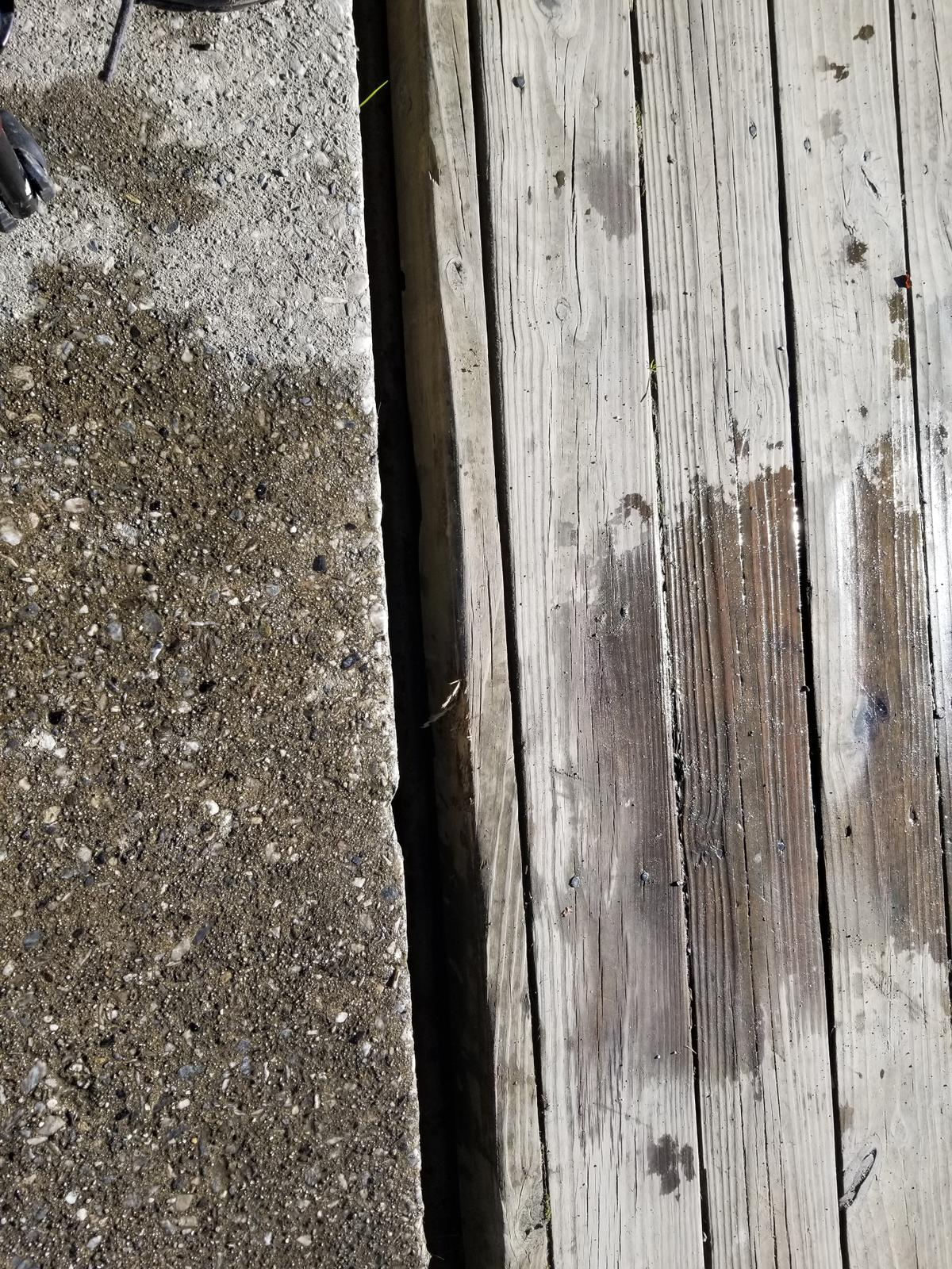
I parked by the boat launch and as I got back I noticed how accessible the dock is. I had to go try it out and have a look. One minor caution there is a gap between where the concrete ends and the dock starts.
This was the icing on the cake. What a beautiful way to end a hike.
I would highly recommend trying this trail at least to the ditch. If there was a bridge over the ditch, the entire trail would be doable for most people. I think I have a new rating. Although this trail isn’t technically accessible because the trail surface is so varied, I am rating this one Just do it! This is a beautiful place to spend some time having a picnic and taking in the views.
Just do it!:
Although not fully accessible, most people will be capable of navigating this trail with very little assistance.
If you have a different type of mobility issue or a totally different disability and you visit this trail or others, please comment on this post and give us your feedback. The more knowledge we gather and share, the more people we can get outside using the trails of Maine!
Success! A new password has been emailed to you.