Berry Picker's Trail to Saddleback or the Horn (via Appalachian Trail)

The Berry Picker’s Trail is a side trail between the Fly Rod Crosby multi-use trail and the Appalachian National Scenic Trail that follows, in part, a route used by local residents for more than 150 years to harvest mountain blueberries and cranberries on Saddleback Mountain.
Trail Activity
Hiking
Length
4.60 miles, Network
Difficulty
Advanced
Towns
Madrid Twp, Sandy River Plt
Surface
Dirt/Forest Floor, Gravel/Crushed Stone, Rock/Ledge
Pets
Permitted
Fees
No

Description

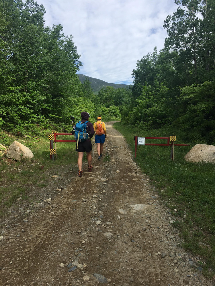
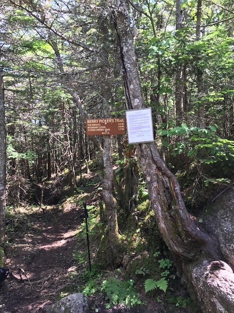
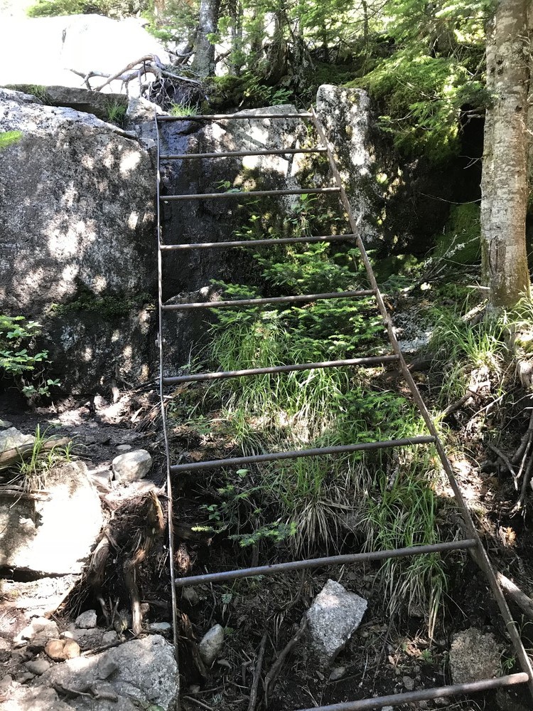
From the ATV gate, proceed 0.9 miles up the ATV trail and turn left onto the Fly Rod Crosby multi-use trail at a group of signs on two wooden posts. At 1.4 miles you will reach the Berry Picker's trailhead proper, which is on the right side just before a bridge over Winship Stream. From the trailhead at Winship Stream, the route ascends through mixed hardwood and softwood forest along the stream, which has beautiful cascades. The trail becomes steeper, turns away from the stream and at approximately 1.9 miles turns up the ridge toward Saddleback to the left (northwest). On the right, the former route of the historic Berry Picker's Trail can be seen going down the slope.

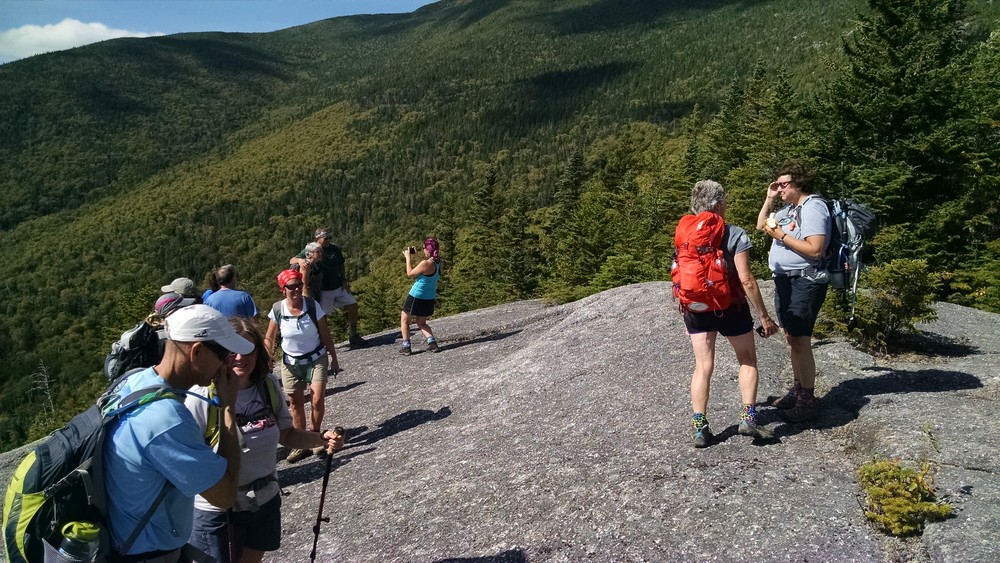
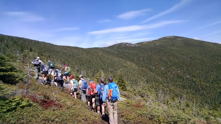
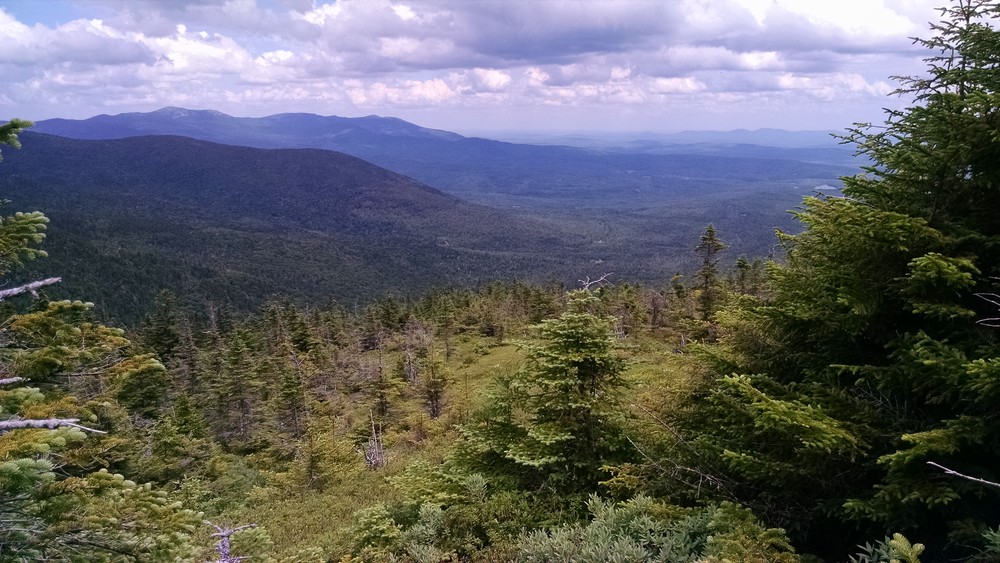
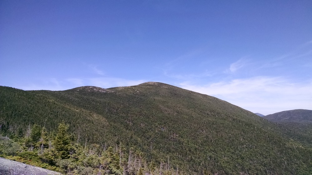
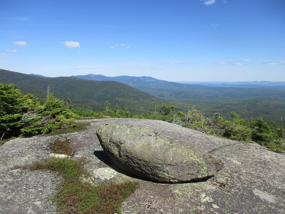
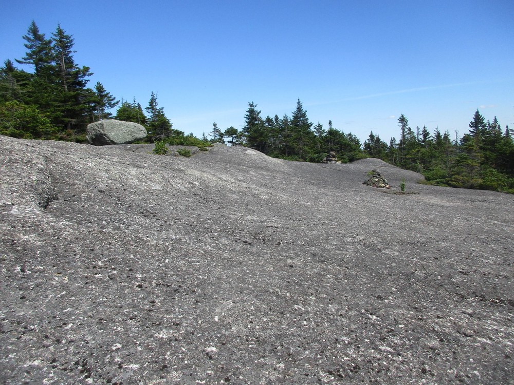
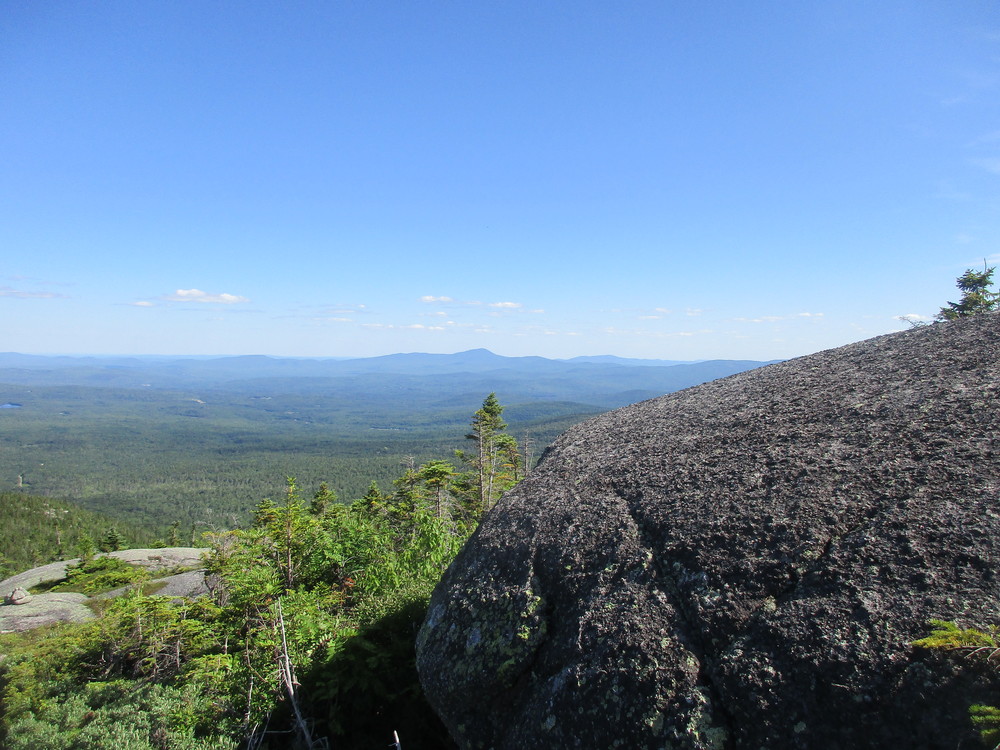
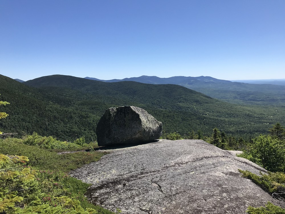
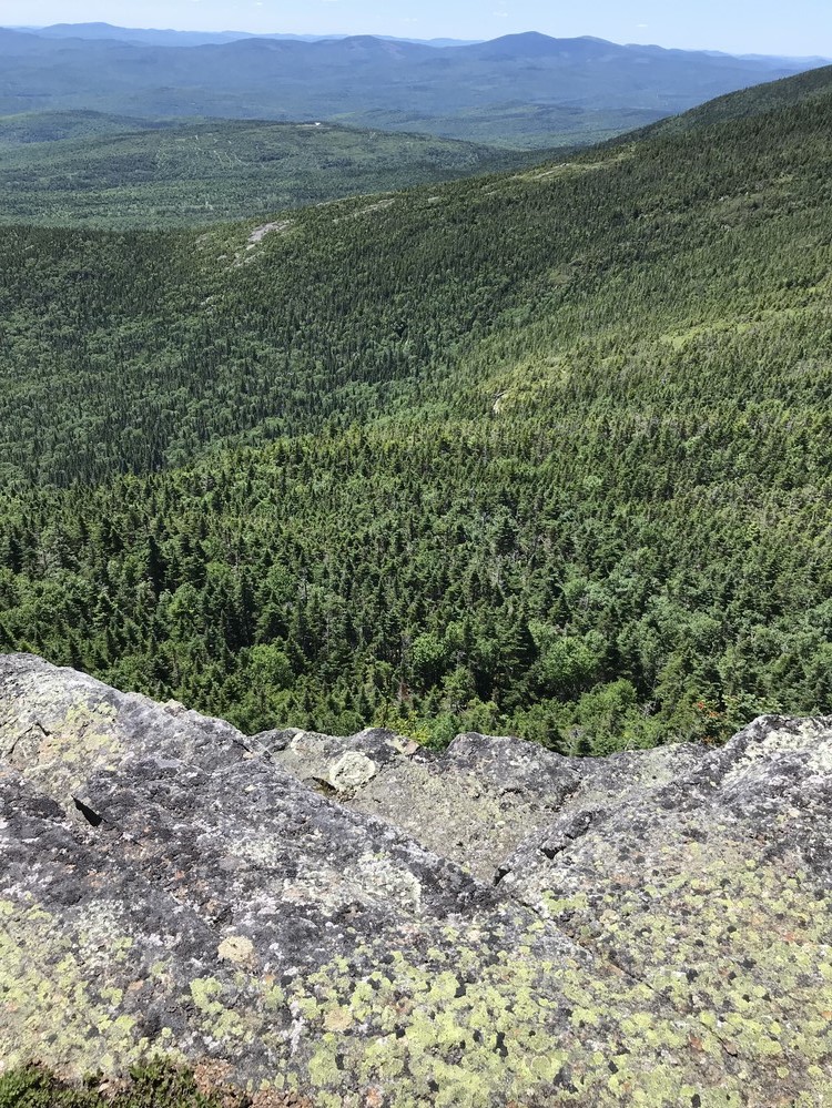
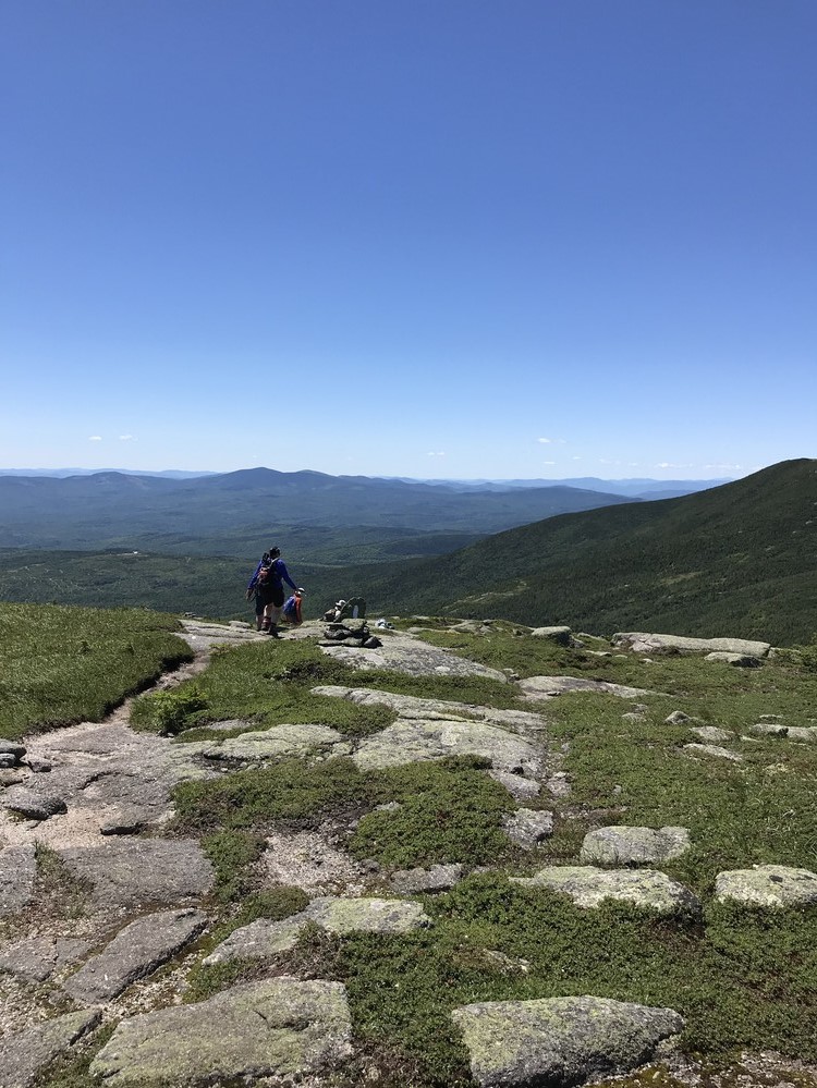
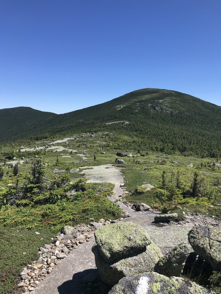
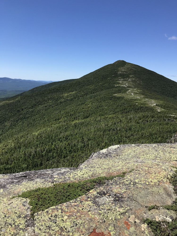
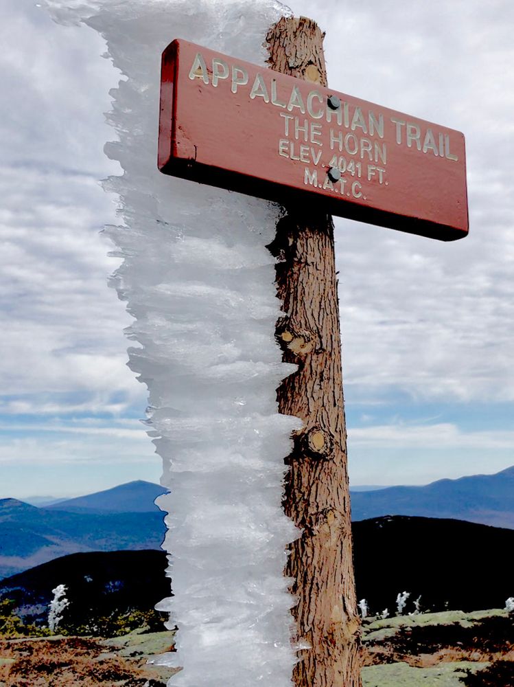
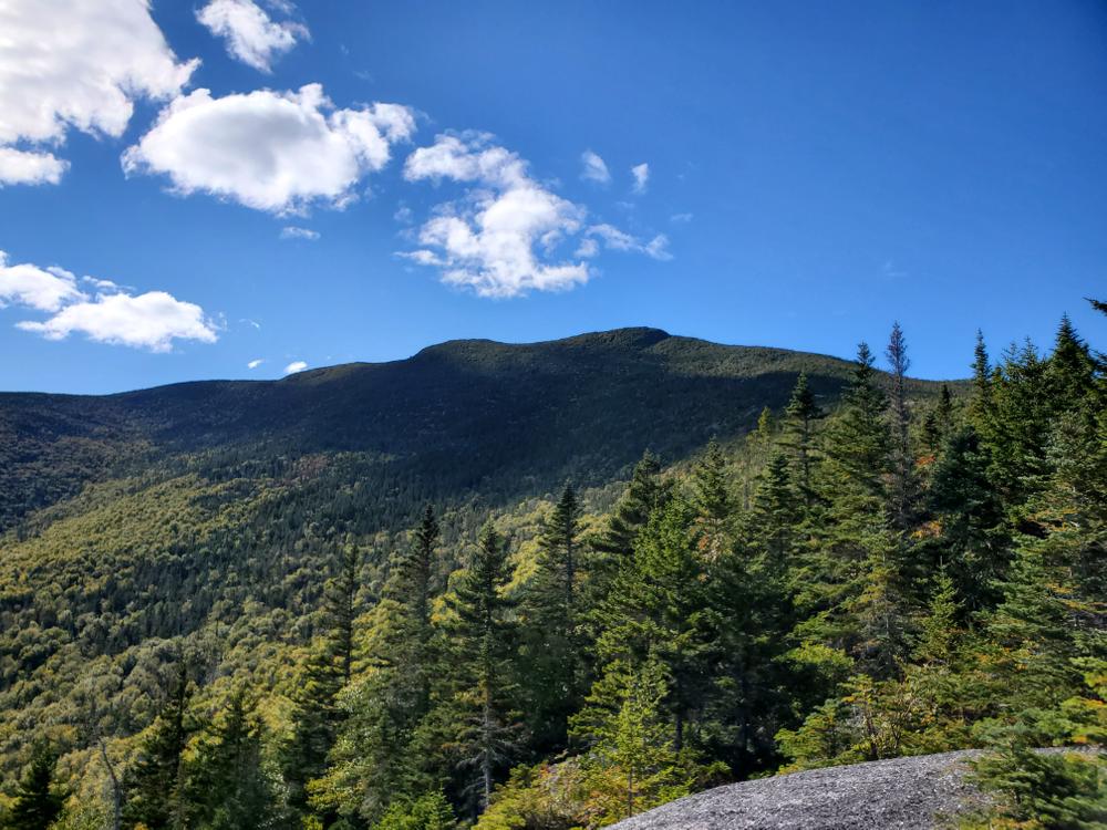
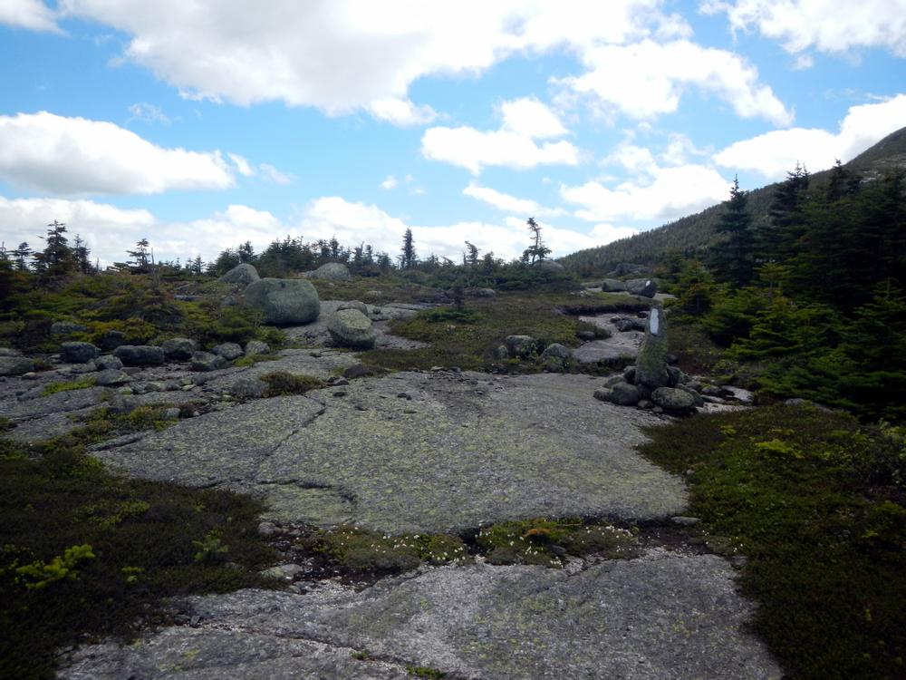
The trail transitions to open ledges dominated by dwarf spruce, alpine blueberry, and mountain cranberry. At 2.1 miles the trail reaches Boundary Ledge, which is marked with yellow blazes to denote the boundary line between the landowners. At 2.6 miles the trail reaches The Erratic (a large boulder), and then the Appalachian Trail (A.T.) at the top of the ridge at 3 miles. From there, it is 0.7 miles southbound on the A.T. to the summit of Saddleback and 0.9 miles northbound on the A.T. to the summit of The Horn.

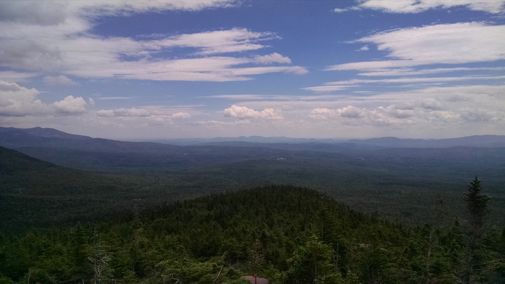
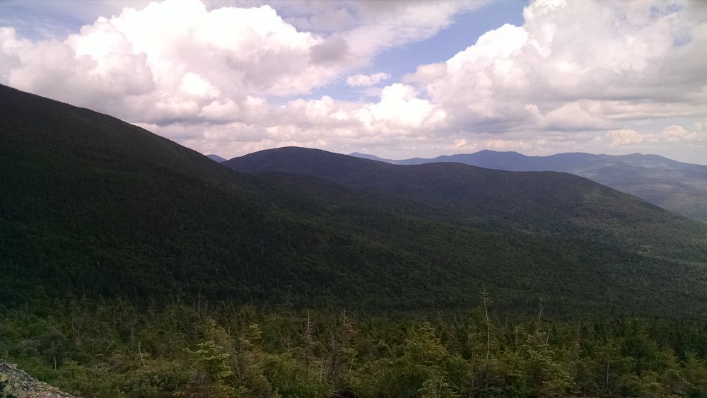
The Berry Picker's Trail was also the route originally planned for the Appalachian Trail in 1933. The trail crosses the Orbeton Stream Conservation Easement, land owned by Appalachian Trail Conservancy and land owned by the Maine Appalachian Trail Land Trust before finally entering the A.T. corridor owned by the National Park Service. Except for occasional double blazes which indicate sharp or unexpected turns, the trail is marked by single, rectangular blue blazes and rock cairns. Much of the route follows open ledges with outstanding views.

Other Information

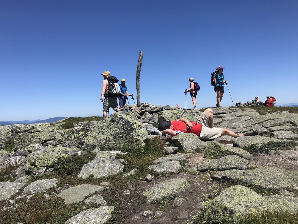
Do not underestimate the difficulty of hiking the Appalachian Trail (A.T.) in Maine. Be sure to carry equipment and supplies necessary for this undertaking and be prepared for challenging weather conditions. Please educate yourself before hiking, so that you can have the knowledge and skills necessary for an enjoyable and safe hike. Fires are only allowed in the provided fireplace ring at established campsites; it is illegal in Maine to build a fire elsewhere.

The Appalachian National Scenic Trail runs from Maine to Georgia along the spine of the Appalachian Mountains. It is managed cooperatively by the National Park Service, the Appalachian Trail Conservancy, and 31 trail-maintaining clubs along with other federal and state land managers whose land the trail crosses. Over 3 million people visit the A.T. every year. Since its inception in the 1920s, thousands of volunteers have worked tirelessly to maintain, manage, and protect the Appalachian Trail. 

In Maine, the all-volunteer Maine Appalachian Trail Club (MATC) maintains and protects the 267-mile section of the Appalachian Trail extending from Katahdin in Baxter State Park to Grafton Notch at ME-26. In addition, MATC maintains over 60 miles of side trails as well as a system of regularly-spaced shelters and campsites to preserve access to wild, backcountry hiking in Maine. MATC publishes The Official Appalachian Trail Guide to Maine, which includes seven maps, please visit their website for information on how to purchase the guide or to learn more about becoming a member of MATC.

Natural Heritage HikesNatural Heritage Hikes is a project of the Maine Natural Areas Program in partnership with Maine Trail Finder. View the "Saddleback Mountain, The Horn - Berry Picker's Trail" guide online here

Trail Manager

Visit Maine Appalachian Trail Club online for more information or contact:

Maine Appalachian Trail Club (MATC)

Maine Appalachian Trail Club (MATC)
PO Box 7564
Portland, ME 04112
info@matc.org
View website

Nearby Events

VIEW EVENTS CALENDAR

Trail Tips

Minimize Campfire Impacts
Use only small pieces of dead and down wood for campfires and let them burn down to ash. Please extinguish your campfire before leaving.
Legend
Hide All

Trailhead Information

To reach the trailhead, turn off Route 4 in Phillips to Route 142 heading north.  After 2.5 miles, take a left onto East Madrid Road (note - the street sign is often missing but there is a large sign that says Pike Industries where you should turn).  Proceed on East Madrid Road which will become a gravel road and will pass over Perham Stream in the hamlet of East Madrid.  After 5.3 miles, turn left onto Potato Hill Road. This road is also used by ATVs so be sure to look out for traffic.  After 1 mile, the road reaches a wide intersection with the Railroad Road - stay to the left and proceed on the main road.  At the next fork after 0.8 miles, stay to the left.  Continue for 1.8 miles and stay left.  Proceed for 0.7 miles, over a wet low-lying section of road, and park at the junction with the ATV trail. 

Please note: Potato Hill Road is not maintained for regular vehicular traffic and low-clearance vehicles are not recommended for traveling this route.

Click on a parking icon to get custom directions
Please Log In or Create Account to add comments.
shambolic94
August 12, 2023
We tried following the new directions, but the first part of East Madrid Road was closed in early August 2023. We discovered that you can take Reeds Mill Rd to what google calls Voter Hill Rd (I think it might actually be Brays Hill Rd), and then make a left onto East Madrid Road to bypass the closure. Nice hike -- great views much of the way up.
tmd307
August 08, 2022
This trail requires: (1) a very strong desire NOT to hike the ski trails and (2) the patience to drive the 4+ miles to the trailhead at 5 mph so you don't die.

The fact that the last 2-3 mules BEFORE the trailhead are mixed use roads with atvs mean that on some of the steep hills there is basically no road left, just a cascade of rocks that have been spun up by atvs drivers. I have a 4wd high clearance suv- it is not the pot holes or the huge bones (exposed rocks) but the fact that there just isn't any dirt holding the rocks together. If you can deal with that (or if you get an atv-uber driver) this trail is pretty good.

The directions end at a triangle turn around area and I bared right up to a higher part just beyond, and there is green grass and another fork. The right fork is the start of the HIKED portion of the atv road. The left fork says dead end.

There is no gate anymore, so just park near the fork and take the right side with all the signs. Road walks are boring as heck but you are looking right up to the col between Saddleback and the Horn as a little taste of what's to come. After you split off from the fly rod trail onto Berry Picker's, you're on a casual ascent over roots and rocks for a little bit until you build to a steeper climb. If you are a weekend warrior like me, you'll be fine. Just when you'd like a little break from the climb, you break out onto the ridge and it's beautiful! The blazes and cairns are good and easy to follow. After you pass the Erratic, you had back into the trees and wind along the side of Saddleback to the col. When you hit the col, you have .7 up to Saddleback (left) and .9 to the Horn (right). I opted for Saddleback first and there are few steep climbs interspersed with ledges. On the Horn side there are few spots where you need to do a little scrambling but one has a ladder and the other one is do-able without. If you have a dog like I do, they can do a little side trail around the ladder (not for humans) and if they might need a little help getting up/down the second one.

Overall, great hike if you want to skip the hoardes on the ski trail but you're prepared for a interesting drive into the trailhead. I'd say at the rate of decline of the road conditions, this trail won't be usable for more than a few years unless someone opens an atv rental on East Madrid Rd so people can get in that way.
mainetrailfinder
June 02, 2022
Please note new directions to the trailhead as of June 2, 2022. High clearance vehicles are still recommended for accessing this trail.
randjt10
July 29, 2021
Great views from both peaks. Trail is in good shape a little muddy. The total mileage is off though when you add in the walk in on the atv trail. Road in is not very good. Very narrow and you will brush your car along trees. 4wd is a must with good Clarence.
ljmrook
May 25, 2021
Enjoyed the hike, but both my daughter and I think that the rating of “moderate” underrates the difficulty. Although short, it is pretty vertical...based on All Trails app, 1700’ vertical in less than 2miles. Road was passable with 4wd pickup- no problem.
smr260
October 15, 2020
Please note that the road conditions on the route to the Berry Picker's Trail have deteriorated - a nearby landowner is no longer maintaining the road. If you head in you need, at minimum, a high-clearance vehicle like a Subaru Outback. Hopefully we can get the road improved for next year!
smr260
July 17, 2020
The road to the trailhead has deteriorated but is still passable for a high-clearance vehicle like a Subaru Outback or an SUV. Take it slow!
ofsevit
June 26, 2020
Trail in pretty good shape, a little wet up top, buggy at the bottom along the stream. Road was passable with a 2WD with low clearance, but not particularly fun. Bottom mile was the worst. The ATV gate is open and it would be pretty easy to drive the first mile of trail and park in the clearing at the intersection of the Fly Rod Crosby Trail, that bit of road didn't look much worse than below (definitely fine with a 4WD).

It makes an excellent loop to go 2.5 miles up the ATV/FRC trail to the AT, follow that across Saddleback, and return down the BP Trail (or reverse). 9 miles, 11 if you go over the Horn, too.
Simon Rucker
June 13, 2019
Road in is in pretty good condition - culverts have been replaced and one of the bridges has been re-decked. Take it slow on the bumpier parts but most vehicles should be able to make it in fine! Trail is in great shape.
theresa york
July 15, 2018
As of July two of the culverts are damaged to the point that l walked miles to the trailhead rather than take my Jeep over them. But with that being said others were driving cars over them.
Simon Rucker
August 08, 2017
The drainage ditches (culverts) have been fixed as of August 8, 2017. Road is rough but any car can probably make it to ATV gate!
hikejb
August 01, 2017
The road to get to where you start can be rather rough unless you have a vehicle with good clearance (SUV or truck). We did it in an Impreza but I probably wouldn't again. There's one place with a drainage ditch where I could see someone in a car without all wheel drive getting stuck. From start to top is 2300 vertical feet over 5.6 miles. Round trip I think took us 4.5 hours. Great trail!
These awesome businesses support our goal of connecting people to outdoor adventures in Maine!
Hang Tight!
Nearby services are loading
No Results
No Services Found
SHARE THIS TRAIL

Add Trail Log

Please wait…
Join In on the Fun!
Log in or create an account below to unlock all the great features of Maine trail finder: keep track of trails you want to do, preserve memories of trails you’ve done, earn badges, and more!
Your log in attempt was not successful. Please try again.
    Lost your password? Reset your password
    Don't yet have an account?
    There was an issue with your submission. Please try again.
      * Indicates required field
      Already have an account? Login here
      Enter your username, and we will send you a new, randomly generated password to your email account.
      There was an issue with your submission. Please try again.

        Success! A new password has been emailed to you.

        Log in now

        Please wait…