Roughly 10 miles of single track trails for mountain biking, walking, and snowshoeing along with five miles of Nordic ski trails have been developed to date at Bond Brook. The single track trails can be ridden in either direction but remember to yield to walkers or uphill travelers. Many numbered signposts have been added to trails and are referenced below.
The Nordic ski trails are groomed in the winter and are one-way for safety. Please do not walk, snowshoe, or bike on the groomed ski track.
Western Trails:
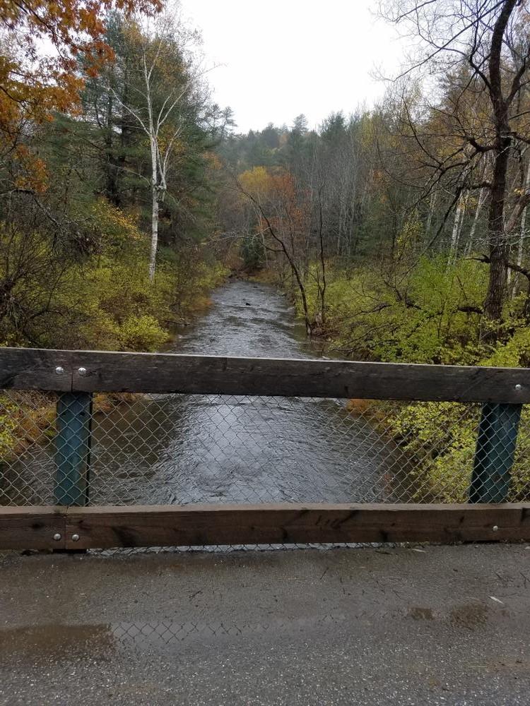
Western Way (0.6 miles): Western Way heads west out of the stadium on Jim’s Trails and turns onto the single track at V4. The intersection at V3 on Northern Exposure will take the rider down Western Way. The tough windy turns will take you downhill and over a bridge to lead you onto Tall Pines Way. Take a right on the main road and there will be more single track to the right that’ll take you back into the woods. A few switchbacks mixed with two bridges makes for a fun ride down the trail that leads right back to Tall Pine Way. Once on the road again cross the street to the V8 signpost and follow the last part of Western Way down by Bond Brook and finish out near the bridge at the entrance. V7 marks the end of Dragon’s Lair.
Northern Exposure (0.8 miles): This first of the western side trails can be reached from the ski trails to start at V1 by the sprint hill climb and heading out on Jim’s trail at J3. The other access is off Western Way at V3.. A level trail for the most part, there are some technical challenges to improve skills. Riding clockwise, the single track rejoins Jim’s Trail at V1 and one can return to the stadium going right at the first crossing of the ski trail or continue on the Nordic network through the chicane turns to meet either the Land of Make Believe at R3 or Split Rock Trail at R5.
Lizzard (0.55 miles): The Lizard trail falls to the southwest of the Stadium Parking Lot. Start by heading out on Jim’s Trail and at the V5 post take a left across Tall Pines Way. A small windy loop that takes you uphill over a few bridges with tight turns at every corner is waiting on the other side. This trail also follows the fencing of the airport. Take it down through the woods where you’ll hit an intersection at V6; left takes you to Dragon’s Lair and straight takes you back to Tall Pines Way to finish the loop.
Dragon’s Lair (1.05 miles): The newest of the trails at Bond Brook allows the rider to wind in and out of trees on the southwest side towards the airport. Beginning at the V6 post, this is a challenging addition to the Bond Brook trail system, it rides down along the fences of the airport. There are tight turns, dirt berms and many other challenges that await the rider. There are some parts of the tread that are sand, but if you follow the trail you will junction with Western Way at V7 where you may continue or head to the right towards Tall Pines Way and post V8 or left to the lower junction with Tall Pines Way.
Central Trails:
Land of Make Believe (0.4 miles): The Land of Make Believe climbs up the Sprint Loop trail behind the stadium and becomes single track at the R1 post on the powerline. It leads down a ridge crossing Jim’s Trail, another trail, and descends into the valley. After crossing the stream, one can exit to Jim’s Trail and climb up to the junction with Split Rock Trail at R4 or one can traverse to the ridgeline and meet Split Rock Trail as well. The last part is usually ridden in the downhill direction. One can exit to the trail and head up the Chicane turns or cross the bridge to the trail itself.
Split Rock Trail (0.5 miles): This trail gets its name from the large glacial erratic that one rides by and is a major connector between the summit and the western trails. At its northern terminus, the trail leaves the Old Logging Road to ride a new section on the bluff before crossing several trails. It then climbs 200 ft to the summit area on the powerline. Alternatively, in riding from the top one has a long flowing descent from the summit to either the western or northern exit. This trail is a user favorite. The A7 post is a reference point for exiting out to the west towards the stadium area.
Bluff Trail (0.3 miles): This trail allows more single track riding for the accomplished mountain biker as it parallels the Old Logging Road. A second part to the west has been incorporated into the Split Rock Trail.
Old Logging Road (0.43 miles): Easy riding comes on the Old Logging Road. This double track trail follows the contour along the north end of the trail network, staying above Bond Brook. The trail is an extension of the Groomer’s Way and can be reached from Augusta Public Works on this trail. Split Rock Trail is the usual access or exit on the western end.
Rock Garden (0.3 miles): This trail snakes up from Split Rock at A4 and then loops around the northern summit of the BBRA. One can exit to the trails or to the ‘Bikers Paradise’ where all trails lead downhill!
Wannabe or Bikers Halfpipe (0.4 miles): This trail does not “wannabe” anything but a fast rolling downhill culminating in 180 degree turns on the walls of the halfpipe. The trail leaves the summit trailhead at ‘Bikers Paradise’ and descends first in the powerline and then in the woods to arrive at the head of a natural U-shaped bowl. The ride then descends this bowl in a series of six turns on either wall of the bowl and then exits out to the sand bridge.
Insulator (0.3 miles): Conceived as an uphill climb to the more established trails, Insulator leaves Bills Trail at A8 just after the sand bridge, the trail runs adjacent to the powerline in a series of switchbacks to finish at the granite bench at ‘Bikers Paradise’ (A1). Junctions with Split Rock and the Rock Garden Trails are possible at the stone wall.
Columbine Trail (0.25 miles): Named for the columbine flowers in the late spring, this trail connects from the summit trailhead to the Water Tower Trail. Several trail junctions allows for a number of loops on the summit or connections to other trails.
Logging Connector (0.25 miles): This trail leaves from the Summit or Columbine Trail to ride a skidder’s path to end at the water tower parking lot. It is a single track connector for many of the trails.
Summit Trail (0.25 miles): This first of the BBRA mountain bike trails leaves the Water Tower Trail to climb up and then ride around the southern summit in BBRA. It shares this summit with the high point of the Nordic ski network providing for an easier ride on the summit then finishes at the Columbine Trail near the summit trailhead.
Eastern Trails:
SixBack (0.55 miles): This southernmost trail leads east out of the stadium and climbs the 200 ft open slope to the cemetery parking lot. Six switchbacks later you have reached the plateau above the stadium and onto the parking lot or Quarry Trails. Riding downhill, one will enjoy the banked turns on the switchbacks.
Quarry Trails (0.43 miles): This series of trails leads north from the cemetery toward the major single tracks on the eastern face of the hill in BBRA. One starts out on a gravel road servicing the airport towers and go left onto the single track just after one begins to climb. The trail rides first above the rock face and then drops 80 feet to ride below it. After a serpentine track to test your turning skills, you will descend to cross the groomer’s way and the climb to the trailhead at the water towers. From here the Summit Trail or the Double “B” begins. Two additional trails await the expert rider. The first leaves directly out of the cemetery parking lot and climbs to the part of the old quarry on public land (please obey the private property signs). A variety of ledges and other obstacles can challenge the rider before leaving the quarry to rejoin the main trail. The second known as the Double Diamond drops straight down the rock face and then winds through the rocks and rubble of the quarry before finishing at a small powerline. One can climb the powerline or proceed through the scrub forest and exit west of the Parks and Recreation garage. Straight ahead across the paved water tower access road is Groomer’s Way to the Works Trail.
Double B (0.33 miles, N7-9): Named for Brian Beneski and Brian Alexander who were the pioneers of its creation, this trail leads down the eastern face of the hill in a series of switchbacks with two banked turns built on an old dirt berm. The trail can exit at the Groomer’s Way but most will continue straight to the Works Trail.
Works Trail (0.64 miles): This trail leads down the powerline and through a series of gullies before entering the woods and heading out a series of spurs that drop directly to Bond Brook below. Several of the spurs have nearly vertical walls adding a dimension of visual intimidation to the riding. After riding four of the spurs the trail finishes on the Old Logging Road, an extension of the Groomer’s Way.
Trail Etiquette for Winter Use (Snowshoers, Walkers, and Fat Bikers)
Augusta Trails maintains specific trails for snowshoers, classic cross-country skiers, and skate skiers, please respect each of the different trail types. If you have questions or would like more information please contact Steward.AugustaTrails@gmail.com. More information is also available from Central Maine New England Mountain Bike Association (CeMeNEMBA).
To stay informed on trail closures and events please visit Augusta Trails on Facebook.
Wash with Care: Use biodegradable soap at least 200 feet from water, disperse strained dishwater, and carry out food scraps to an available trash can.
From Downtown Augusta, head north on Mt Vernon Ave and turn left onto Bond Brook Road. From Civic Center Drive, head south and turn right on Bond Brook Road. Turn left on Tall Pines Way; there is parking located before and after the bridge and more parking is available at the stadium. Follow Tall Pines Way up the hill to the Stadium Parking Lot. Parking is also available at Mt. Hope Cemetery off Winthrop Street.
Success! A new password has been emailed to you.