The Oyster River Bog section of the Georges Highland Path trail system is a moderately easy “walk through the woods” and provides excellent hiking opportunities for people of all ages and abilities. The Oyster River Bog, also known as the Rockland Bog, is an unusual 6,000-acre woodland nestled amid the busy mid-coast communities of Rockland, Rockport, and Warren. Over 1,600 acres are held in conservation by the City of Rockland, the Oyster River Bog Association, and Southern Maine Wetlands Conservancy. The Bog is an area rich in history and diverse in natural resources. Its forests, streams, wetlands, and peat bog offer prime habitat for an impressive variety of wildlife and plants.
The combination of the Oyster River Bog and Thomaston Town Forest sections of the Georges Highland Path provide a continuous ten-mile hiking experience that connects US Route 1 in Thomaston to ME Route 90 in Rockport.
The Georges Highland Path network of conservation trails is a project of the Georges River Land Trust.
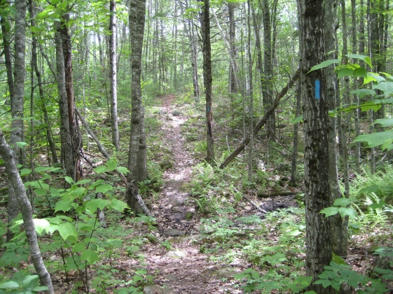
Please respect that this trail is on privately owned property. No overnight camping is allowed. There is a confusing network of active and abandoned woods roads in this area, so be careful to stay on the trail by following the blue blazes.
Visit Georges River Land Trust online for more information or contact:
Follow Fire Restrictions: Maine’s dry seasons mean fire bans—always check first. Many areas of Maine will require you to have a permit for your campfire. Check here first to avoid issues later.
The parking lot at northern end of the trail is on ME Route 90, 1.8 miles west of the intersection of ME Routes 90 and 17 in West Rockport.
The parking lot at southern end of trail (Jack Baker Woods) is on Beechwood Street in Thomaston, 3.3 miles south of the intersection of Beechwood Street and ME Route 90.
Success! A new password has been emailed to you.
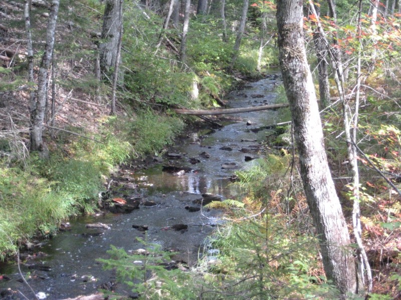
That completely ignores a difficult section of the trail, where heading north from the southern end in Thomaston, you eventually need to make a 90 left turn to stay on it. Critically, I ignored that turn as you would go from the very well used and biked trail up to that point on to what looks like a very little used goat path. Also there are just two arrow markers there - one pointing you to go left to stay on Georges Highland Path was not pointed very well that way. The first time I paid no attention to it because it looked so unused and ended up well east of the trail where it passed near to the Oyster River - with several nice views of it. The only reason my wife and I took it was from a tip by a guy working on the trail near there. I really wanted to see any views of the river, and today I am paddling it up from the St George!
There is a strong warning to mountain bikers about this section in some places online - describing as having to cross several brooks with very steep hillsides forcing you to carry your bike and that only experienced riders with top condition bikes should try it. And I had tried to walk this section in the winter from the other direction - the parking lot on Beechwood St - but when I got maybe a mile and a half in after a couple turns, that section of the the trail was marked closed - right where you take a right to stay on it., you were on your own to figure out how to have to reconnect to it.
I wondered why it was closed - the other trails get quickly packed in the winter - good to hike and bike. So a month ago my wife and I found out why that was closed - I dont know if its marked closed in the winter where the other end, headed north/east takes that sharp left turn described above. I think it would be. The reason I think it was closed was because we came to the at least 3 creek crossings - just barely jumpable at these water levels with careful preparation, and quite steep hillsides, one of which i had to descend on my bumpter. My wife wanted to turn around at the first one. I dont think they want people going in there by any means and getting hurt. So it must surprise people to suddenly lose the blue blazes if you dont take that left turn when heading north from the Thomaston parking lot. And good luck finding the trail again in the maze of mountain biking trails you go into if you dont make that turn, which are all ok for walking as far as I know. Many people report getting lost in there though and most maps posted are very confusing. And there are many trails that arent on the maps, very confusing.
So it was a real curiousity for me to finally figure it out. And it made sense quickly that it was such an unused trail from the south, as so few hikers or bikers ever try it. But you can take that left and pretty soon you get a river view and can turn around before you get to a creek crossing and steep hillside if you want more river views. There are several more nice views of the Oyster river if you pay the price of continuing on to more creek crossings and steep hills - which were quite slippery when wet. Seems like largely unknown information given the popularity and awareness of this trail. And just fyi we run into way more bikers that hikers in here, but never many, especially on weekdays. Many of them are surprised not expecting you to appear.