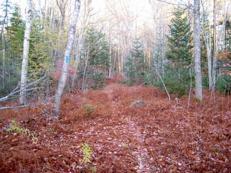
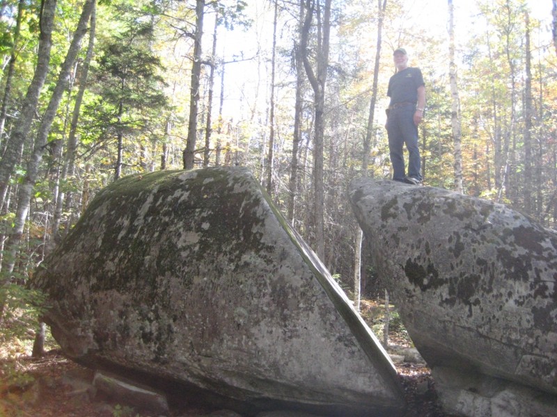
The Thomaston Town Forest section of the Georges Highland Path trail system passes through the 350-acre town forest that lies to the east of the Oyster River. The trail parallels the western boundary of the forest before veering northeast to pass Split Rock, a huge glacial erratic. The trail offers mostly level hiking through mixed and coniferous woods which provide habitat for deer, wild turkey, and moose.
The combination of the Oyster River Bog and Thomaston Town Forest sections of the Georges Highland Path provide a continuous 10-mile hiking experience that connects US Route 1 in Thomaston to ME Route 90 in Rockport.
The Georges Highland Path network of conservation trails is a project of the Georges River Land Trust.
No overnight camping is allowed. Leashed dogs are permitted. Please clean up after your pet! There is a confusing network of active and abandoned woods roads in this area, so be careful to stay on the trail by following the blue blazes.
Harmless mist from the town’s wastewater treatment facility’s dispersal fields occasionally drifts through segments of this trail. The mist can be avoided by hiking on weekends and holidays when the system is shut down, or when there is little or no wind. The system does not operate in the winter months. The water treatment facility benefits both the town and the St. George River by safely and effectively managing wastewater disposal.
Visit Georges River Land Trust online for more information or contact:
“Go” Before You Go: Use available restrooms before your adventure. And, if there’s no restroom, dig a 6-8 inch hole and bury waste at least 100 feet from trails and water.
Parking at the northern end of the trail (Jack Baker Woods lot) is on Beechwood Street in Thomaston. From the US Route 1 stoplight in the center of Thomaston, head north on Beechwood Street for two miles. The Jack Baker Woods parking lot is on the left at the Georges Highland Path trailhead sign.
There are two parking lots available at the southern end of the trail. One is at the Thomaston Pollution Control Plant at the end of Booker Street (off US Route 1), and the other is directly on US Route 1 at the trailhead kiosk on the Thomaston Green, next to the Strong Insurance Agency building.
Success! A new password has been emailed to you.
So my wife and I tried from over near Rt 1 and the on maps we used you just had to stay left twice to stay on the part that went near the river - we hoped to find the point we had reached coming the other way. And voila, as we were about to reach the second junction we came upon trail workers who were very nice and I asked one guy how you stay on the Georges River Trail and he said the turn was right up ahead, as I thought. So before when I had reached this spot and the trail you needed to turn left on to stay on Georges Highland looked almost unused and nothing like the main trail. I didnt even consider it the first time, AND the two arrow trail markers, you could only go straight or left on this goat path, were not aligned very well. They were just arrows with no words. I never dreamed that was this famous trail going left from this direction. No way mountain bikers had used it. So right away I realized that we saw how challenging it gets coming from the other end, so thats why no one takes it. We went down it and quickly reached a spot on the river. I am old and didnt want to go further but sometime I want to reach where we got to coming the other way. BUT no one tells you about this and you never read about it on any reviews. And the river looks gorgeous and is paddleable with the tides. And the trail maintenance people are so awesome!!