Mount Zircon Trail

The Mount Zircon Trail ascends gradually along along a dirt road before climbing more steeply on a trail to an open summit that provides excellent views.
Trail Activity
Hiking
Length
5.40 miles, Round Trip
Difficulty
Advanced
Towns
Milton Twp, Peru, Rumford
Surface
Dirt/Forest Floor, Gravel/Crushed Stone, Rock/Ledge
Pets
Permitted
Fees
No

Description

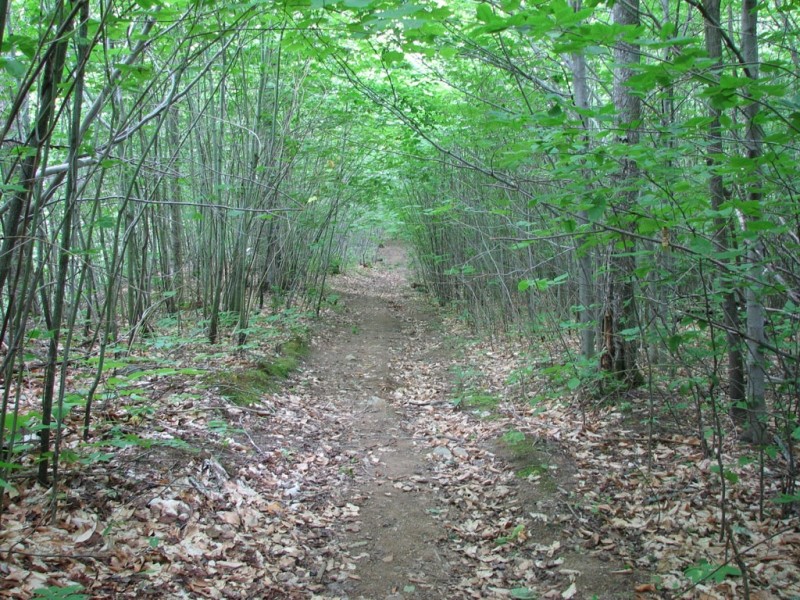
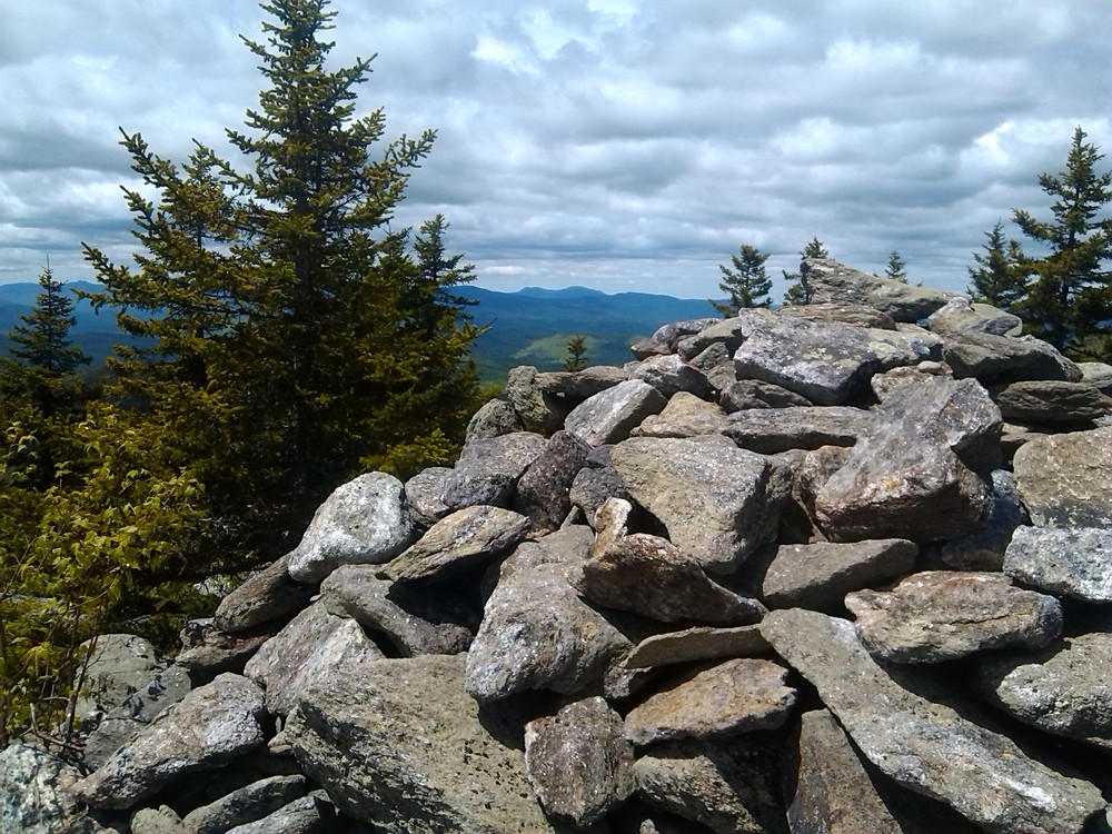
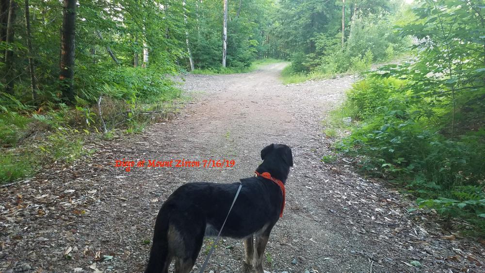
Pass under the gate and follow the gravel road. The trail ascends gradually, staying on the main gravel road. At approximately 1.5 miles on the left is the former spring house for the once-famous Moontide Spring – take an opportunity to sample the water from the overflow pipe that empties on the right side of the road. Continue for another 0.5 mile to where the trail leaves the gravel road on the left (sign) and continues steeply for another 0.5 mile to a nearly treeless summit.

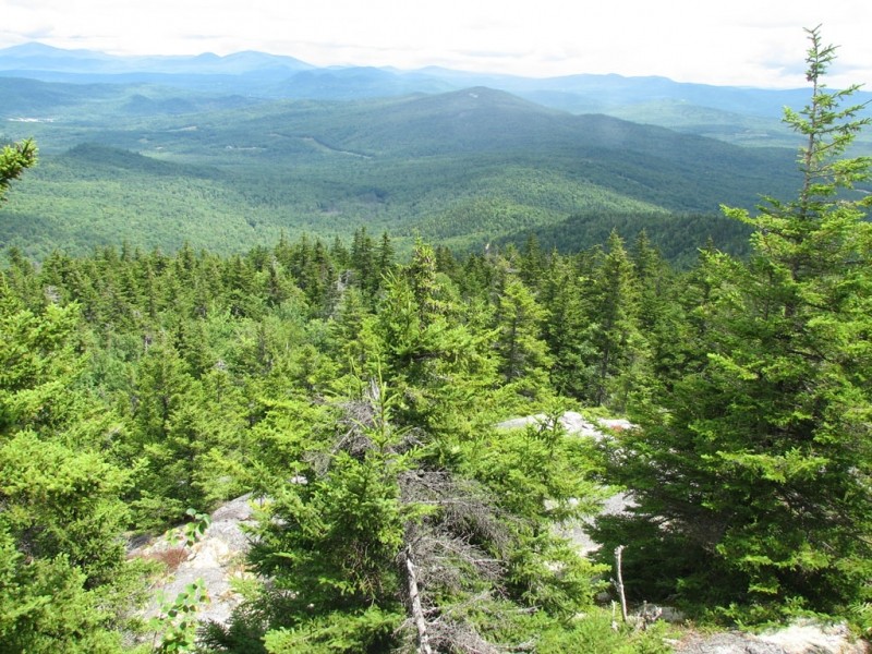
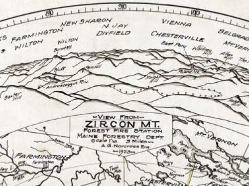
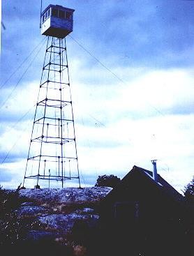
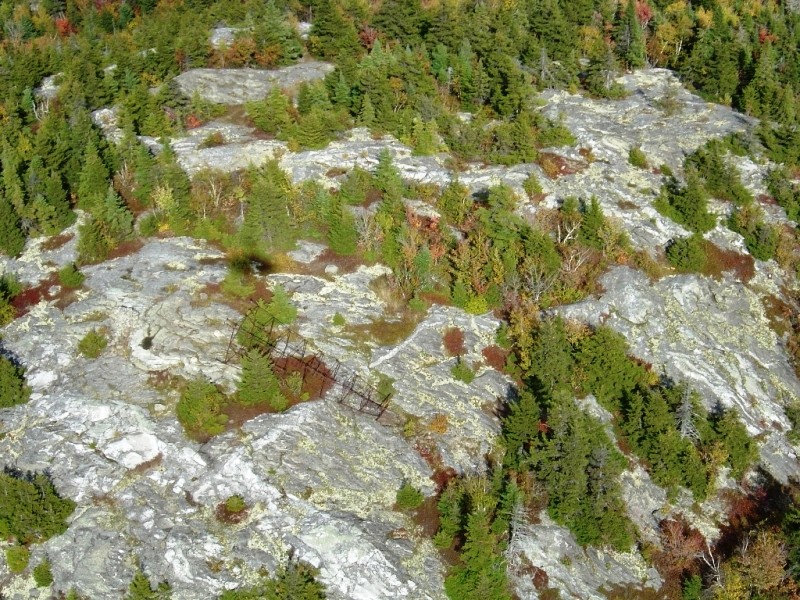
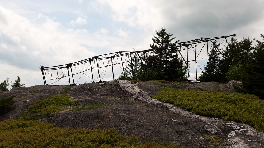
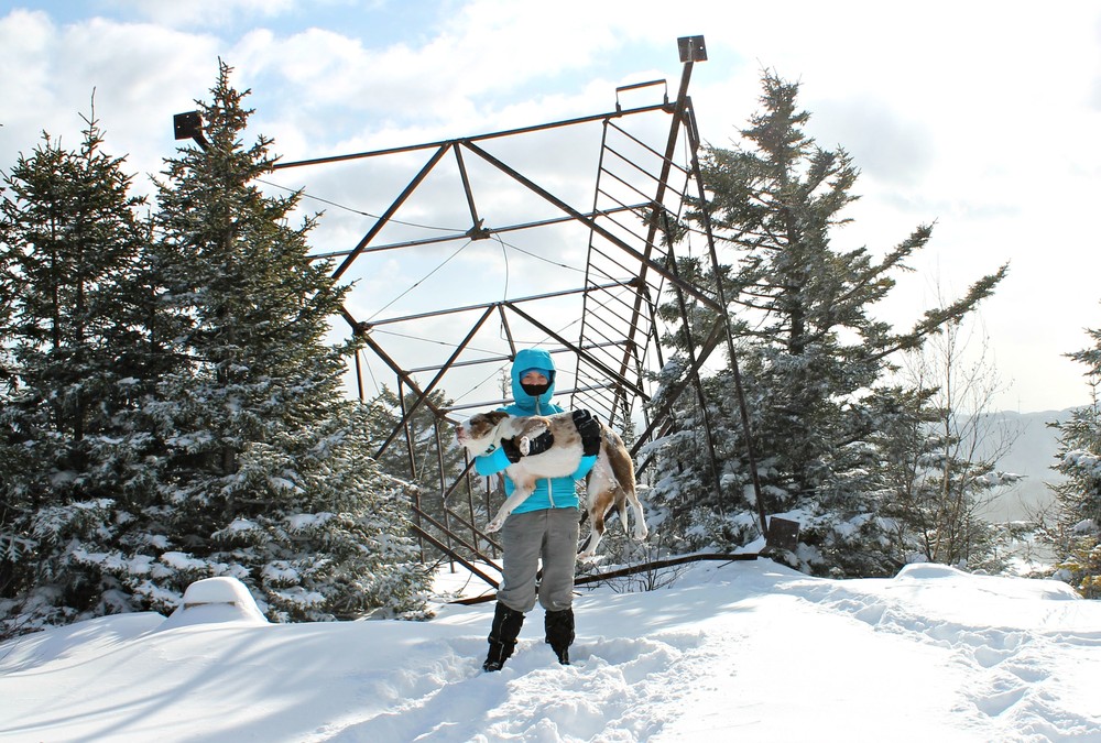
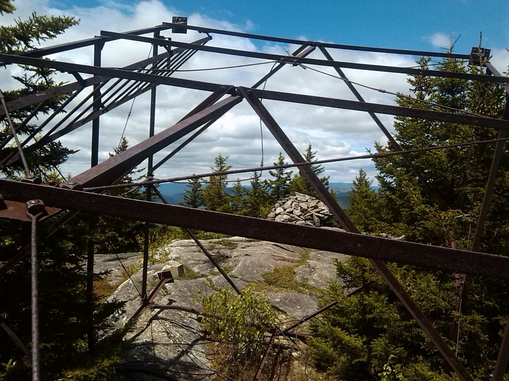
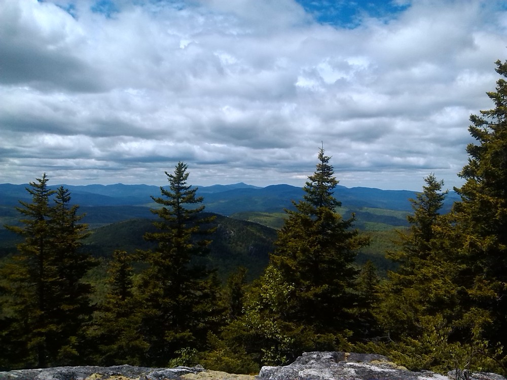
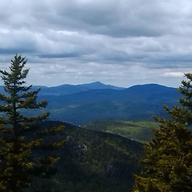
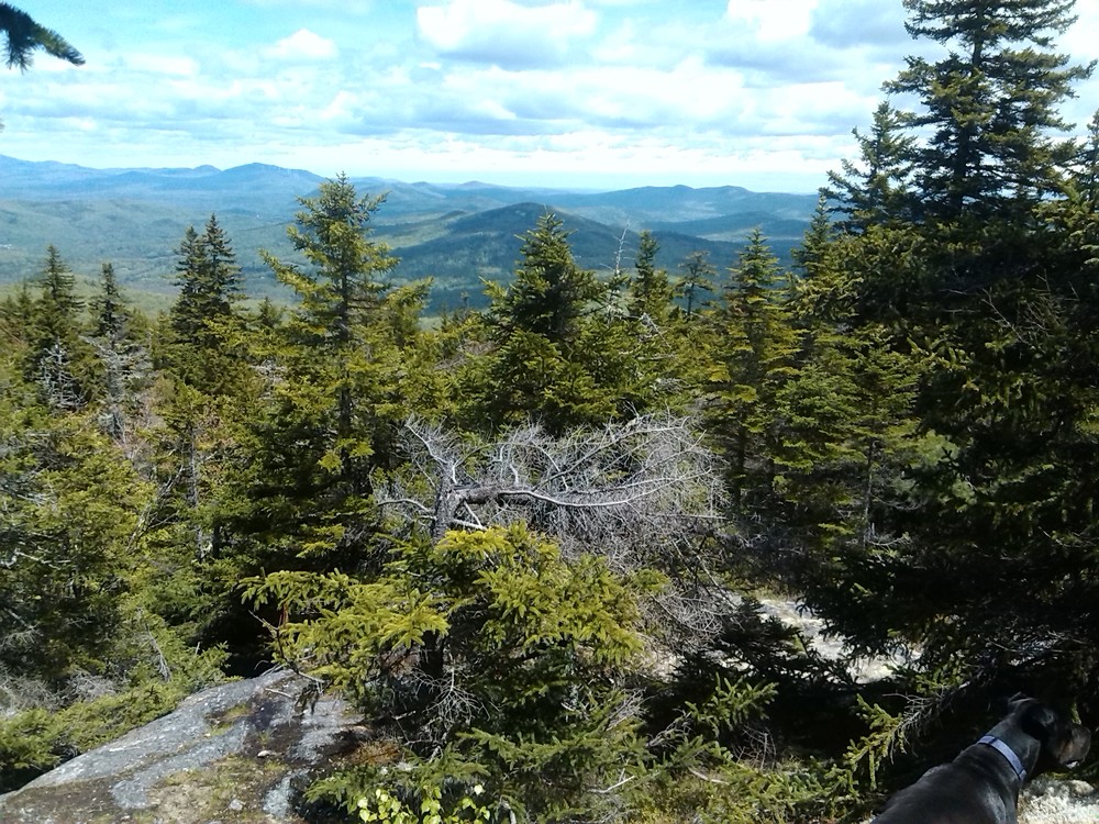
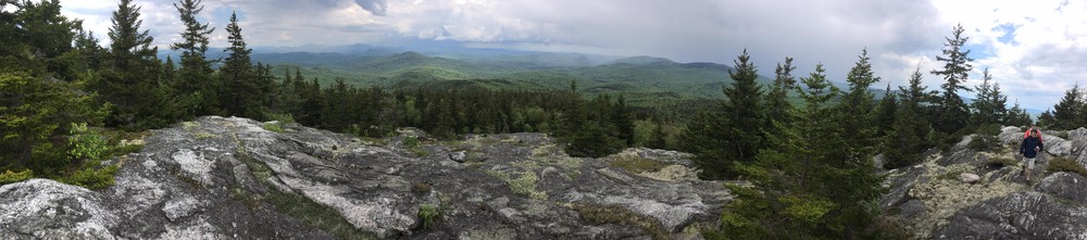
From the summit, the long views of Rumford and  the surrounding foothills make it an obvious place for the fire tower that was once here.

Other Information

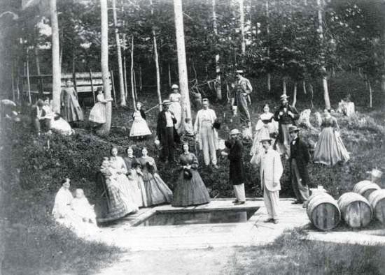
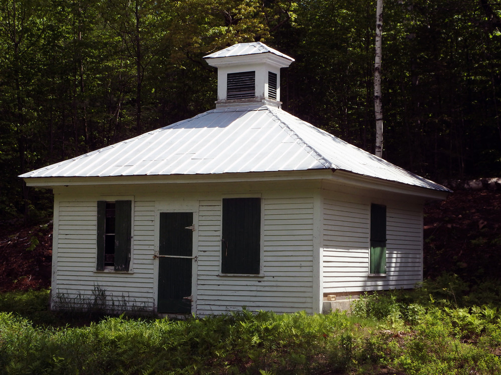
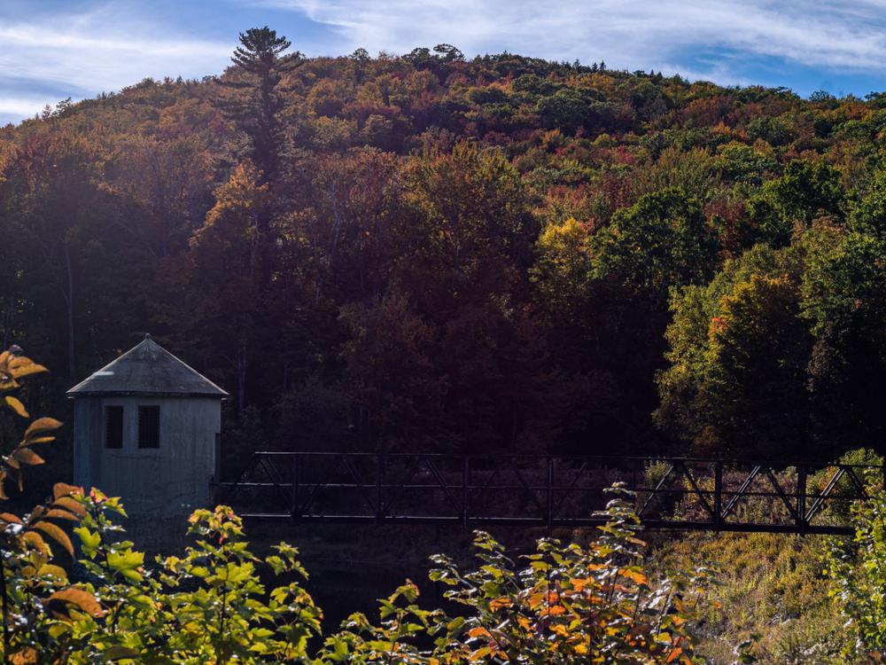
Long regarded as one of the Northeast's most unusual natural landmarks because of the cyclic fluctuations in its flow, the Mount Zircon Spring was officially opened to the public in the 1850s by a branch of the same marketing-savvy family who started the Poland Spring resort. Before long, there was a 50-room hotel on the spot, accessed by a county road. Now all that remains is a springhouse, and of course, the spring, whose medicinal properties may help get you up the steep section of trail to the summit. Although the gravel road passes through land owned by the Mount Zircon Water Company (now part of Poland Spring Water company, whose corporate parent is Nestle), the current landowner of the spring and much of the surrounding land is the Rumford Water District. The RWD started 100 years ago by building a large dam to create the Mount Zircon Reservoir, which included the outflow from the famous spring.

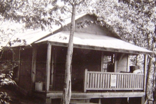
The 60-foot steel fire tower on the summit was built in 1922, along with a watchman's camp down near the gravel road. The camp was burned and the tower cut down and left in place in 1975.

There are three history-oriented geocaches on this hike.

Trail Manager

For more information contact:

Rumford Water District
25 Spruce Street
Rumford, ME 04276
Phone: (207) 364-8531

Nearby Events

VIEW EVENTS CALENDAR

Trail Tips

Plan Ahead and Prepare
Know your limits – it’s okay to turn back. Your home is the ultimate destination, not the summit.
Legend
Hide All

Trailhead Information

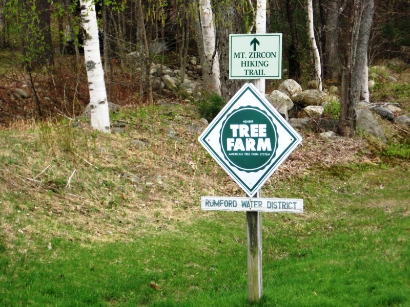
The trailhead is at a gated gravel road on South Rumford Road. From the west, the trailhead is 6.2 miles from ME Route 232. From the east, the trailhead is 3.2 miles from US Route 2 in Rumford. Turn on to the dirt road and park on the shoulder before the gate. Don't block the road. The trail follows the gravel road beyond the gate.

From the Rumford Information Center parking lot, turn left and proceed to the top of the hill. Turn left on to the South Rumford Road, crossing the river on the high bridge and proceed 0.9 mile to a fork. Bear right at the fork and continue for 2.2 miles to where Hall Hill Road comes in from the left. The trailhead is approximately 100 yards beyond this point at a gravel road between two houses. It is marked by a pipe gate and a Rumford Water District sign. An alternative parking spot is the pull-out at the former site of the Mount Zircon Spring Water Company 100 yards east along the South Rumford Road.

Click on a parking icon to get custom directions
Please Log In or Create Account to add comments.
tryingnottogetlost
May 25, 2022
Hiked this over the past weekend, took me a bit to find the access road with the gate (there's parking across from the house at 324 S Rumford Rd and then the dirt road is between houses 331 and 337 if I remember right). Bugs were annoying but a light hoodie kept them at bay and didn't see or hear any goshawks. The path isn't well marked until you reach the trailhead which was further than I thought it would be - don't second guess yourself and keep going straight until you see the trail sign and stack of rocks on the left. You will know you're in the right spot as the trail will quickly get steeper. Overall the trail isn't too well maintained and it was quick slippery due to recent rainfall. The views from the top were spectacular but I will hesitate to repeat this one because the majority of the ascent was rather boring.
nlgress.shp
October 09, 2021
Views from the top are spectacular! Husband and I are both getting back to hiking after knee & Achilles injuries. Enjoyed the easy 2 miles of logging roads to start and finish. Moderate hike up to top with limited scrambling. Dogs really enjoyed this hike too!
smcdaniel
June 05, 2021
June 2021 hike there was no goshawk bothering me, but me & my dog (leashed thank goodness) were stormed by a spruce grouse about 100 yards before the trail diverges from the road. Tail out, neck plume out & came right at us repeatedly! Hot day & the black flies were pretty bad, but the view at the top is outstanding!
pine
June 17, 2020
The issue with the Goshawk? is real. As others have said, just before the spring house (if coming up) One literally knocked me on the head on the way up. He/she comes at you from behind suddenly, quietly until last second then he/she screams at you. I hollered back.
On the way down they used the same tactics, (sudden from behind) after passing spring house.
Be wary.
lidie
June 01, 2020
Most of the trail follows a gravel road used by ATVs, before going left up a steep hiking trail that takes a straight route to the summit. Great views.
We also heard and saw a hawk that was aggressively defending its nest just below the spring house. We identified it as a Northern Goshawk.
travelin light
May 22, 2020
Excellent hike that was clearly marked and easy to follow with great views at the top. However, be aware there are a pair of large birds(falcons?) that are aggressive or nesting or something, because I got screeched at then dove at for about 10 minutes as I walked. It was on the way out around 1:45pm after passing the spring house. I was no threat to them as I walked the snowmobile trail, but that didn't stop them from diving at me.
dalyj
March 28, 2020
The trail was well marked today, with the start clearly posted at the road and the turn off the snowmobile trail well marked. The sign at this turn is now posted (securely) to a tree on the left side of the trail, and there is blue paint on trees on either side of the snowmobile trail indicating the turn. We had a great hike! Firm snow (but not icy) and excellent views of the Presidentials.
dprotaganist
April 28, 2019
Trail is presently in rough condition and completely unmarked. You can probably find your way, but be prepared.
doyletl05
August 27, 2017
Hiked trail on 8/12/17. Good directions to the trailhead. A steady walk uphill from trailhead (along gravel road). I missed the turnoff for the sign on the left of the trail for Mt Zircon. Anticipated it was at eye-level on a tree but it was a sign on the ground. Pay attention since I missed it. A steep hike up from that point to a dramatic vista. Fantastic view. Highly recommended
mkconnolly
July 28, 2017
Hiked the trail today.. Due to logging in the bottom half the directions need to be changed a little. The snowmobile trail on the right is overgrown. A little before you get to the spring house the road divides in 2 - stay straight on 17S. Also the trail sign at 2.2 miles is now posted on the ground on the right at the start of the trail up the mountain. Views are amazing at the top.
jshikes207
May 29, 2017
Hiked on 5/27/17 - Trail was great. A little slick on the rocky dirt sections due to water run off and recent rain fall. Use caution descending. Views were Incredible. Black flies were out in swarms but worth it. Plenty of water at the spring also.
ndemillo
October 08, 2016
Hiked on 10/7/16. Get out to the mountain tops people color looks like it is near or at its peak. Beautiful at the summit. Use caution there is still a logging operation going on nearer the bottom of the trail.
girlsopo
May 13, 2016
Heading there tomorrow 5.14.16, will verify distance and log after if cell service is active!
mainetrailfinder
June 02, 2014
We just reviewed the original data and confirmed a round trip distance of 5.4 miles.
egilbe
June 01, 2014
The distances on this trail is off. Round trip right around 8 miles. The hike from the gravel road to the summit is a good mile of some fairly steep terrain. Other than that, the walk up the road is fairly easy. The road the gate is on is easy to miss from So. Rumford road. I drove by it twice thinking it was someone's drive way. A house is right at the gate.
These awesome businesses support our goal of connecting people to outdoor adventures in Maine!
Hang Tight!
Nearby services are loading
No Results
No Services Found
SHARE THIS TRAIL

Add Trail Log

Please wait…
Join In on the Fun!
Log in or create an account below to unlock all the great features of Maine trail finder: keep track of trails you want to do, preserve memories of trails you’ve done, earn badges, and more!
Your log in attempt was not successful. Please try again.
    Lost your password? Reset your password
    Don't yet have an account?
    There was an issue with your submission. Please try again.
      * Indicates required field
      Already have an account? Login here
      Enter your username, and we will send you a new, randomly generated password to your email account.
      There was an issue with your submission. Please try again.

        Success! A new password has been emailed to you.

        Log in now

        Please wait…