Mousam Way: North

This is an extremely scenic trail through Riverside Cemetery and along the banks of the Mousam River to Indian’s Last Leap. Trail through woods is very rugged with rocks and roots in the footpath.
Trail Activity
Snowshoeing Mountain-biking Cross-country-skiing Hiking
Length
3.90 miles, Network
Difficulty
Moderate
Town
Sanford
Surface
Pavement, Gravel/Crushed Stone, Dirt/Forest Floor, Rock/Ledge
Pets
Permitted
Fees
No

Description

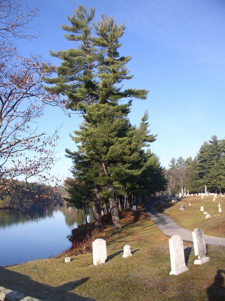
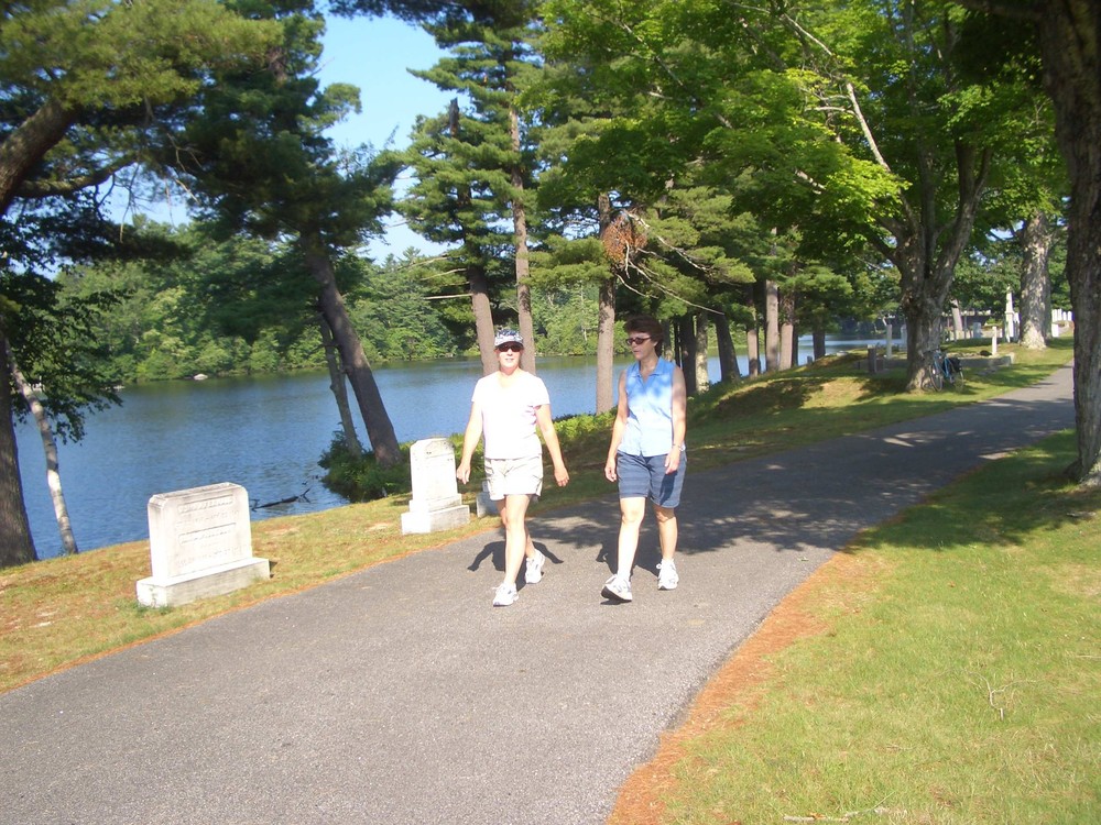
Going north: From Mousam Way Park, follow the brick crosswalk onto Water Street. Continue to the end of Water Street where it intersects with Mill Street. Cross Mill Street and follow the Haven Cove Condominium driveway to reach the gravel trail. Follow to the top of the dam on left and along the shore of Mill Pond toward the condominiums. The trail crosses pavement between buildings to a fence at the perimeter of the property. Follow the gravel ramp along the fence to reach an opening through to Riverbank Court. Trail proceeds down Riverbank Court and enters Riverside Cemetery. Follow painted logo on pavement around to left. Fine views of Mill Pond.

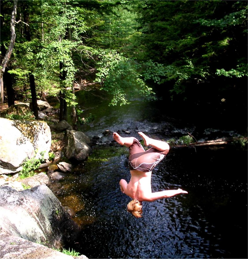
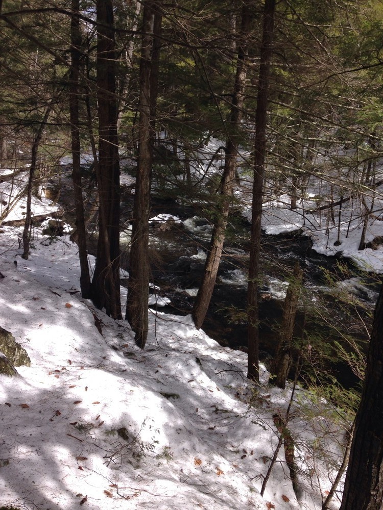
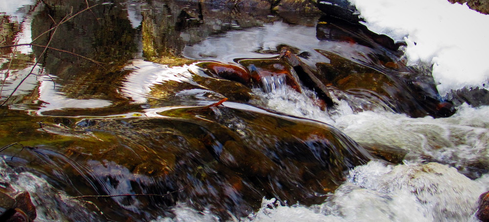
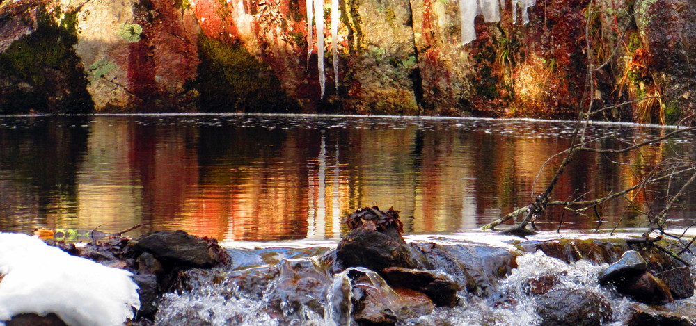
At the far end of the cemetery and within sight of water, the trail leaves pavement and continues as a footpath through woods. Immediately, there is an option to continue straight ahead and climb ledges or turn right and circle around behind ledges. The trail becomes quite rugged. It is marked by green dots and yellow logos and follows the Mousam River for about a half-mile to Indian’s Last Leap, a scenic spot and swimming hole, where legend has it that a Native American chasing a settler fell to his death. Leaving Indian’s Last Leap, the trail soon comes to an open area and power transfer station on Stanley Road. The trail heads left, crossing a footbridge and returns to the river’s edge. The trail continues to the Springvale Recreation Area. Continue across fields to stairs and a parking area, then along the sidewalk on Main Street back to Springvale Village and the trail’s beginning.

Trail Manager

Sanford Trails is an all-volunteer organization that promotes, builds, and manages trails in Sanford and Springvale. Learn more by visiting: www.sanfordtrails.org

Sanford Trails

Sanford Trails
919 Main Street
Sanford, ME 04073
Phone: (207) 324-9130
recreation@sanfordmaine.org
View website

Nearby Events

VIEW EVENTS CALENDAR

Trail Tips

Leave What You Find
Leave the trail work to the pros: they will add or remove blazes, cairns (stone trail markers), structures, and trail improvements as deemed necessary.
Legend
Hide All

Trailhead Information

There is parking available along the trail in these locations:

  • Mousam Way Park: at the intersection of Pleasant and Bridge Streets in downtown Springvale.
  • Holdsworth Park: on ME-109/11 at scenic overlook toward Mousam River, about a half mile north of Springvale downtown.
  • Springvale Recreation Area: just off ME-109/11 near Holdsworth Park.
  • Stanley Road: about a quarter mile from ME-109/11, in the dirt parking area next to the Central Maine Power substation.
Click on a parking icon to get custom directions
Please Log In or Create Account to add comments.
rosyrae1
January 31, 2021
Hiked to Indian's Last Leap yesterday from Holdsworth Park. Beautiful area! We didn't do the full loop as we didn't want to go up the embankment after the ledges but it was a nice out and back hike with avoidable patches of ice on the trail. I would definitely do this hike again in full in the warmer weather!
cannelozier
August 21, 2019
Walked it on a warm summer evening and the river was calm and reflecting. At the end of the cemetery the woodland path follows the river. It is a mixed path, tree roots, rocks and slight inclines, so wear good footwear, as the boulders can be mossy. The only detraction is to be expected, located in the middle of the town, there is inescapable traffic noise. If I lived there I would walk this path often because it is pretty.
awent9
September 28, 2016
I parked at Holdsworth Park off of route 109 in springvale. Finding the trailhead was a bit tricky from here, it's close to the river past the playgrounds and pavilion off of a sort of parking lot. Following the green blazed trail was easy until a small bridge crossed a smaller part of the river, then the blazes seemed to fade.. there, but not super visable... i know someone who bikes in the area and it turns out i followed sort of a bike path at the end of a small field, which was much easier to navigate than the trail along the river. Overall a great trail, lots of roots and rocks to jump around when running, kept things interesting! Indians last leap rocks were very cool also, I'll try to grab a picture next time!
These awesome businesses support our goal of connecting people to outdoor adventures in Maine!
Hang Tight!
Nearby services are loading
No Results
No Services Found
SHARE THIS TRAIL

Add Trail Log

Please wait…
Join In on the Fun!
Log in or create an account below to unlock all the great features of Maine trail finder: keep track of trails you want to do, preserve memories of trails you’ve done, earn badges, and more!
Your log in attempt was not successful. Please try again.
    Lost your password? Reset your password
    Don't yet have an account?
    There was an issue with your submission. Please try again.
      * Indicates required field
      Already have an account? Login here
      Enter your username, and we will send you a new, randomly generated password to your email account.
      There was an issue with your submission. Please try again.

        Success! A new password has been emailed to you.

        Log in now

        Please wait…