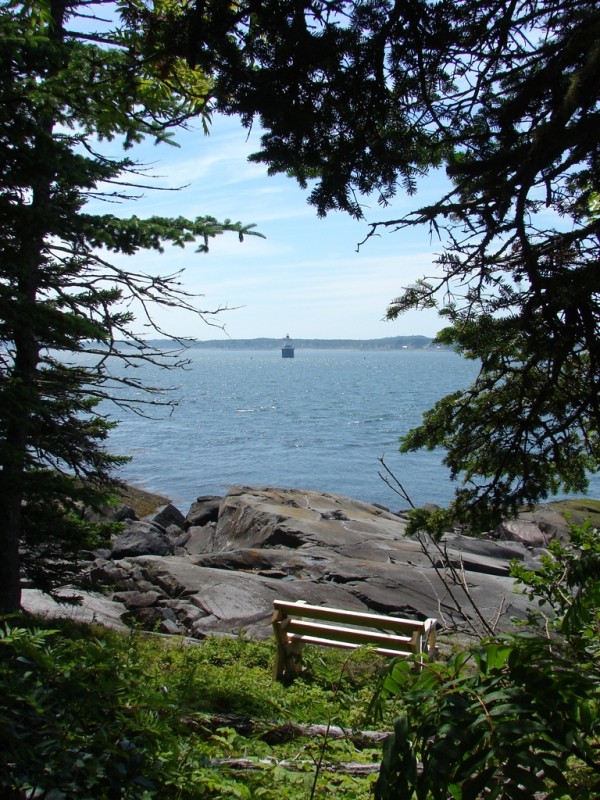
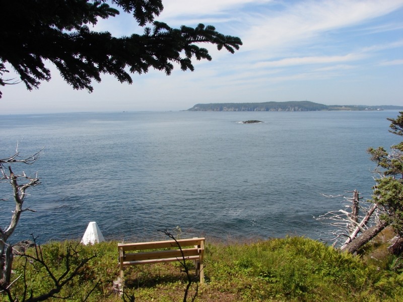
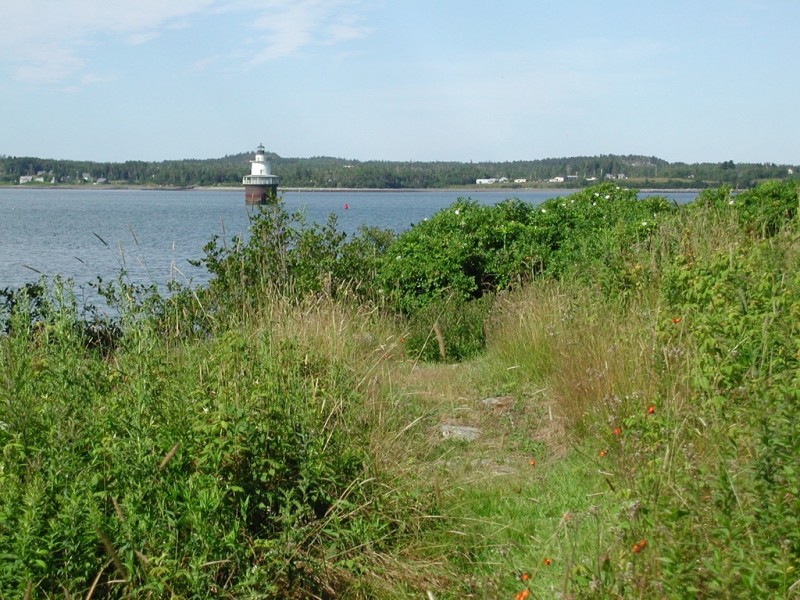
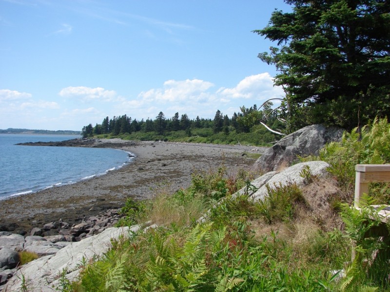
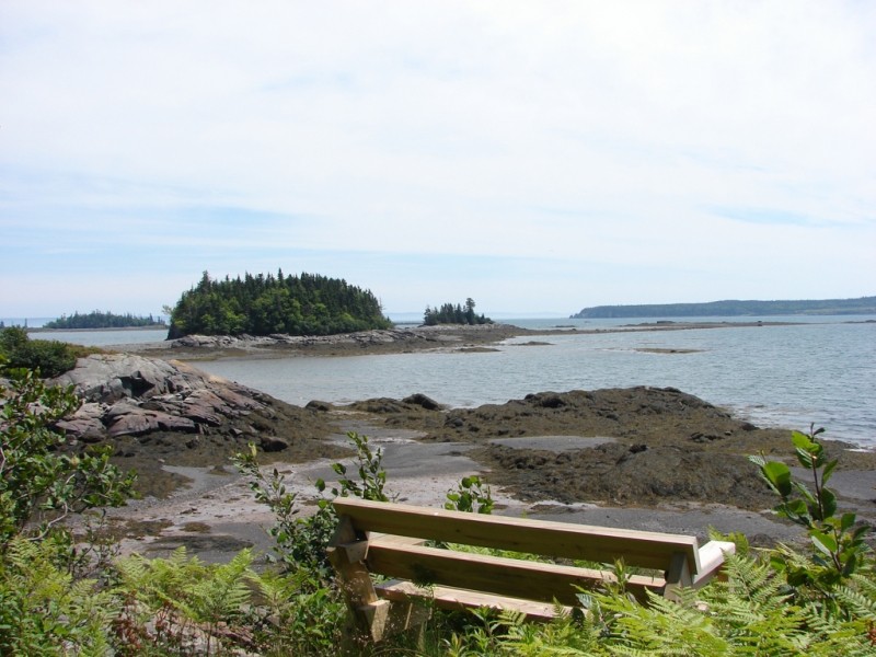
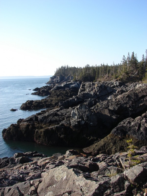
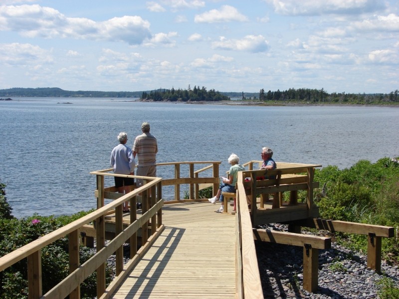
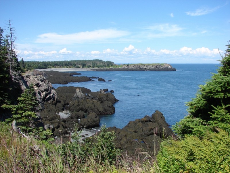
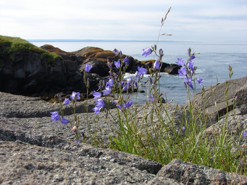
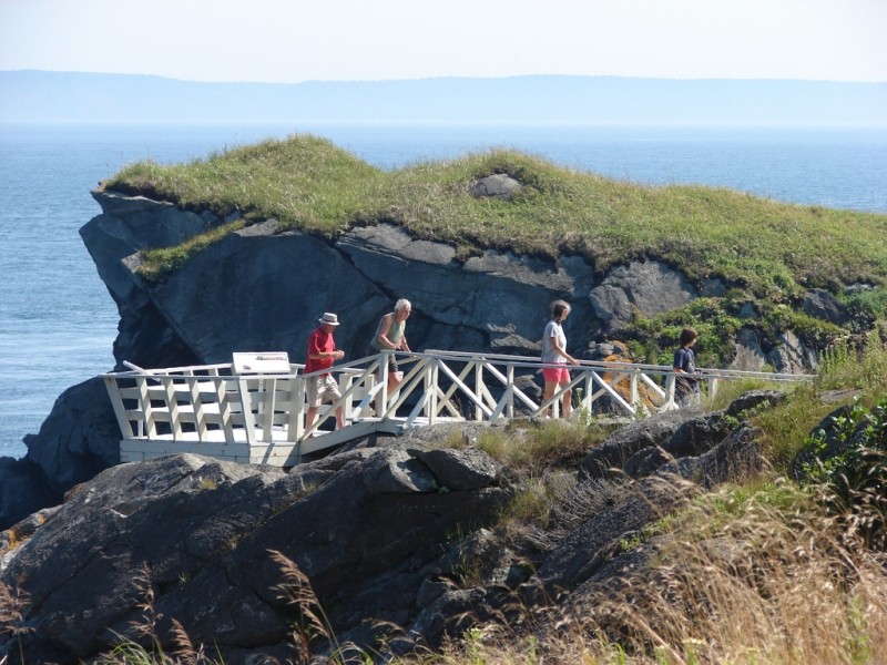
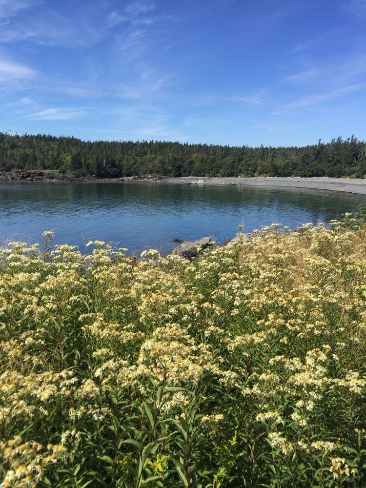
Roosevelt Campobello International Park is a combination indoor and outdoor sites that include the Franklin Delano Roosevelt (FDR) summer home and a 2,800-acre (1,133-hectare) natural area. Natural Area trails wind through and past varied habitats including spruce-fir and hardwood forests, sphagnum bogs, fields, and seashore. The trails are designed to offer short hikes when done individually or moderate to long hikes when traveled in combination. A short walk down a gravel road may be necessary to travel trails in combination. Views from the trails included shaded forests, marsh, bogs, small secluded covers, cobble, sand and gravel beaches, cliffs, and headlands. Observation decks at Friar’s Head, Eagle Hill Bog, Lower Duck Pond, and Liberty Point offer panoramic views. Friar’s Head Trail and Eagle Hill Bog (follow links to Maine Trail Finder postings) offer self-guided nature brochures that are available at the Visitor Centre.
The trails of the park are reached from the park’s three drives and it is best to get directions from the Visitor Center to the trail you want explore. All trails are well cleared, clearly identified, and easy to follow. Difficulty varies with the trail. They are designed to offer short hikes, or moderate to long hikes when traveled in combination. This may require walking a short distance down a drive to reach the next trail. All are well-cleared, clearly identified, and easy to follow. Difficulty varies with the trail. See the brochure, Trails of Roosevelt Campobello International Park.
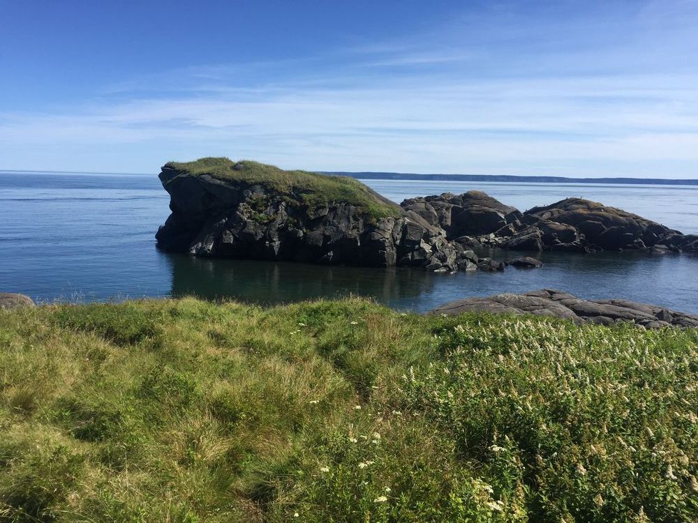
Trail Description: Friar’s Head and Eagle Hill Bog are separate trails. Fox Farm and Liberty Point trails provide loop experiences when combined with short sections of Park road. Shoreline trails weave between forest and shore and past secluded coves, cobble and sand beaches, headlands, and spectacular ocean views. Interior trails wind through mixed woods, regenerating and maintained fields, sphagnum bog, and hardwood forest. Scenic observation decks and panoramic views at Friar’s Head, Eagle Hill, and Liberty Point.
Campobello Island Tourist Information Centre to Fox Farm (2.2 mi, 3.5 km round trip, moderate): Begin at visitor center at top of hill beyond Canadian Customs. This trail includes hills and gullies and passes through regenerating forest that was logged nearly 40 years ago.
Fox Farm Loop (1.8 mi, 2.9 km round trip, easy): To get there follow Glensevern Road from Park entrance less than 0.1 miles (0.2 km) to Cranberry Point Drive and take Cranberry Point Drive 1.9 mi (3.0 km) to Fox Farm. Park and take the Upper Duck Pond Trail on your left, weaving 0.9 mi (1.4 km) between spruce-fir forest and small estuary with views of a marsh, to Upper Duck Pond. At Upper Duck, go left along the road 0.1 mi (0.2 km) to Cranberry Point and continue up the road to the Fox Farm Trail. Follow the 0.7 mi (1.1 km) Fox Farm Trail (coastal and lighthouse views) along the shore to the road near Fox Farm. Turn left to return along the road 0.1 mi (0.2 km) to your vehicle.
Raccoon Beach–Liberty Point Loop (4.7 mi, 7.6 km, round trip, advanced): Take the Glensevern Road 2.2 mi (3.5 km) to Liberty Point Drive, then Liberty Point Drive 0.5 mi (0.8 km) to Raccoon Beach field. Begin at the Liberty Point trail on left, at the southern end of the field. Hike 1.7 mi (2.7 km) (moderately difficult, ups and downs) to the Sunsweep intersection. Follow the Sunsweep branch 0.1 mi (0.2 km) through an open area to the Sunsweep sculpture and return by the same route to main trail. Follow the main trail (numerous narrow foot bridges) 0.6 mi (1 km) to the Liberty Point parking area. Enjoy views from Liberty Point, then follow the road 0.1 mi (0.2 km) to Lower Duck Pond trail on left. Follow the trail 1.1 miles (1.8 km) through Yellow Bank picnic site to Lower Duck Pond. From Lower Duck, walk the gravel drive to the top of the hill, turn left, and walk to the Raccoon Beach trail on the left (under 0.2 mi, 0.3 km). Follow the blazed, flat, easy trail 1.1 mi (1.8 km) through mostly open hardwoods to a gravel road. Raccoon Beach is just within sight to the left. The entire loop weaves between interesting, pleasant forest and shore. Weaves back and forth through interesting, pleasant forest and shore. Splendid views!
Footwear for wet and slippery conditions is recommended, especially along trails that follow the shore for part of their course.
Cobscook Trails Project
The trails at Roosevelt Campobello International Park are part of a larger network of hiking trails in known as Cobscook Trails. Cobscook Trails is a cooperative project of conservation landowners and community partners that seeks to expand opportunities for nature-based recreation and tourism in eastern Washington County. The group produces "Cobscook Trails: A Guide to Walking Opportunities around Cobscook Bay and Bold Coast Region", a 55 page booklet describing walks on 19 area properties. Find more information about Cobscook Trails, including how to purchase the guidebook, visit: The Cobscook Trails Project.
IMPORTANT: A valid passport or equivalent is required to cross international borders, including the Maine-Canadian border. You must have these documents with you when visiting the park.
Visit Roosevelt Campobello International Park online for more information and a printable map or contact:

Know the Rules and Be Prepared: Research local regulations, including permits and fire restrictions, on sites like Visit Maine. Pack plenty of food, water, and the other Ten Essentials before heading out on your adventure.
To Visitor Center: Take ME Route 189 to Lubec. From Lubec follow ME Route 189 onto the FDR Memorial Bridge and cross the US-Canadian border into Canada (passport/equivalent required). The main road becomes NB Route 774. Follow NB Route 774 approximately 1.5 miles (2.4 kilometers) to the intersection with Glensevern Road and take a left into the Visitor Centre and parking area. Ask at the Visitor Center for directions to the trail(s) you want to visit as well as gather maps or information about the park.
During the summer months there is also an Tourist Information Centre on NB Route 774 just after crossing the US-Canadian Border. You can also ask for directions to the trailheads from here.
Success! A new password has been emailed to you.