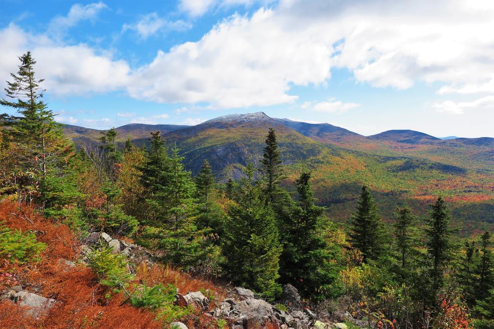
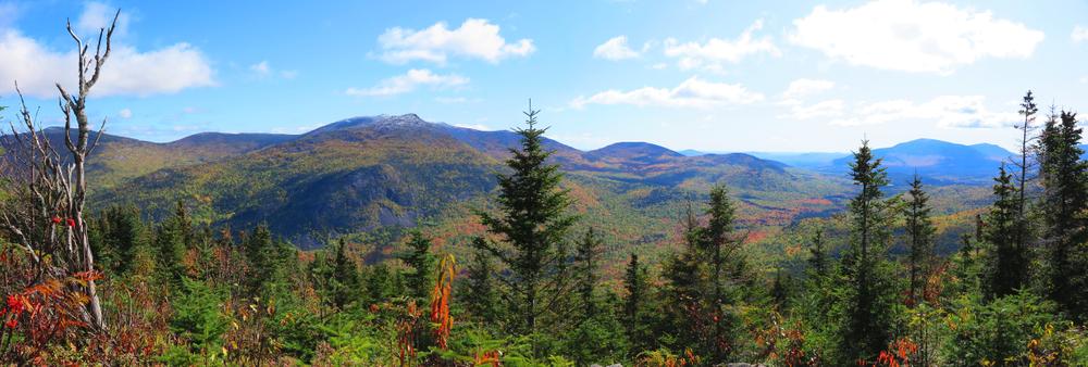
South Branch Mountain is a twin peaked mountain (the south peak is named Black Cat Mountain on several maps) enclosing the west side of the South Branch Ponds. There are limited views from the north peak but excellent views from the grassy, open south peak. The views of the Traveler Range east across the valley are especially striking. Katahdin can be seen looming to the south.
The trail is best hiked as a loop trip, ascending from South Branch Pond Campground to the north peak and then and then to the south peak before descending steeply to the southern end of Upper South Branch Pond at a junction with the Pogy Notch Trail. This trail proceeds north along the east shore of both ponds back to the campground.
The trail is blue-blazed and involves a net elevation gain of 1,618 feet. 5-6 hours should be sufficient for a trip over the mountain and a return via the Pogy Notch Trail. There is no water on the trail, so water must be carried.
TRAIL DETAILS
0.0 Miles: The trail begins on the northwest shore of Lower South Branch Pond near the Ranger's Cabin. A sign on the shore marks the trailhead. The outlet of the pond must be forded. The trail leads southwest away from the pond.
0.2 Miles: The trail parallels a brook upstream, then gradually bears away from it. This is the last water. The trail commences a moderate ascent.
0.7 Miles: The trail takes a sharp left (southeast) and continues to climb. Ahead is a short side trail to a northerly viewpoint.
1.1 Miles: Ledges with views north and east.
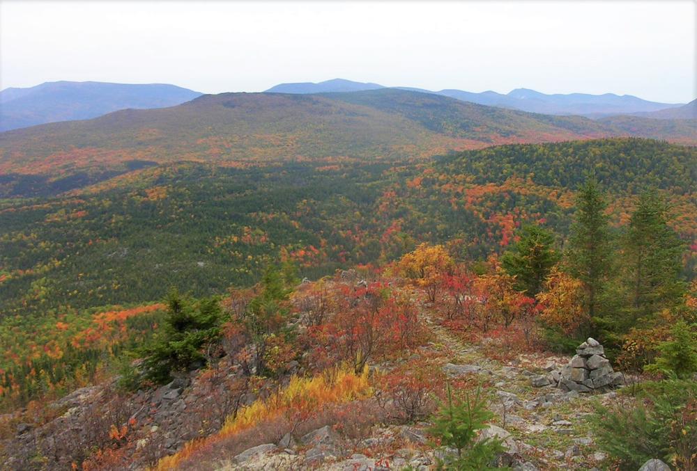
1.5 Miles: A rocky knob on the ridge provides excellent views. The campground is visible far below. Above this point, the trail crosses a series of open ledges.
2.1 Miles: The trail reach the partially-wooded North Peak (elevation 2,599 feet). Ahead, the trail descends into a shallow saddle before ascending to the South Peak.
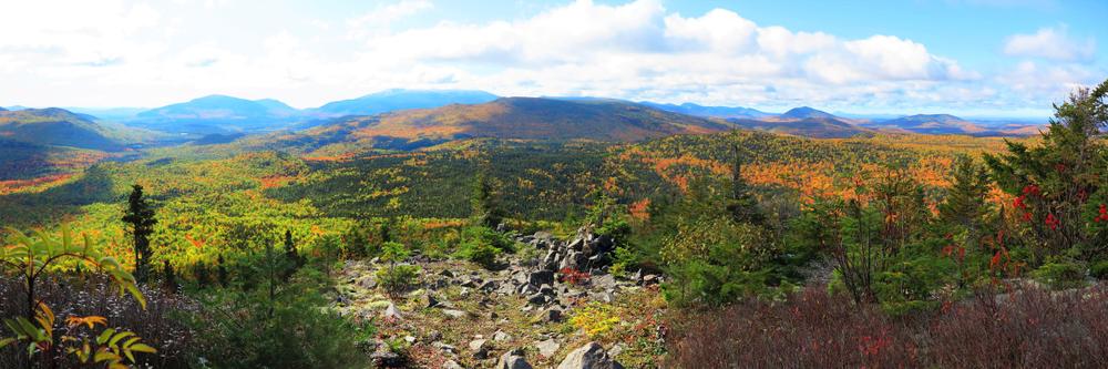
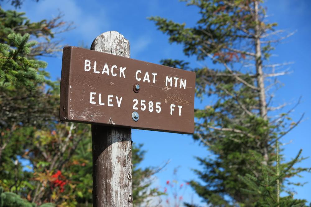
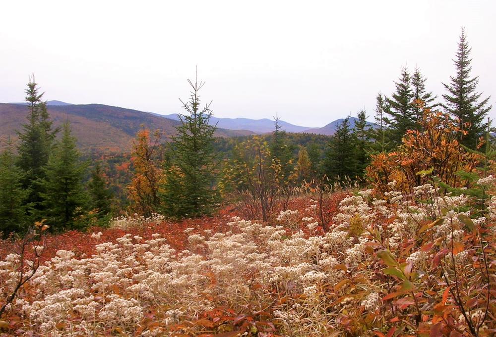
2.6 Miles: The trail reaches the South Peak of South Branch Mountain, also called Black Cat Mountain (elevation 2,585 feet). The 360-degree view is outstanding, especially of Pogy Notch and the South Branch Ponds. The trail continues down the south ridge passing through beautiful open meadows.
3.0 Miles: A rock outcrop signifies the end of the meadows. The trail swings left (east) and enters hardwoods, descending steeply with some sections over old talus slopes.
3.9 Miles: The trail reaches the bottom of the steep slope, and continues on more level terrain.
4.3 Miles: A side trail is on the left, leading 200 feet to the Upper South Branch Lean-to. The trail continues over bog bridges through an extensive alder and cedar swamp.
4.5 Miles: The South Branch Trail ends at a junction with the Pogy Notch Trail. To left (north), the trail proceeds 2.1 miles along the east shore of the ponds to return to the trailhead and parking area at South Branch Pond Campground. A canoe landing and picnic site are located on the nearby shore of pond.
5.1 Miles: A trail junction with the Center Ridge Trail marks the high point of a rise up to some cliffs. Beyond the junction, the trail descends back to the shoreline of Upper South Branch Pond, to the the wide, ancient delta of Howe Brook, passing through a beautiful grove of mature hardwoods, one of the best in the Park.
5.6 Miles: The trail crosses Howe Brook, with the junction with the Howe Brook Trail (to the right) just on the other side.
5.7 Miles: The trail emerges onto a wash (part of a true delta) of Howe Brook, with a canoe landing to the left.
6.6 Miles: The Pogy Notch Trail reaches South Branch Pond Campground.
Park Fees: See website for entrance and camping fees. [No entrance fee for Maine residents.]
Park Rules: See a more complete list here.
For more information and detailed trail maps, visit the Baxter State Park Authority website, or contact:

Be Prepared to Share the Space: Outdoor recreation in Maine welcomes everyone. Have an alternative plan in case the parking area is already full.
From ME-11 in Patten, head west on ME-159. At 10.1 miles you will pass Shin Pond Village; at 11.6 miles you will pass Matagamon Wilderness Campground. At 13.4 miles (1.8 miles after Matagamon Wilderness Campground) you will arrive at Baxter State Park's Matagamon Gate entrance.
Go 6.7 miles on the Tote Road, then turn left on South Branch Pond Road. Go 2.1 miles to the campground and pond at the end of the road. Parking is just north of the campground. The trailhead is by the northwest shore of Lower South Branch Pond near the Ranger's Cabin. Or, to loop in a clockwise direction, find the trailhead for the Pogy Notch Trail located in the campground at its east end, by the northeast corner of South Branch Pond.
Success! A new password has been emailed to you.