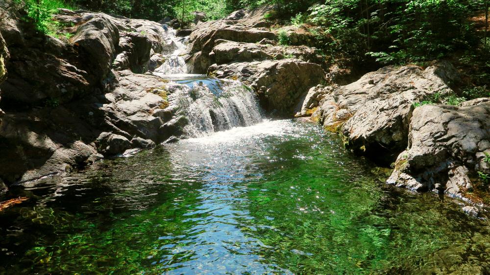
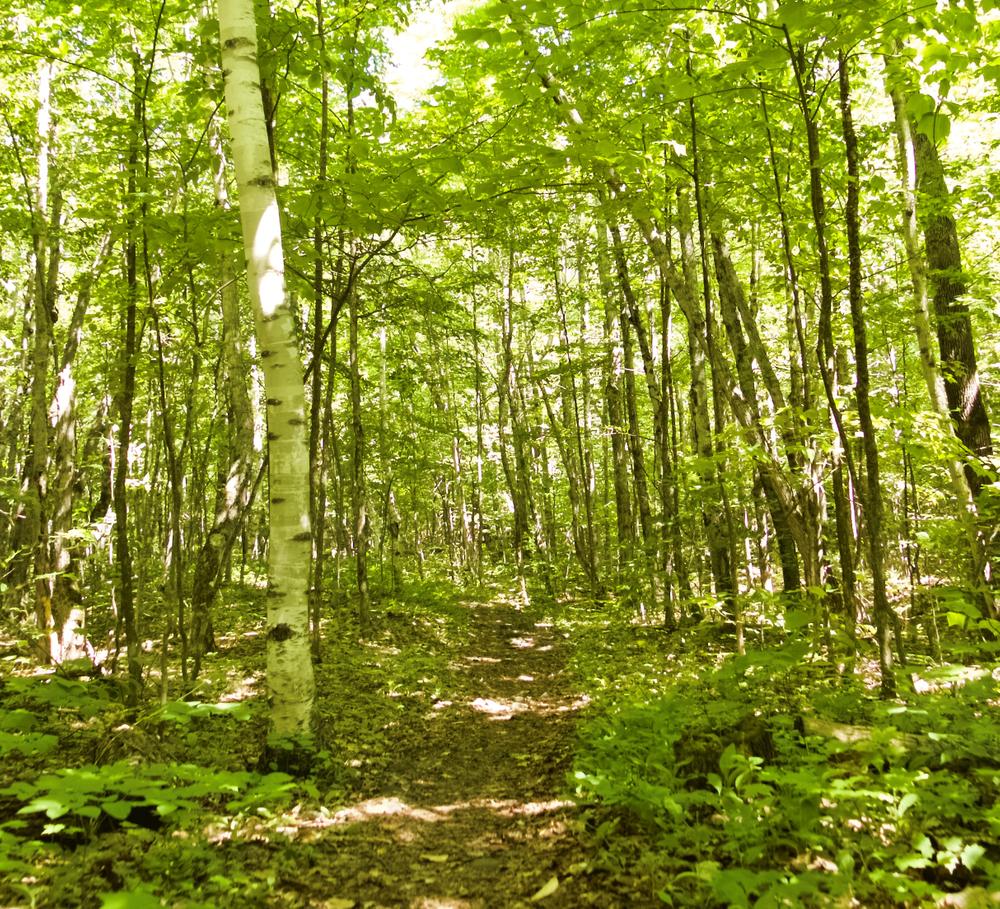
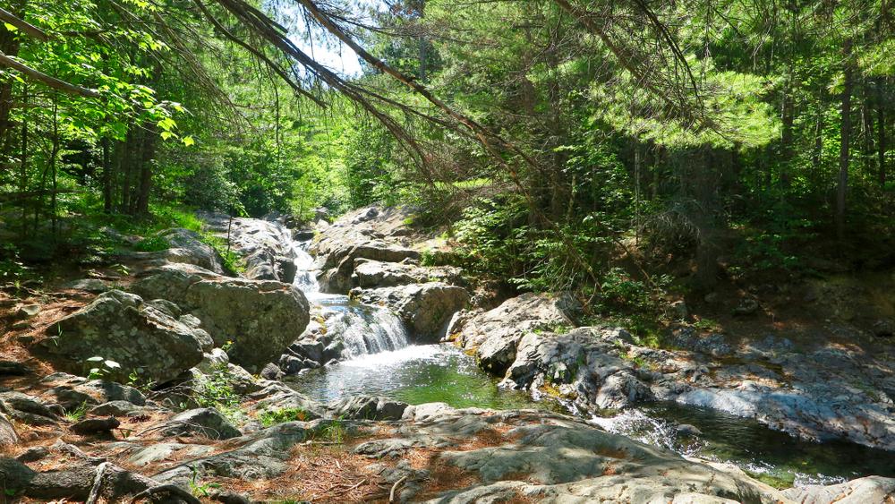
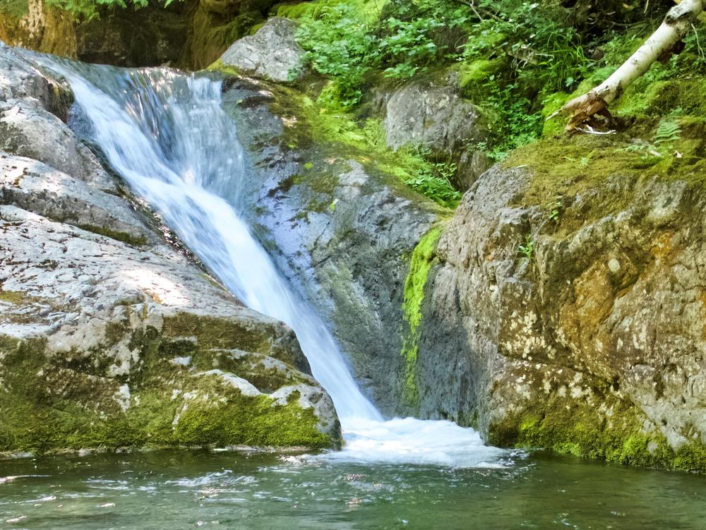
Howe Brook is located in a deep valley between the North Ridge of The Traveler and Center Ridge. The trail was opened in the mid-1970s. It is primarily a valley trail and offers a leisurely day hike along the many falls and pools of the brook. There are two sets of falls that are particularly impressive, the lower one having a number of smooth sluices and potholes. The other has a sheer drop in a deep dark ravine.
The trail has ample water and is blue-blazed. There is an elevation gain of 700 feet.
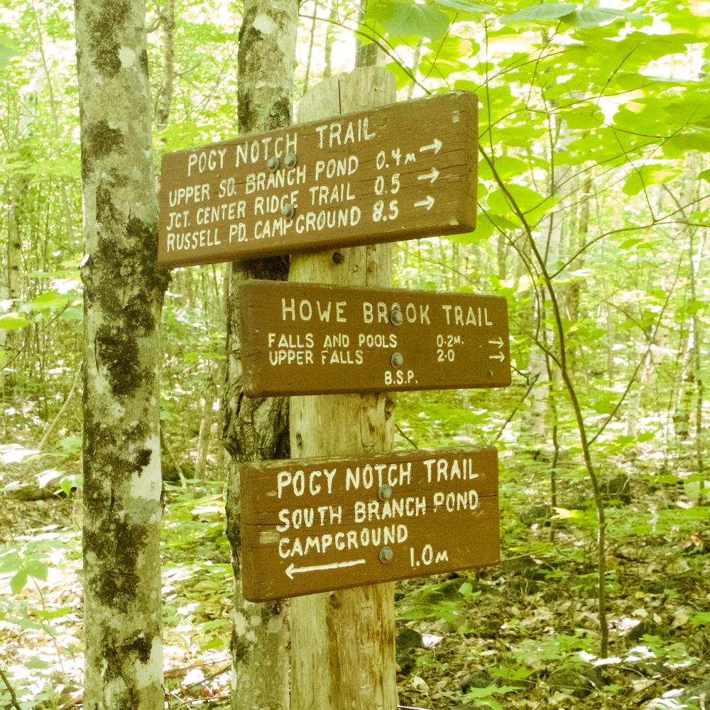
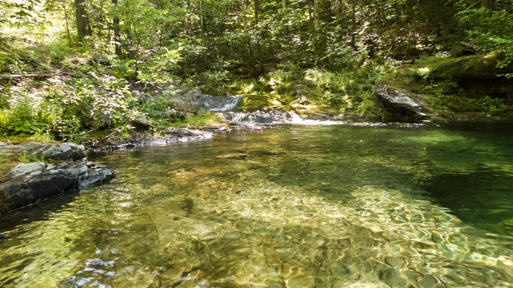
The trail begins on the Pogy Notch Trail, starting at the east end of South Branch Pond Campground. The trail follows along the shore of South Branch Pond for 1 mile before reaching the junction with the Howe Brook Trail, to the left. The Howe Brook Trail parallels the north bank upstream for 0.2 miles, where the first of a series of smooth chutes with deep pools is encountered. There are also a number of well-developed potholes formed by the grinding action of pebbles propelled by circular currents. These provide interesting and invigorating swimming in natural "bathtubs.”
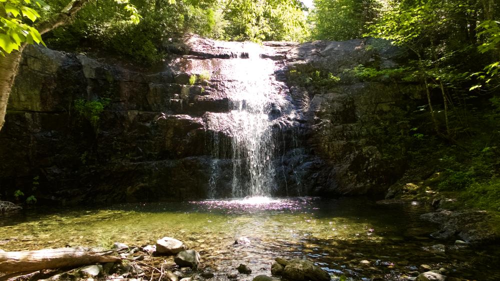
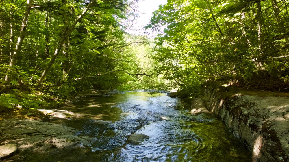
Above this point is a continuous series of falls to 0.5 miles. The trail crosses and re-crosses the brook, then commences a long gradual climb along its banks. At 1.8 miles an unmarked side trail leads right (south) to a set of falls and flumes located in a deep ravine. The main trail climbs steeply away from this ravine (use caution here) but rejoins the brook above the ravine. At 2.0 miles the trail ends at the base of a 20 foot sheer waterfall with a small pool at its foot. This is a good picnic spot.
The 6 mile hike to the upper end of the trail from South Branch Pond Campground can be shortened 1.75 miles, by canoeing across the pond from the campground to a landing on the Pogy Notch Trail just north of the mouth of Howe Brook.
Park Fees: See website for entrance and camping fees. [No entrance fee for Maine residents.]
Park Rules: See a more complete list here.
For more information and detailed trail maps, visit the Baxter State Park Authority website, or contact:

Bag & Carry Pet Waste: Dog waste doesn’t belong in nature—pack it out and put it in the trash.
From ME-11 in Patten, head west on ME-159. At 10.1 miles you will pass Shin Pond Village; at 11.6 miles you will pass Matagamon Wilderness Campground. At 13.4 miles (1.8 miles after Matagamon Wilderness Campground) you will arrive at Baxter State Park's Matagamon Gate entrance.
Go 6.7 miles on the Tote Road, then turn left on South Branch Pond Road. Go 2.1 miles to the campground and pond at the end of the road. Parking is just north of the campground. The trailhead is located in the campground at its east end, by the northeast corner of South Branch Pond.
Success! A new password has been emailed to you.