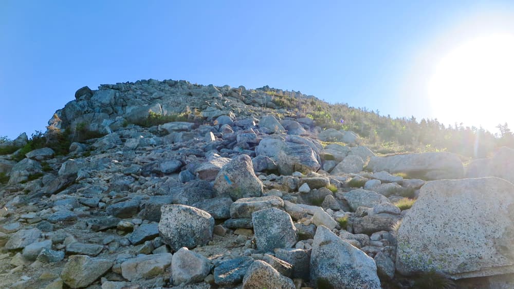
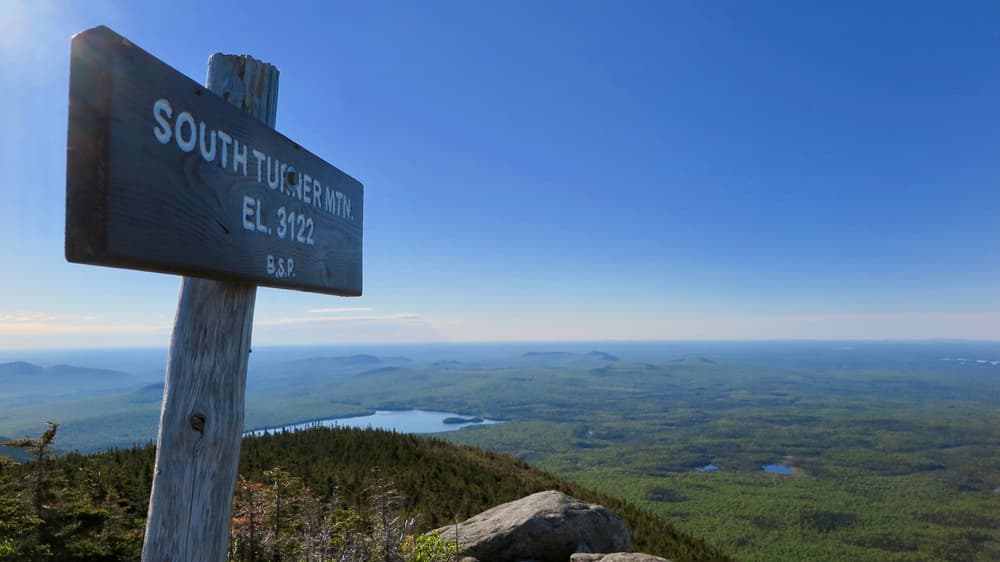
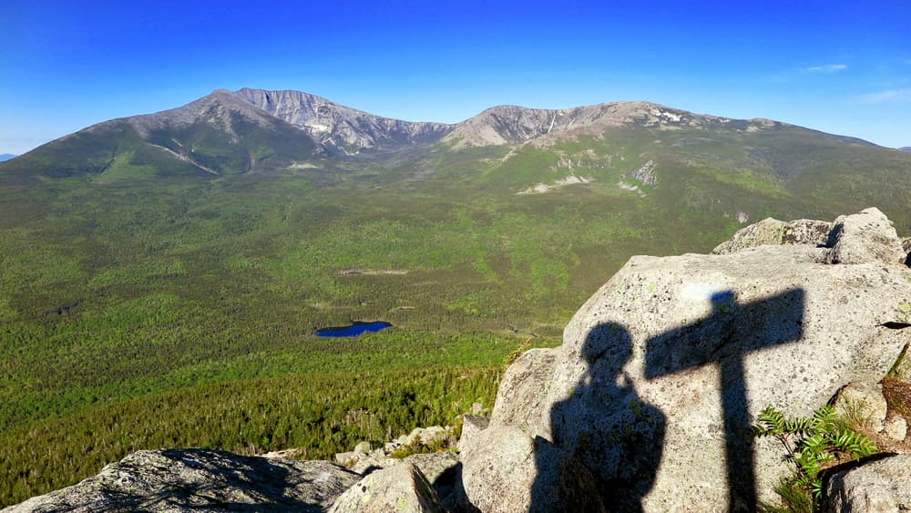
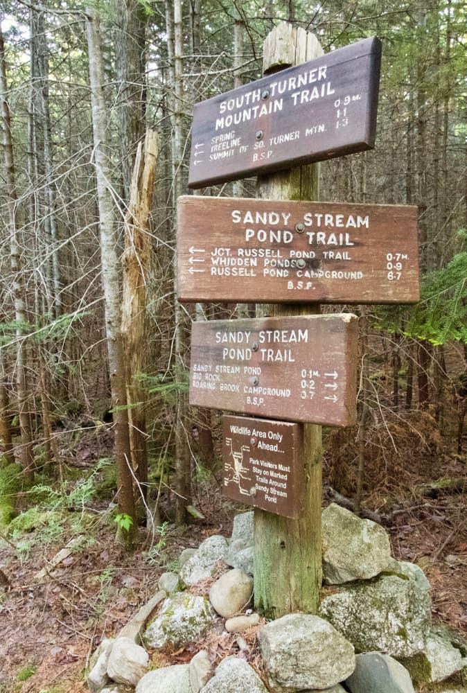
Starting at Roaring Brook, the Russell Pond and Sandy Stream Pond Trails are utilized as an approach for the first 0.7 miles, passing by the pond to the west before reaching the base of the mountain. It is a steep but not lengthy hike up the mounatin (1.3 miles to the summit from the juction with the Sandy Stream Pond Trail). For the effort required, it may be one of the most rewarding climbs in the Park. The summit (elevation 3,122 feet) has a small, open, rock cone so there are views in all directions. South Turner Mountain is directly across a valley from Katahdin, and has superb views of Katahdin's great cirques with their open ends facing South Turner. The net elevation gain from Roaring Brook Campground is 1,638 feet.
Please note: in the trail map, the white dotted line depicted is the trail shown by the Google basemap and is inaccurate; the orange line is the correct trail.
Park Fees: See website for entrance and camping fees. [No entrance fee for Maine residents.]
Park Rules: See a more complete list here.
For additional information, visit the Baxter State Park website, or contact:

Take Only Pictures: Rocks, driftwood and plants provide habitat and nutrients.
The trail is accessed from Roaring Brook Campground, which is reached via the Togue Pond Gatehouse (South Gate) of Baxter State Park.
From downtown Millinocket, travel 16 miles northwest on the paved Baxter Park Road to the Togue Pond Gatehouse, passing buildings and the Golden Road Crossing after eight miles. After entering the park at Togue Pond Gate, bear right and continue onto the Roaring Brook Road for 7.9 miles. Roaring Brook Road ends at Roaring Brook Campground. Park in the designated day-use lots (straight ahead) or overnight lots depending upon whether or not you are camping. The trailheads are located at the north end of the parking area near the Roaring Brook Ranger Station.
Success! A new password has been emailed to you.