This is a guest post written by Enock Glidden, MTF Accessibility Ambassador, Public Speaker, Adaptive Athlete, and Adventurer. To learn more about Enock, please visit his website.
On the third and final day of our trip, we wanted to head home around 2 pm. I decided to check out Cobscook Bay State Park and the Moosehorn National Wildlife Refuge - Baring Division. Both of these properties are within 45 minutes of Lubec. It is unbelievable how many outdoor recreation places are within an hour of this beautiful little town. Oh and this has nothing to do with trails, but if you visit Lubec make sure you look for supper before 7 pm. You will thank me later I promise.
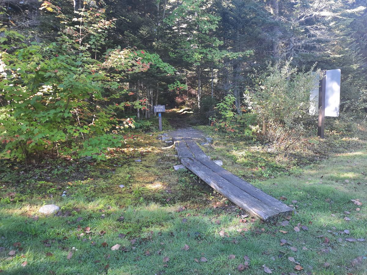
I chose to visit Cobscook Bay State Park because of the descriptions of the two trails on Maine Trail Finder:
“Nature Trail (1.2 miles, easy): The Nature Trail, which begins near the Park entrance, offers a forested, one-mile path that leads through forests, passes along a brook, and then rises to two scenic outlooks with views out over Whiting Bay and Burnt Cove. The trail up to the outlook has a short, steep, and rocky section: take extra care here in wet weather. The Nature Trail ends by two campsites, allowing walkers to return on a gravel road (for a 2-mile round trip).
Shore Trail (0.75 mile loop, easy): The Shore Trail (also known as the Anthony’s Beach Trail) is a 0.75-mile loop path that begins beside campsite 17, which follows the shore to the boat launch and then winds back through woods to come out between campsites 18 and 20. Many visitors enjoy shoreline explorations as well, but please don’t wander into waterfront campsites and be mindful of fast-moving tides.”
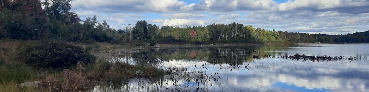
The description for the Nature Trail didn’t sound difficult other than that short steep rocky section. I planned to just turn around before that. The Shore Trail didn't sound difficult either and they are both rated easy. We drove around the entire park just checking it out while looking for the Shore Trail. They have amazing picnic areas with water views. There are also a lot of picnic areas. There are fields with benches for viewing wildlife and scenery. They have a large number of campsites as well including two that are accessible. I was quite impressed. Unfortunately, that is where the accessibility stopped.
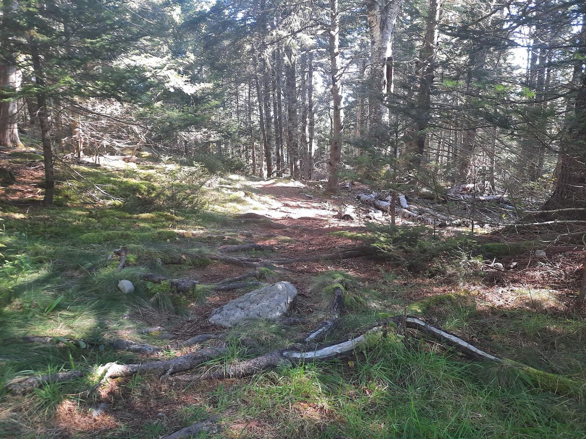
We eventually found the Shore Trail which was not very well marked. It starts by Campsite 17 but it is a very narrow and steep descent down to the water.
That didn't seem like it would be worth trying. We made our way back out toward the entrance to find the Nature Trail.
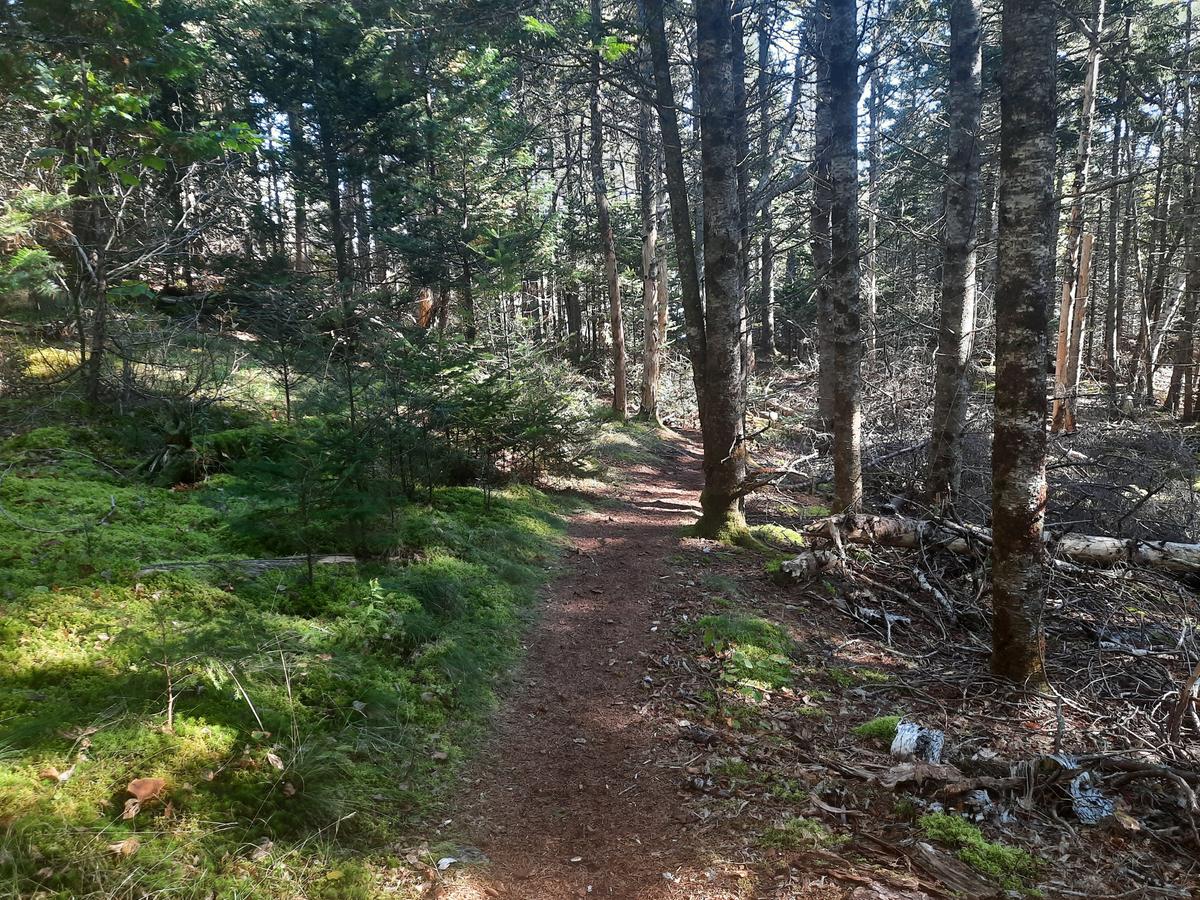
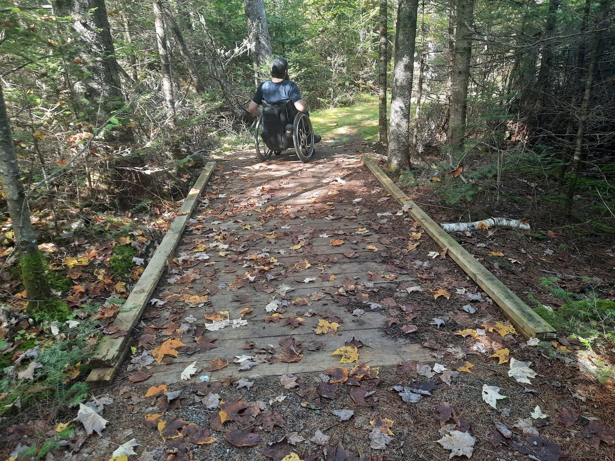
The Nature Trail literally started out with a 2 board wide bog bridge. Even if I could have gotten across the bridge the terrain was just too rough to manage. It looked like I could probably just go beside the bridge but I decided against it. I wouldn't want to cause damage to a property with my tires if it isn’t necessary. If that was the only place we were going to that day I may have tried it. I knew I had another place to check out that would definitely be accessible.
I would rate this the perfect spot to have a picnic, go camping, or just enjoy sitting in the field. To go hiking there really isn’t a good accessible option. My rating for hiking would be a Just Don’t Do It. Just don’t do it means there are not any accessible or reasonably accessible hiking options for manual wheelchair users.
JUST DON'T DO IT:
There are no accessible or reasonably close to accessible hiking options for manual wheelchair users.
The final property we visited on our whirlwind tour of Downeast Maine was the Moosehorn National Wildlife Refuge in the Baring Division. I have to say this place is an outdoor mecca and is incredibly accessible. If I lived in Calais or anywhere near there I would be there very often.
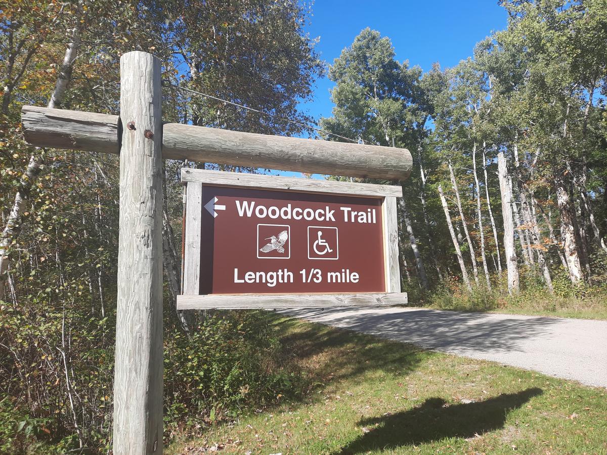
When we first arrived at the Refuge, we came to the paved accessible trail called Woodcock Trail. It is a one-third-mile-long paved loop that passes through the forest. There are interpretive signs along the route identifying species of animals and trees.
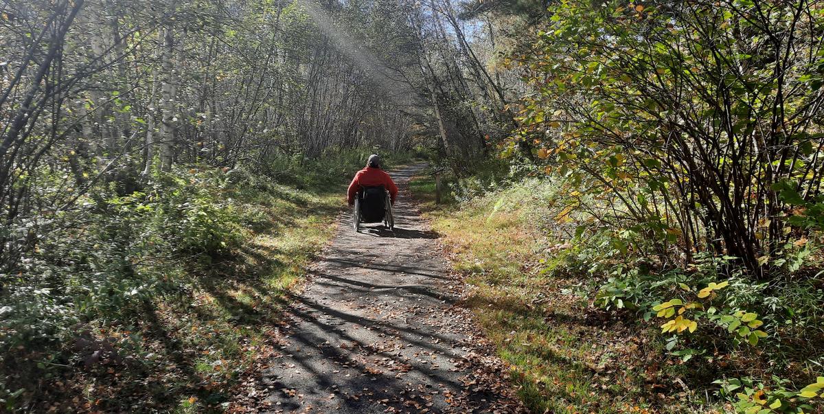
At the end of the first section of the Woodcock Trail, if you start on the right, there is another trailhead. This trail is called Greg's Pond Trail. It looked to be quite accessible. I wanted to see that pond. We trekked off down the trail and found it to be very doable. It probably isn't legally accessible because it does have a grass surface in a lot of places but I found it very easy to push over. The trail had a very firm surface for most of the way other than the grassy areas. Even the grass was still quite firm. It also goes slightly uphill for part of the trail but it was very gradual. The only kicker is that it ends back out on the road, not at the pond. The name is quite deceiving. If you go up the road, the trail turns back into a field that leads to the pond.
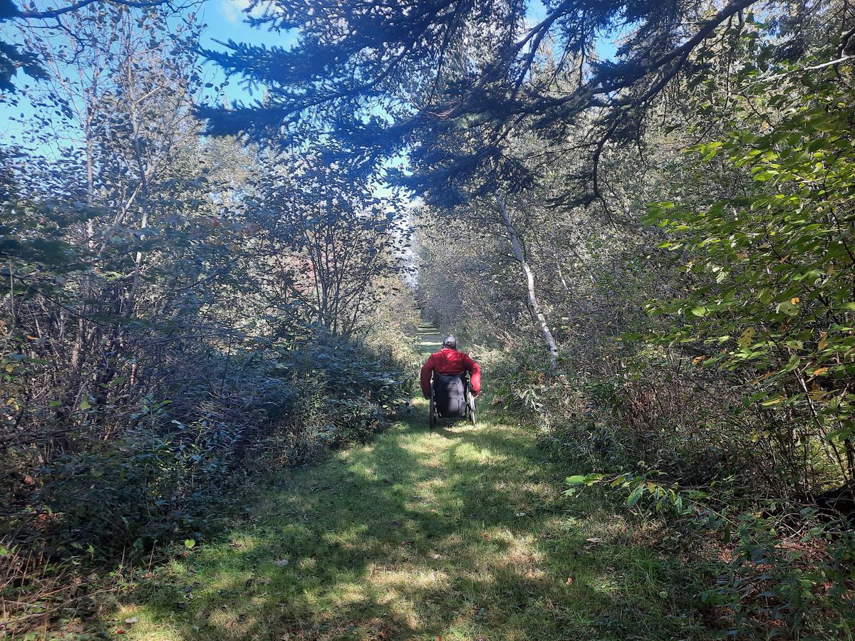
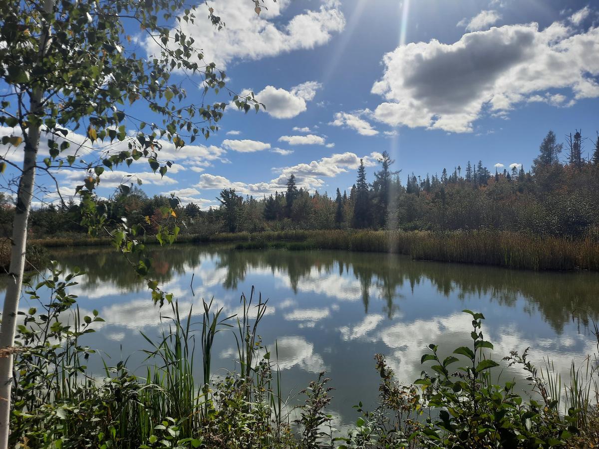
The field section is very steep and I could not have made it without Sandy's help. I definitely think it was worth the effort but you would have to ask Sandy for her opinion on that one. She put in a lot of effort to get me back on the road. The view of the pond is quite beautiful and it is a very peaceful spot to sit and ponder.
Navigating down the steep section to Greg's Pond. Video credit: Enock Glidden
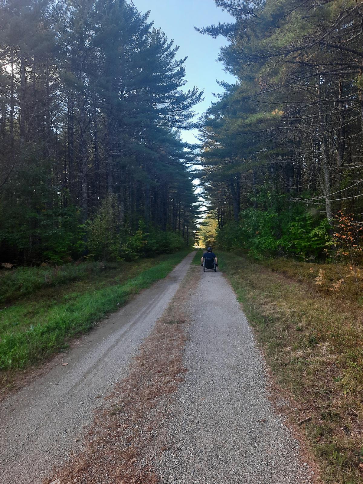
We continued up the main road and came to the main area of the refuge. This is where the bathrooms are, the main trail system starts, and there are information kiosks. We skipped the headquarters building as it wasn’t open the day we were there. After checking out the bathroom which is very accessible, we headed off down the Headquarters Trail.
All of the main trails in the refuge are old roads. They are very hard-surfaced and smooth. They are also mostly flat with very gradual inclines if any are encountered. The Headquarters Trail is about 3 miles long. It starts at a gate but there is a way around the gate. In the interest of time, we only did about a mile just to get a good sense of what the trail is like. I found it to be quite perfect. It was super easy to push over. There weren't any obstacles. For a dirt road, it was amazingly smooth. I would definitely spend a lot of time there if I lived closer.
On the way out of the refuge, we stopped to check out Charlotte's Trail. This is the last of the 3 designated accessible trails. Charlotte's Trail is another beautifully built trail. It passes through multiple natural environments from forest to field. There is one section that is uphill and a minor challenge but overall it is almost perfect. The beauty is beyond words. Also, be careful of bear poop. There is a lot of it. This technically means there are probably a lot of bears too. We didn't have the privilege of seeing one but maybe next time.
After Charlottes Trail we ventured back across the street to Woodcock Trail On our first hike through Greg's Pond trail, we noticed there was a trail called Greg's Pond Trail Extension YCC 2010. I couldn't leave without checking to see if it was an easier way to get to the pond. I was totally wrong. It was not even close to accessible. It was very narrow and rough. It had bog bridges that eventually stopped us from even trying to continue but as I say if you don't go you don't know.
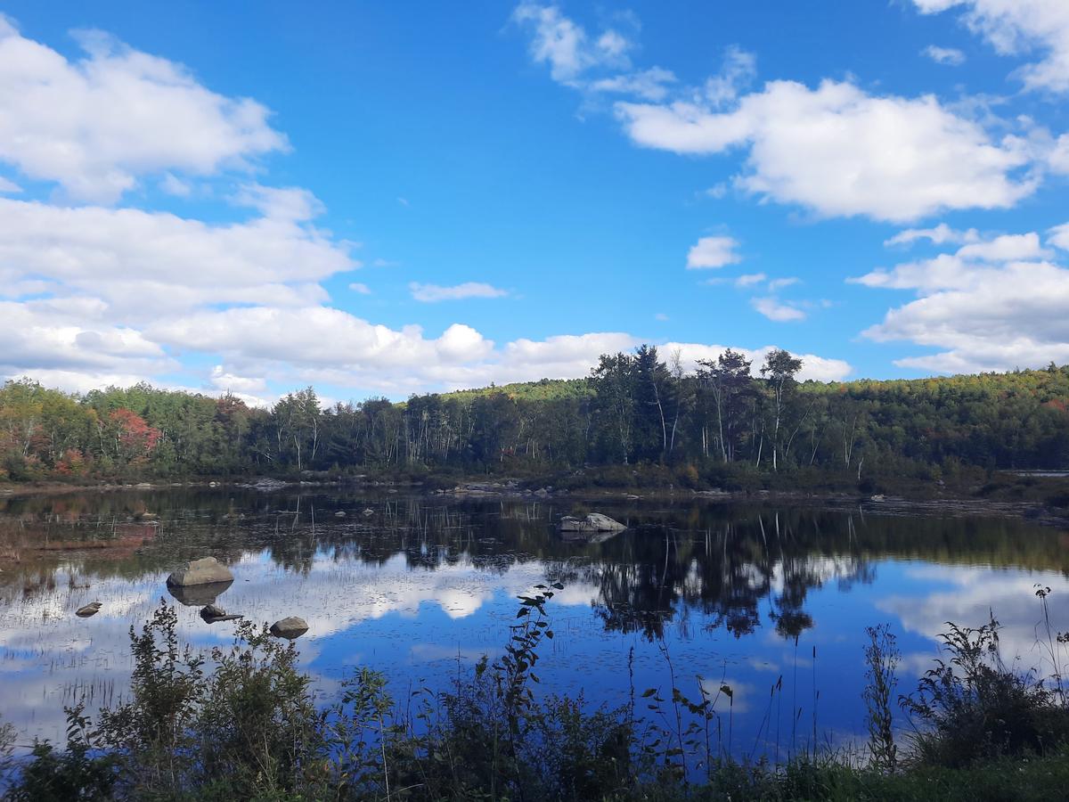
During my research about the refuge, I came across a description of the annual Auto Road Tour. Each October they open a 4-mile long road to allow cars to take a tour. It is across the street from the main headquarters road. This is another way that parks can be accessible. I love doing auto roads. Every national park I have visited has had one. They tend to take you to the most spectacular spots in each park and this one was no exception.
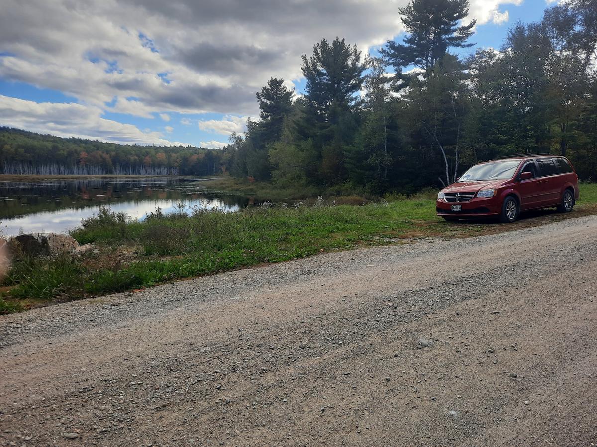
We had the chance to view such beautiful scenery over ponds and rivers. We saw blue herons, ducks, and many other birds and wildlife. The leaves had gotten a lot of colors already which made for an even prettier ride. If you are only going to visit the refuge once, October is the time to do it. This road was also very smooth. It was a superbly beautiful ride. I am so glad we chose to push back our trip to October because we would have missed this opportunity.
The auto road was the perfect end to an amazing weekend Downeast. Overall the Moosehorn Wildlife Refuge is a definite Just do it! It truly is breathtaking and very accessible.
JUST DO IT!:
Most people will be capable of navigating this trail with very little assistance.
If you have a different type of mobility issue or a totally different disability and you visit this trail or others, please comment on this post and give us your feedback. If you would like to go on a hike with me feel free to reach out. The more knowledge we gather and share, the more people we can get outside using the trails of Maine!
Success! A new password has been emailed to you.