This is a guest post written by Enock Glidden, MTF Accessibility Ambassador, Public Speaker, Adaptive Athlete, and Adventurer. To learn more about Enock, please visit his website.
After my adventure last weekend in the Lewiston/Auburn area, I realized I needed to go back. There are so many trails in the area it will take multiple weekends to really do a great survey of all there is to offer.
This weekend I decided to check out one trail that I knew for certain is accessible and one that I suspected might be. The first trail we checked out is the Lewiston/Auburn Greenway Trails. I had actually done this trail before. Apparently I didn't do even close to the entire thing. I didn’t realize how far it went and to how many locations. This also happens to be where Sandy and I met for the first time.
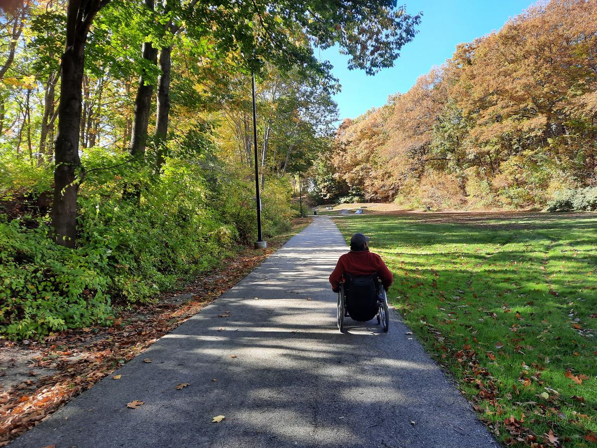
This completely paved and accessible trail starts right behind the Hilton Garden Inn at the Great Falls Plaza. There is accessible parking, a ramp onto the trail, and you are instantly greeted with a beautiful view of Great Falls. Well, when there is water you can see them. There wasn’t a ton of water so it was more of a trickle than a falls. That’s ok though because this trail has tons of other things to offer.
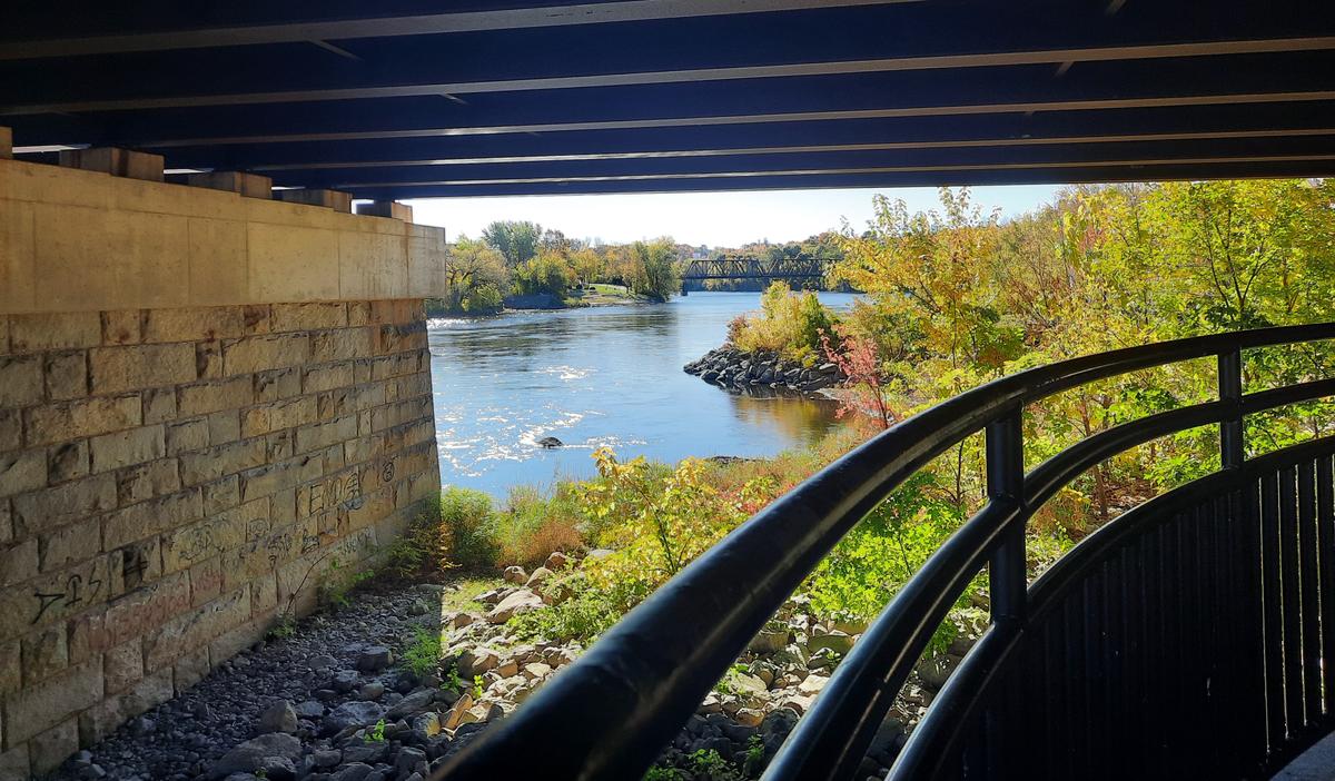
As you enter the trail if you turn left you will go toward a steep hill that leads to an overlook platform to view the falls. That direction is not accessible. If you turn right the accessible adventure begins. Not too far after the hotel, there is a gradual hill that goes down and underneath a bridge. It isn’t very steep but I could see that some people may have some trouble holding themselves back going down it. This is the only hill you will have to navigate in the entire trail if you choose to do the 1.6 mile loop. Once under the bridge, there is a huge circular seating area with a beautiful view of the river. There are a few of these seating areas along the trail. They consist of a short wall that is wide enough to sit. With an opening for the trail to pass through. The railing along the trail is a bit high for those of us using wheelchairs. It obstructs the view a bit, but what you can see is still quite spectacular.
If you are a history buff you will love the number of historical buildings and artifacts that can be found along the trail. They have also curated a lot of historical storyboards to read as you stroll beside the Androscoggin River.
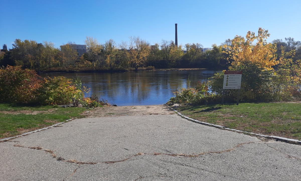
There is a boat launch where it is possible to rent kayaks in the summer months. It also makes it possible to get down to the water with a wheelchair.
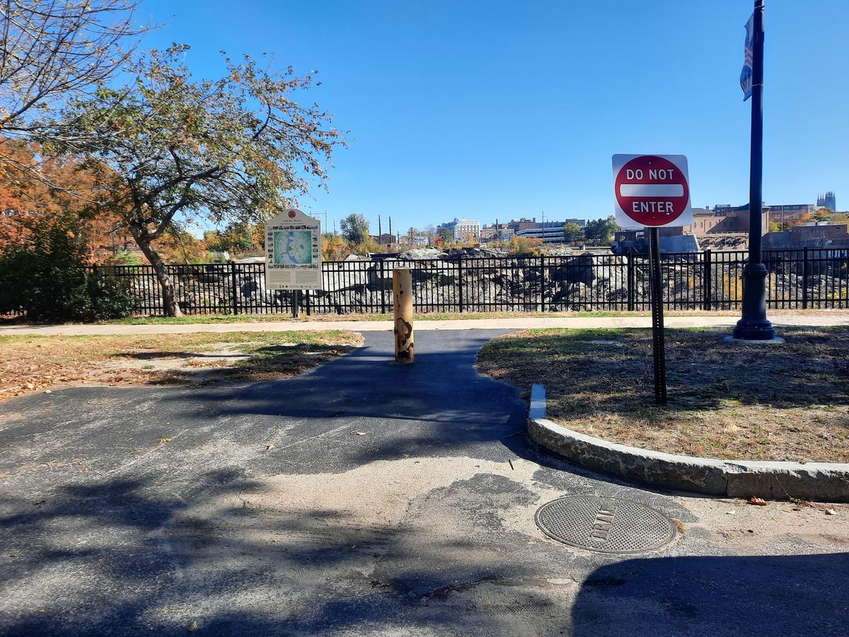
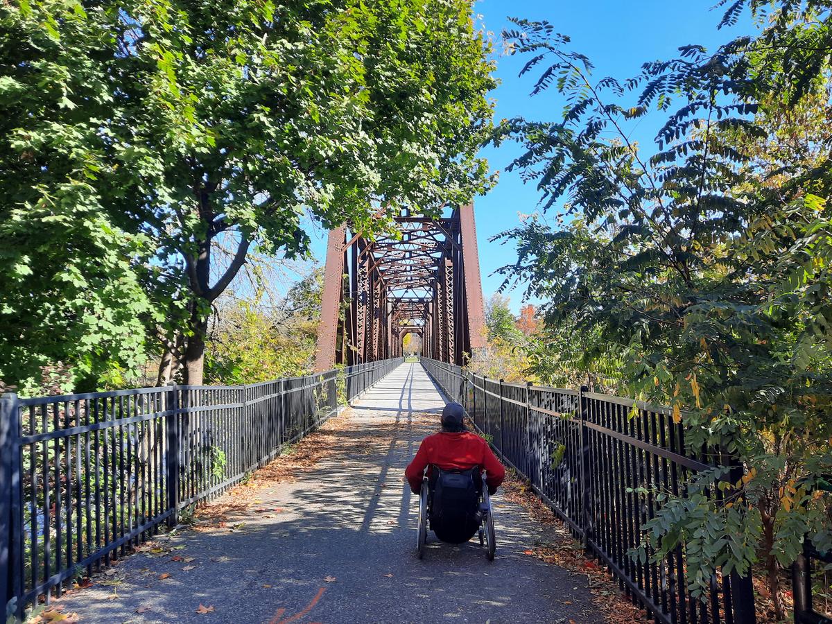
From here the trail is mostly flat until coming to a T intersection in Bonney Park. The sign directs trail users either to Moulton Field or to continue across an old railroad trestle along the river trail.
I decided to check out Moulton Field. It is a beautiful little spot to hang out and has some skateboarding features. I felt like I wasn’t in a city anymore. There is a short hill getting down into and back out of Moulton Field but again it wasn’t very steep at all.
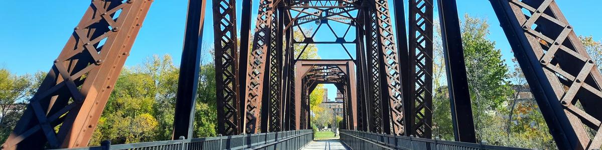
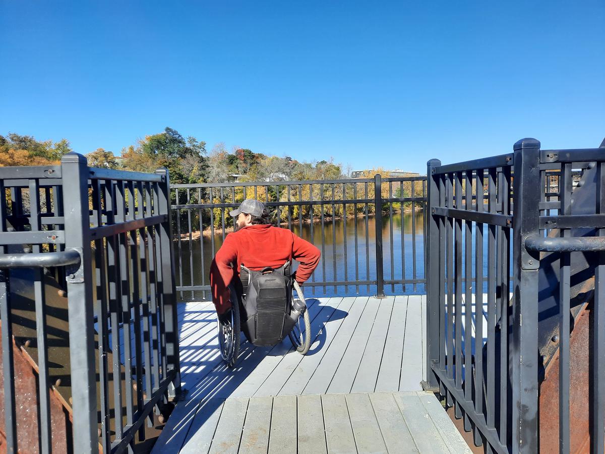
After checking out Moulton Field, I trekked out onto the railroad trestle for the best view of the Androscoggin you can possibly get on this trail. The trestle has literally been turned into a gigantic boardwalk with 2 viewing platforms -- one on each side. The view is stunning. We saw a large number of ducks and other birds. The railing is really tall for safety purposes I am sure. It impedes the view a bit but not so much to ruin it.
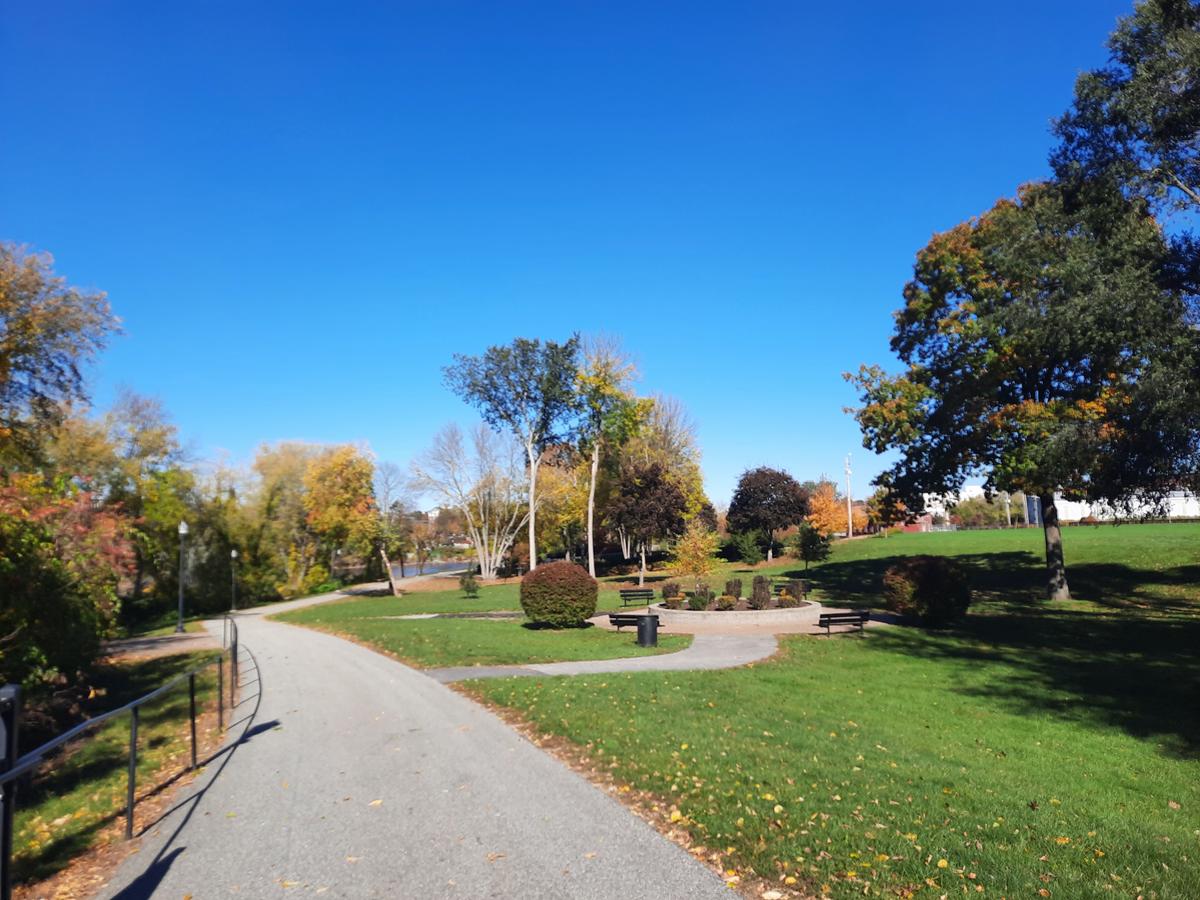
The railroad bridge leads into the aptly named Railroad Park where you can still see remnants of train tracks and other artifacts from a time gone by. It is another gem of a spot along this well-constructed path through history.
The whole trail culminates with crossing the Court Street bridge. This is the bridge you passed under at the beginning of the loop. In order to get onto the bridge, I would recommend taking the road beside the car wash and turning onto the sidewalk in front of the car wash. There is a shorter path across some grass in between the building and the bridge but the road and sidewalk is much easier. I actually chose that route based on the advice of one of the attendants at the car wash.
Once you cross the bridge you will have to go across court street and follow the sidewalk behind the hotel back to the parking area.
I am definitely giving this trail a Just do it! rating. As long as you start behind the hotel and turn right, there aren’t any hills or obstacles that could make this hard to do for just about anyone. Going in the other direction might make it a bit harder because of the hill under the bridge but I would still consider it accessible.
JUST DO IT!:
Most people will be capable of navigating this trail with very little assistance.
Our final trail of the day is actually an old road that goes alongside Lake Auburn. This entire day actually turned into one big history lesson. The Spring Road Trail has an extensive history of its own -- “The trail is hardened grass and gravel and was abandoned in the 60s as a road. Though the original historic "Spring Road" was built in 1879, this trail has been in use since the mid-1700s. It brought the early settlers from West Auburn Village to the Lake Auburn spring house and hotel amenities.
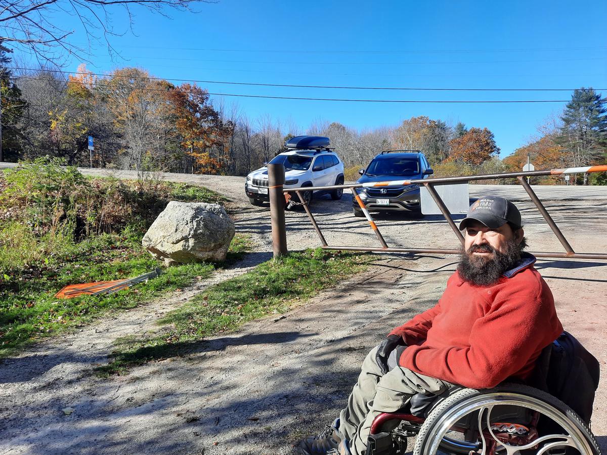
To access the trail I first chose to try the north gate entrance. There were quite a few cars there and not a lot of parking other than next to the road. I decided against that and headed for the south gate.
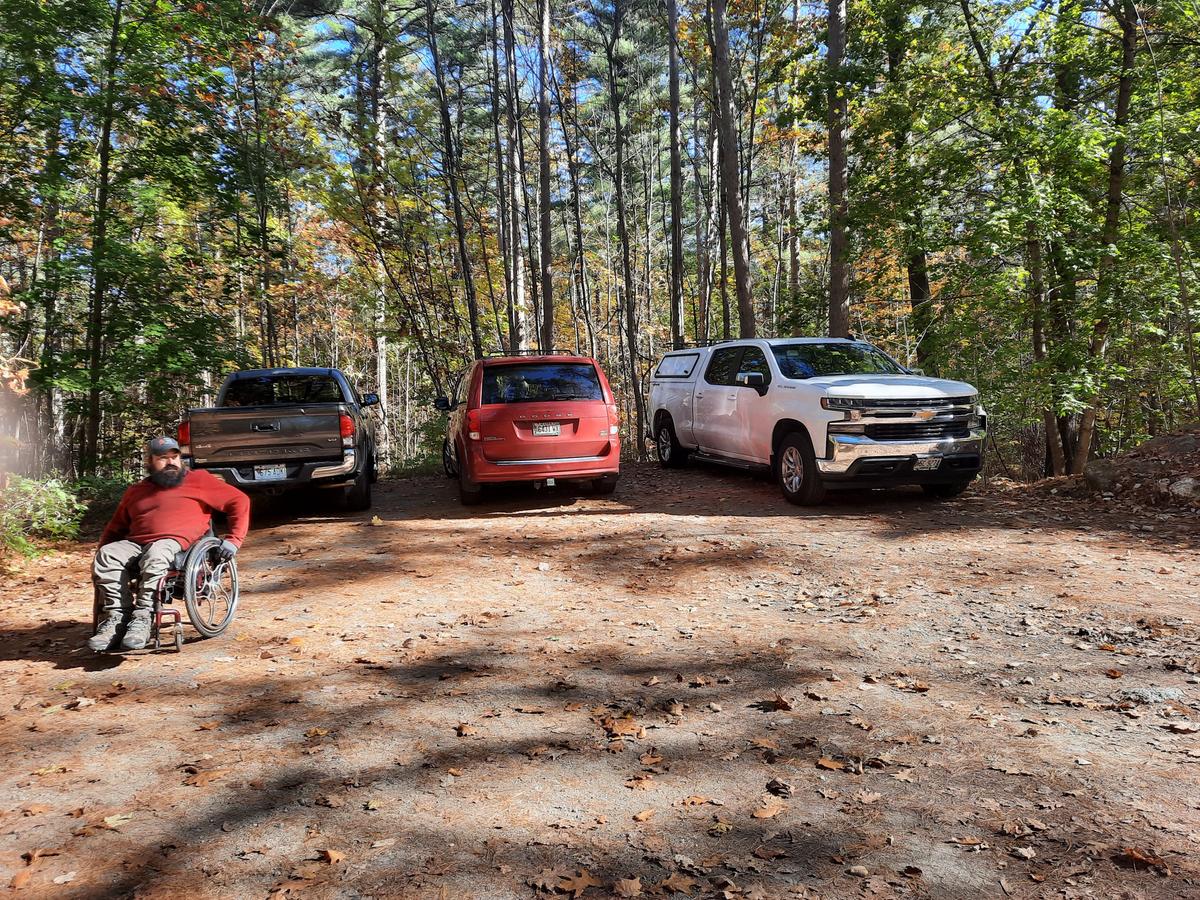
The south gate was a bit hard to find as Google Maps didn’t quite lead us to the right spot. You will need to turn down the dead-end Whitman Spring Road (which makes sense since the trail is just the road gated off.) Just drive until you see the gate and there is a great parking area with room for about 3 to 4 vehicles and some parking along the dirt road. I would definitely park here and not at the north gate if you are a person with a disability. You won’t be getting out of your car into traffic and the parking area is flat with lots of room.
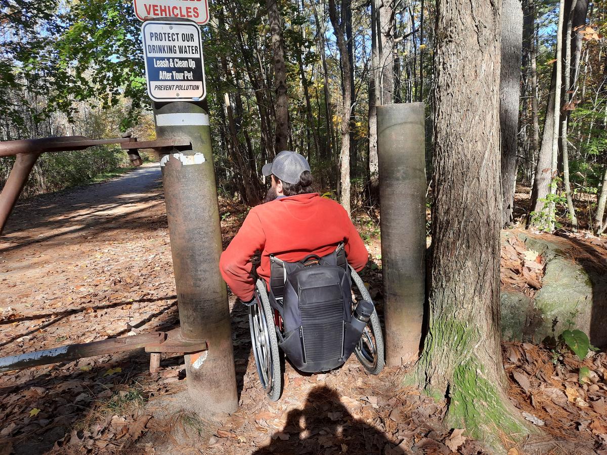
As I said before the trail starts at a closed gate. There is an open area between two pillars that allows access around the gate. It is almost too narrow for my wheelchair but I made it through. My wheelchair is 22 inches wide and I probably had 3-4 inches on each side. It definitely isn’t the 36 inches that it should be. This technically makes it not accessible, which is a shame given that the rest of the trail really is quite accessible. For those of us under 25 inches wide this trail is very doable. If you have a wider chair, you could possibly have someone lift your chair over the gate and then hop into the chair through the pillars. If you have a folding wheelchair you could hop out on the ground through the pillars and fold your chair. You could then just roll it through and hop back in. All of all this depends on whether you are in an "adventurous, I am going to do this" kind of mood. If you decide to go through, keep in mind there is also another identical gate about 1.5 miles into the trail with similar pillars.
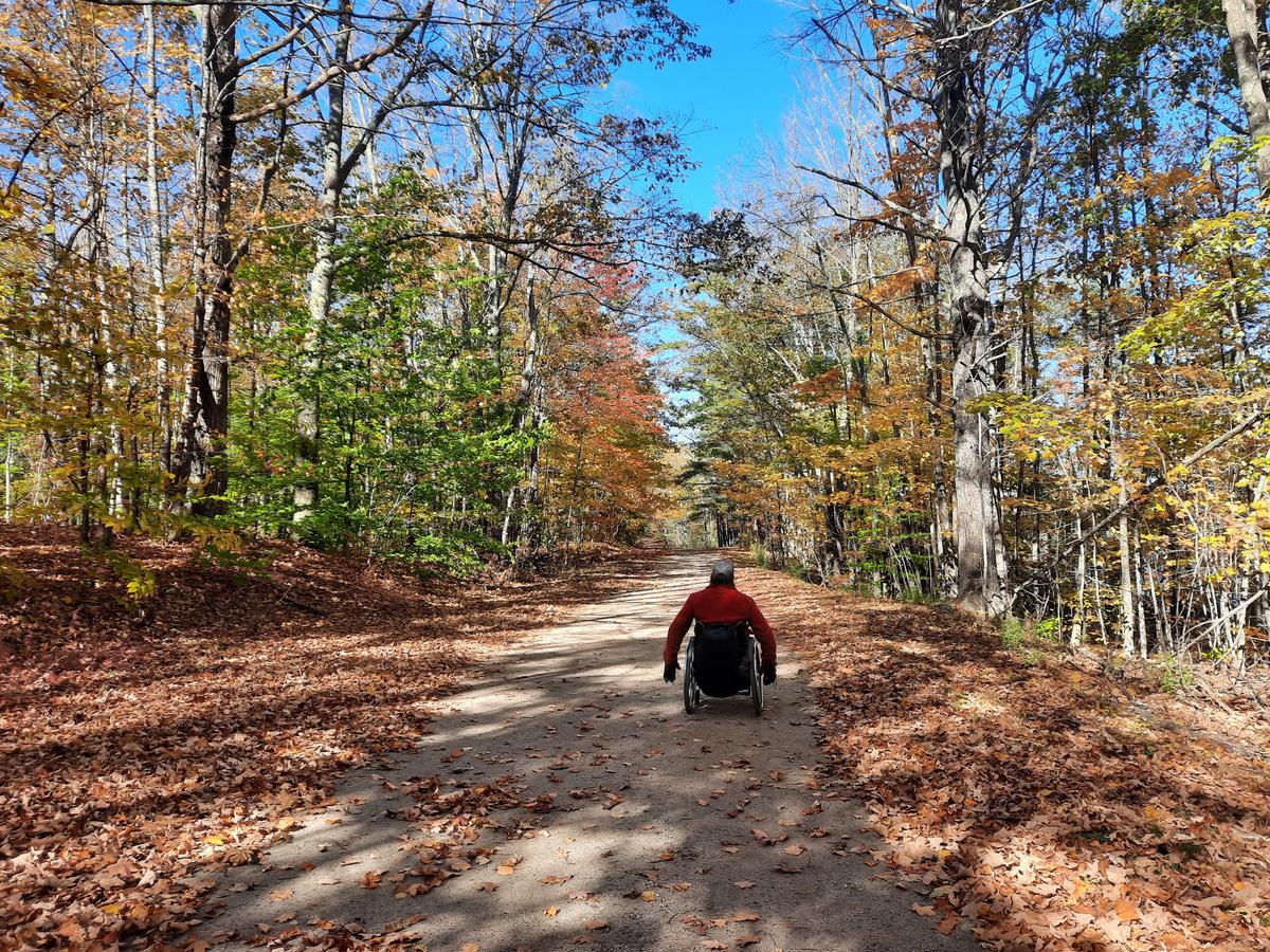
Once you are past the gate you will find a really wide, hard-packed, smooth road. There are some very fine gravel rocks. This trail is 2.1 miles one way and has the same surface for almost its entirety. There are a couple of sections where it gets slightly rocky. It doesn’t pose much of an obstacle. The most it will do is rattle your chair a bit. The city has done a massive amount of work to mitigate water erosion and contamination of the lake with a number of new culverts. In these areas, the road is a bit less firm from being dug but should firm back up over time.
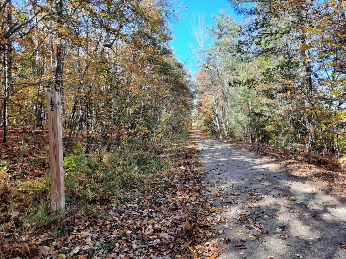
They have also installed distance markers every quarter mile which I find quite useful. If I am feeling tired it allows me to judge how far I have gone and how far I have to go back if I turn around. It also makes it easier to know where certain features are in relation to the beginning of the trail, for instance, hills.
Yes, there are a number of very gradual hills along this trail. They are so gradual, I didn’t realize I was going downhill until I turned around at the end to go back. This is a hill a half-mile from the trailhead. Even in the picture, it is hard to see that there is actually an incline to the road.
There is a side trail with a sign explaining the history of the Lake Auburn spring house and hotel amenities along with artifacts along the trail to check out. We chose to save this one for another time since by the end of this trail we will have done about 6 miles for the day.
We made it to the south gate in about an hour which included stopping to take in the views. Instead of pillars at this end, there is a rock to impede access but is very easy to get around.
After turning around is when I realized how much of the trail is actually on an incline. There are a few long stretches of very gradual uphill. It still only took about an hour to get back to my van. Of course, we weren’t stopping to take in the views as much. My shoulders hurt a little bit. It was definitely a good work out but really nothing particularly hard about it at all.
I am rating this one a Just do it! also. It is pretty amazing to have nearly 6 miles of potentially accessible trails within 10 minutes of each other. I am sure there are more in the area. I just need time to check them all out.
JUST DO IT!:
Most people will be capable of navigating this trail with very little assistance.
The season is getting shorter but I will do my best to get as much information out there as possible. I came up with this little slogan this morning. “Access to information is inclusive,” I think that is really true and this is what this project is all about. Stay tuned for a lot more information on the trails of Maine.
If you have a different type of mobility issue or a totally different disability and you visit this trail or others, please comment on this post and give us your feedback. If you would like to go on a hike with me feel free to reach out. The more knowledge we gather and share, the more people we can get outside using the trails of Maine!
Success! A new password has been emailed to you.