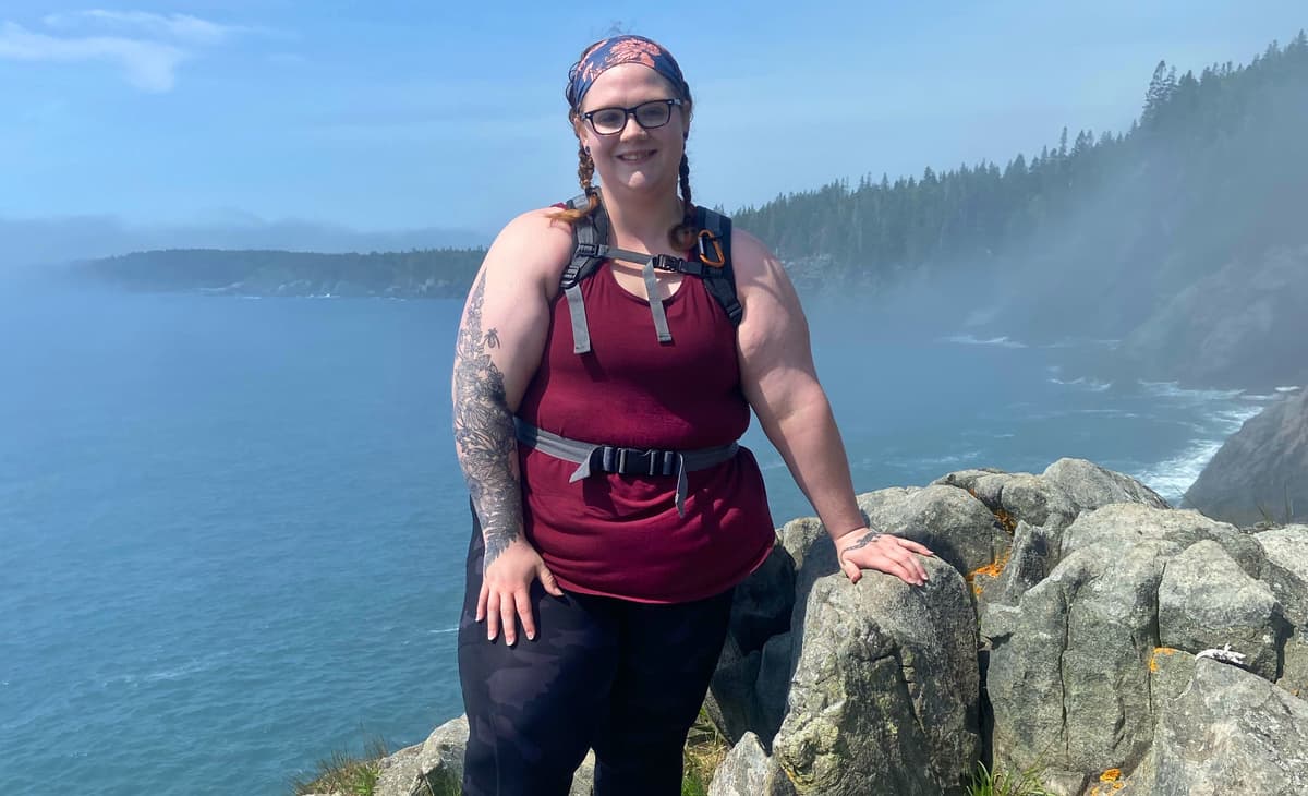
Hey all! My name is Paige Emerson and I run a social media account called @chubbyhikerreviews, where I review hikes from the perspective of someone who is plus sized. In 2020, I started reviewing hikes because I found that the trails I was interested in had ratings that were really subjective (as the words “easy” or “hard” are relative to the raters' fitness level, body type, and experience with hiking). I didn't see anyone who looked like me reviewing the trails that I was interested in, so I chose to be that person for others. I am passionate and driven to make the outdoors a more accessible place for humans of all shapes and sizes.
In the past four years I’ve had the chance to review over 60 trails in Maine, and I’ve been able to encourage an innumerable amount of people to get outdoors who never thought they could. I’ve been invited to partner with Maine Trail Finder to share my experiences and some of my reviews through the years, and I thought we would kick it off with my top five favorite trails of all time!
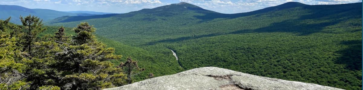
Trail Length: 2.4 miles
Elevation: 1,122 feet
My Time: 3.5 hours
Chunky Rating: hard
Views: 10/10
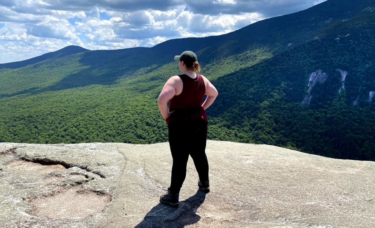
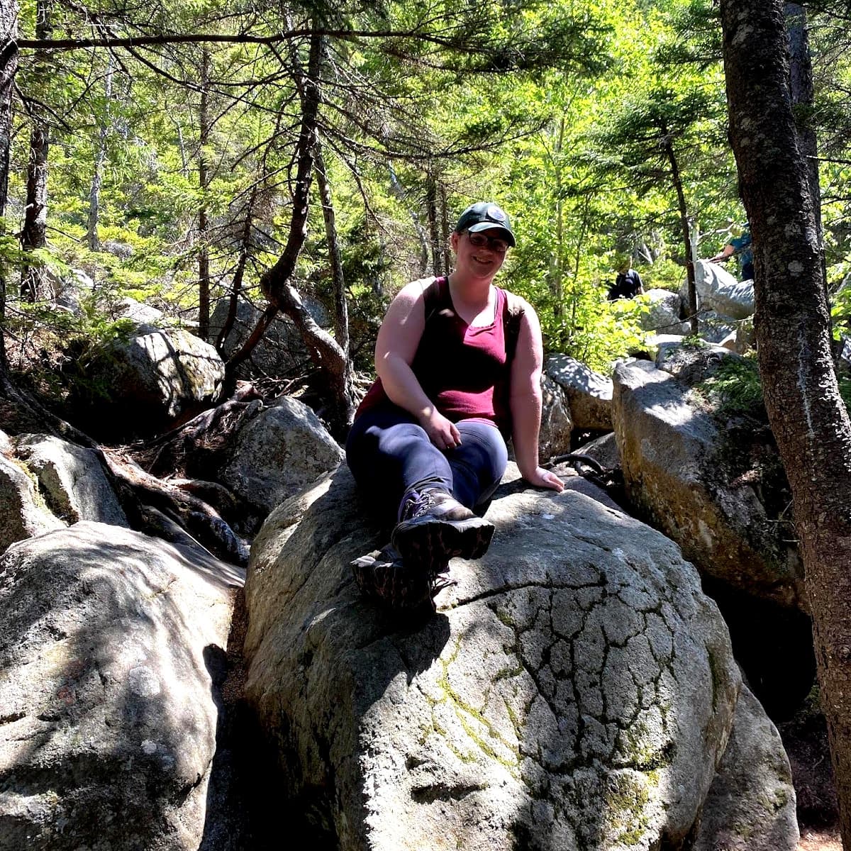
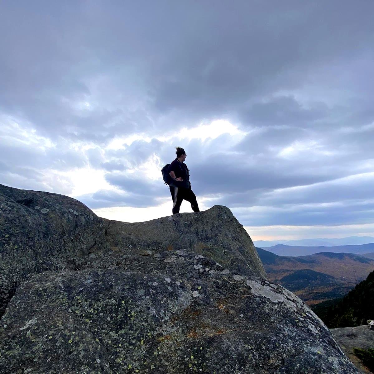
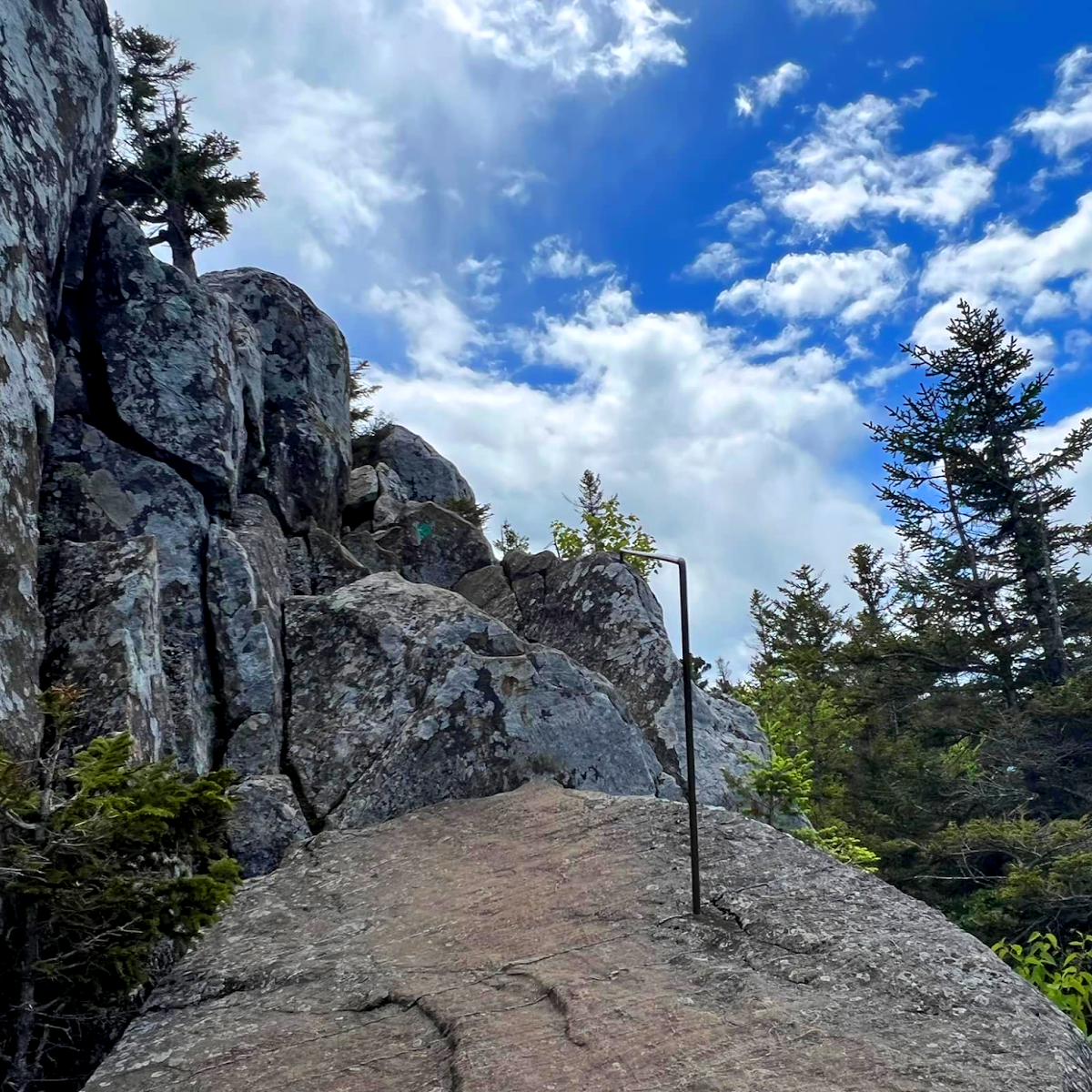
Wow. First off, this hike was absolutely incredible and the views were unlike anything I’d ever seen. Secondly, this one is a doozy (do people say that anymore?). We chose to do the orange trail up because it sounded short but challenging. That is an understatement! I have never climbed so many boulders in my entire life (pic of the boulder field included). However, the fact that it was challenging made it go by faster, and it was actually pretty fun!
Towards the end there are some caves that you can climb into if you’re brave. We briefly got lost and thought that you had to go through the caves to get to the summit. I was prepared to yeet my friend through the hole in the top of the cave when a kind stranger told us we were going the wrong direction.
We chose to take the Blue Trail down, which connects to the AT and brings you back to the parking lot. For a less strenuous hike, you could take this trail on the way up. It’s still pretty steep, but a lot less climbing. You may even run into an AT through-hiker, depending on what time of year you go!
For this mountain, I would say that the Blue/White Trail is chubby hiker approved!
But for the Orange Trail, maybe not.
Pro tip: I would recommend bringing bug spray, because they were pretty bad. And don’t do what I did and hike it when it is 93 degrees out! I thought I was going to die from the heat. I’m glad I planned ahead and brought plenty of water and Gatorade, but even so I was still dehydrated.
Trail Length: 5.3 miles (Loop Trail up, Brook Trail down)
Elevation: 1,952 feet
My Time: 10 hours (continue reading to find out why)
Chunky Rating: Hard
Views: 10/10
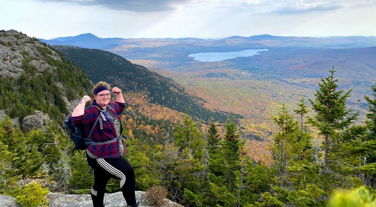
Tumbledown! I finally made it to my goal mountain!
At the beginning of the summer I made this mountain my goal so that I could work toward it, and while I’m glad I finally made it, I just have to say: this mountain kicked my butt. It just. Kept. Going.
The map says the trail is 5.3 miles but my watch says I did ten! Idk. But this trip had me thankful that I am always over prepared. Half way up I ended up with a debilitating migraine and felt like I couldn’t continue. But I always carry ibuprofen and electrolytes, so I took what I needed and found a shady spot for a quick nap until I was able to keep going.
The top was beautiful! There’s quite a view, and a lake with fish in it. The descent took the longest and I’m not sure why. We could hear thunder in the distance so we booked it out of there, but we still didn’t make it out before dark. I was glad I brought flashlights!
I have a love hate relationship with this mountain. I’m glad I hiked it, but it was a weird experience. Four days later I still feel like I got hit by a truck, and I have a softball sized bruise on my knee. While I am glad I did it, this chubby hiker does not approve. It did, however, inspire me to keep working on my goals at the gym. Maybe some day this mountain won’t seem so hard. Who knows!
Pro tip: Park at the Brook Trail and walk down the road to the Loop Trail. Hike up loop and down the Brook Trail. You’ll thank me later when you don't have to do that long walk along the road at the end of your hike!
Trail Length: 1.4 miles
Elevation: 488 feet
My Time: 1.5 hours
Chunky Rating: Moderate
Views: 10/10
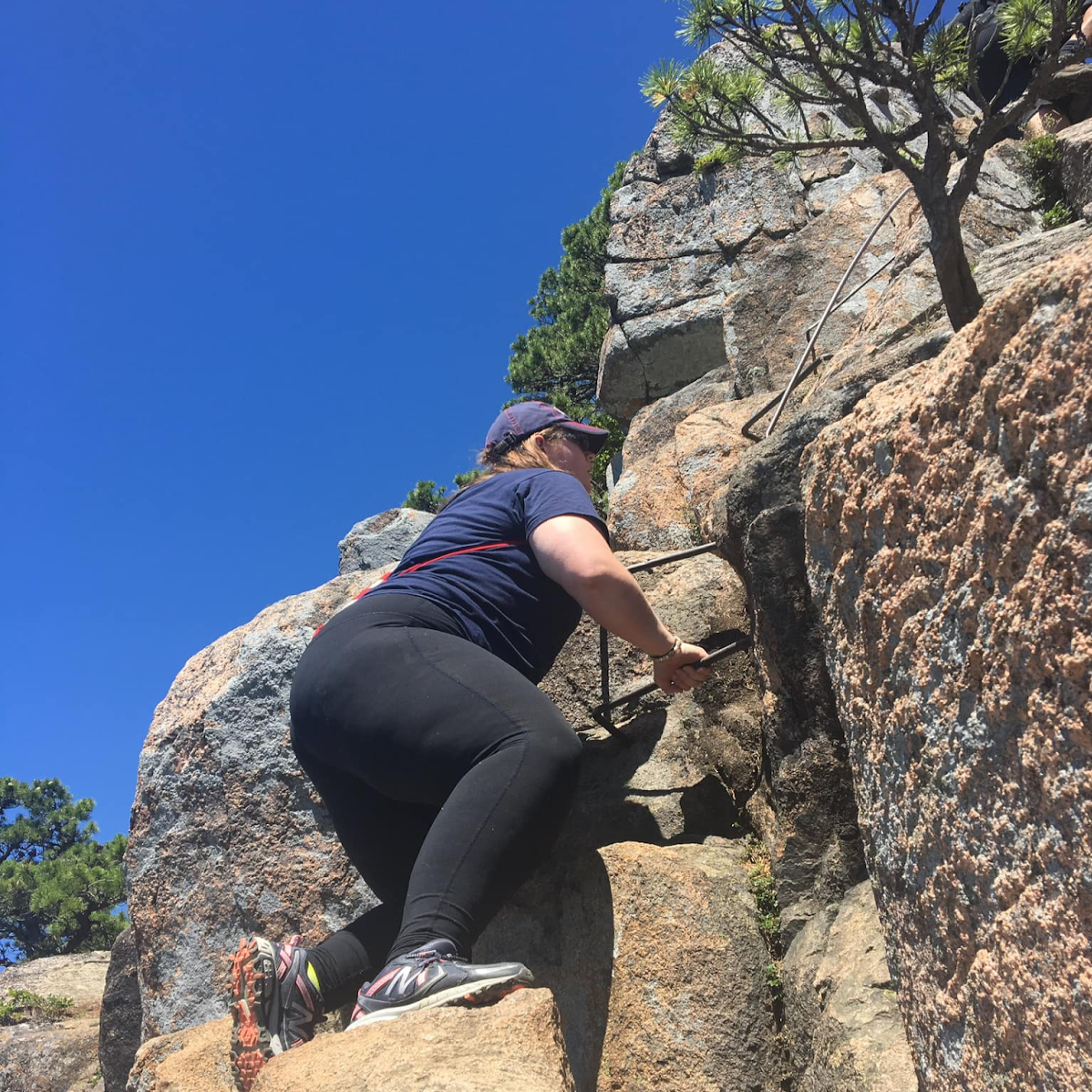
I often call this trail “Baby Precipice.” I’d like to hike the Precipice Trail in Acadia, but I’m scared of heights, so this was good practice for working towards that goal. The trail is pretty short but gets challenging quickly with rock scrambling, steep ledges, and several ladders and iron rungs.
The first time I hiked this one, I had a hard time finding good footholds at some points and struggled to pull myself up. The second time was easier, as I was with an experienced hiker who knew all the sweet spots to put your feet for the best grip. It just goes to show that the company you have can really make or break your hike!
The good news is, after you get to the top you can take a trail down the back side that is WAY easier.
If you’re interested in doing some exploring, you can check out the Bowl Trail. The Bowl is a round little pond in between the mountains where there was once an active volcano. A great place to sit and eat some lunch and watch the beavers do their thing!
While this hike was a bit challenging, it’s relatively short so I would still say it is chubby hiker approved!
Trail Length: 3.5 miles
Elevation: 1,223 feet
My Time: 3 hours
Chunky Rating: Hard
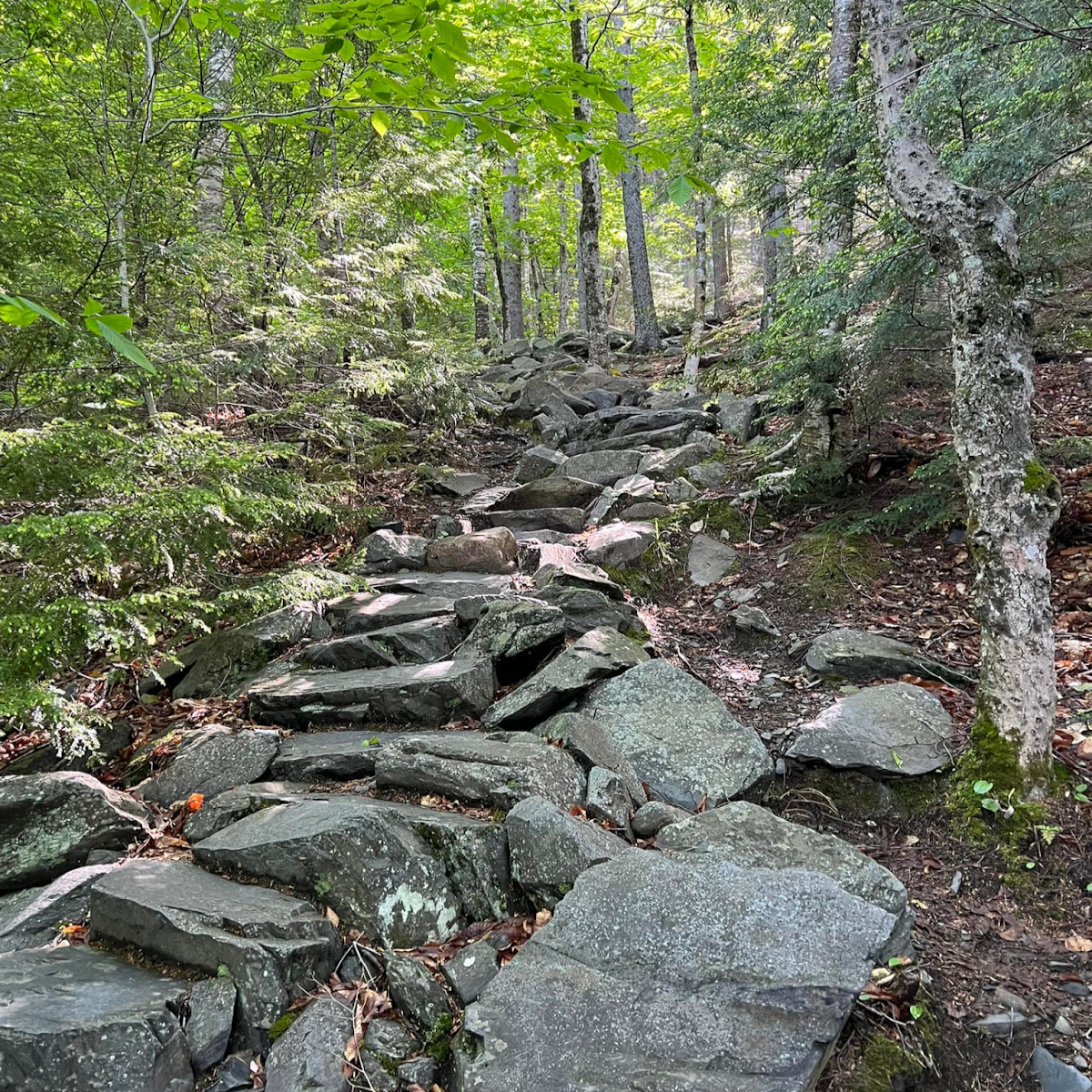
The trail conditions are dry for the most part. There are LOTS of stone steps, which would be slippery in rains. The trail is very rocky and rooty, but well maintained and easy to follow.
I like to divide this hike into two parts. There’s the first section before you get to the pond and info center, and the second section which ends at the summit.
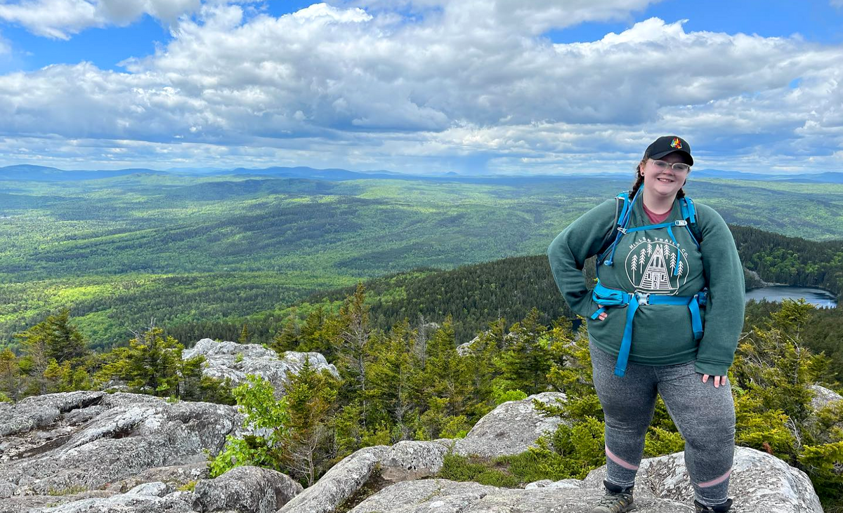
Overall I found this hike to be hard. This is no leisurely stroll through the woods. Right off the bat you start uphill, and it only flattens out in a few spots. There’s a nice overlook that you’ll come to before the pond and it’s a good stopping place for lunch. Keep going and you’ll reach a beautiful pond and an info center where you check in and pay your fee.
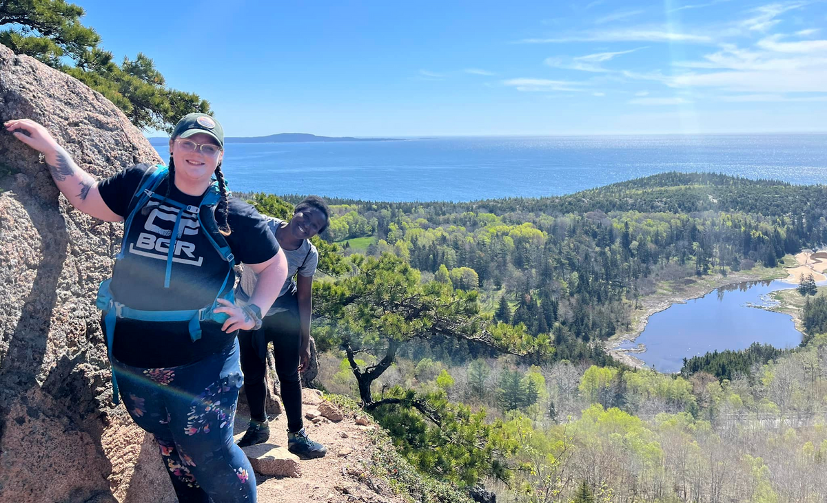
Here’s where it gets intense. After hiking around the pond, the trail gets incredibly steep, and then you come to some boulders where you will need to do a bit of rock scrambling and use the provided iron rungs. I had done the Beehive and the heights didn’t bother me then, but I got a little nervous here. If heights aren’t your thing, maybe skip this one. The wind was also very intense and I thought it was going to blow us over the cliff.
But the view was incredible and totally worth it. I did really struggle on this one, which is why I rate it hard. It’s doable but hard on the knees. Know your limits and take lots of breaks. Chubby hiker approved!
Trail Length: 2.7 miles
My Time: 1.5 hours
Views: 10/10
Chunky Rating: Moderate
The bold coast is exactly what it sounds like: 10+ miles of trail along a dramatic coastline with waves crashing against huge walls of sharp and craggy granite. Bold is a fitting name because this destination is anything but timid.
This hike had me feeling like I had stepped into the pages of a fairy tale, with the coastline a perfect stand-in for the ocean-side cliffs in Ireland. I thought at any moment the birds might start talking, or the moss covered stones along the path might roll into trolls and burst into song. This is truly a magical place, and if you have any kind of imagination you’ll be in heaven. If ever you’ve wanted to feel like Merida, Snow White, or Elsa, this is the place for it.
In total, there are 10+ miles of trails and many choose to make it a backpacking trip and camp along the way. However, I hear the campsites are often in high demand, so plan accordingly and go with a back up plan!
We only chose to do the Coastal Trail that goes straight to the shore, but it was still just as beautiful. The trail alternates between mud, rocks, roots, wet stepping stones, and planks over bog. You definitely want to wear boots on this one. It also is one of those trails where you could easily twist an ankle, so if you are concerned about any past injuries, you may want to skip this one.
Last but not least, don’t forget the bug spray! I had a cloud of mosquitoes swarming me every time I stopped and a tick in my hair before we had even begun. The insects are brutal.
This wasn’t a hard trail but it wasn’t easy either. There are so many things to trip over and I got tired of looking at my feet all the time. But it wasn’t particularly long, and the view was definitely worth it. Chubby hiker approved!
Check out Paige's blogs and social media at:
Success! A new password has been emailed to you.