Trailhead is located just off the Katahdin Loop Road before mile marker 12, with plenty of parking. The trail begins on a brief section of the IAT (International Appalachian Trail), for about 1.5 miles up a gravel logging road frequented by moose, bear, mountain bikers, and hikers. Within the first few minutes of the hike you will cross Katahdin Brook and pass the first lean‐to and outhouse on the northbound section of the IAT. Continuing up the long hill, follow the IAT to the right. The trail head sign will be on your right. This portion of the trail can be biked as well as hiked.
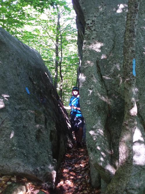
From here you leave the logging road and hike through thick young hardwoods, large boulders, switchbacks, and stone steps built in 2014 by the Maine Conservation Corps. Young hikers will enjoy passing through a large boulder about a third of the way up. Bring your lunch and enjoy the views from the top. Watch for a multitude of moose signs near the summit where they hang out in the cool breezes of summer.
Pets must be leashed at all times, and are not allowed in or near the huts.
Permits are required for overnight parking and stays at huts. Reservations are made through the National Park Service.
Fires are permitted only in designated sites and require a permit from the Maine Forest Service (Ashland Office, 207-435-7963).
The Katahdin Loop Road is accessible from late May until late October. At times, this road may be under construction; please check the National Monument website for any construction alerts.
Visit Katahdin Woods and Waters online for more information and a printable map, or contact:

Give Back: Look for ways you can give back to the communities and organizations that make Maine’s outdoors great. Consider integrating volunteer work into your trip, or make a donation to local conservation groups.
From the south: Take Interstate 95 North to Sherman, Exit #264. Turn left and go approximately 1/8 mile take left on ME-11 South (watch for the signs). Take ME-11 South for 5.2 miles (also known as the Grindstone Road). On a very sharp left-hand turn you will go straight onto dirt road; this is the Swift Brook Road. Travel 5.2 miles on this road (one bridge crossing, go slow). This is an active logging road, so be prepared to yield to trucks. You will come to a fork, see a sign for Katahdin Loop Road, take left at the fork. For Lunksoos Base Camp take a right here. Travel 2.5 miles on the Grindstone / Staceyville Road and you will come to Whetstone Bridge crossing the East Branch of the Penobscot. Continue on past bridge, stay on main road, and follow KWW Loop signs approximately 4 miles to a kiosk on left at Sandbank Campsite (45 51' 43.88"N, 68 40' 27.30"W). Continue past kiosk AFTER SIGNING IN and STAY LEFT to KWWRA Gate. Follow signs to Barnard Mountain hike and trailhead parking (45°54'56"N, 68°45'37"W)
Vehicle access is not available winter through mud season; please check the National Monument website for any road-closure alerts.
Success! A new password has been emailed to you.
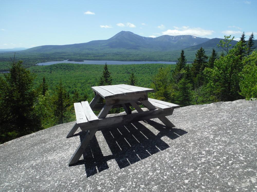
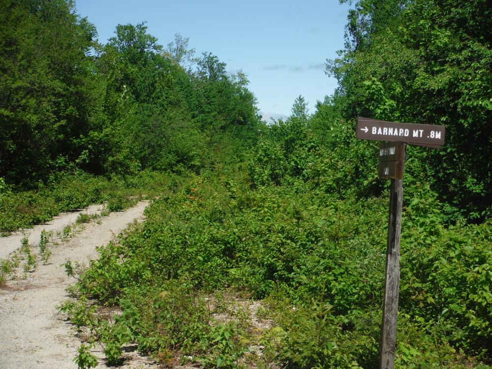
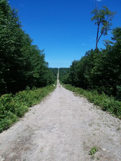
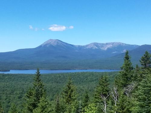

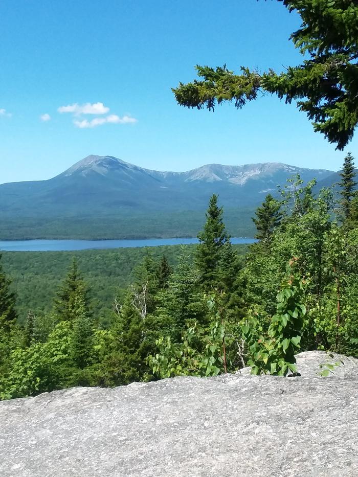
The trail begins with a steady uphill walk along an old logging road for about a mile which was pretty long, but easy going. Just after you crest the hill, a sign points you down another logging road to the right that is also an easy walk. About 2/10 a mile down this road you come to a well marked trail that heads into the woods and up the mountain. Once in the woods, the trail was easy to follow starting with a gradual uphill, then into a few switchbacks until you got to the top of the ridge. The payoff is the unobstructed view of Katahdin and Katahdin Lake to the west.