The Caribou Loop Trail ties together rugged Black and Caribou Mountains to create over 6 miles of backcountry hiking in Downeast Maine. The core loop is 6.1 miles, though hikers will need to add at least 0.9 miles of trail to reach the core loop. Multiple access points mean that hikers can combine different sections of the loop into unique experiences. The differen access trails and sections of the loop are described below.
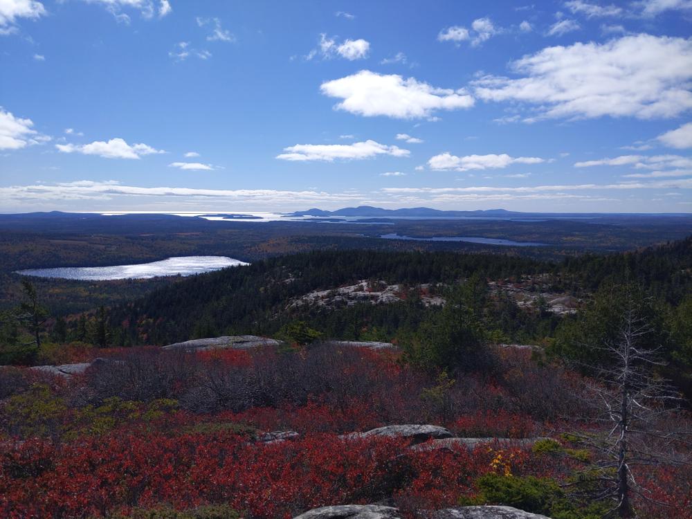
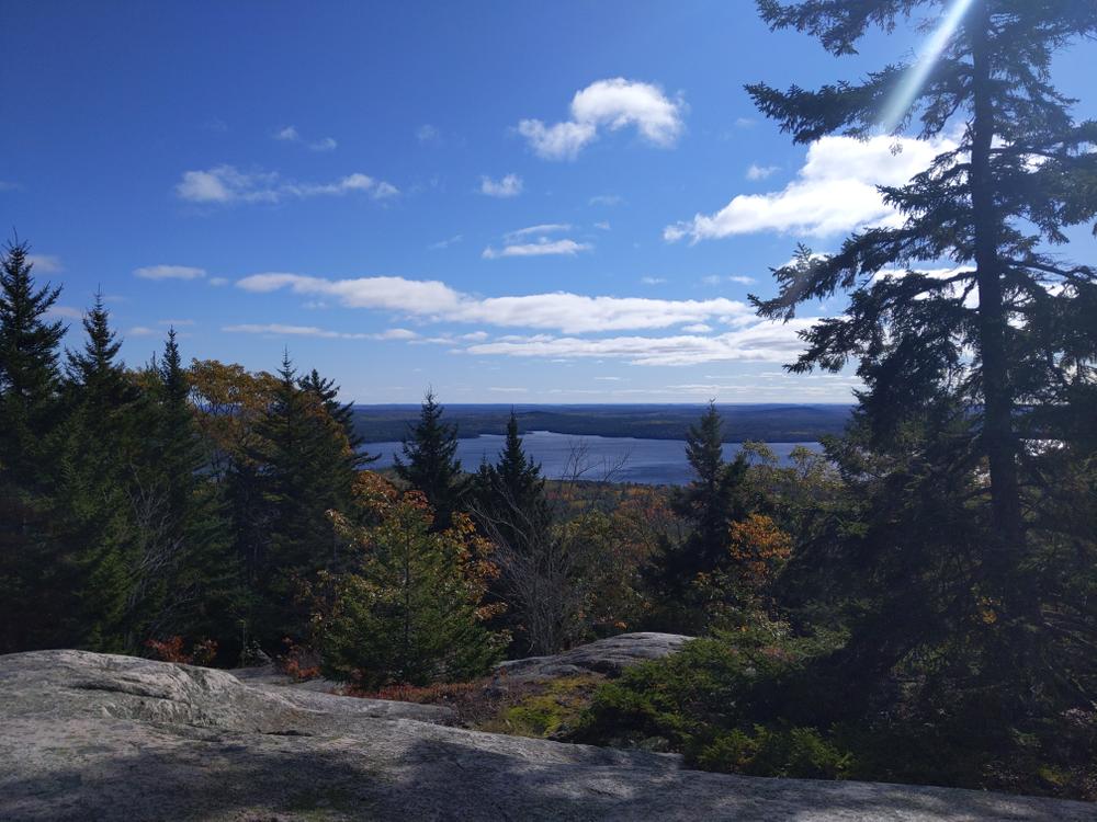
Black Mountain (1.8 or 2.4 miles, moderate): The popular Schoodic Beach Parking Area is the starting point for hiking to Black Mountain and thereby the Caribou Loop. There are two ways to access the loop, either by leaving directly from the parking area to begin the climb or by hiking out to Schoodic Beach and then up the Black Mountain Loop to the Caribou Loop. Via the beach, the hiking begins just after passing through a boulder barricade at the end of the parking lot. At the beach, turn right and hike 1.2 miles to a trail junction on the southwest flank of Black Mountain. This is where the trail directly from the parking lot also connects. From here, head north. This 0.6 mile section of Caribou Loop brings you to the western summit of Black Mountain, and from here, the Caribou Loop Trail travels north towards the saddle between Caribou and Black Mountain and east towards the east summit of Black Mountain.
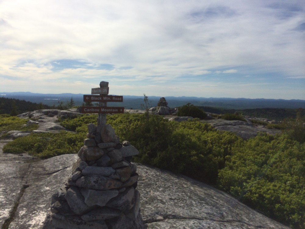
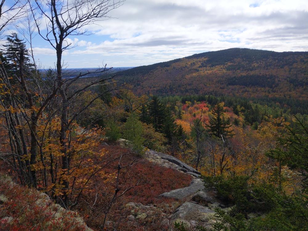
Black Mountain - Big Chief Trail (2 miles, moderate): It climbs steadily through mixed woods and transitions into spruce and fir shortly before crossing onto open ledges with extensive views to the south and east. At 0.6 miles, stone cairns and signs direct hikers to various access points to the Loop.
Heading northeast, the trail to Black Mountain's east peak dips down and crosses the outlet of Wizard Pond in a mossy hollow populated by cedar trees before climbing back up to the bald east peak. This trail section covers 0.6 miles to reach the east peak. From the east peak, hikers can head west down a small col and back up to the west peak or can head northward 3.2 miles to the summit of Caribou Mountain (970'). This trail section heading north crosses several tributary streams to Tunk Lake.
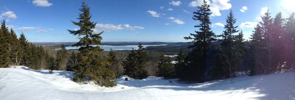
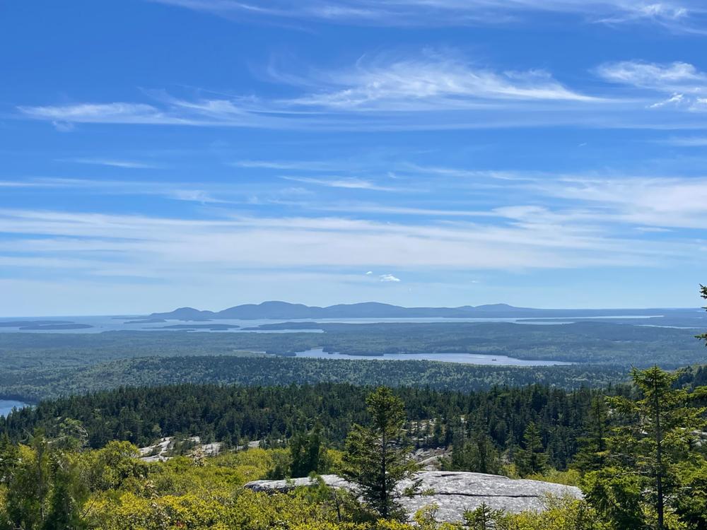
Caribou Mountain from North (0.9 miles, moderate): Starting at a small trailhead on the Dynamite Brook Road (a gravel forest management road accessed off ME Route 182), approximately 0.9 miles of moderately climbing trail connects to the main Caribou Loop Trail at the summit of Caribou Mountain. There are good views southward over Rainbow Pond to Black Mountain. To the east, views of Tunk Lake and surrounding forests can be enjoyed. It is another 1.5 miles from Caribou's summit west to the junction with a trail segment joining the loop from Redman's Beach on Donnell Pond. To the east, the trailheads for the bald east summit of Black Mountain (3.2 miles away).
Redman's Beach, Donnell Pond (1.4 miles moderate): A 1.4-mile section of trail loosely following an attractive brook runs from Redmans Beach on the east shore of Donnell Pond to a saddle between Caribou and Black Mountains. From the junction, it is 1.5 miles north to the summit of Caribou Mountain. It is 0.9 miles south to the western peak of Black Mountain.
View BPL's map & guide for Donnell Pond Public Reserved Land.
The majority of trail described here runs through a 1,940-acre ecological reserve designated to protect and study the unique natural areas and plants found on Black Mountain.
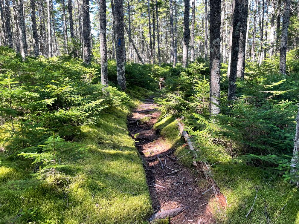
Stay on trail to minimize damage to plants and soils. Whenever possible, walk on rocks to reduce erosion and to protect sensitive plants. Cairns, constructed piles of rocks, are used to mark trails on open ledges. Do not make your own cairns or construct "rock art". Other visitors are looking to experience nature and may very well not appreciate rock art and can be mislead by confusing, inappropriate piles of rock. Additionally, removing rocks from fragile soil can create the opportunity for erosion to remove entire areas of soil/vegetation.
Water-access campsites are found on Donnell Pond, the southern end of Tunk Lake, and Spring River Lake. Walk-in access to campsites is available via the Schoodic Beach access trail.
The 2.2 mile (one-way) Tunk Mountain trail can be linked to by hiking northward 0.9 miles from near the summit of Caribou Mt to the Dynamite Brook Rd. (gravel). From here, it is an approximately one mile walk down the Dynamite Brook Rd. to reach ME Route 182.Cross Rt. 182 and look for the Tunk Mt./Hidden Ponds Trailhead on the north side of the road just east of where the Dynamite Brook Rd. Meets Rt. 182.
 Natural Heritage Hikes is a project of the Maine Natural Areas Program in partnership with Maine Trail Finder. View the "Black Mountain - Big Chief Trail" guide online here.
Visit Maine Bureau of Parks and Lands online for more information and a printable map or contact:
![]()
Be Courteous at Boat Launches and on the Water: Have patience at boat launches and make sure to share these public spaces. Give space to anglers, paddlers, and boaters, and remember, there’s no swimming at water-access sites. Swimming access points can be found here.
Caribou Loop Southern Access:
From US Route 1 in Sullivan, turn onto ME Route 183 and proceed about 4.5 miles. After crossing Down East Sunrise Trail (the former Calais Branch railroad), take first left onto gravel Schoodic Beach Road. The left turn is marked by a blue and white Donnell Pond Public Lands sign.
Caribou Loop via the Schoodic Beach trailhead: Shortly after entering the Public Lands, bear left at a fork in the road and follow the Schoodic Beach Road for 2.3 miles to its end and the Schoodic Beach parking area. (Note: Google mistakenly labels the Schoodic Beach Road as the Donnell Pond Road in the map above.)
Caribou Loop via the Big Chief trailhead: Shortly after entering the Public Lands, bear slightly right at a fork in the road and follow the Black Mountain Road for approximately 2.2 miles to a small parking area on your right (the trail starts just slightly beyond this parking area on the left -hand side of the road).
Caribou Loop via Redman's Beach (Water Access): Take the Donnell Pond Road eastward from ME Route 182 in Franklin. A public boat launch is located approximately 1 mile from the junction with ME Route 182. It is a little over 2 miles by boat across Donnell Pond to Redman's beach, where the trail leaves from behind a camp.
Caribou Loop Northern Access:
From West: Take ME Route 182/Blackwoods Scenic Byway from Franklin.The trailhead access is from Dynamite Brook Road located off ME Route 182 just under 1 mile past Fox Pond which is visible south of the road. Dynamite Brook Road leaves from the south side of the road just opposite the new Tunk Mountain Trailhead on the north side. The trailhead is 0.9 miles down the road, and there is space for several cars just east of the trailhead.
From East: Take ME Route 182/Blackwoods Scenic Byway from Cherryfield. The trailhead access is from Dynamite Brook Road located off ME Route 182 just over 2 miles past Tunk Lake visible to the south of the road and the Tunk Lake boat launch. Dynamite Brook Road leaves from the south side of the road just opposite the new Tunk Mountain Trailhead on the north side. The trailhead is 0.9 miles down the road, and there is space for several cars just east of the trailhead.
Success! A new password has been emailed to you.