Donnell Pond Public Reserved Land - Schoodic Mountain and Beach Trails

Schoodic Mountain and Schoodic Beach are popular destinations within the Donnell Pond Public Lands Unit. Schoodic's summit is bare and flat with 360 degree views, including dramatic views over Frenchman Bay and Mount Desert Island.
Trail Activity
Walking Hiking
Length
2.40 miles, Network
Difficulty
Easy, Moderate
Town
T9 SD
Surface
Dirt/Forest Floor, Rock/Ledge
Pets
Permitted
Fees
No

Description

The most direct route up Schoodic Mountain leaves from the Schoodic Beach parking area. However, hikers can also access the mountain via Schoodic Beach. A popular route on a hot summer day combines an ascent from the parking area with a descent to Schoodic Beach for a refreshing swim before the short walk back to the parking area.

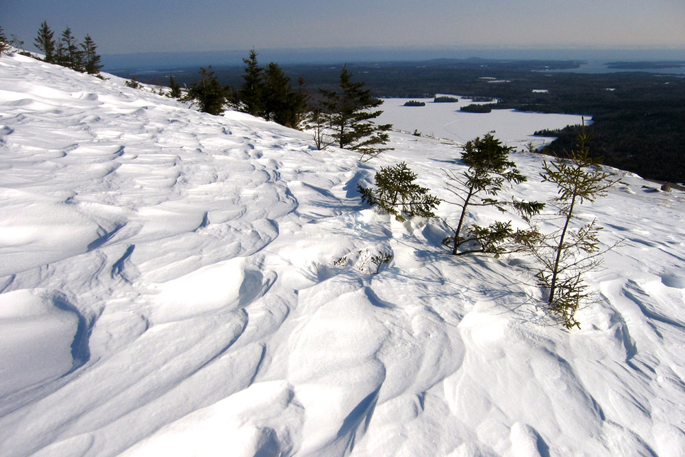
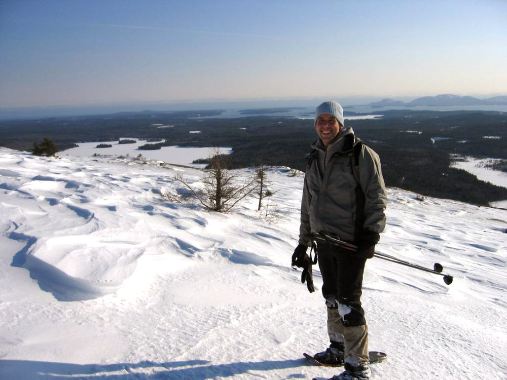
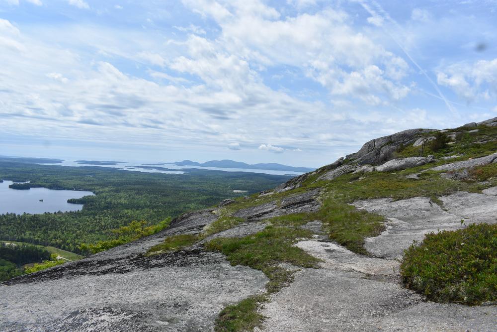
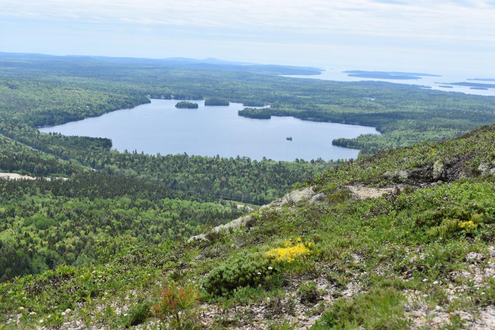
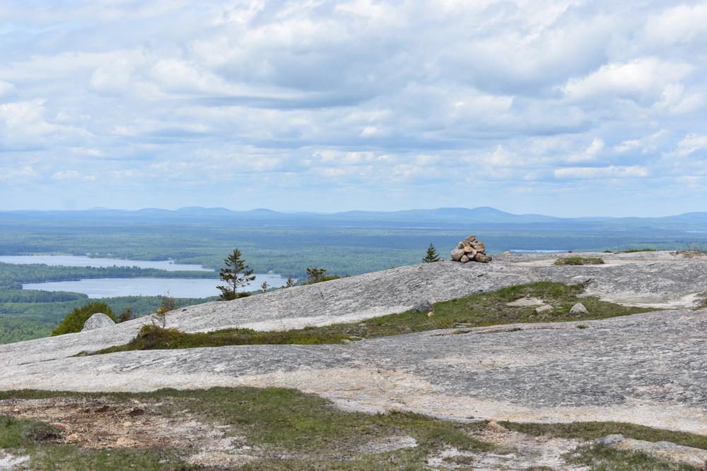
Parking Area to Schoodic Mountain summit (1.3 miles one way, moderate): The trail leaves the parking area near the outhouse and travels through the woods and across several streams before beginning a steep climb towards the summit. At 0.9 miles, the trail crosses some open ledges and converges with the trail from Schoodic Beach. Continue over ledges for 0.4 miles to the summit.

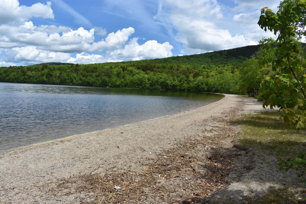
Parking Area to Schoodic Beach (0.5 mile one-way, easy): The trail follows the route of an old jeep trail down to the beach.  

Schoodic Beach to Schoodic Mountain summit (1.0 mile one-way, moderate): The trail leaves the west end of the beach and travels through forests as it begins to ascend the mountain's northeast slope. At 0.6 miles, the trail crosses some open ledges and converges with the trail from Schoodic Beach. Continue over ledges for 0.4 miles to the summit.

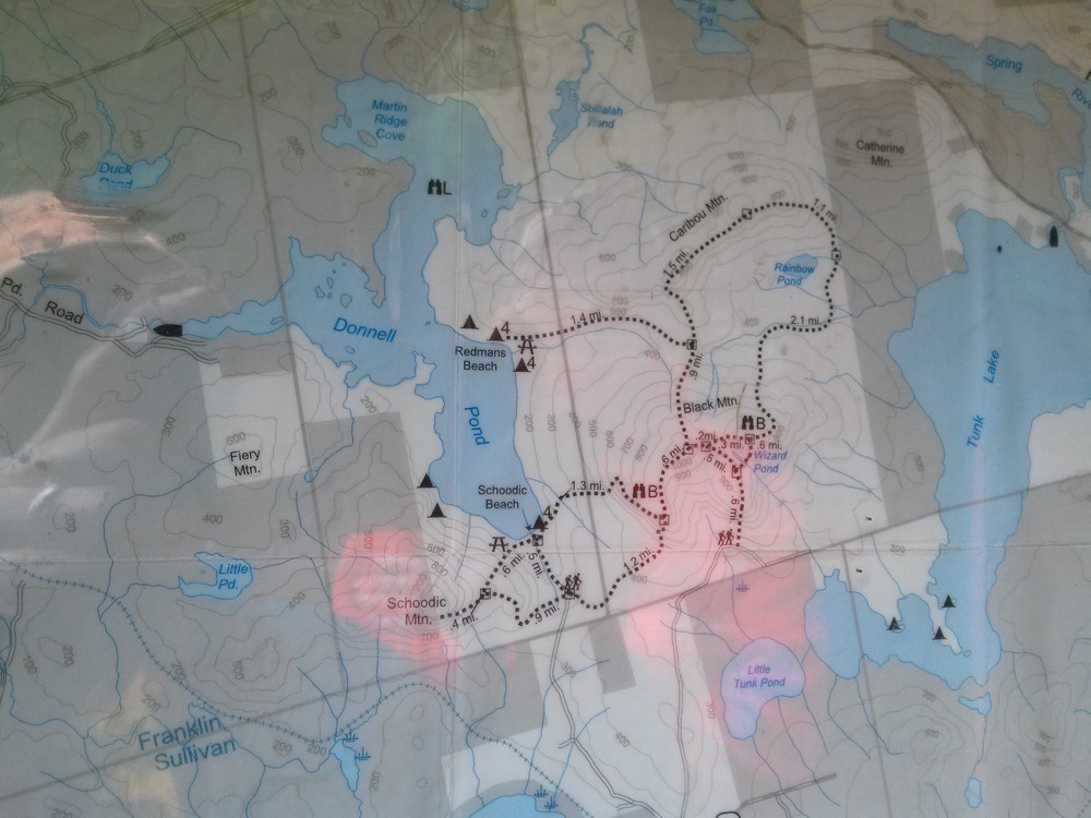
View BPL's map & guide for Donnell Pond Public Reserved Land.

Other Information

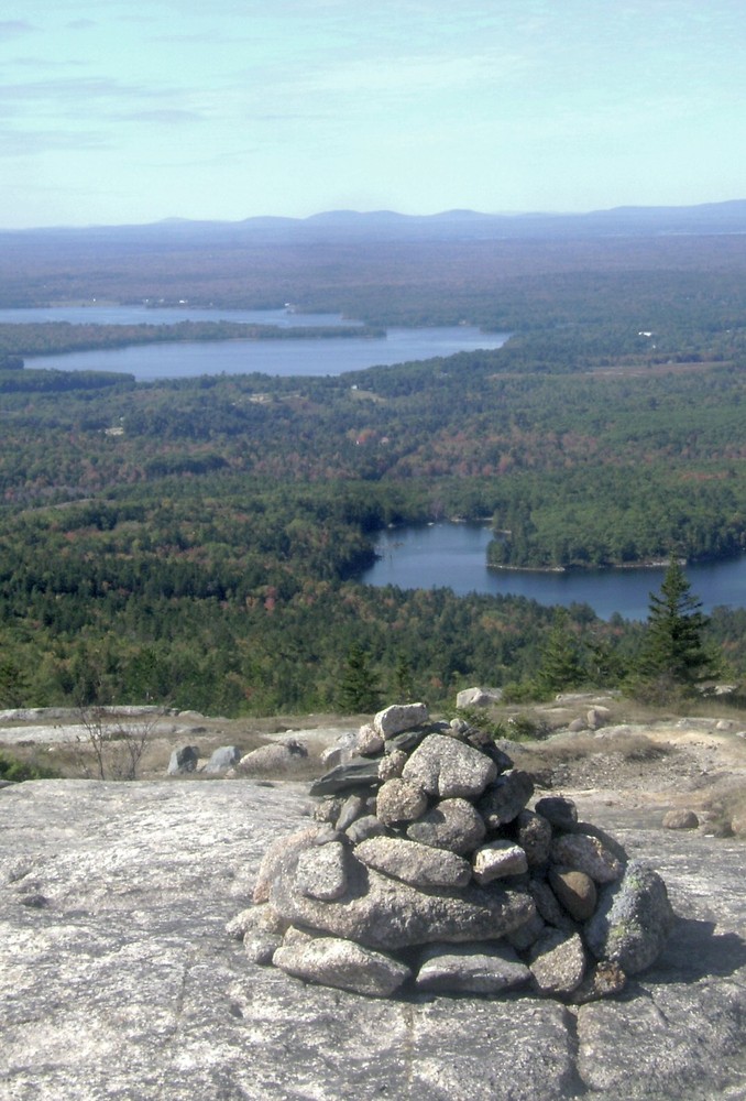
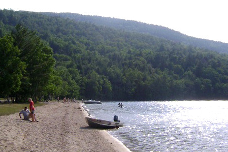
Trails are marked with blue blazes and stone cairns. Camping, swimming, and picnicking are allowed at the beach.

The western half of Schoodic Mountain's summit, including the communications tower, is private property. Please respect our neighbors and stay on marked trails.

Trail Manager

Visit Maine Bureau of Parks and Lands online for more information and a printable map or contact:

Maine Bureau of Parks and Lands, Eastern Public Lands Office

Maine Bureau of Parks and Lands, Eastern Public Lands Office
106 Hogan Road, Suite 5
Bangor, ME 04401
Phone: (207) 941-4412

Nearby Events

VIEW EVENTS CALENDAR

Trail Tips

Leave What You Find
Leave the trail work to the pros: they will add or remove blazes, cairns (stone trail markers), structures, and trail improvements as deemed necessary.
Legend
Hide All

Trailhead Information

From US Route 1 in Sullivan, turn onto ME Route 183 and proceed about 4.5 miles. After crossing Down East Sunrise Trail (the former Calais Branch railroad), take first left onto gravel Schoodic Beach Road. The left turn is marked by a blue and white Donnell Pond Public Lands sign. Follow the Schoodic Beach Road for 2.3 miles to its end and the Schoodic Beach parking area. (Note: Google mistakenly labels the Schoodic Beach Road as the Donnell Pond Road in the map above.)

Click on a parking icon to get custom directions
Please Log In or Create Account to add comments.
mainetrailfinder
August 26, 2022
Dozer,

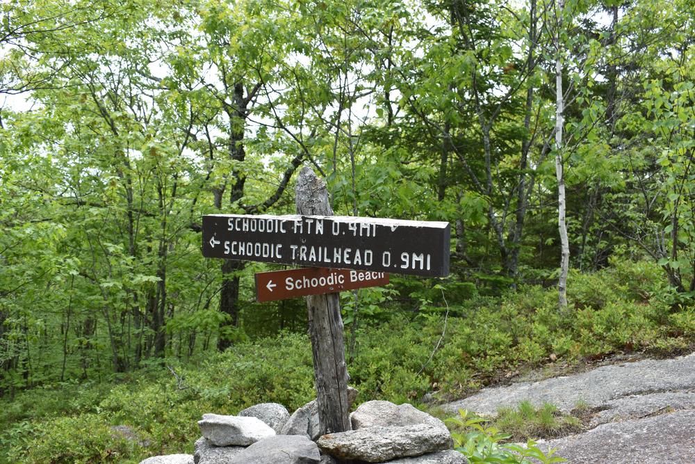
From the parking area, it a half mile to the beach area. You cannot drive all the way to the beach.
dozer
August 26, 2022
Can I drive to the beach area
carrie l
May 10, 2021
Beautiful hike, not too strenuous, good for kids. Unfortunately, in early May the black flies are already out in force. Didn't notice them too much the first half of the trail from the parking lot, but by the second half, they were really terrible. Bring your bug spray for a more enjoyable hike.
islandgirl1
September 27, 2016
Went to hike this trail, but took the wrong one on accident. I didn't see the sign marking this trail, because it was quite small. Wish it had been bigger!
jeffjapan055
January 04, 2016
June 1 '15 Joe & I hiked Schoodic & Black intending to head out Caribou loop trail to Dynamite Rd northern trailhead where spotted 2nd vehicle, figured 10mi day hike, my training for finishing ME AT sections mid June-July. Schoodic climb from beach parking lot, great windy views, down steep beach trail (bypassing Goat trail!) to lunch stop at Red man's Beach (white caps blowing into single tent), up Big Chief trail to Black summit, 6mi, when realized my spot vehicle keys left in Joe's truck! Returned long back ridge descent via steep cliff to corduroy & log woods road out to parking for 10 mi long day! Future mantra on AT, "keys?" Wind turbines are beautiful green energy vistas.
blueyes1119
August 29, 2015
Very sad to climb Schoodic Mt. and see the out of scale, out of place industrial wind turbines at Bull Hill. Wind power is a scam that is destroying Maine's Quality of Place!
Doug
May 17, 2014
Nice conditions Friday May 16; road to the parking lot off 183 was also in good condition.
These awesome businesses support our goal of connecting people to outdoor adventures in Maine!
Hang Tight!
Nearby services are loading
No Results
No Services Found
SHARE THIS TRAIL

Add Trail Log

Please wait…
Join In on the Fun!
Log in or create an account below to unlock all the great features of Maine trail finder: keep track of trails you want to do, preserve memories of trails you’ve done, earn badges, and more!
Your log in attempt was not successful. Please try again.
    Lost your password? Reset your password
    Don't yet have an account?
    There was an issue with your submission. Please try again.
      * Indicates required field
      Already have an account? Login here
      Enter your username, and we will send you a new, randomly generated password to your email account.
      There was an issue with your submission. Please try again.

        Success! A new password has been emailed to you.

        Log in now

        Please wait…