First Debsconeag Water Trail

Remote day-paddle or overnight. First Debsconeag Lake offers several campsites and access to the Ice Caves Trail.
Trail Activity
Paddling
Length
6.00 miles, Round Trip
Difficulty
Moderate
Town
T2 R10 WELS
Surface
Water - Lake/Pond, Water - River/Stream
Pets
Not Permitted
Fees
No

Description

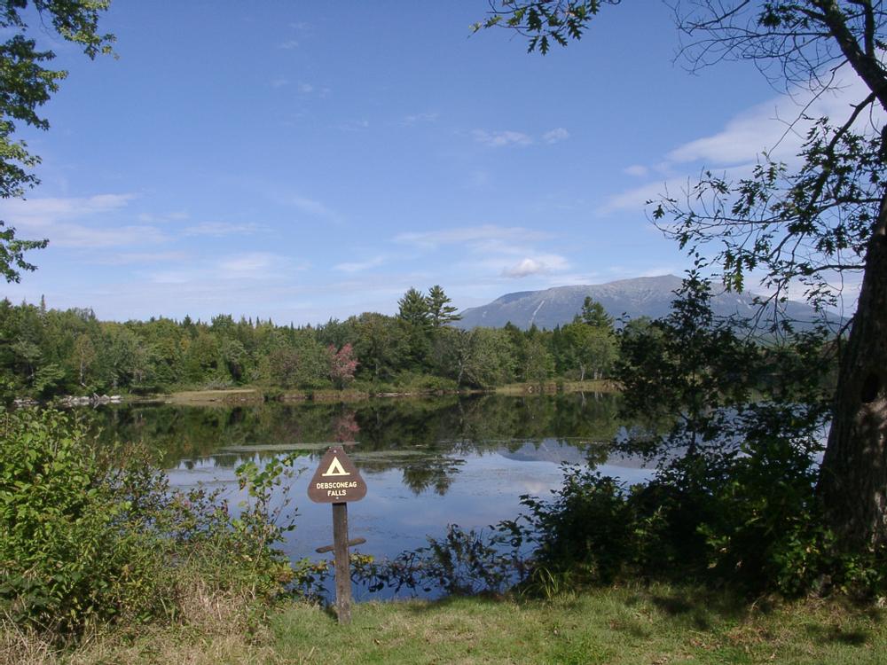
First Debsconeag Lake is a 1.6-mile long lake within The Nature Conservancy's 46,271 acre Debsconeag Lakes Wilderness Area. The lake is connected to the West Branch Penobscot River by a narrow channel. In order to reach the lake, paddlers must travel from the boat launch through several braided river channels. First time visitors should print a map to assist with navigation.

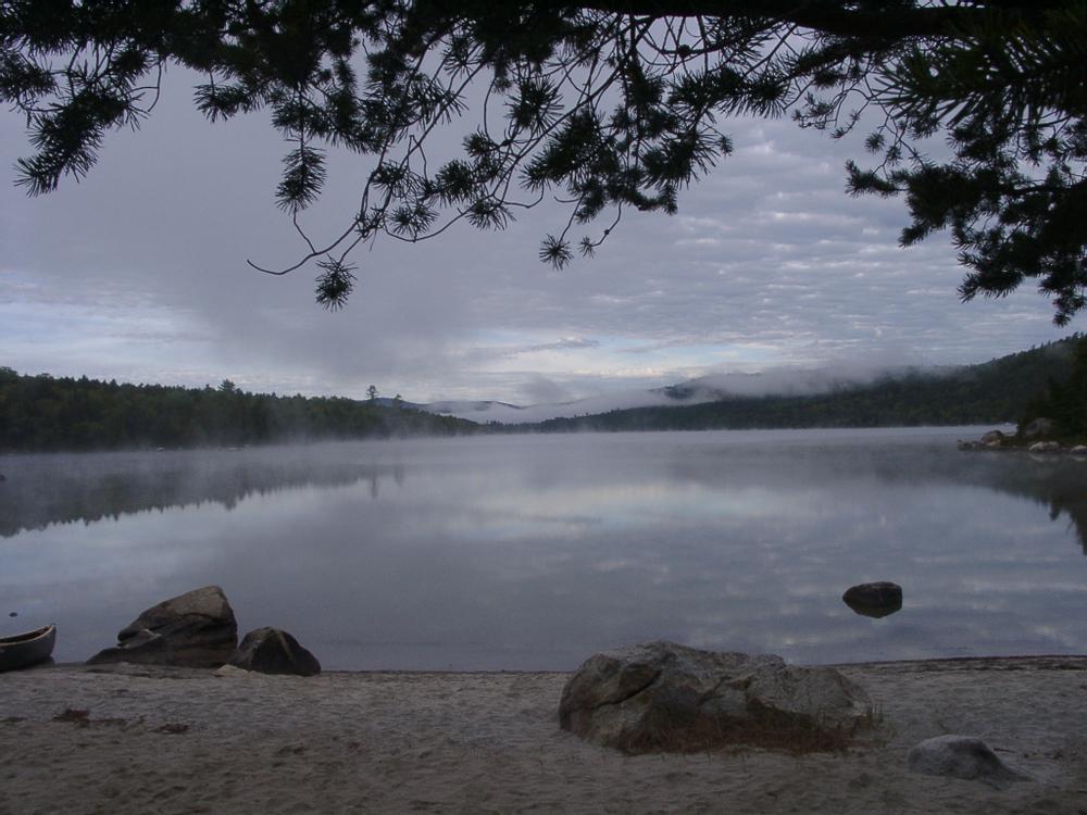
First Debsconeag Lake has three campsites on the east end, each with their own private sandy beach. On the west end, there is one campsite and a portage trail accessing Second Debsconeag Lake. All campsites have fire rings, picnic tables, and pit toilets. Day-use and overnight visitors to these campsites should use leave-no-trace ethics to reduce their impact and preserve a primitive natural experience for the next visitor.

The Ice Caves Trail can be accessed on the north shore of Debsconeag Lake, a few hundred feet below a rocky outcropping visible from the lake. A small sign marks where the trail meets the lake. The sign is easy to miss, so pay close attention or bring a GPS showing the trail location. The Ice Caves are less than a half mile from the lake.

Paddlers seeking an extended trip may paddle into the Debsconeag Deadwater and the West Branch of the Penobscot River. See the Maine Trail Finder connector trail posting for the West Branch Penobscot River for more information.

Other Information

Debsconeag means "carrying place," named by native people for the portage sites where they carried their birch bark canoes around rapids and waterfalls. The Debsconeag Lakes Wilderness Area contains the highest concentration of pristine, remote ponds in New England, as well as thousands of acres of mature forests.

Preserve Guidelines:

  • Hunting and fishing are allowed according to state laws and regulations.
  • Vehicles are restricted to designated roads; ATVs are not allowed anywhere on the property.
  • Mountain bikes are not permitted on hiking trails.
  • Horses, pets, and other domestic animals are not permitted.
  • Fires are allowed by permit only in existing fire rings at designated locations. Use only dead and down wood.
  • Do not collect or remove plants or animals.
  • Camp only in designated campsites. First come first served. No reservations or fees required.
  • Camping at any one site is limited to a two week maximum stay.
  • Please use the latrines installed at campsites.
  • Carry water for washing at least 200 feet away from streams or lakes and use small amounts of biodegradable soap.
  • Pack it in, pack it out! Remove all trash and leave your campsite looking better than when you arrived.

Trail Manager

For more information, contact the Maine Field Office of The Nature Conservancy:

The Nature Conservancy, Maine Field Office

The Nature Conservancy, Maine Field Office
14 Maine Street, Suite 401
Brunswick, ME 04011
Phone: (207) 729-5181
naturemaine@tnc.org
View website

Nearby Events

VIEW EVENTS CALENDAR

Trail Tips

Plan Ahead and Prepare
Use common sense. If it seems like a bad idea, it probably is.
Legend
Hide All

Trailhead Information

From Millinocket: travel about 10 miles northwest on the Baxter Park Road and turn left at the junction marked "Allagash." This short connecting road quickly comes to the Golden Road; turn right here. Travel about 3.7 miles on the Golden Road and turn left onto the road marked "Debsconeag Area 4.5 Miles." This very rough road, not suitable for most vehicles, goes about 3.5 miles directly to the boat launch. HIGH CENTER VEHICLES ONLY.

Warning: the Golden Road is a private logging road, all visitors must yield to log trucks.

Click on a parking icon to get custom directions
Please Log In or Create Account to add comments.
These awesome businesses support our goal of connecting people to outdoor adventures in Maine!
Hang Tight!
Nearby services are loading
No Results
No Services Found

Trail Alerts

Safety
Be a Safe and Respectful Paddler
Paddling conditions will vary according to the weather and season, so always exercise caution and always wear a lifejacket. With good judgment and proper equipment, the risk associated with paddling can be minimized. Respect the natural world and the rights of landowners, and be considerate of other outdoor enthusiasts. Paddlers should seek to avoid causing erosion, trampling vegetation, disturbing wildlife, and harming water quality.
Roads
Logging Road Access
Access to the trailhead/put-in is on gravel logging roads managed and maintained to transport timber. Be aware that logging trucks have the right of way and be prepared to pull to the side of the road when encountering logging trucks. Do not park in the travel portion of the road or block side roads. Yield to any equipment working on roads. Logging roads may be closed during active logging operations.
Roads
Remote Access
This part of Maine has poor signage and GPS driving directions can be misleading. Mobile phone use may also be limited. First time visitors should carry a map and printed directions.
SHARE THIS TRAIL

Add Trail Log

Please wait…
Join In on the Fun!
Log in or create an account below to unlock all the great features of Maine trail finder: keep track of trails you want to do, preserve memories of trails you’ve done, earn badges, and more!
Your log in attempt was not successful. Please try again.
    Lost your password? Reset your password
    Don't yet have an account?
    There was an issue with your submission. Please try again.
      * Indicates required field
      Already have an account? Login here
      Enter your username, and we will send you a new, randomly generated password to your email account.
      There was an issue with your submission. Please try again.

        Success! A new password has been emailed to you.

        Log in now

        Please wait…