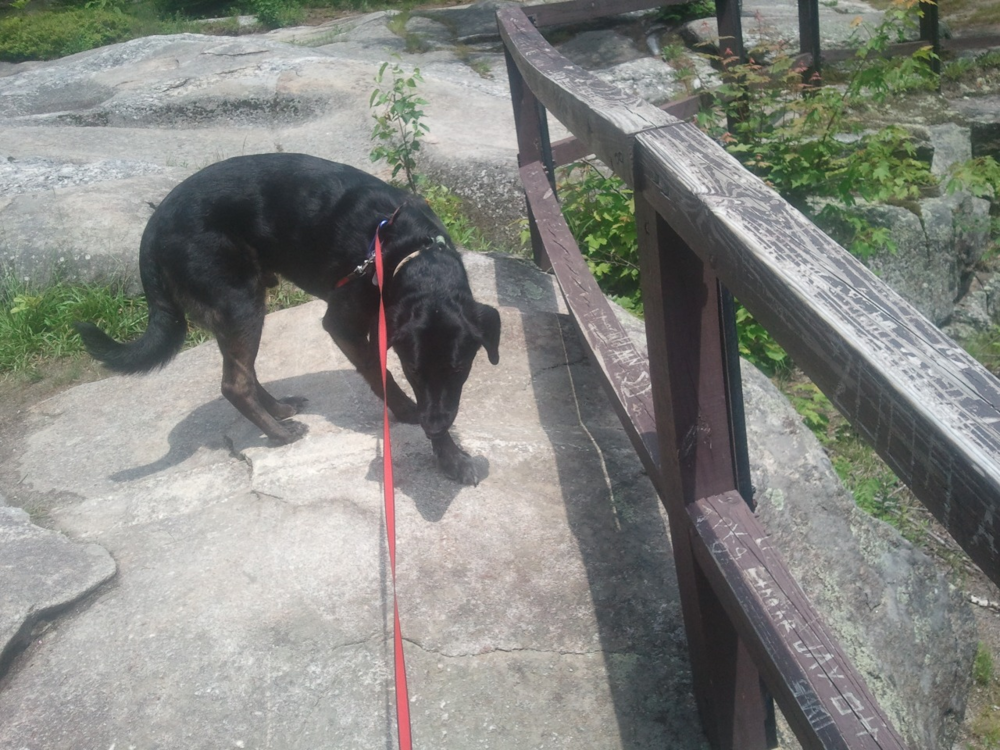
The Grafton Loop Trail is a 38.6 mile, backcountry hiking experience in the Mahoosuc Mountains of Maine. The trail, which connects to the Appalachian Trail at Old Speck and the East Peak of Baldpate Mountain on either side of ME Route 26, highlights the natural features and mountain peaks of the area encircling Bear River Valley. Because of its length and the terrain it traverses, the trail is strenuous and requires appropriate equipment and preparation.
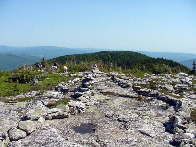
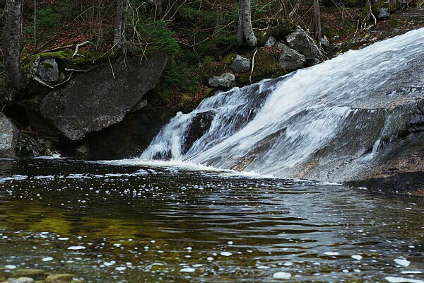
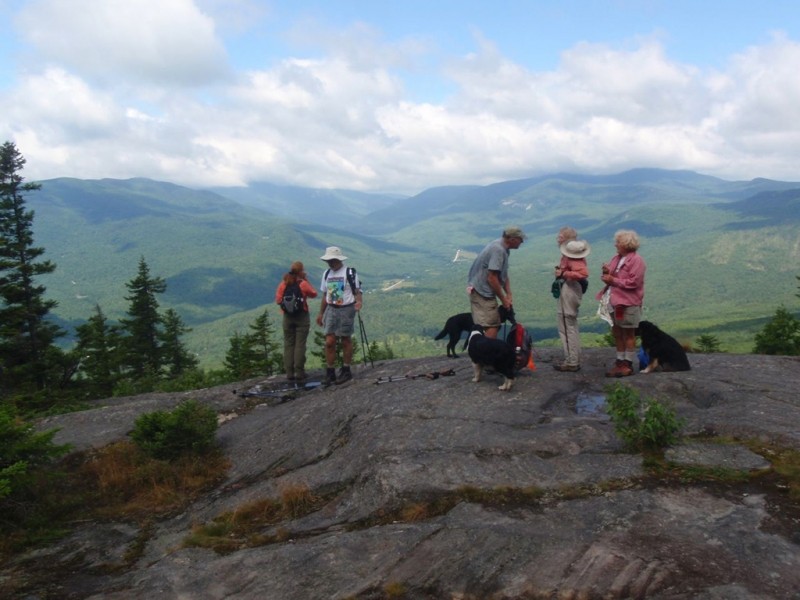
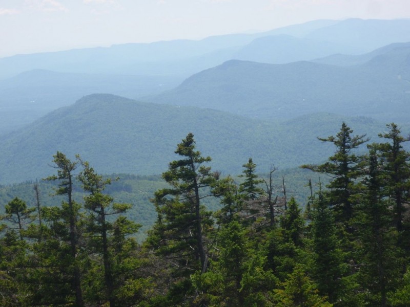
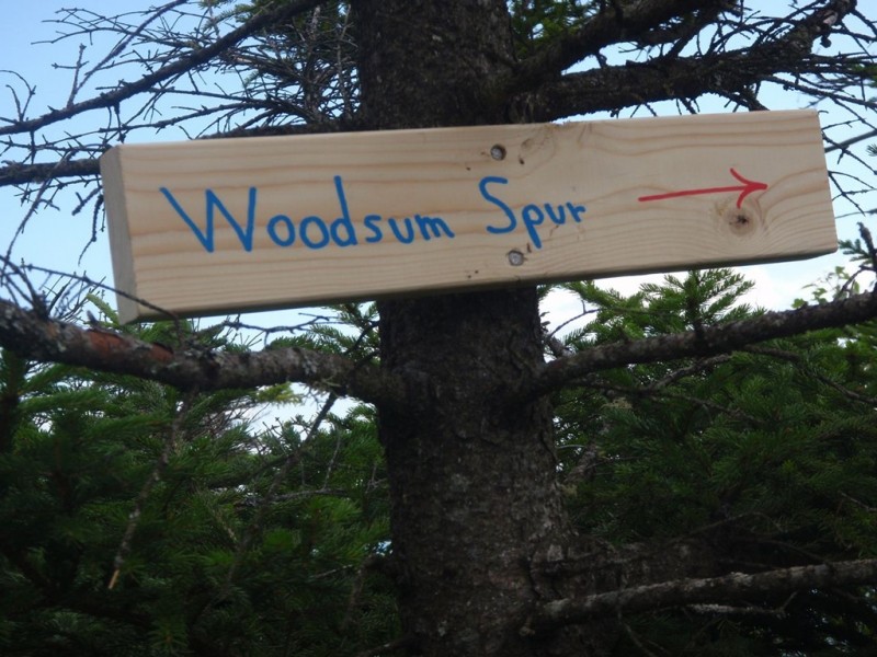
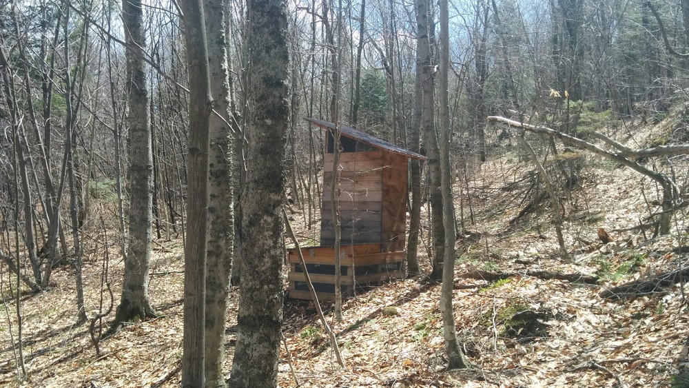
East of ME Route 26 (21.1 miles, strenuous): The eastern half of the trail, coming from the south, leaves ME Route 26 at the southern trailhead and continues to the open summit of Puzzle Mountain after passing several ledges with fine views of the Bear River Valley, the Mahoosuc Range and the Presidential Range beyond. About 0.1 mile before the southwest summit, the Woodsum Spur trail leaves the main trail to the right. After the cairn on the summit the trail follows open ledges to about .2 miles after the summit where the other end of the Woodsum Spur trail branches to the right. The trail then heads down Puzzle, passing the Stewart Campsite on a short spur to the left, to the valley between Puzzle and Long Mountain, where it crosses the headwaters of Chase Hill Brook (reliable water). The trail then ascends Long Mountain, following the Andover-Newry town line north over rugged terrain and mostly private land. A short side trail leads to a good view near the summit. Along the gradual descent there is a campsite to the right. About 1.5 miles from Long Mountain there is reliable water as the trail descends one fork of Wight Brook and the ascends another. There are two campsites on short side trails in this section, about 1.3 miles apart; one has a spectacular waterfall and pool. The trail then ascends Lightning Ledges for several good views. After a 0.5-mile descent, the East Baldpate campsite is on the right. From here is the 2.1-mile ascent of East Peak of Baldpate, where, after 17.1 miles, the trail connects the Appalachian Trail. From there it is another 4 miles southbound along the A.T. to return to ME Route 26. Camping is allowed only in 5 designated campsites along the trail, and in some sections, it is a long distance between reliable sources of water. No fires are allowed on the trail or at the campsites.
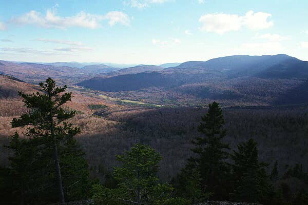
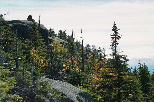
West of ME Route 26 (17.5 miles, strenuous): The western section, leaving from the northern trailhead at the A.T. crossing of ME 26, follows the A.T. southbound along Cascade Brook. The trail crosses many streams then ascends the north shoulder of Old Speck, rising out of the woods and offering frequent views of the Notch. Take the 0.3-mile spur to the left, at approximately 3.5 miles from the trailhead, to the summit and observation tower. Old Speck, at 4180 feet, is the third highest mountain in Maine. Here the Grafton Loop trail branches off and heads south. There is a campsite about 2 miles after the summit of Old Speck. The trail then continues descending southward, skirting Slide Mountain, to Miles Notch. From here the trail begins ascending Sunday River Whitecap, passing several open views and then coming out on the open north ridge to finish the climb to the summit where there are views in all directions. The trail across much of the summit is on a unique raised walkway that protects fragile, rare alpine plants from hiker’s boots. From Whitecap the trail descends to a campsite below Sargent Mountain and then to Bald Mountain. After some views to the south and east, the trail descends a long series of rock steps to a campsite and finally down to the Bear River and ME Route 26. The trail emerges on the road a half mile south of the Southern trailhead parking area. There are four campsites that allow camping on this portion of the trail. No fires are allowed on the trail or at the campsites.
View BPL's Grafton Notch and Mahoosuc Public Land map and guide.
This massive trail-building effort was done over a six-year period by members of the Grafton Loop Trail Coalition, which includes the Appalachian Mountain Club, Maine Division of Parks and Public Lands, the Maine Appalachian Trail Club, the Appalachian Trail Conservancy, the Maine Conservation Corps, Hurricane Island Outward Bound School, several timber management companies, Sunday River Ski Resort, and other private landowners. Funding was provided by several private donors and foundations, as well as by the Maine Outdoor Heritage Fund and federal Recreational Trails Program funding.
This trail is partially within the 9,993-acre Mahoosuc Ecological Reserve, which, like all Maine State Ecological Reserves, is specifically set aside to protect and monitor natural ecosystems. More information about the reserve can be found at Maine Natural Areas Program's Ecoreserve Fact Sheet for Mahoosuc Unit.

This trail passes through a property that was acquired in part with funds from the Land for Maine’s Future program. For more information about the LMF program and the places it has helped to protect, please visit the LMF webpage.
Visit the Maine Bureau of Parks and Lands, Appalachian Mountain Club, and Maine Appalachian Trail Club online for more information and a printable map or contact:

![]()
![]()
Follow Fire Restrictions: Maine’s dry seasons mean fire bans—always check first. Many areas of Maine will require you to have a permit for your campfire. Check here first to avoid issues later.
Northern Trailhead: This trailhead also serves as the main trailhead for Grafton Notch State Park. From the intersection of US Route 2 and ME Route 26 in Newry, follow ME Route 26 approximately 12 miles north to where the Appalachian Trail crosses the road. Coming north on ME Route 26, the trailhead and parking area will be on the left with signs indicating the state park.
Southern Trailhead: The southern trailhead is 4.7 miles north on ME Route 26 from the intersection of US Route 2 and ME Route 26 in Newry. Coming north on Route 26, the parking area are will be on the right, directly across from Eddy Road on the left. Access to the eastern half of the trail is from the northern end of the parking area. To access the western section of the trail, walk south along ME Route 26 for 0.5 miles; the trail leaves from the western side of the road.
Success! A new password has been emailed to you.
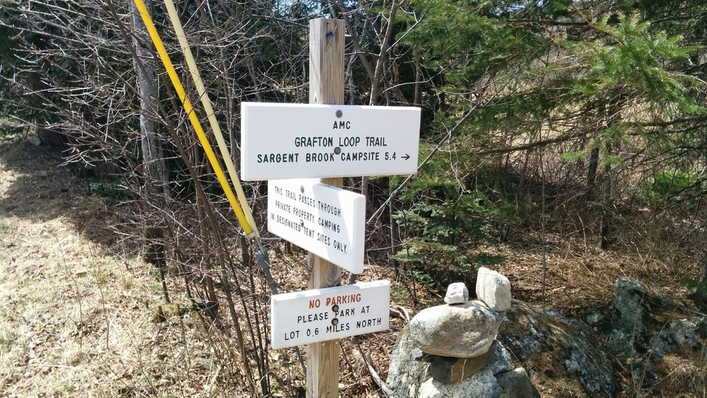
As noted in prior post conditions are extremely dry and most water sources have dried up. Clockwise water can be found at the following campsites and locations:
Bald Mountain: trickling pools
Sargent brook: none found
Slide Mtn: trickling pools
Bull Run: nice flow
Baldpate Shelter: not checked
E Baldpate site: good flow
Lane: good flow
Town corner: NONE (looked downstream)
-- heading north a mile towards Baldpate the creek starts to flow.
-- heading south none until Chase creek at the foot of puzzle mountain
Chase creek: good flow - this is the only water between RT 26 and past Town Corner
Stewart Campsite: NONE
Baldpate Shelter: Not checked
E Baldpate site: Good flow
Lane: Great flow