Seboeis River Paddling Trail

Paddle the Seboeis River through pristine pine forest from Grand Lake Road to Lunksoos Camps on the East Branch of the Penobscot.
Trail Activity
Paddling
Length
20.00 miles, One Way
Difficulty
Advanced
Towns
T3 R7 WELS, T4 R7 WELS, T5 R7 WELS, T6 R7 WELS
Surface
Water - River/Stream
Pets
Permitted
Fees
No

Description

The Seboeis River Paddling Trail runs for 20 miles between Grand Lake Road and Lunksoos Camps. An easily accessible put-in at the Seboeis Bridge on the Sherman Lumber Company Road provides the option of dividing the Paddling Trail into a 14-mile upper section with quicker water or a 6-mile lower section of easy paddling. The last few miles of the Paddling Trail are over calm water on the East Branch of the Penobscot River below its confluence with the Seboeis.

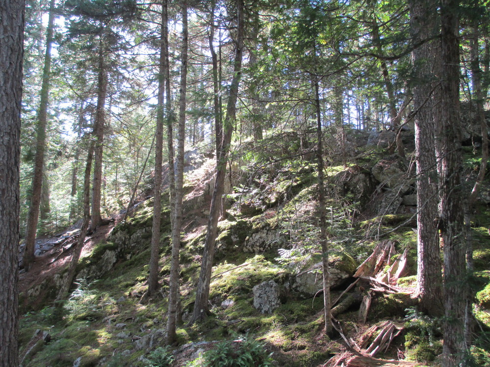
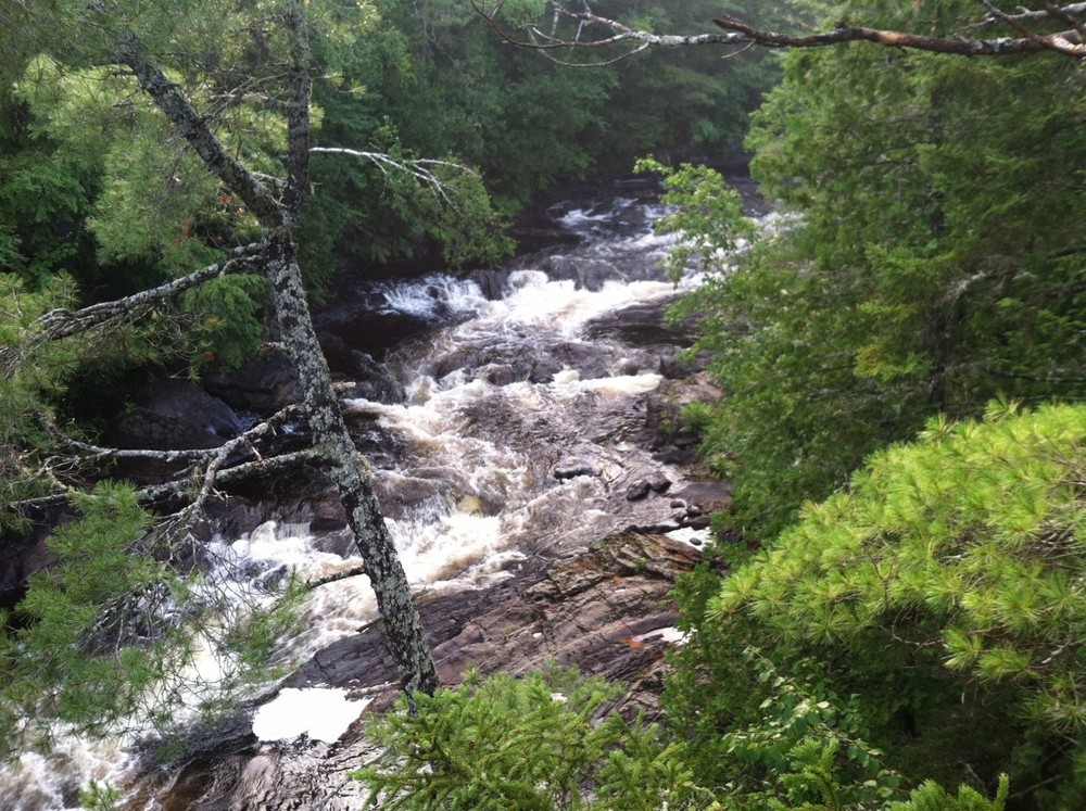
The first 1 mile of water below Grand Lake Road is characterized by moderate Class I and II rapids. Sugarloaf Mountain to the east is briefly visible. After approximately 1 mile, the river banks begin to rise and evergreens are visible on the ledges downstream as the unrunnable Grand Pitch approaches. Portage along river left anywhere accessible and join the hiking trail which runs along the east bank of the Seboeis to the bottom of Grand Pitch. Pass through a forest with a rich understory of mosses and lichen to the put-in at the pools below Grand Pitch.

Below Grand Pitch, Class II rapids quickly give way to Class I water and the river often braids itself through island channels. For the next 10 miles the river passes through moose country and the Katahdin Woods and Waters National Monument.

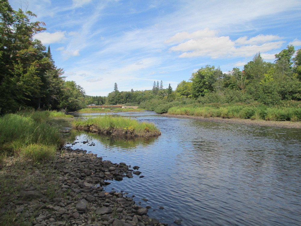
14 miles from Grand Lake Road, the Seboeis River passes under the Seboeis River Bridge on the Sherman Lumber Company Road. A hand-carry boat launch on river-right just below the bridge provides an alternative take-out point.

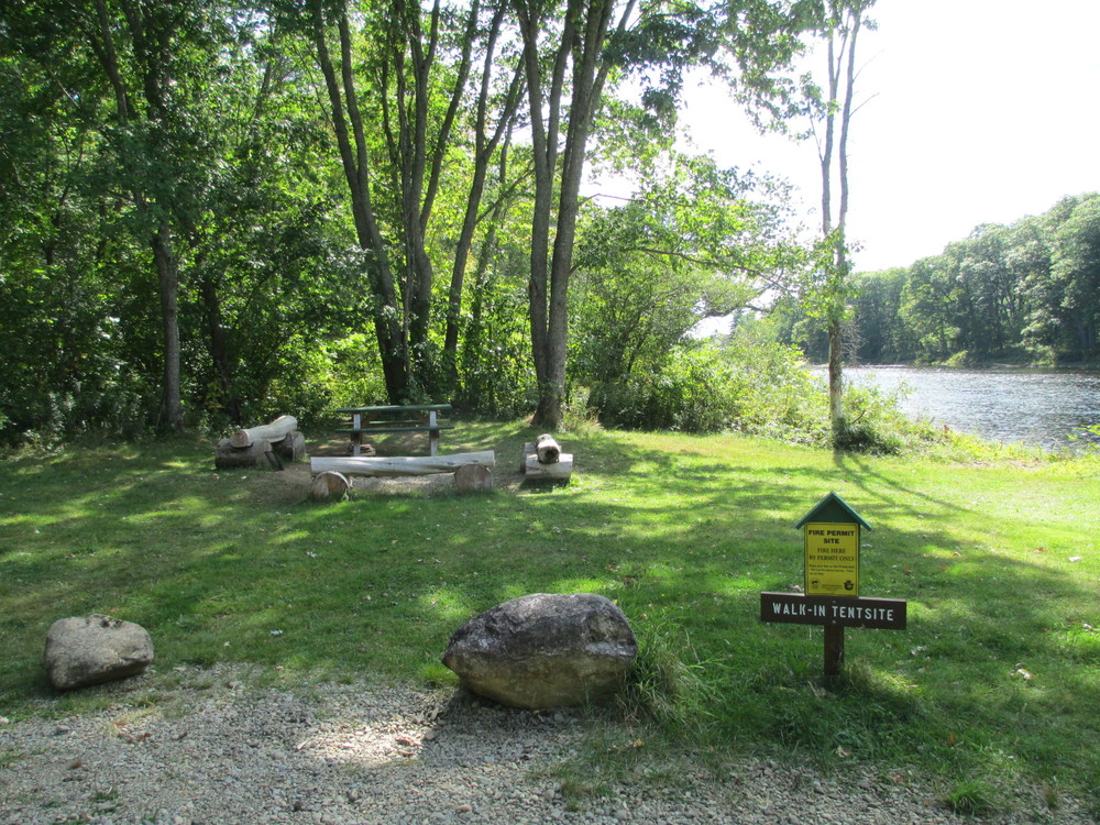
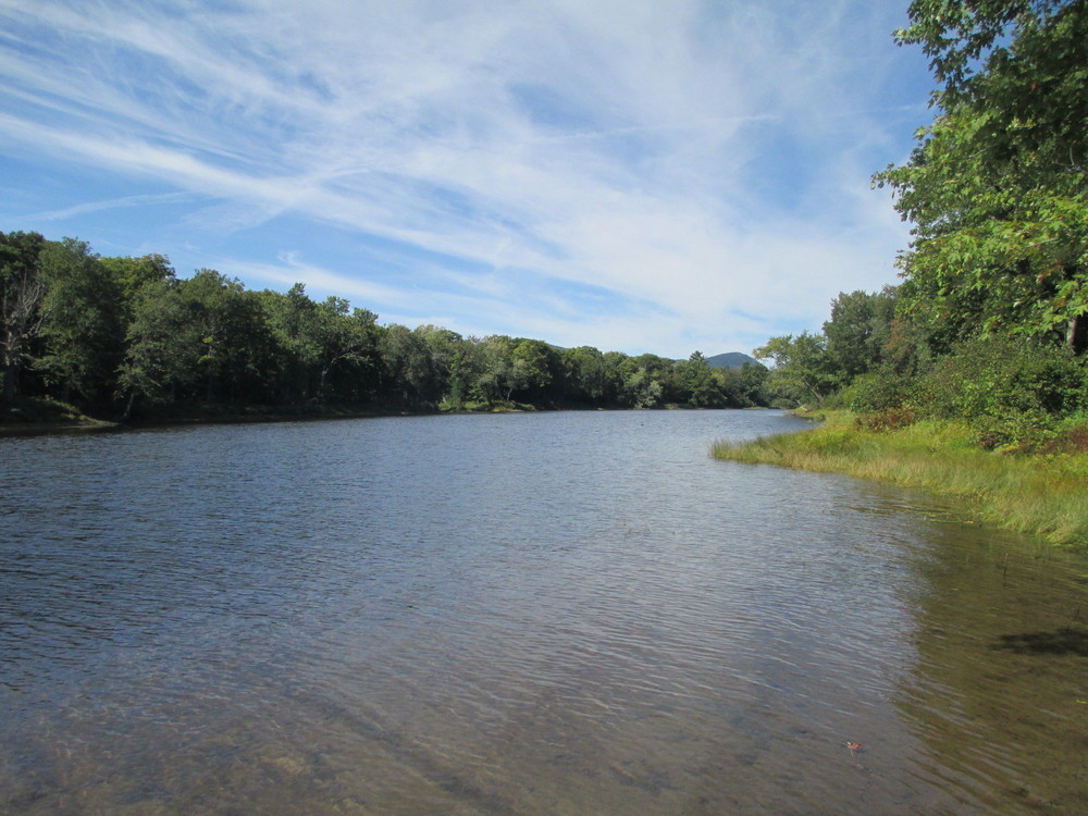
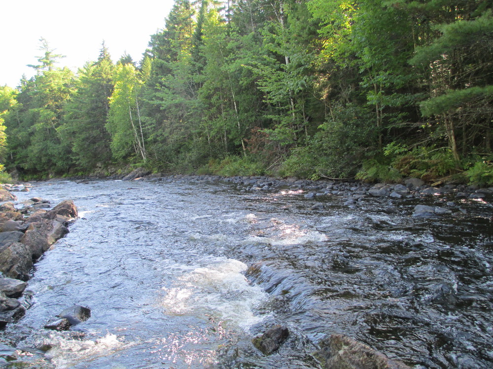
Below the Seboeis River Bridge, the river continues for another 3 miles through smooth and Class I water to its confluence with the East Branch of the Penobscot River. Here the East Branch is calm and wide. Big Seboeis campsite may be found 0.5 miles from the confluence on river-right. 

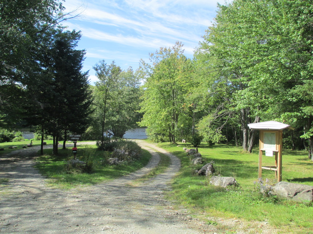
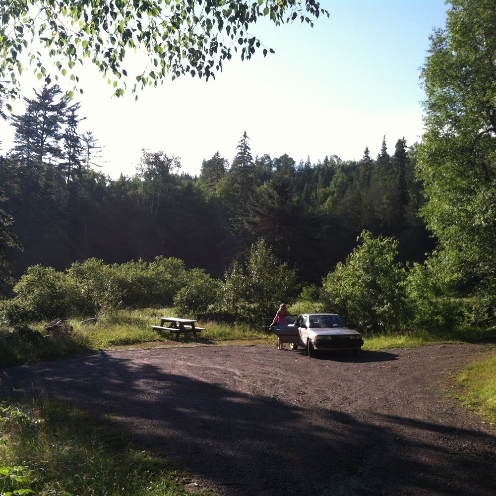
Lunksoos Camps boat launch is 3 miles downstream from the confluence of the Seboeis and East Branch of the Penobscot. Pass through the Lunksoos Deadwater and look for the boat launch on the east bank. Camping is available at the Lunksoos Katahdin Woods and Waters turn-out. Five single sites are across the road from the boat launch and two group sites are located near the boat launch. Reservations for the campsites are available through recreation.gov

The Seboeis River is best run in high water and is typically too low after mid-summer.

Other Information

Changes in water level will significantly alter the condition of this paddling trail. Some portions may be unrunnable in low water conditions. Some whitewater experience recommended.

Trail Manager

For more information please contact Katahdin Area Trails or Katahdin Woods and Waters National Monument.

Katahdin Area Trails

Katahdin Area Trails
PO Box 669
Millinocket, ME 04462
Phone: (207) 723-5438
info@katahdinareatrails.org

Katahdin Woods and Waters National Monument

Katahdin Woods and Waters National Monument
PO Box 446
Patten, Maine 04765
Phone: (207) 456-6001
View website

Nearby Events

VIEW EVENTS CALENDAR

Trail Tips

Leave What You Find
Respect natural resources, cultural and historic items, and wildlife by looking rather than touching.
Legend
Hide All

Trailhead Information

  • To the put-in at Grand Lake Road: From Patten, travel north on ME-159 towards Grand Lake Matagamon and the North Gate of Baxter State Park. Note Shin Pond Village on the hill just past Shin Pond. 11 miles north of Patten (1.5 miles past Shin Pond Village), round a large left curve on ME-159 and continue to bear left and straight to proceed onto Grand Lake Road. Travel on Grand Lake Road for 4 miles and then turn right into a dirt parking area immediately before the bridge which crosses the Seboeis River. A large wooden sign for the "Seboeis River Trail" will be on the left hand side of the road opposite the parking area. The put-in for the Seboeis River Paddling Trail is down a short path from the edge of the parking lot to the confluence of the Seboeis River and Sawtelle Brook just above the bridge.
  • To the take-out at Lunksoos Camps: [CAUTION- Private Logging Roads: Stay alert and yield to company vehicles on these narrow roads] From Sherman, travel south on ME-11 for 5 miles to Stacyville. Here the paved ME-11 makes a hard left turn at its junction with the unpaved Swift Brook Road. From ME-11, continue straight through this junction onto Swift Brook Road/Stacyville Road. In just over 4 miles Swiftbrook Road/Stacyville Road comes to an unsigned junction with a road from the left. Do not turn here; continue straight for another mile to a second junction on a downhill turn. Here, the main road curves sharply to the left, while a second road continues slightly right and directly down the hill. Bear right (west) towards Lunksoos Camps. The road approaches the Seboeis river and follows it. In 2.5 miles the well Signed Lunksoos Camps recreational area will be on your left.
  • To the optional Seboeis Bridge put-in/take-out: [CAUTION- Private Logging Roads: Stay alert and yield to company vehicles on these narrow roads] From Sherman, travel north on ME-11 4.2 miles and turn left onto the unsigned dirt Sherman Lumber Company Road. Travel just over 2 miles south to an unsigned junction with another Sherman Company road and bear right (west). From this junction travel approximately 8 miles west and then 3 miles north on the Sherman Lumber Company Road to the bridge where it crosses the Seboeis River. The Parking area is on the left just after the bridge.
Click on a parking icon to get custom directions
Please Log In or Create Account to add comments.
These awesome businesses support our goal of connecting people to outdoor adventures in Maine!
Hang Tight!
Nearby services are loading
No Results
No Services Found

Trail Alerts

Safety
Be a Safe and Respectful Paddler
Paddling conditions will vary according to the weather and season, so always exercise caution and always wear a lifejacket. With good judgment and proper equipment, the risk associated with paddling can be minimized. Respect the natural world and the rights of landowners, and be considerate of other outdoor enthusiasts. Paddlers should seek to avoid causing erosion, trampling vegetation, disturbing wildlife, and harming water quality.
SHARE THIS TRAIL

Add Trail Log

Please wait…
Join In on the Fun!
Log in or create an account below to unlock all the great features of Maine trail finder: keep track of trails you want to do, preserve memories of trails you’ve done, earn badges, and more!
Your log in attempt was not successful. Please try again.
    Lost your password? Reset your password
    Don't yet have an account?
    There was an issue with your submission. Please try again.
      * Indicates required field
      Already have an account? Login here
      Enter your username, and we will send you a new, randomly generated password to your email account.
      There was an issue with your submission. Please try again.

        Success! A new password has been emailed to you.

        Log in now

        Please wait…