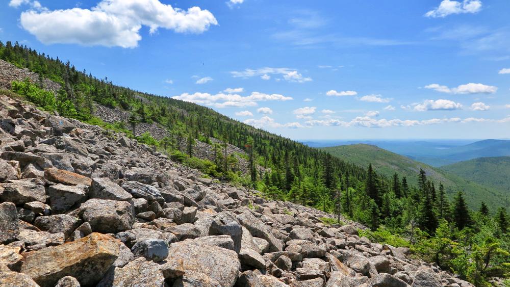
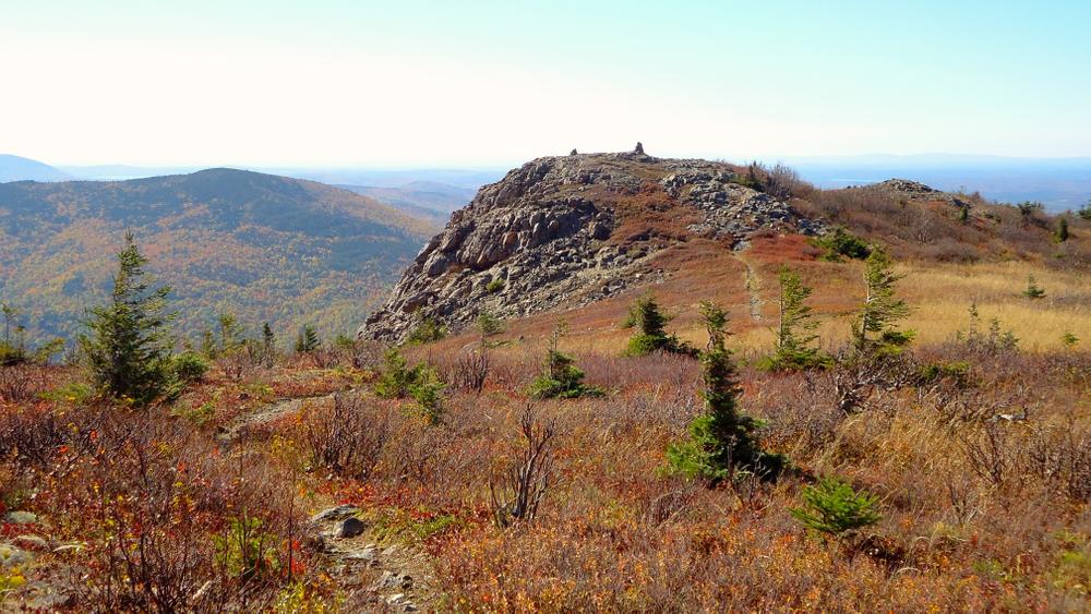
The Traveler (elevation 3,541 feet) is one of the major peaks in Baxter State Park. It is very different from the solid granite giants in the south part of the Park. It is an old volcanic peak consisting of a fine grained volcanic stone called rhyolite, recognized by its orange-red hue. Rhyolite easily fractures when exposed to the rugged weather of this region and altitude. Loose, fractured rock make up the footways of the mountain’s trails, difficult when dry, treacherous when wet.
In 2005, the Park constructed a new trail from the Peak of the Ridges to the summit of Traveler, then across to the North Traveler Trail. This new addition allows a long loop trail traversing the three peaks: Peak of the Ridges, The Traveler, and North Traveler. The total elevation gain is a challenging 3,700 feet, only 400 feet less that a climb of Katahdin from Katahdin, and in some ways more difficult. The loose rock particularly on Center Ridge and across Traveler requires constant concentration. Because much of the trail is very exposed, traversing this loop in windy or rainy weather can border on dangerous.
Parties attempting the entire 10 mile long loop should be strong hikers, have foul weather gear, and have footwear that can withstand the difficult loose rock. The recommended direction in which to hike this loop is counter-clockwise, to avoid a descent over the extremely steep talus slopes on the Center Ridge Trail.
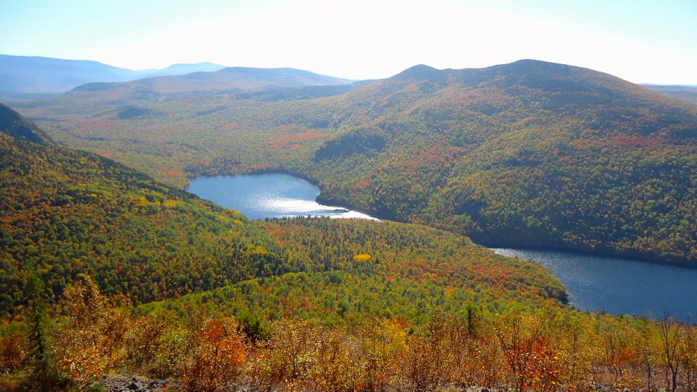
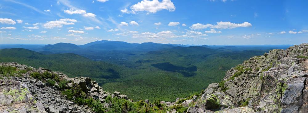
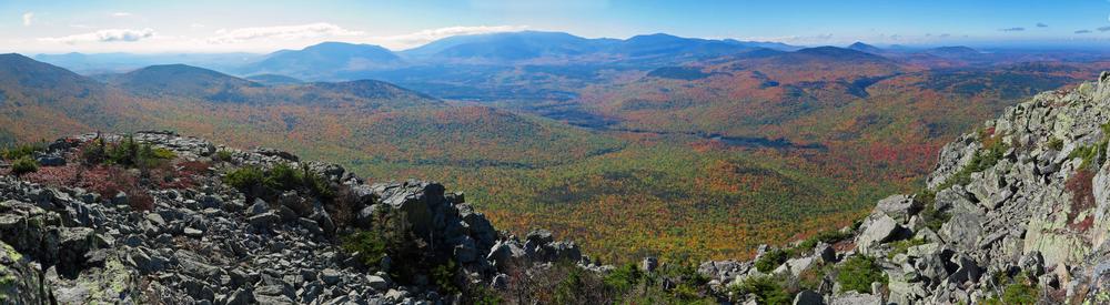
The hike begins on the first 1.5 miles of the relatively level Pogy Notch Trail, following the shore of South Branch Pond. It then proceeds up the Center Ridge Trail, which traverses numerous rocky knobs before culminating in a rocky peak called Peak of the Ridges. The Center Ridge Trail is almost entirely above treeline, so views are continuous and varied. Because of the tough footway over broken, fractured rock, the effort needed to traverse this trail is considerable.
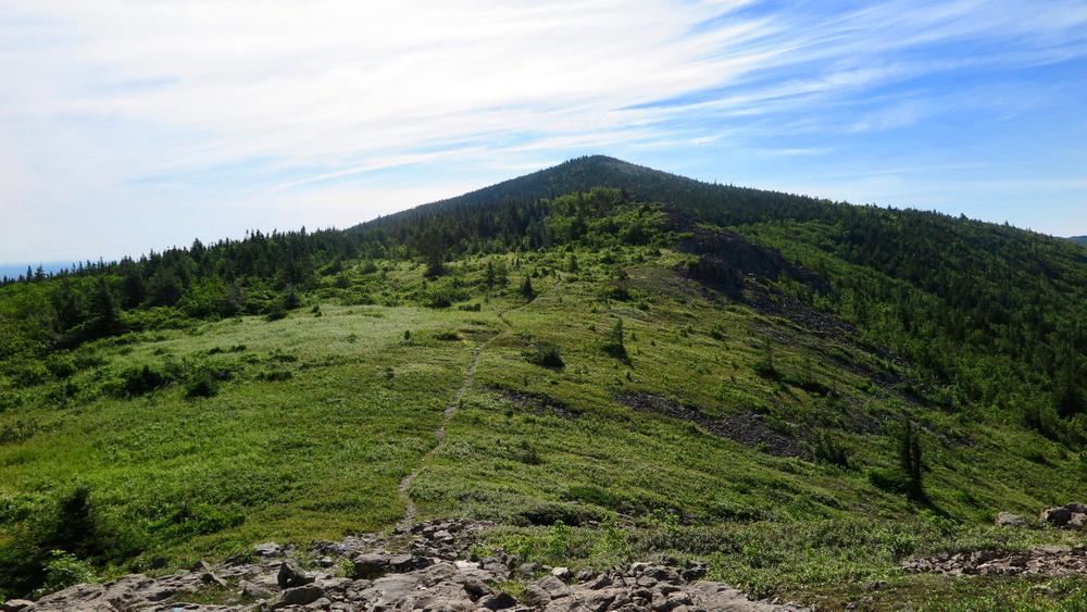
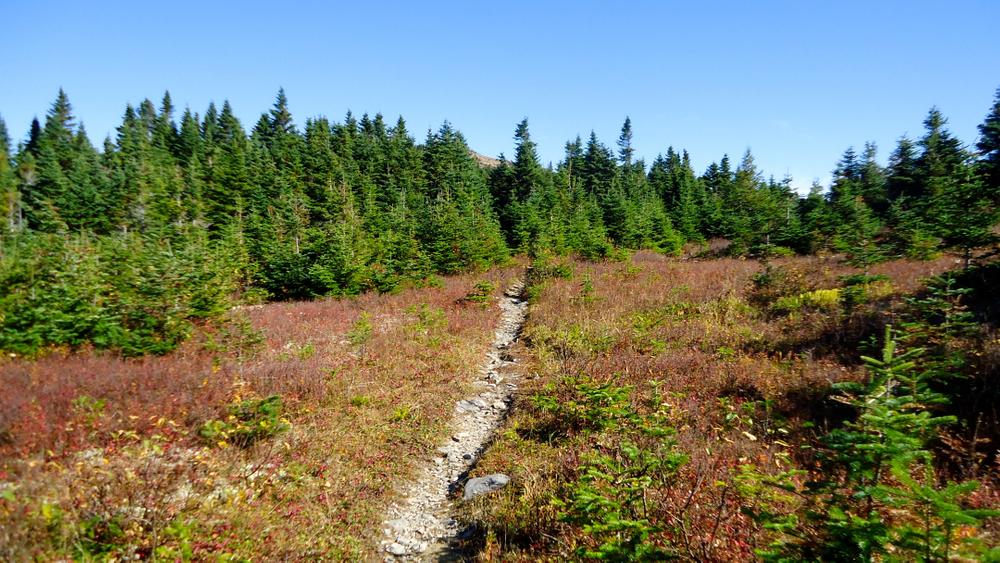
From the Peak of the Ridges, the Traveler Trail traverses ridges mostly above treeline, 1.3 miles to the summit of Travler, then another 2.6 miles to North Traveler. From this northern-most peak, the North Traveler Trail follows the North Ridge that is perched over Lower South Branch Pond. Along the upper reaches of the ridge are several beautiful upland meadows that are reminiscent of the Southern "balds" in the Great Smoky Mountains. The trail is almost entirely in the open with exciting and constantly-changing views all along the route.
POGY NOTCH TRAIL DETAILS
0.0 Miles: At the east end of South Branch Pond Campground, the trail begins at a prominent sign post. It proceeds over a well-worn woods trail.
0.1 Miles: The first trail junction. To the left (east) is the North Traveler Trail leading 2.6 miles to its summit. The Pogy Notch Trail continues south paralleling the east shore of pond, soon passing the base of the sheer cliffs of North Traveler Ridge.
0.9 Miles: The trail emerges onto a wash (part of a true delta) of Howe Brook. To the right (west) is a canoe landing. The trail bears away from pond and soon parallels Howe Brook.
1.0 Miles: The next trail junction, with the scenic Howe Brook Trail leading 2.0 miles to the head of Howe Brook. The Pogy Notch Trail turns sharp right and crosses Howe Brook. The trail then traverses the wide, ancient delta of Howe Brook, passing through a beautiful grove of mature hardwoods, one of the best in the Park.
1.4 Miles: At the base of a talus slope of Center Ridge, the trail ascends over cliffs that drop directly into Upper South Branch Pond.
1.5 Miles: At the high point on cliffs is a trail junction with the Center Ridge Trail to the left.
CENTER RIDGE TRAIL DETAILS
1.5 Miles: The Center Ridge trail leaves the Pogy Notch Trail at a junction on a high bluff overlooking Upper South Branch Pond. It immediately begins a steep ascent following ledges across the face of the ridge.
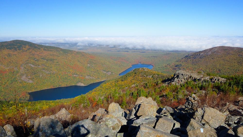
2.2 Miles: The trail reaches a rocky overlook with outstanding views of Pogy Notch and the South Branch Valley. Pinnacle Ridge is to the south across a deep ravine. North Traveler is across Howe Brook Valley to the north. Above this point, the trail is less steep and slabs towards Center Ridge to the north.
2.7 Miles: The trail commences an ascent up a rough, rocky ridge.
3.1 Miles: The trail reaches a point on ridge where a view of the main summit of Center Ridge is seen above, then continues a moderate ascent.
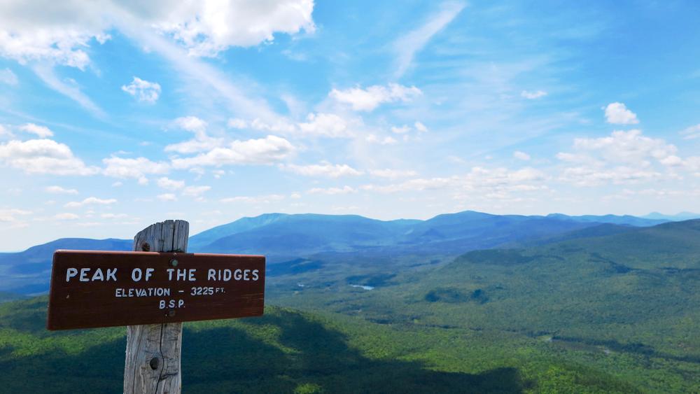
3.6 Miles: Peak of the Ridges (elevation 3,225 feet). This first peak has magnificent views in all directions. Katahdin is to south beyond the Wassataquoik Valley, and Traveler is westward along a high saddle.
TRAVELER TRAIL DETAILS
3.6 Miles: From Peak of the Ridges, the Traveler trail begins a moderate descent eastward.
3.9 Miles: After a 400 foot descent, the trail reaches a level and beautiful alpine meadow. After crossing the meadow, it enters a growth of stunted conifers and begin an ascent of the main peak.
4.2 Miles: The trail climbs over several talus slopes, scree walls of broken volcanic rhyolite rock. It is covered with a growth called “map lichen,” a very elemental life form and one of the few that can survive in this extremely harsh environment. As the trail approaches the summit, the climb becomes more gradual. The elevation gain from the meadow to the summit is approximately 700 feet.
5.0 Miles: Summit of The Traveler (elevation 3,541 feet). Fine views are in all directions. Leaving summit, the trail begins a moderate, then steeper descent to the northeast down an open ridge.
5.5 Miles: The trail descent drops 800 feet, and reaches a col forested with stunted coniferous growth. Almost immediately it then begins an ascent over a long ridge leading northwest toward North Traveler.
6.2 Miles: The trail reach a high point on the ridge (elevation 2,970 feet) and immediately begin another descent of 400 feet into a saddle.
6.5 Miles: At the floor of saddle, beautiful dwarf birch dominates the forest. The trail begins a final 600 foot climb up the southeast side of North Traveler.
7.3 Miles: Summit of North Traveler (elevation 3,152 feet). The Traveler Trail ends here.
NORTH TRAVELER TRAIL DETAILS
7.3 Miles: The North Traveler Trail leaves the summit, descending to the west.
7.5 Miles: The trail enters and passes through an upland meadow.
8.3 Miles: The trail passes a spring to the right (north).
8.8 Miles: After reaching a rocky knob, the trail descends steadily along the edge of a ridge toward the pond below.
9.4 Miles: The trail enters trees and continues its descent.
9.9 Miles: The trail ends at the junction with the Pogy Notch Trail. South Branch Pond Campground is 0.1 mile further up the trail to the left.
Park Fees: See website for entrance and camping fees. [No entrance fee for Maine residents.]
Park Rules: See a more complete list here.
For more information and detailed trail maps, visit the Baxter State Park Authority website, or contact:

Set Up Smart: Use established campsites to avoid damaging new areas.
From ME-11 in Patten, head west on ME-159. At 10.1 miles you will pass Shin Pond Village; at 11.6 miles you will pass Matagamon Wilderness Campground. At 13.4 miles (1.8 miles after Matagamon Wilderness Campground) you will arrive at Baxter State Park's Matagamon Gate entrance.
Go 6.7 miles on the Tote Road, then turn left on South Branch Pond Road. Go 2.1 miles to the campground and pond at the end of the road. Parking is just north of the campground. The trailhead is located in the campground at its east end, by the northeast corner of South Branch Pond.
Success! A new password has been emailed to you.