Kendall Brook Forest

Double-track multiuse pathways and woods roads connect to additional trail networks.
Trail Activity
Hiking Snowshoeing Cross-country-skiing Mountain-biking
Length
8.00 miles, Network
Difficulty
Moderate
Towns
Bethel, Greenwood
Surface
Dirt/Forest Floor, Gravel/Crushed Stone
Pets
Permitted
Fees
No

Description

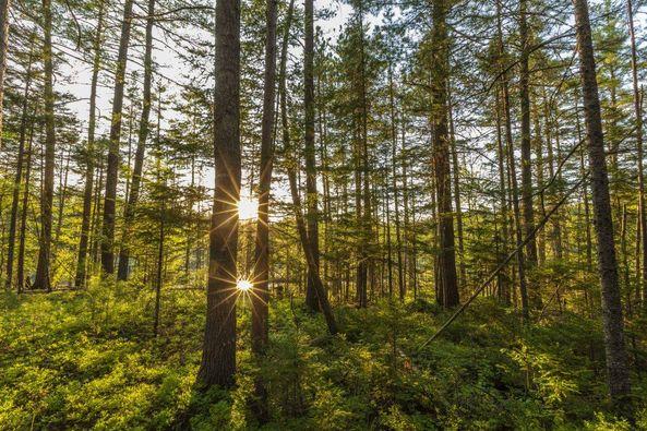
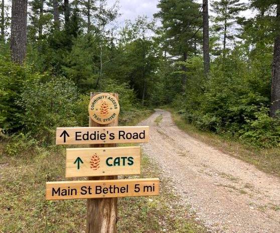
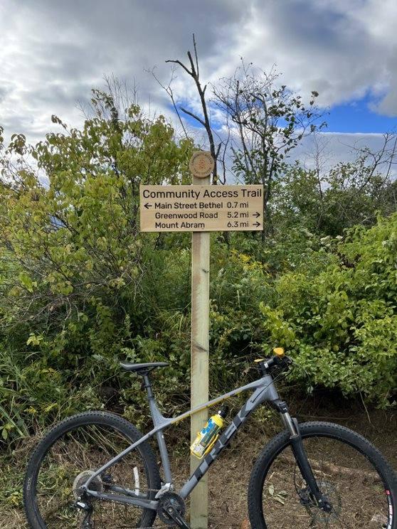
The Kendall Brook Forest is a parcel of Chadbourne Forestlands forest network. It is a crucial piece towards the connection between Sunday River Resort and Mount Abram ski area. 5.8 miles of the Community Access Trail utilizes roads in the Kendall Brook Forest.

The trails are made up of double-track multiuse pathways and woods roads. They include 5.8 on the Community Access Trail, and connections to 2.2 miles of trail along Rabbit Road and Pine Ridge Road.

Other Information

RULES

  • Bikers have the right-of-way on single track bike trails 
  • Dogs allowed on leash or under voice command on all trails 
  • Authorized vehicles may be present at any time on all double track roads and pathways 
  • Motorized vehicles are prohibited on all trails except for the snowmobile trail route in the winter months 
  • Snowmobiles have the right-of-way on the snowmobile trail in winter months 
  • Active forestry may be occurring at any time 
  • Overnight camping is prohibited 
  • Carry out all litter, including pet waste

Trail Manager

For additional information, visit the Inland Woods & Trails website, or contact: 

Inland Woods + Trails

Inland Woods + Trails
PO Box 572
Bethel, ME 04217
Phone: 207.200.8240
info@woodsandtrails.org
View website

Nearby Events

VIEW EVENTS CALENDAR

Trail Tips

Minimize Campfire Impacts
Follow the Maine Forest Service fire regulations and check the current fire danger level before you go camping.
Legend
Hide All

Trailhead Information

PINE RIDGE ROAD TRAILHEAD
Travel east on ME-26 from the center of Bethel. At just over 5 miles east of the intersection of ME-26 and US-2, turn right onto Howe Hill Road. Go 0.2 miles and turn right on Pine Ridge Road. Go another 0.1 mile to the trailhead at the end of the road.

VERNON STREET TRAILHEAD
Park in town, and go a half-mile on Vernon Street from Main Street to the trailhead on the left.

MOUNT ABRAM TRAILHEAD
The trails may also be access from the end of Cemetery Road, which is off Howe Hill Road at the Mount Abram Ski Resort.

Click on a parking icon to get custom directions
Please Log In or Create Account to add comments.
These awesome businesses support our goal of connecting people to outdoor adventures in Maine!
Hang Tight!
Nearby services are loading
No Results
No Services Found
SHARE THIS TRAIL

Add Trail Log

Please wait…
Join In on the Fun!
Log in or create an account below to unlock all the great features of Maine trail finder: keep track of trails you want to do, preserve memories of trails you’ve done, earn badges, and more!
Your log in attempt was not successful. Please try again.
    Lost your password? Reset your password
    Don't yet have an account?
    There was an issue with your submission. Please try again.
      * Indicates required field
      Already have an account? Login here
      Enter your username, and we will send you a new, randomly generated password to your email account.
      There was an issue with your submission. Please try again.

        Success! A new password has been emailed to you.

        Log in now

        Please wait…