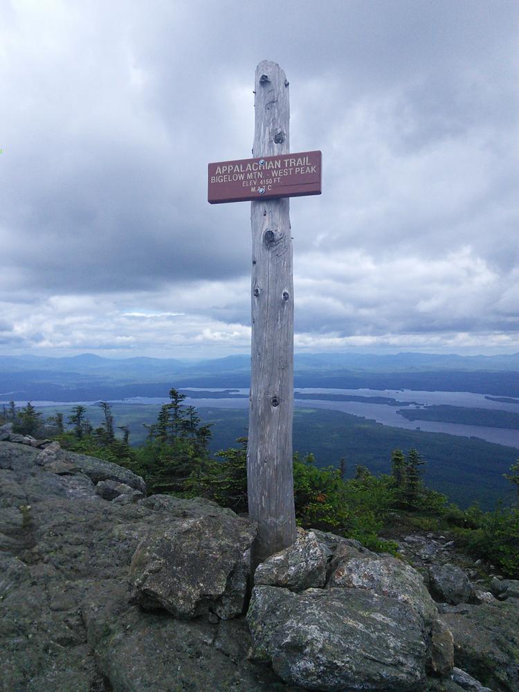
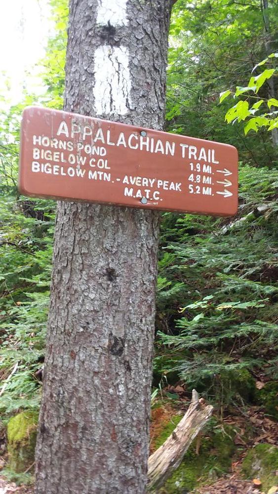
To start this hike from the East Flagstaff Road, download and follow information for the hike up Little Bigelow. Hikers travel southbound on the A.T. until the junction with the Safford Brook Trail. At this point hikers may continue using the information for the Safford Brook hike to reach Avery Peak. Hikers will descend into the Bigelow Col and can choose to hike the Firewarden's Trail. Hikers can download that portion of the Bigelow Firewarden's Trail, Appalachian Trail and Horns Pond Trail Loop needed to continue south on the A.T. Hikers descend to Horn's Pond to the junction of the A.T. and Horn's Pond Trail. Information for the Horn's Pond Trail option is included with the Firewarden's Trail previously mentioned. Hiking southbound 1.7 miles on the A.T. the next side trail encountered is the Bigelow Range Trail which is covered under the Bigelow Range Trail to Cranberry Peak. Descend 1.3 miles on the A.T. to the Cranberry Stream Campsite and then 1.9 miles to ME Route 16/27.
The Bigelow Preserve is a public land managed for multiple uses including wildlife and timber management along with its recreational uses. Part of the Bigelow Preserve, mostly the upper elevations, lies within a state Ecological Reserves specifically set aside to protect and monitor natural ecosystems. Find out more at the Maine Natural Areas Program Fact Sheet for Bigelow Preserve.
Do not underestimate the difficulty of hiking the mountains of Western Maine. Be sure to carry equipment and supplies necessary for this undertaking. If you do not have the information or skills, be sure to research and educate yourself in order to have an enjoyable and safe hike. Be very aware of past, present, and predicted weather. Though the preserve is managed only for summer-time uses, winter uses like cross-country skiing, snowshoeing, and winter camping are allowed and popular.
Fires are only allowed in the provided fireplace ring at the Little Bigelow Lean-to. In the state of Maine, it is illegal to build a fire anywhere except within a certified fire ring. Camp stoves are permitted. Camping is not allowed above the tree line (a very delicate and vulnerable area to hike in), please stay on the trail.
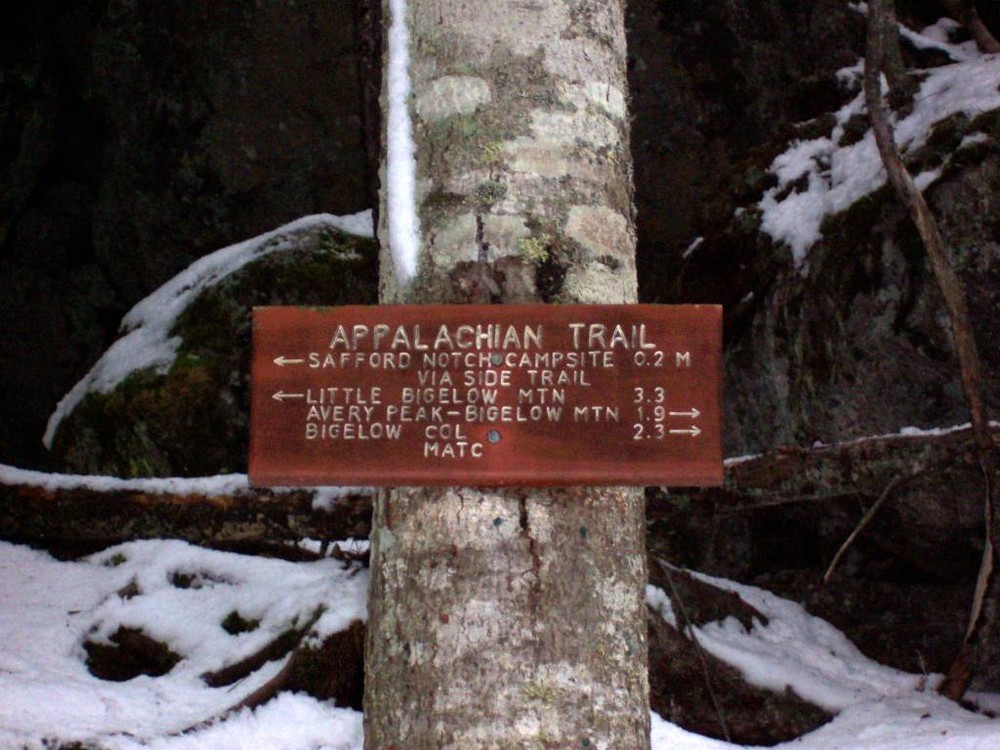
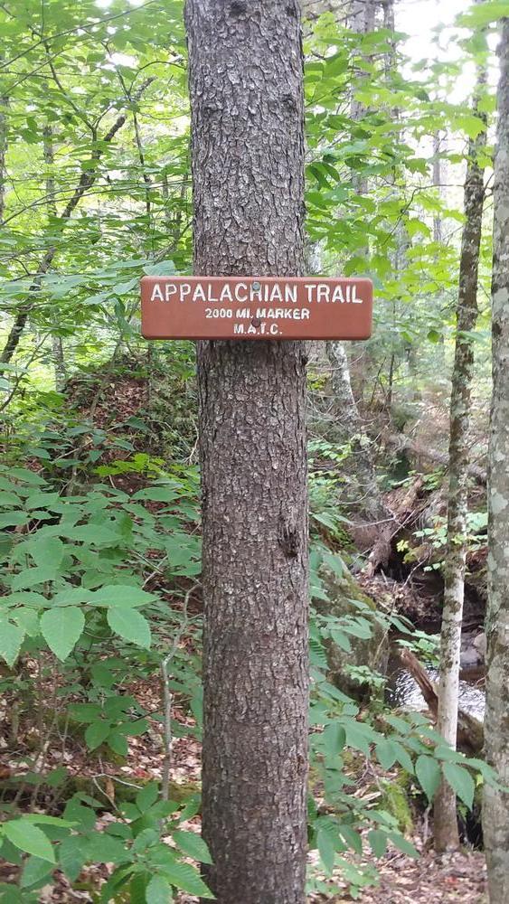
The Maine Appalachian Trail Club (MATC) is an all volunteer organization that exists to maintain and protect the 267-mile section of the Appalachian Trail in Maine extending between Katahdin in Baxter State Park and Grafton Notch at ME Route 26. In addition, MATC maintains over 60 miles of side trails as well as a system of regularly spaced shelters and campsites in order that wild, backcountry hiking remains accessible in Maine. MATC publishes The Official Appalachian Trail Guide to Maine, which includes seven maps, please visit their website for information on how to purchase the guide or to learn more about becoming a member of MATC.
Please contact the Bigelow District Overseer by email (bigelow@matc.org) to report any trail or shelter conditions that may require maintenance or special attention.
Visit the Bureau of Parks and Lands (detailed trail guide) or Maine Appalachian Trail Club online for more information or contact:

![]()
Don’t Disturb Rock Cairns: Those stacked rock formations? They mark the trail—don’t move or build new ones.
East Flagstaff Road and Safford Brook Trailheads: To access the A.T. from the East Flagstaff Road, leave the paved Long Falls Dam Road 17.4 miles north of North New Portland by turning northwest (left) on the gravel Bog Brook Road. At 0.7 miles take the left fork on to the East Flagstaff Road which intersects the A.T. in 0.1 miles. Park in the gravel pit on the right just before the left turn of the A.T. that re-enters the woods. Additional parking, on the left, is just beyond the trailhead just mentioned. To reach and access the A.T. from the the Safford Brook Trail continue about 4.5 miles to an open sandy parking area. A right turn just after the trailhead leads to the Round Barn public use area on the shore of Flagstaff Lake.
ME Route 16/27 Trailhead: To access the A.T. from ME Route 16/27, drive 18 miles east of the junction of ME Routes 16 and 27 in the Town of Kingfield or 5.2 miles west of the junction of ME Routes 16 and 27 in the Village of Stratton. The Trailhead parking is on the west side of ME Route 27.
Cranberry Peak Trailhead: To access the A.T. via the Bigelow Range Trail, you must start from Curry Street which is opposite the town ball field, 0.8 miles south of the center of Stratton. Follow Curry Street to its end 0.7 miles off ME Route 27 to the parking area and trailhead.
Stratton Brook Pond Road Trailheads: To access the A.T. via the Firewardens' Trail enter the rough gravel Stratton Brook Pond Road leave ME Route 16/27, 4.6 miles east from the junction of ME Routes 16 and 27 in Stratton and turn left. A second route is a right hand turn 0.6 miles west of the Appalachian Trail crossing of ME Route 16/27. At 1.4 miles from the highway, Stratton Brook Pond Road crosses the Appalachian Trail. At 2.1 miles reach the trailhead parking for the Firewarden's and Horn's Pond Trails.
In the winter, please park in the parking area. Do not park on Stratton Brook Pond Road unless you can drive all the way in to the parking areas. Never block driveways or trail access.
View BPL's map and guide for the Bigelow Preserve & Flagstaff Lake Public Lands.
Success! A new password has been emailed to you.