This is one of the more family-friendly hikes within the preserve, with several good views, resting spots, and turn around on the way up to the 3040 foot peak of Little Bigelow.
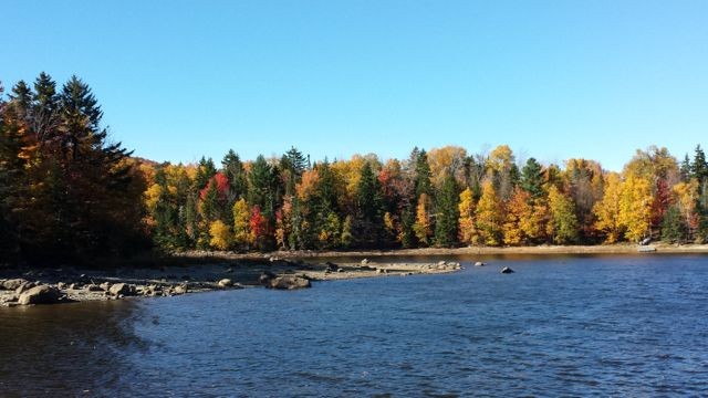
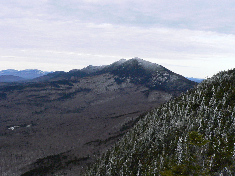
From the trailhead, hikers steadily climb through a dense, mixed hardwood forest, following a fast moving brook. The trail to the Lean-to leaves to the north (right) side of the trail at 1.4 miles above the East Flagstaff Road. Continuing past the Lean-to trail, it is another 1.7 miles upward to the East Peak of Little Bigelow. This section of the trail is steeper climbing but ledges provide good resting points with nice views towards Flagstaff Lake. After another steep section, hikers arrive at the summit of the East Peak of Little Bigelow (3040') where there are great views south and west towards Sugarloaf and the rest of the Bigelow Range. From here, the Appalachian Trail continues southbound along the ridge of Little Bigelow to eventually join with the Safford Brook Trail and onward to Avery Peak.
On a hot day, it may be worth the trip to the Little Bigelow Lean-to where another short side trail leads downhill, following a small brook which flows through a number of pools or "tubs" cascading downhill.
View BPL's map and guide for the Bigelow Preserve & Flagstaff Lake Public Lands.
The Bigelow Preserve is a public land managed for multiple uses including wildlife and timber management along with its recreational uses. Part of the Bigelow Preserve, mostly the upper elevations, lies within a state Ecological Reserves specifically set aside to protect and monitor natural ecosystems.
Do not underestimate the difficulty of hiking the mountains of Western Maine. Be sure to carry equipment and supplies necessary for this undertaking. If you do not have the information or skills, be sure to research and educate yourself in order to have an enjoyable and safe hike. Be very aware of past, present, and predicted weather. Though the preserve is managed only for summer-time uses, winter uses like cross-country skiing, snowshoeing, and winter camping are allowed and popular.
Fires are only allowed in the provided fireplace ring at the Little Bigelow Lean-to. In the state of Maine, it is illegal to build a fire anywhere except within a certified fire ring. Camp stoves are permitted. Camping is not allowed above the tree line (a very delicate and vulnerable area to hike in), please stay on the trail.
The Maine Appalachian Trail Club (MATC) is an all volunteer organization that exists to maintain and protect the 267-mile section of the Appalachian Trail in Maine extending between Katahdin in Baxter State Park and Grafton Notch at ME Route 26. In addition, MATC maintains over 60 miles of side trails as well as a system of regularly spaced shelters and campsites in order that wild, backcountry hiking remains accessible in Maine. MATC publishes The Official Appalachian Trail Guide to Maine, which includes seven maps, please visit their website for information on how to purchase the guide or to learn more about becoming a member of MATC.
Please contact the Bigelow District Overseer by email (bigelow@matc.org) to report any trail or shelter conditions that may require maintenance or special attention.
Visit Maine Appalachian Trail Club or the Maine Bureau of Parks and Lands online (detailed trail guide) for more information or contact:

![]()
Stay On Designated Trails: Staying on the trail protects fragile plants, keeps you away from hazards like poison ivy and ticks, and helps avoid forestry equipment.
To access the north and east side of the Bigelow Preserve is via the paved Long Falls Dam Road. From North New Portland and ME Route 16, turn onto Long Falls Dam Road and follow it 17.4 miles north and then turn northwest (left) onto the gravel Bog Brook Road. At 0.7 miles take the left fork on to the East Flagstaff Road which intersects the A.T. in 0.1 miles. Park in the gravel pit on the right, just before the A.T. intersects the road. Additional parking, on the left, is just beyond where the A.T. heads southbound from East Flagstaff Road.
Success! A new password has been emailed to you.